5-years combined bachelor's/ master's degree Thesis
Poject Team: Brighetti Caterina
Year: may 2023 - march 2025
This button below allows you to open the full italian version of my thesis using Adobe Acrobat.
Today, the relationship between architecture and nature is a true challenge for an architectural engineer. For this reason, through my thesis work, I aimed to explore and develop a personal connection with the environment, addressing the challenges of climate change through a design that emphasizes rewilding and the recovery of existing structures. I strongly believe that architecture should not impose itself on nature, but rather integrate with it—adapting to its changes and fostering a harmonious balance. Through the use of sustainable materials and thoughtful design choices, building can become part of a unique system in which humans and nature coexist in equilibrium.
With this awareness, my project seeks to contribute to a more sustainable future, where building is an act of service, not domination.
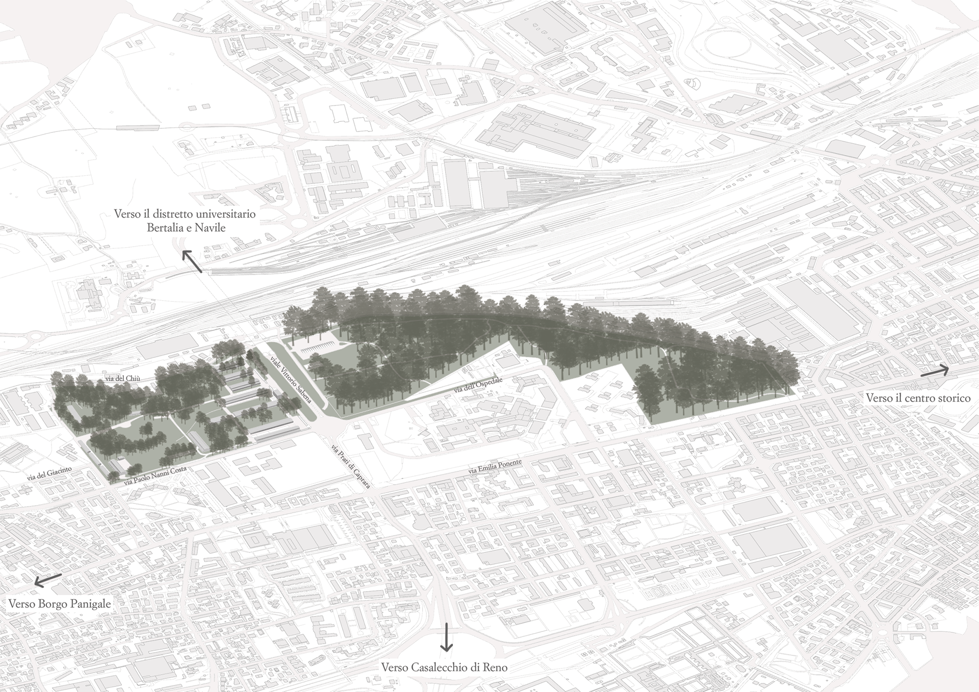
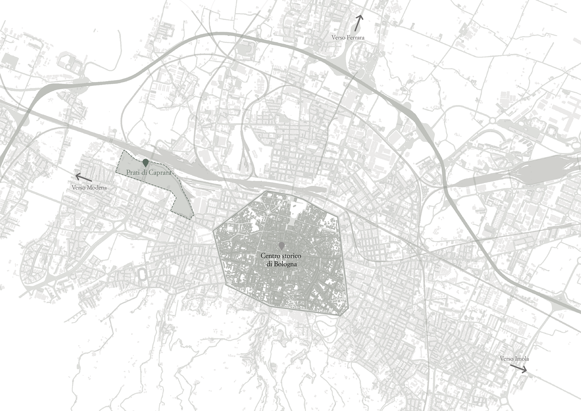
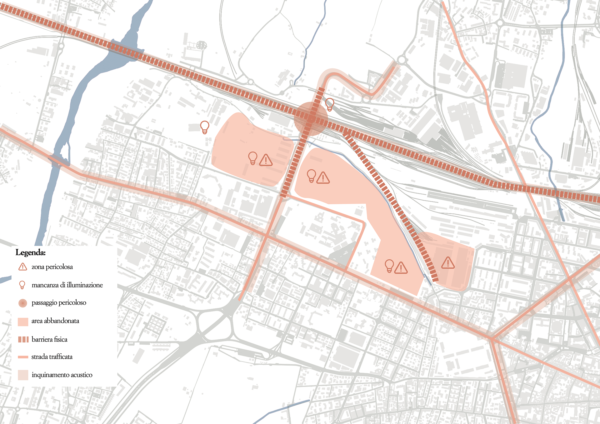
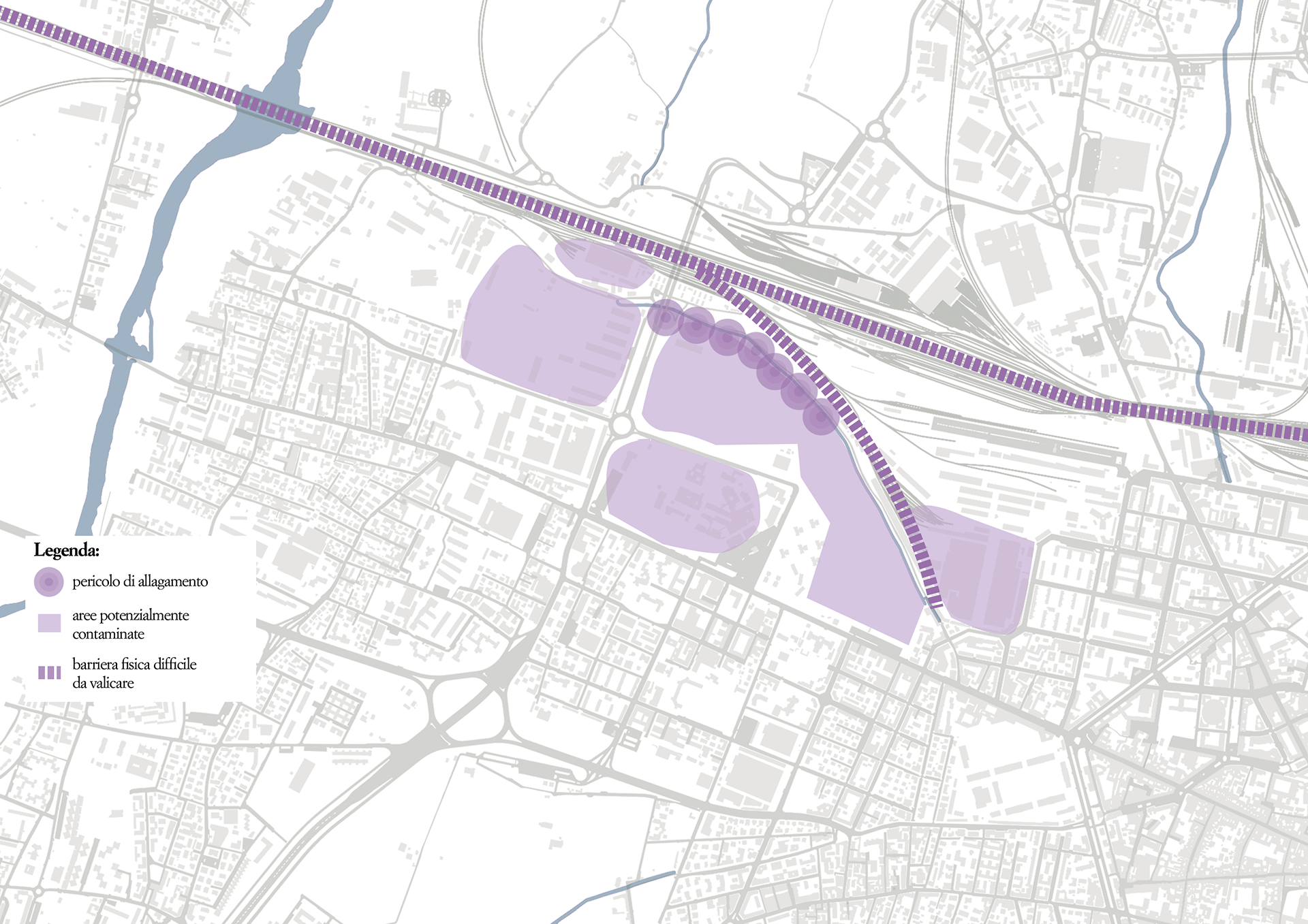
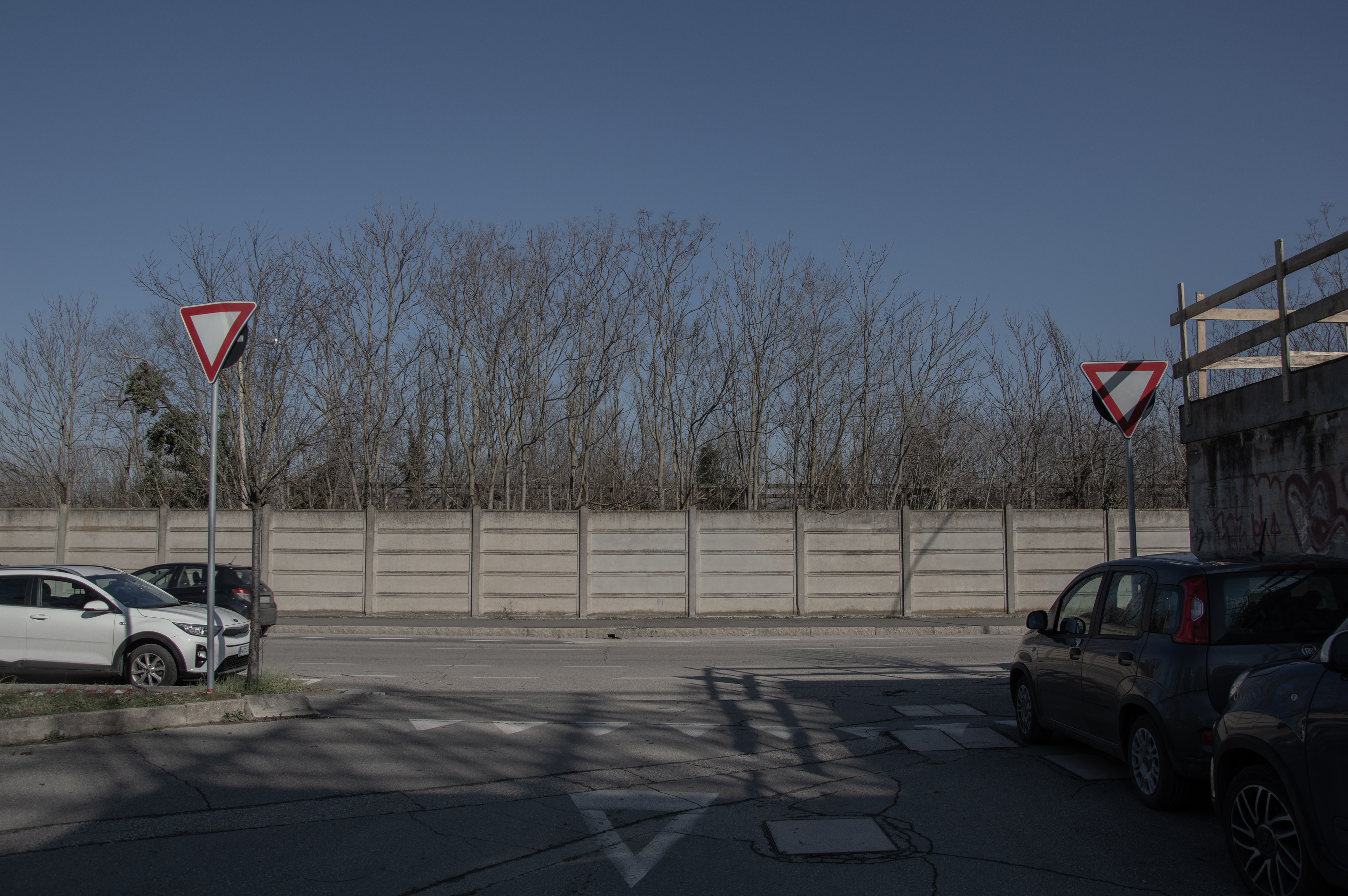
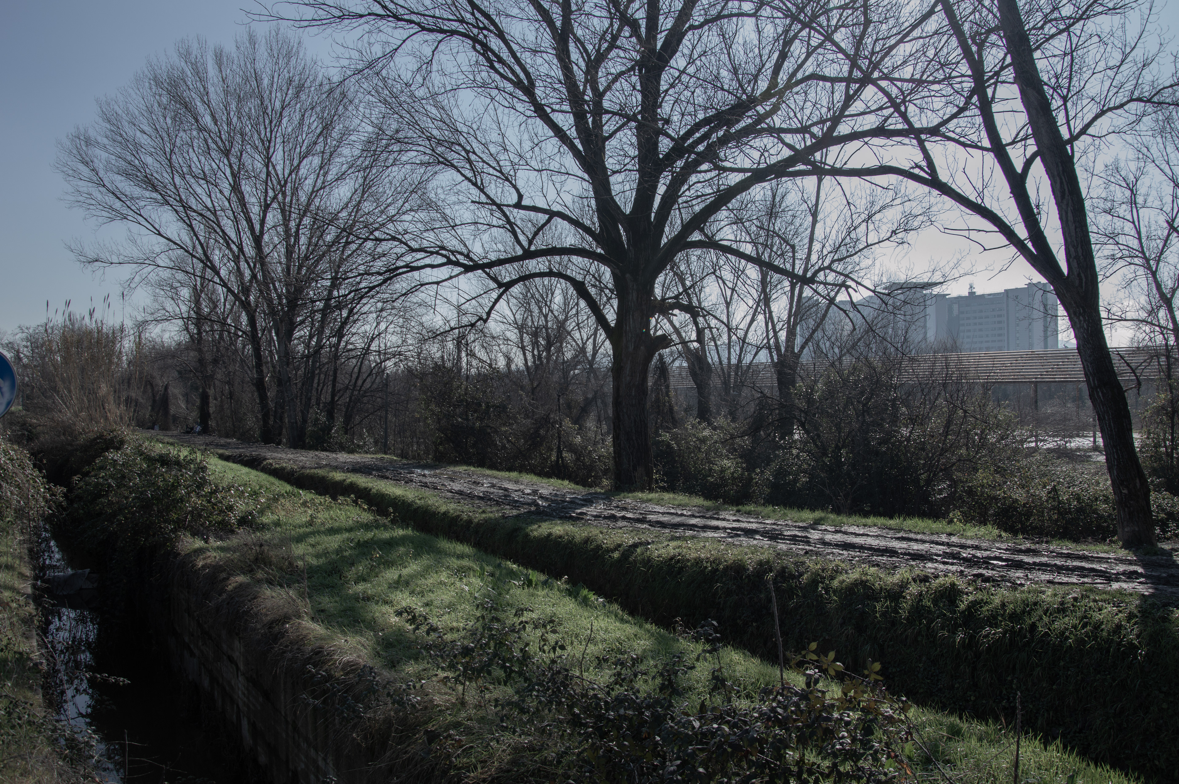
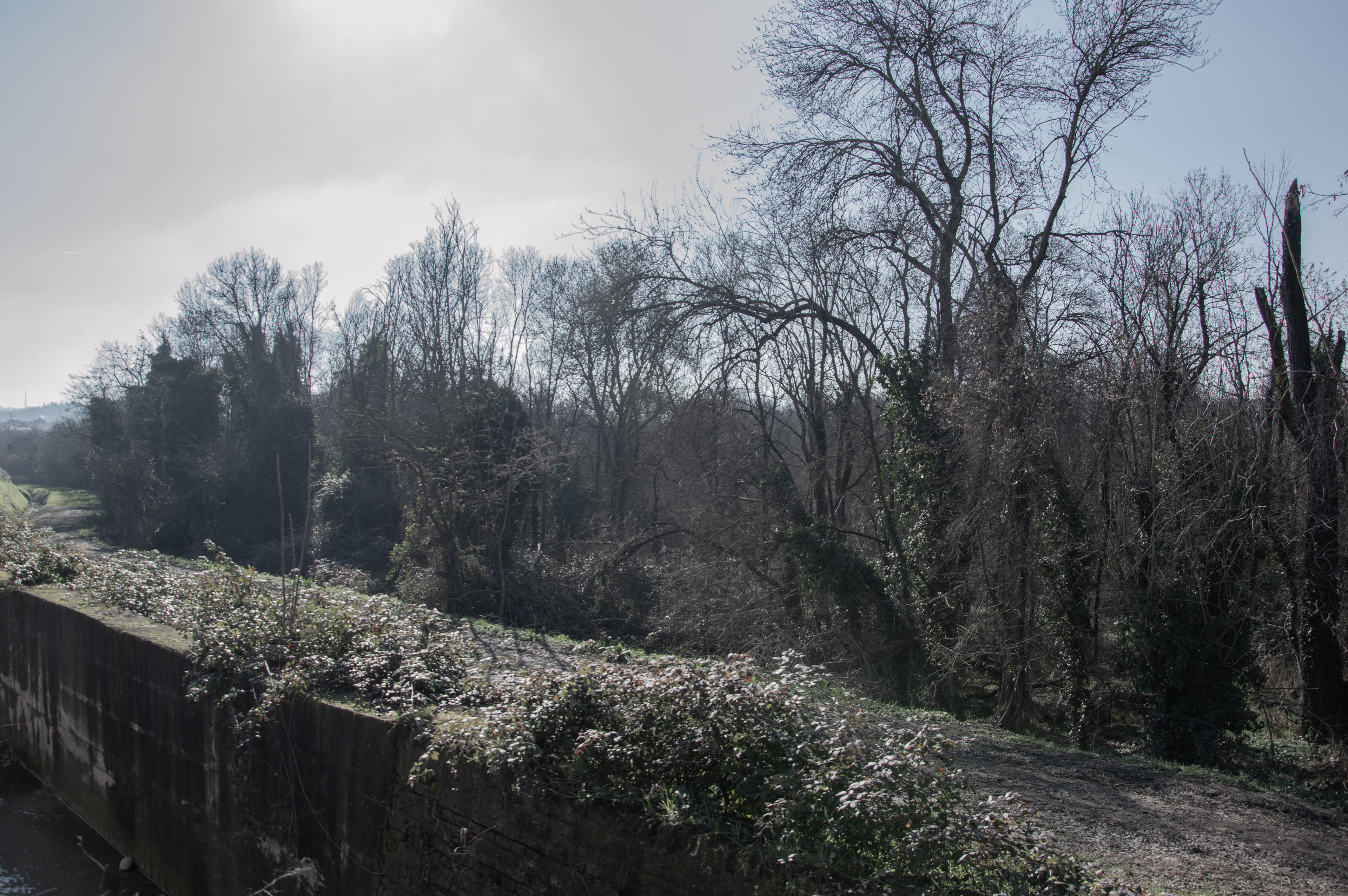
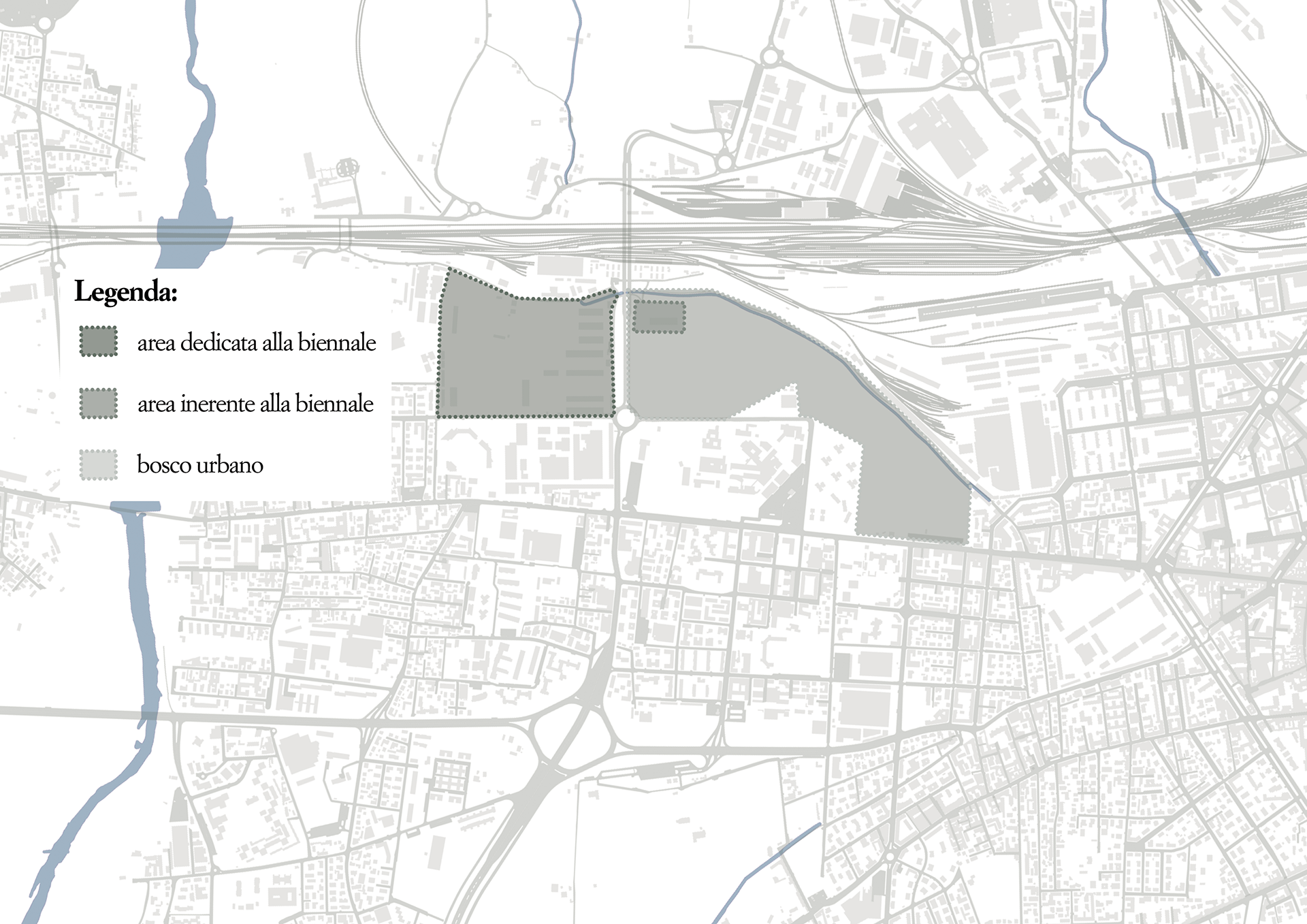
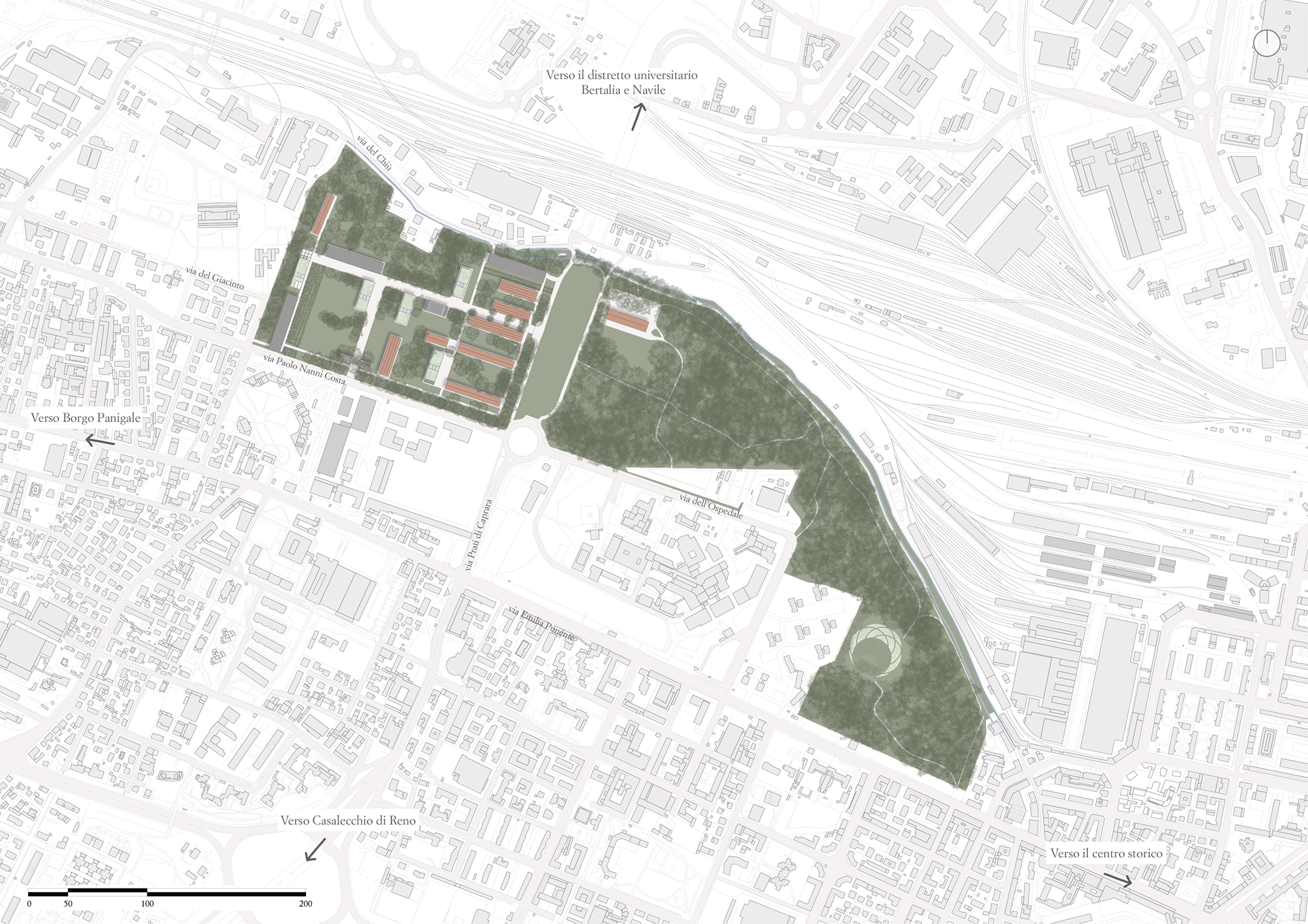
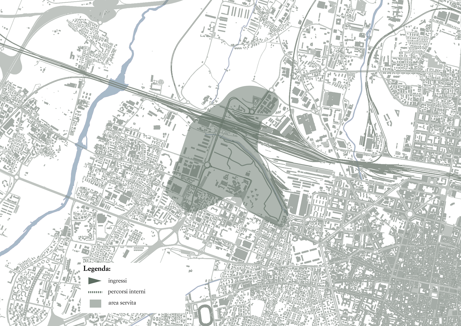
Inspired by Gilles Clément’s concept of the Third Landscape, I chose to intervene in the Prati di Caprara, an area in Bologna where the abandonment of the former San Felice Military Facility has given rise to a unique spontaneous ecosystem. The area spans approximately 47 hectares, located in the north-western part of the city, between Via Emilia Ponente, the Ravone stream, and the Ghisiliera canal. The Prati di Caprara lie in a strategic position between the Porto-Saragozza and Borgo Panigale-Reno districts, within Bologna’s north-west quadrant. Historically, this zone has been divided between the Santa Viola and Porto areas—two neighborhoods that have preserved a strong identity over time.
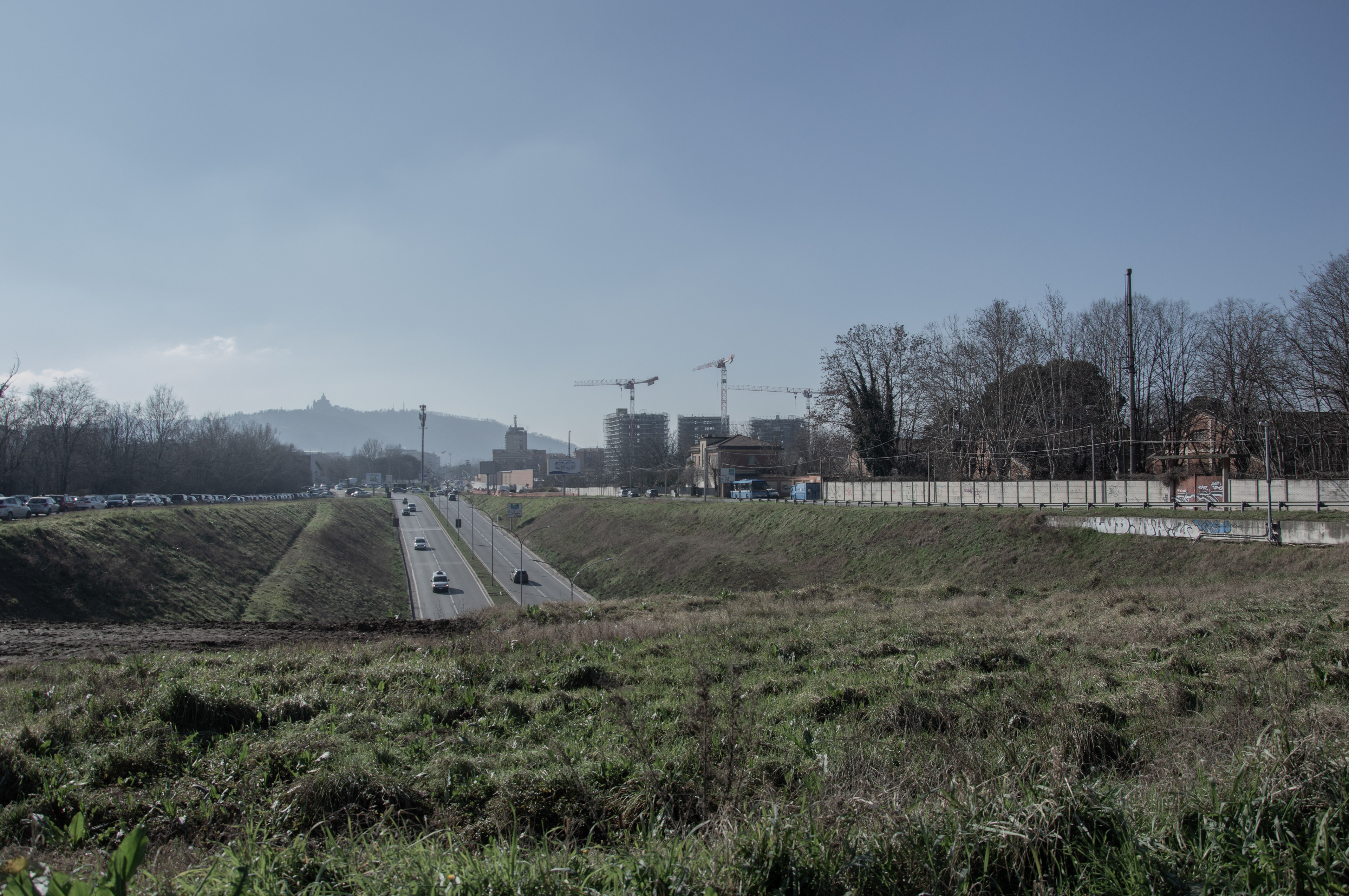
From a mobility perspective, Prati di Caprara are highly accessible: they directly overlook Via Saffi, one of the city’s main thoroughfares connecting the historic center of Bologna to the outskirts toward Modena. To the north, the area is bordered by the railway, while the south side is served by Via Paolo Nanni Costa and the aforementioned Via Saffi. A key infrastructural element is Viale Vittorio Sabena, which divides the area into two parts—East and West—while also serving as a strategic link to the northern periphery. The two zones can be described as follows:
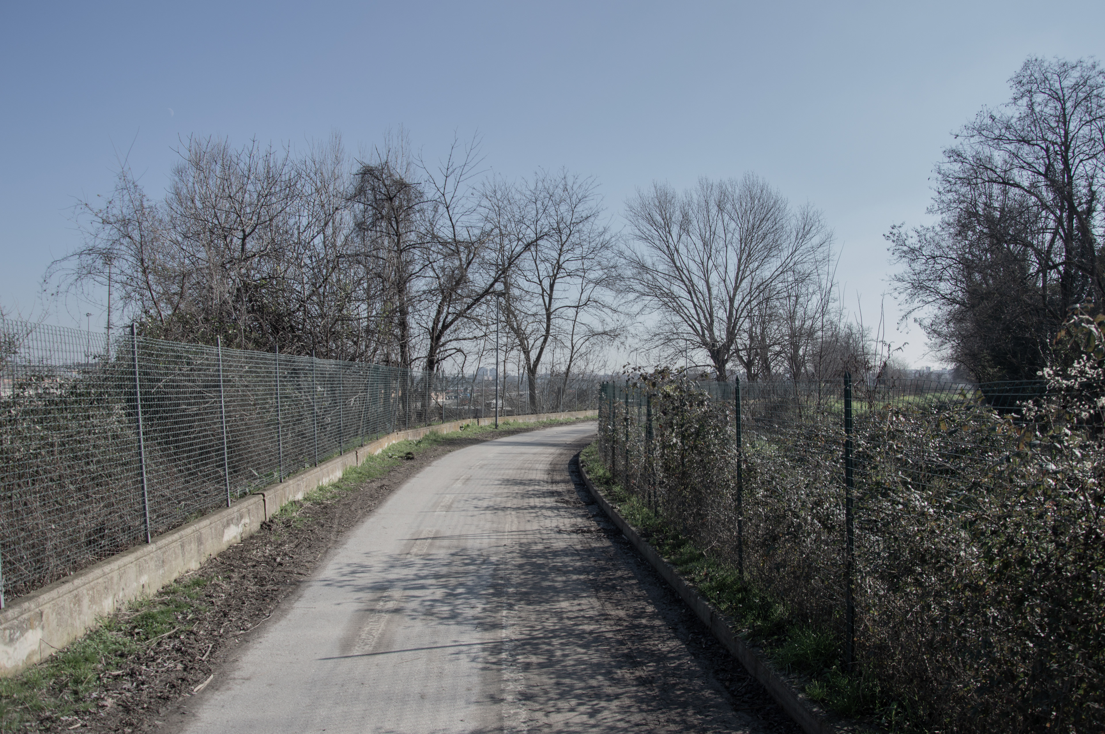
- Prati di Caprara East has been left as spontaneous woodland and represents an important biodiversity reserve for the city, home to a rich variety of plant and animal species. This part is already organized with pedestrian paths and trails.
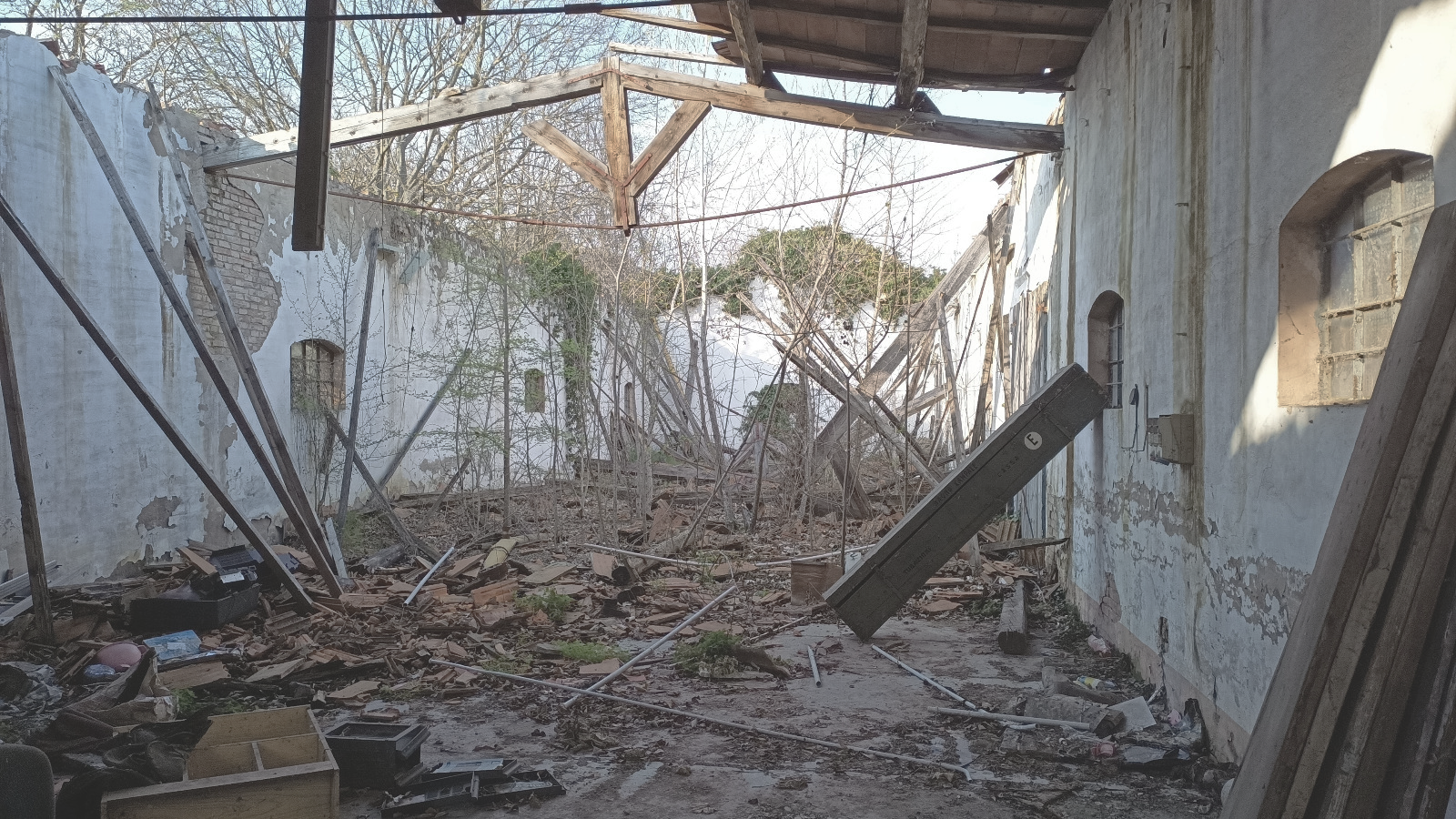
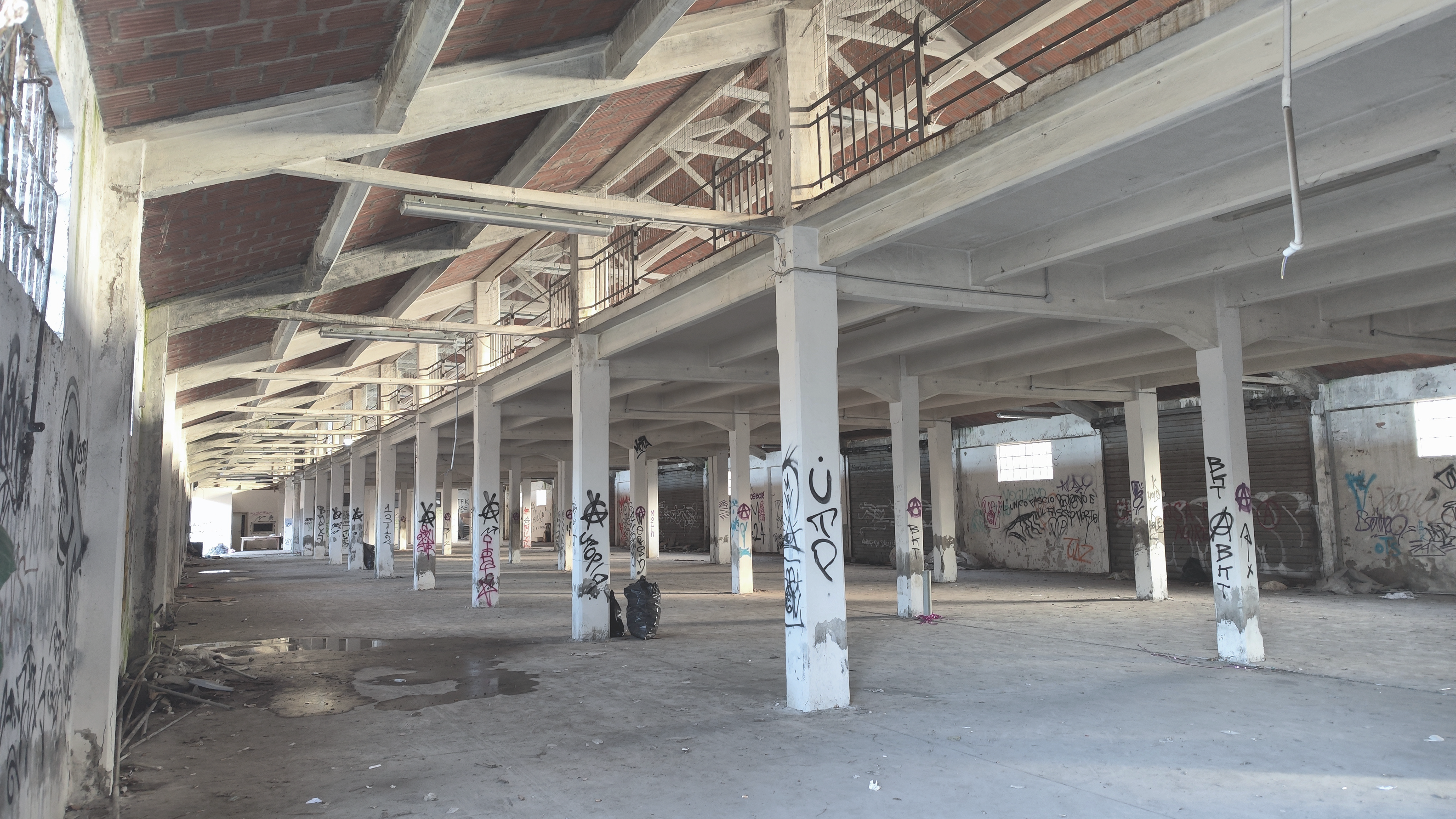
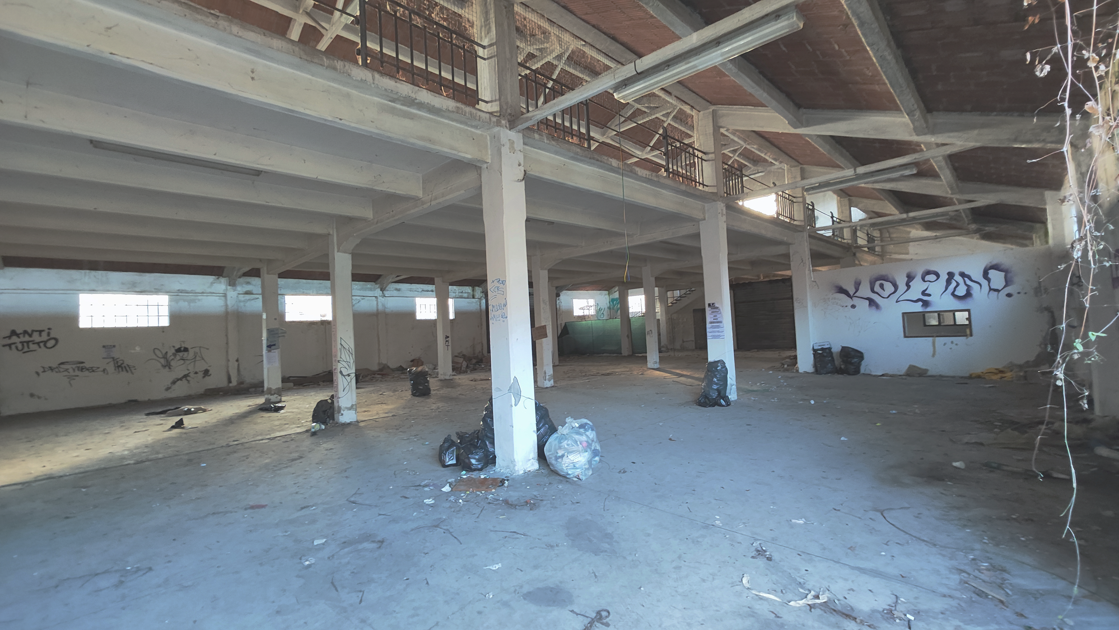
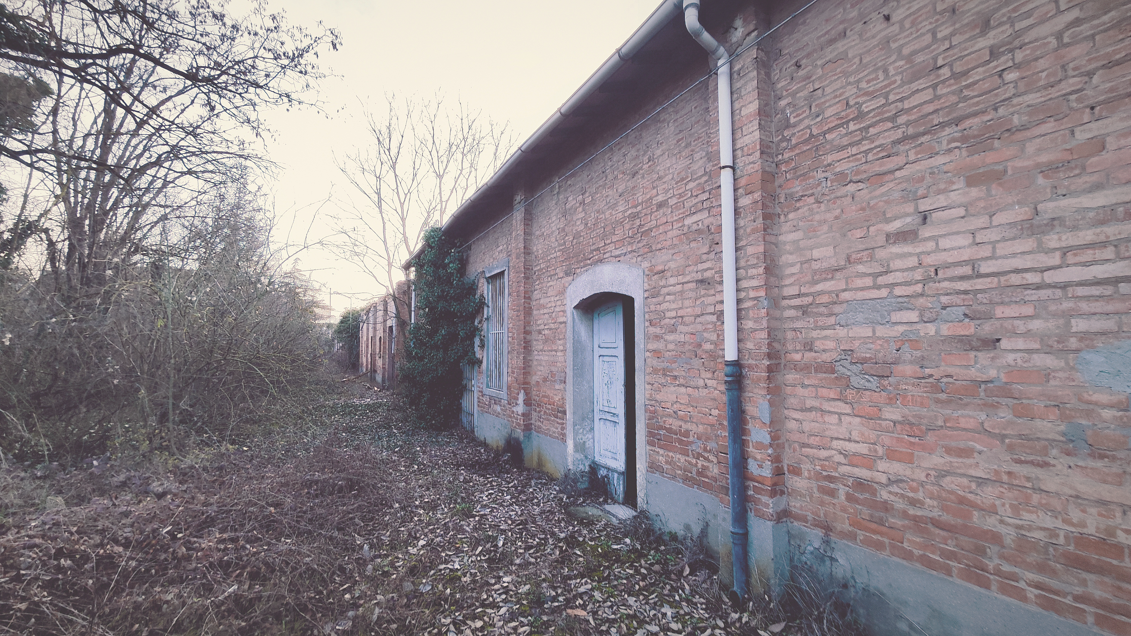
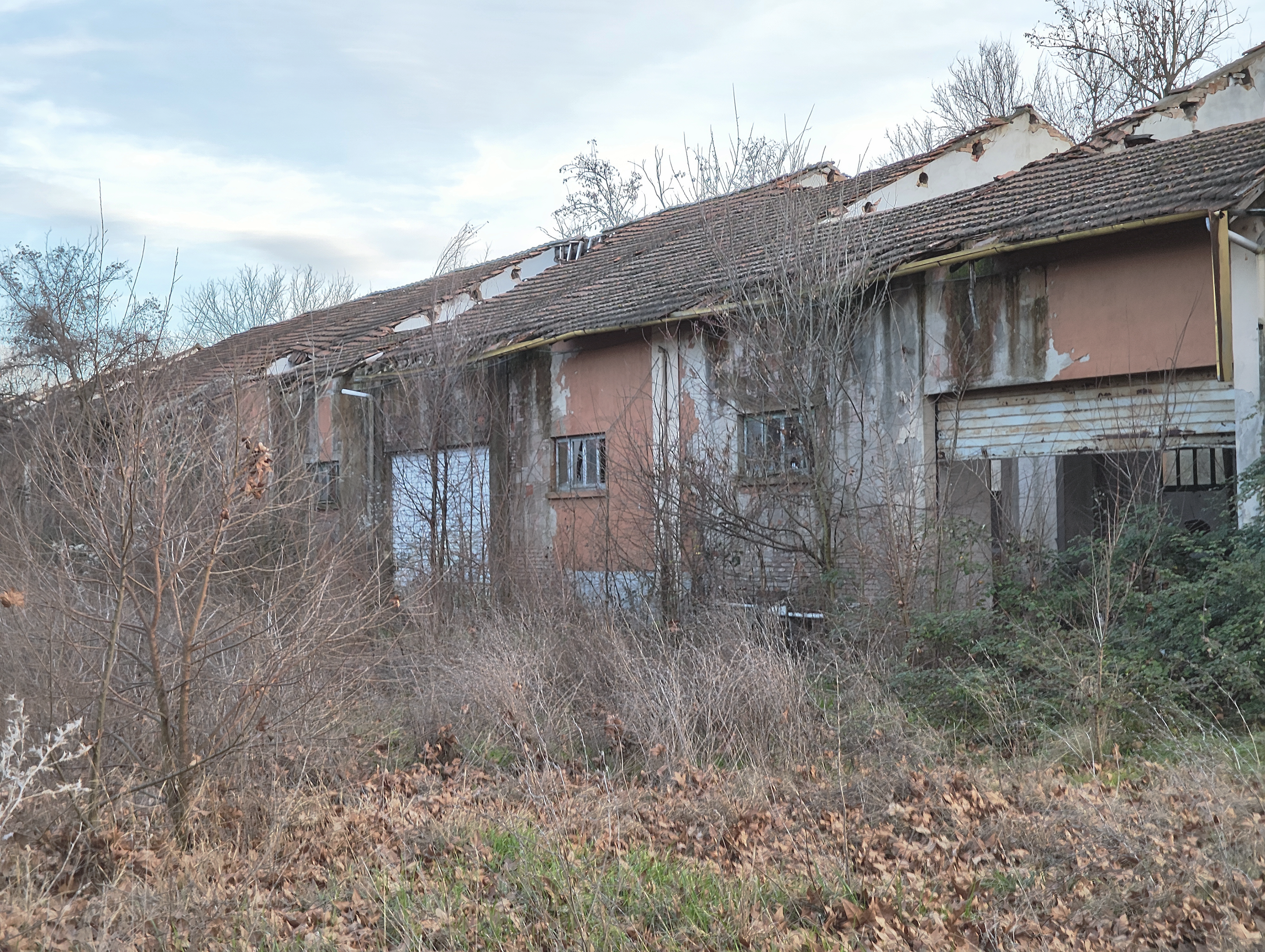
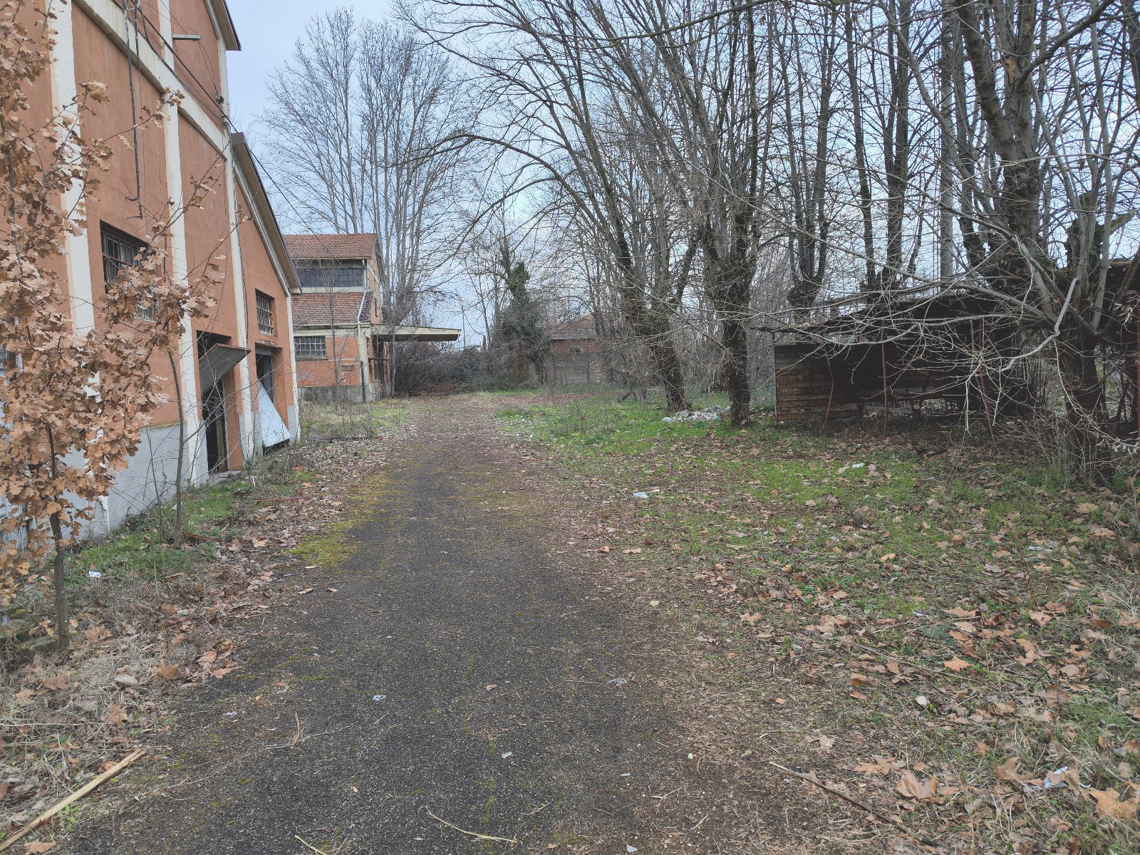
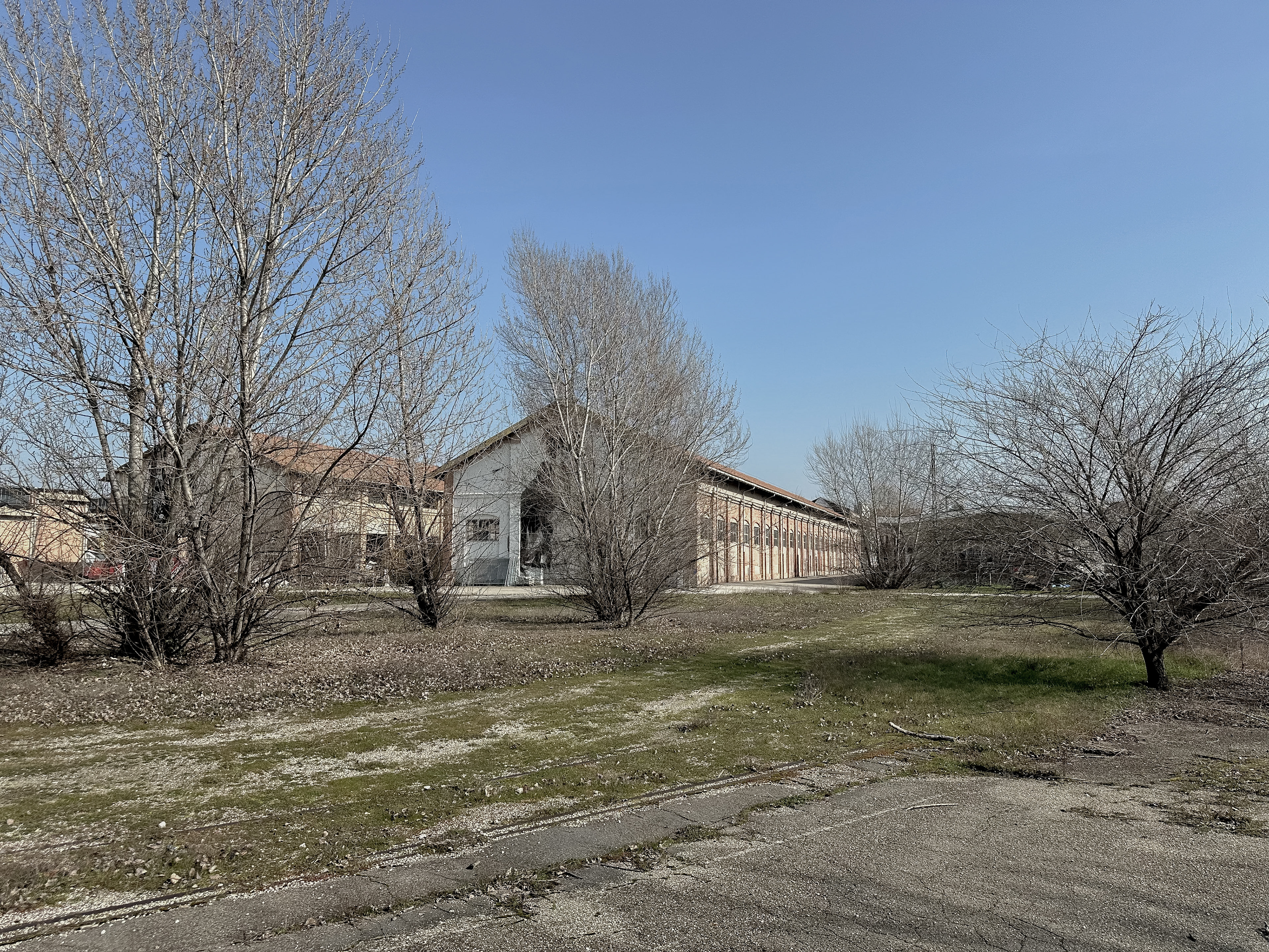
- Prati di Caprara West, on the other hand, spans around 16 hectares and includes the remnants of the former San Felice Barracks, which today is largely in a state of decay. Many of the buildings are dilapidated, with only a few still structurally usable.
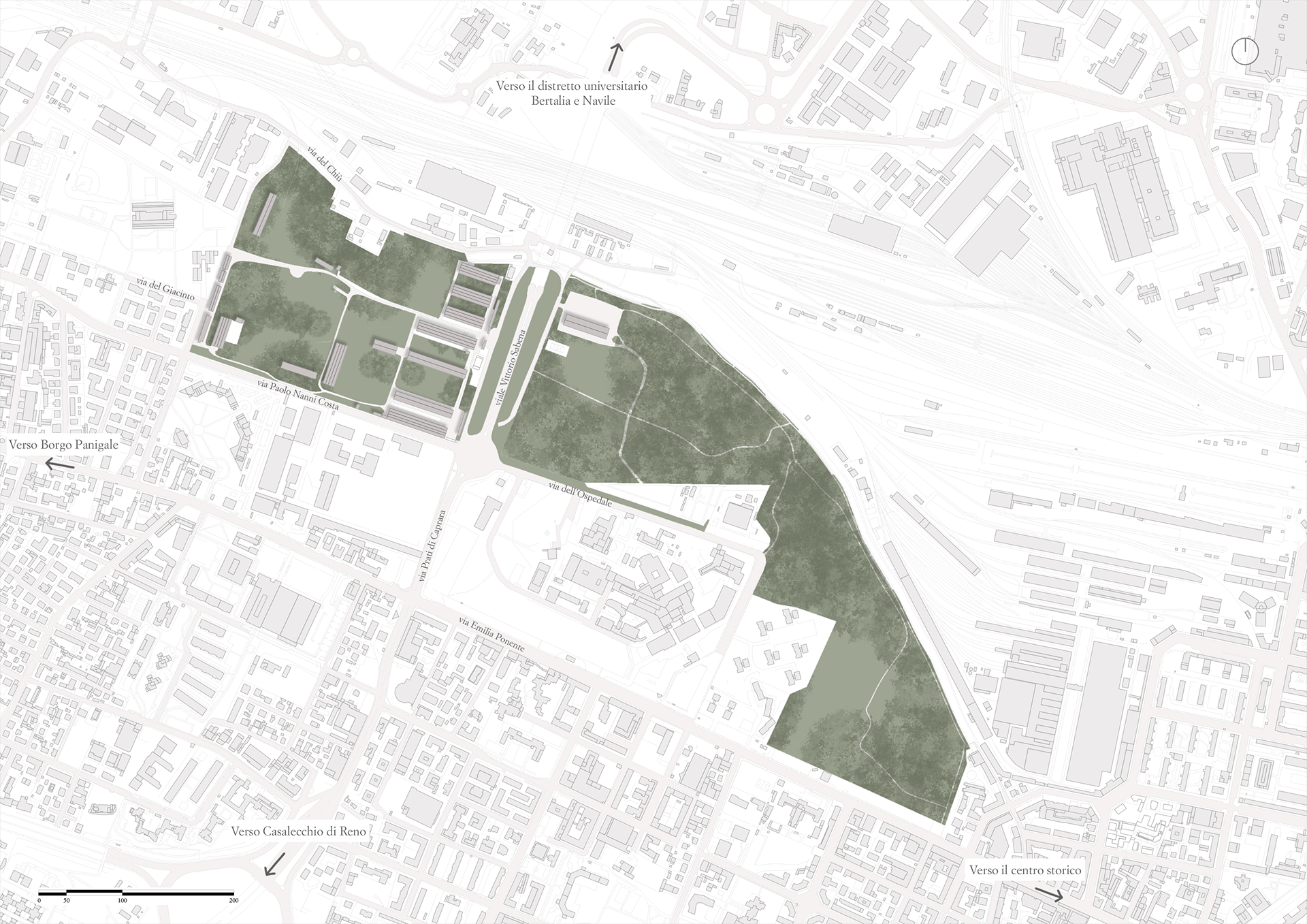
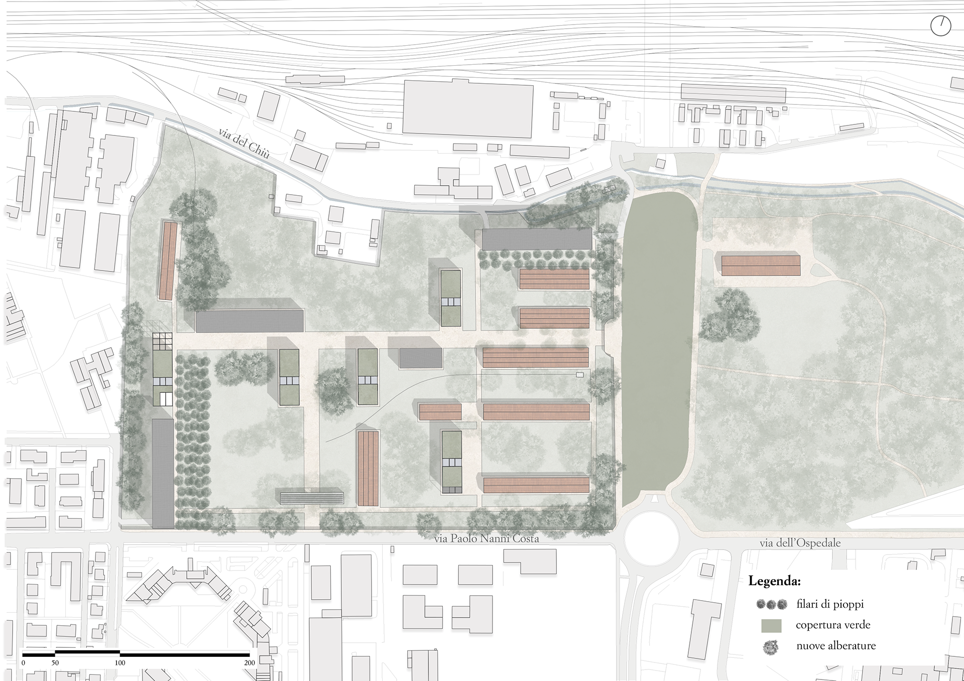
Planivolumetric of the Prati di Caprara
Axonometric projection of the Prati di Caprara
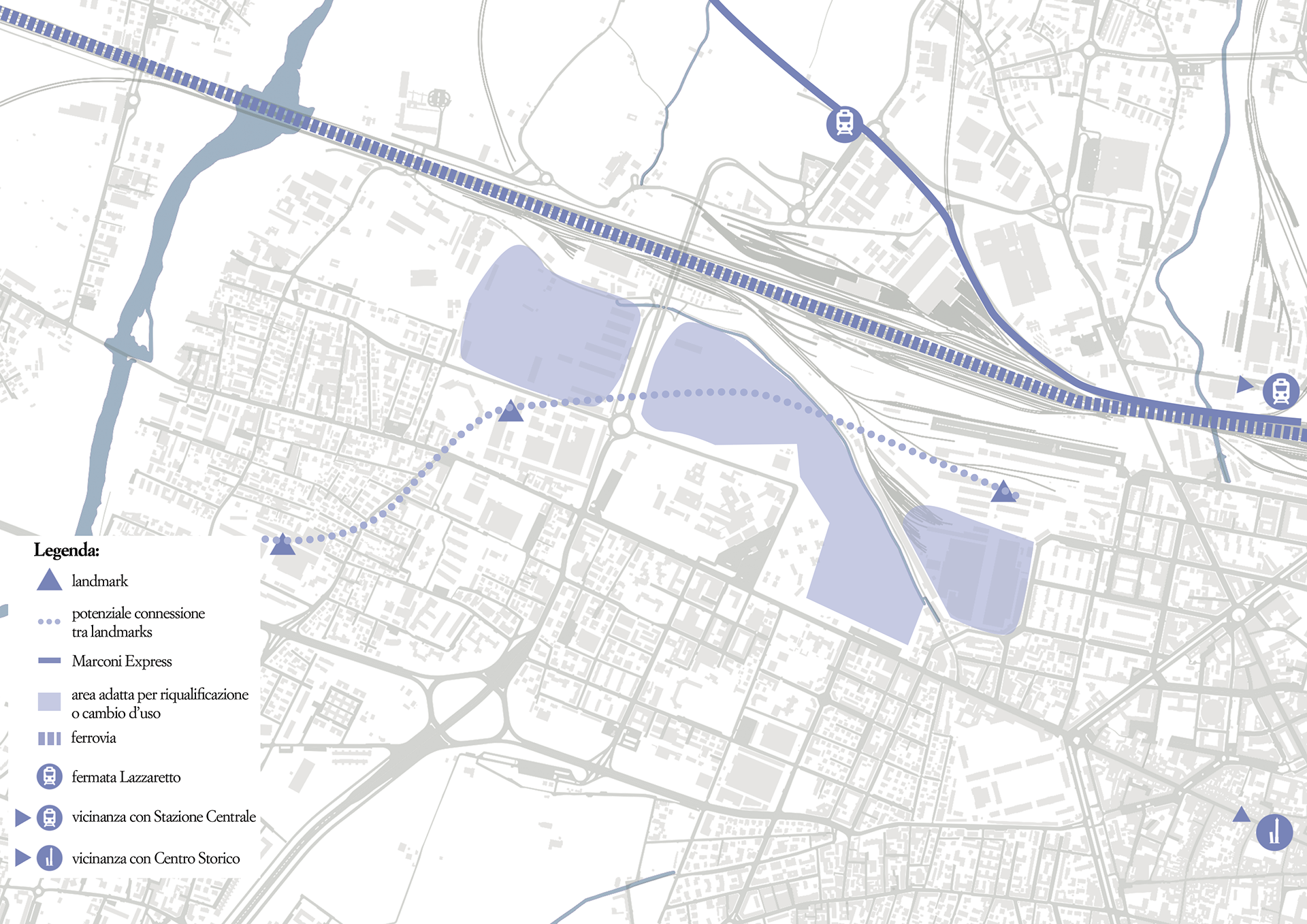
Beyond road infrastructure, the Prati di Caprara are also well-served by public transport: more than 10 urban bus lines make the area easily reachable. In addition, two future stops on the new Red Tram Line—currently under construction—will further enhance accessibility. The proximity to the Lazzaretto stop on the Marconi Express, the direct line connecting Bologna’s central train station to Guglielmo Marconi Airport, makes the site accessible even from outside the city.
Another element that makes this area particularly interesting is the urban and social fabric in which it is embedded. Although the Prati di Caprara are surrounded primarily by residential areas, they are also close to several of the city's key landmarks. These include:
- The headquarters of GD, a leading manufacturer of packaging machinery.
- Maggiore Hospital, one of Bologna’s main healthcare centers.
From a cultural standpoint, the area is surrounded by important hubs of innovation and creativity, such as:
- MAST, an exhibition space dedicated to art, technology, and experimentation.
- DumBo, a multifunctional center hosting cultural and social events.
- Opificio Golinelli, a hub focused on education, research, and scientific outreach.
Just beyond the railway lies the Bertalia District, part of the University of Bologna’s extensive campus, home to the Faculty of Engineering with classrooms, labs, and communal spaces. Lastly, another symbolic site of the city is located nearby: the Certosa Cemetery, a historical and artistic landmark that represents one of Bologna’s cultural gems.
Urban location of the area of the Prati di Caprara
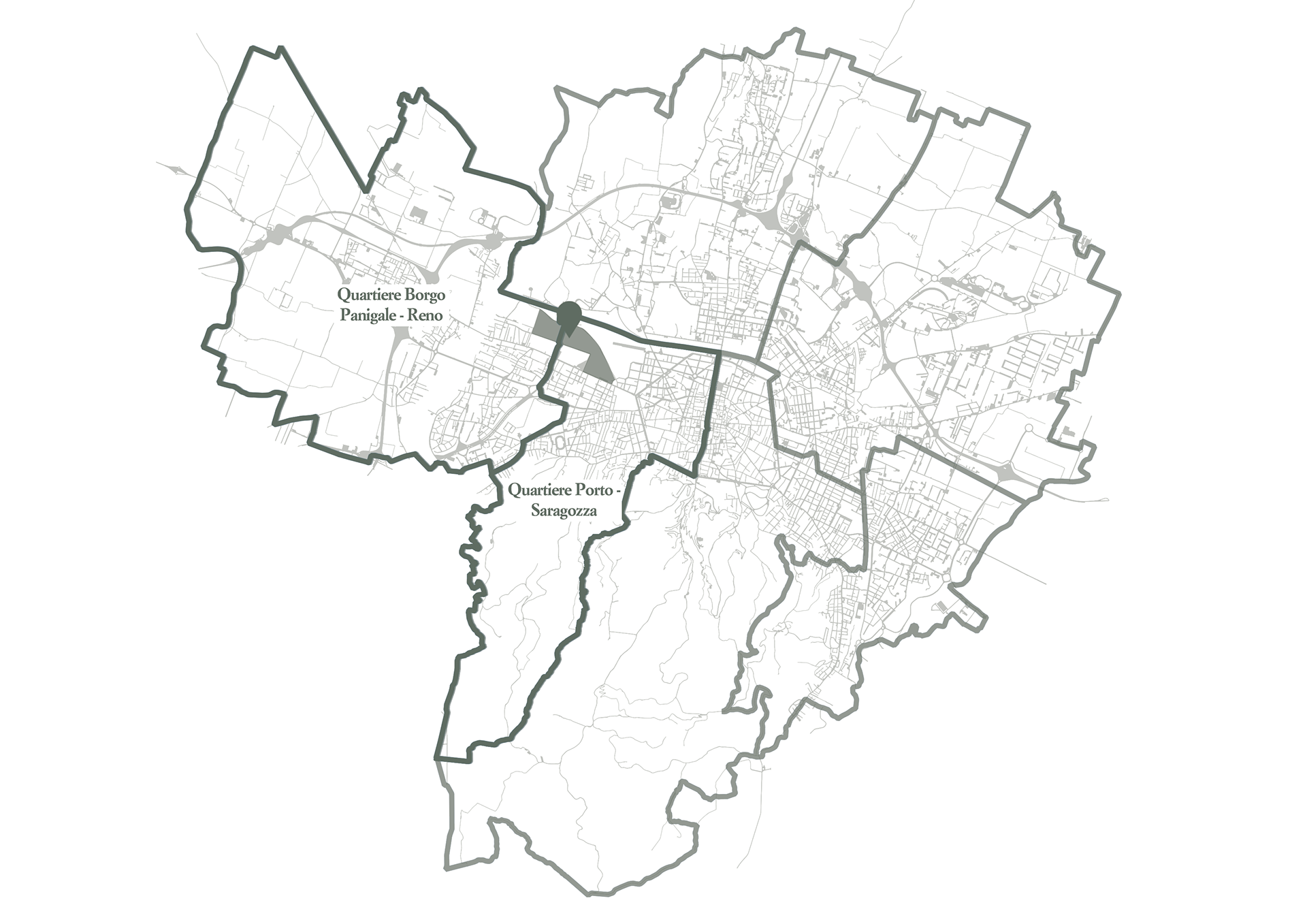
Location of the area in relation to the division into districts
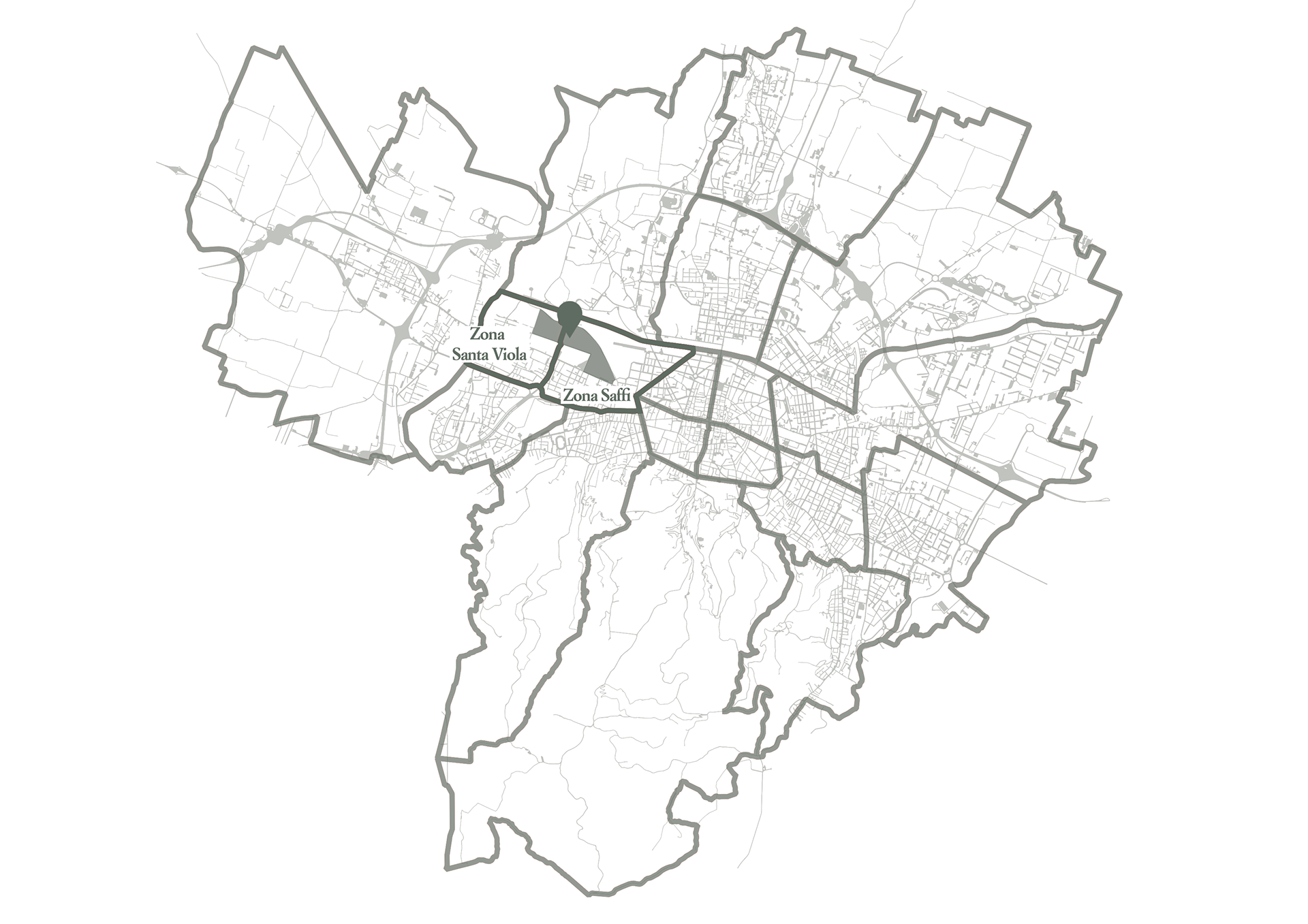
Location of the area in relation to the division into zones, according to the former administrative subdivision
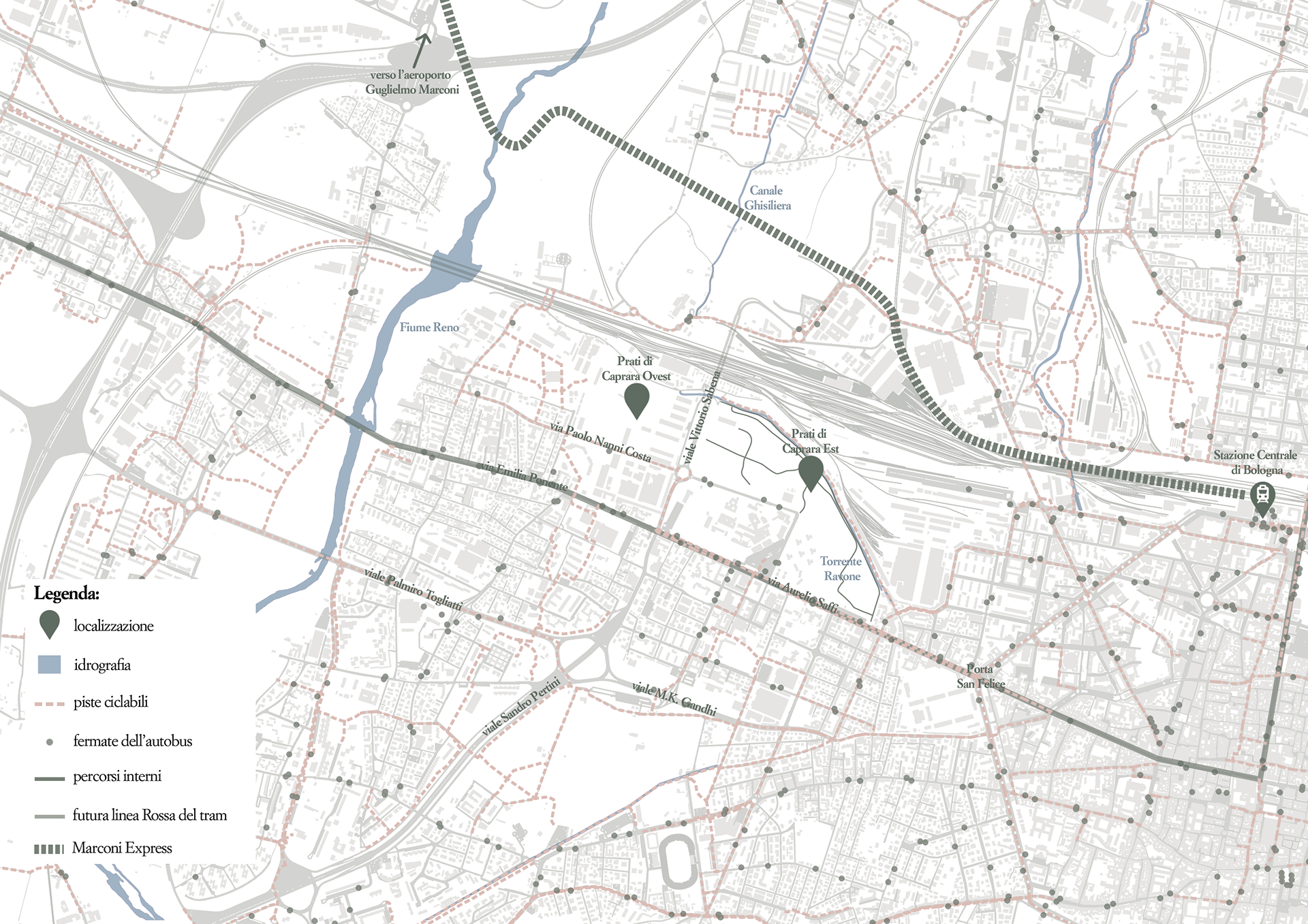
Integration within the urban road network
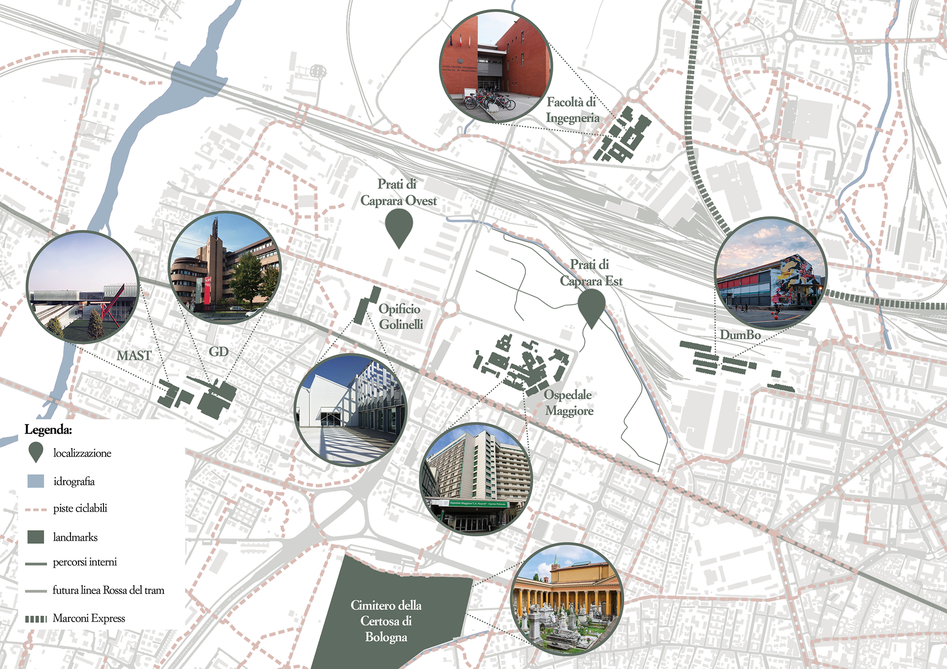
Landmarks near the Prati di Caprara area
Urban green spaces
Forest cover
Services
Buildings in use and out of use
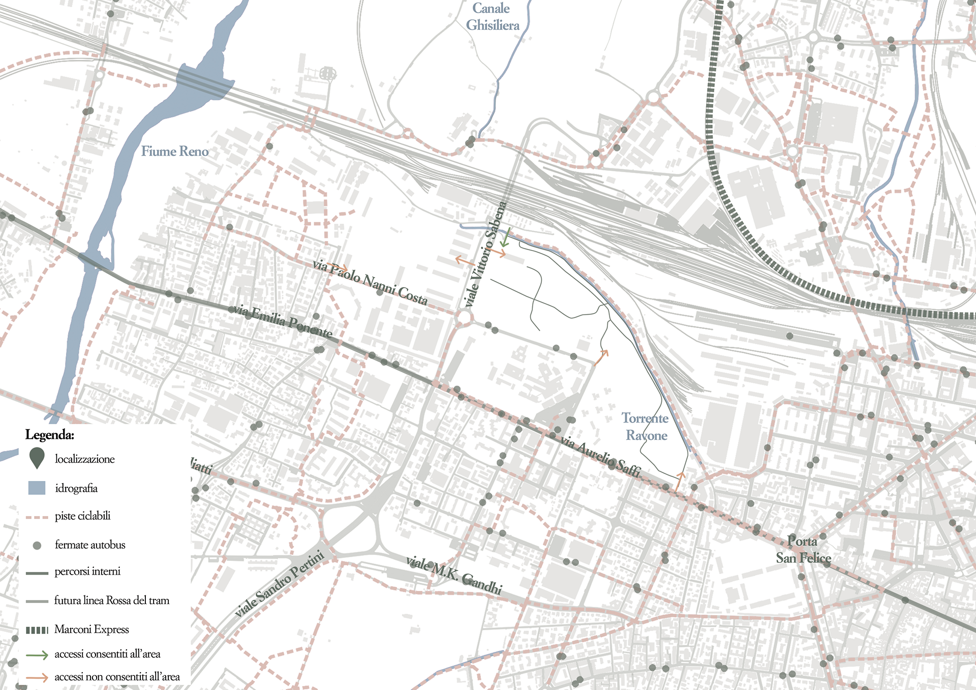
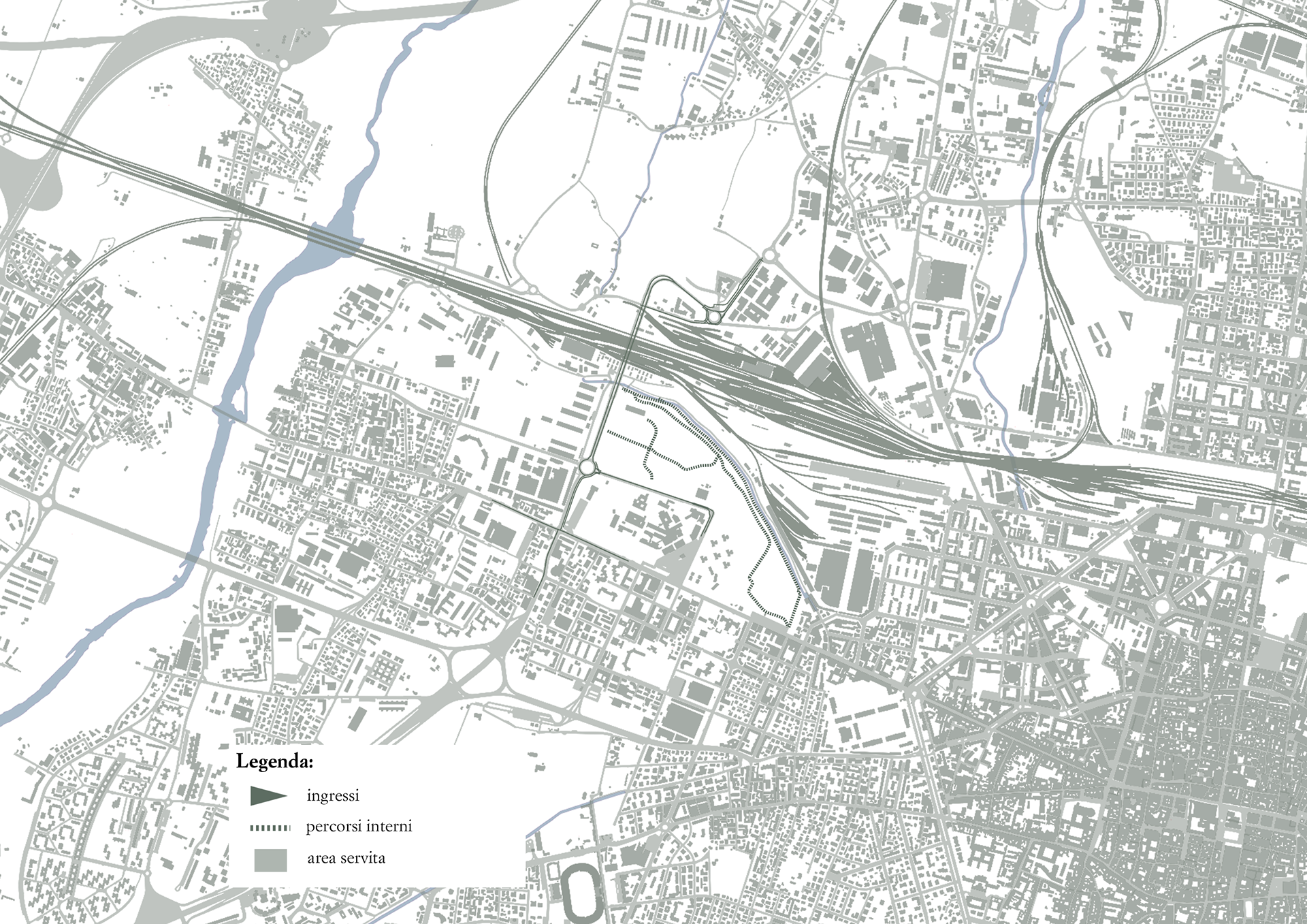
Access points to the area and internal paths
All these factors make Prati di Caprara a site with immense potential—a space capable of becoming a bridge between nature, culture, and innovation.
It is within this context that my project is situated, with the aim of transforming the site into a cultural hub immersed in greenery—one that reconnects architecture with the urban landscape and creates a new valuable space for the city and its residents.
My project seeks to reconcile the two souls of the area, creating a balance between architecture and natural landscape. The challenge is to transform the former barracks into a cultural center without compromising the ecosystem that has gradually reclaimed the space over time.
Current Condition
First, an in-depth historical and cartographic study of the Prati di Caprara was conducted, which made it possible to reconstruct the evolution of the area over time. However, no detailed site plans of the current state were found, which made it necessary to rely on historical orthophotos, satellite images, and recent photographs for analysis.
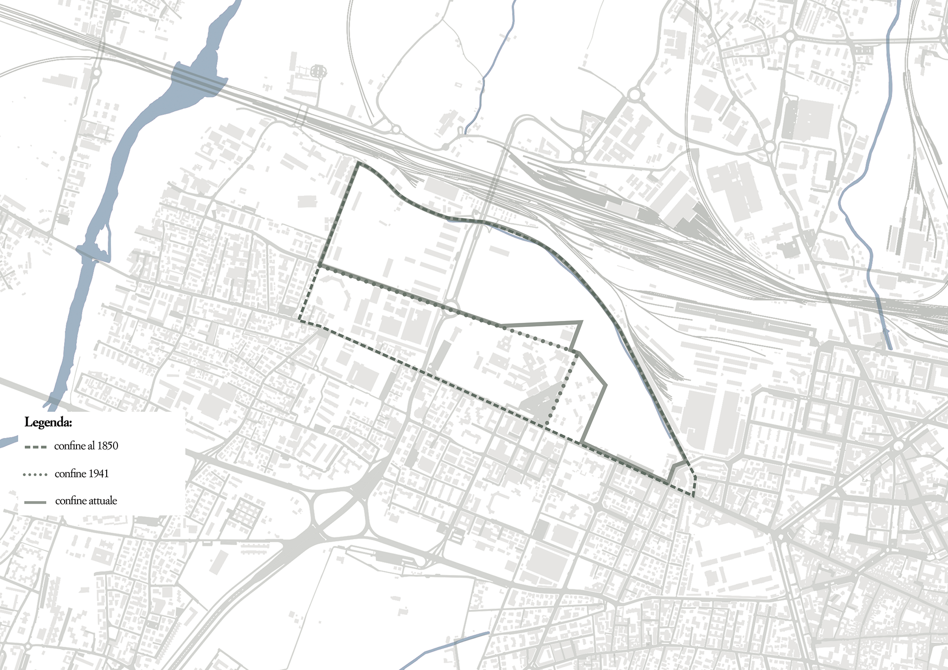
Evolution of the area over time
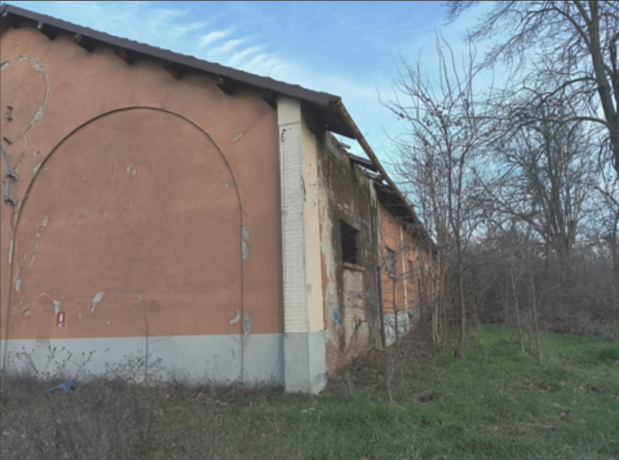
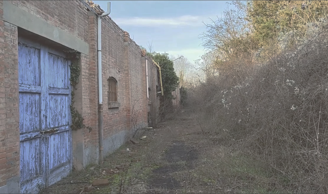
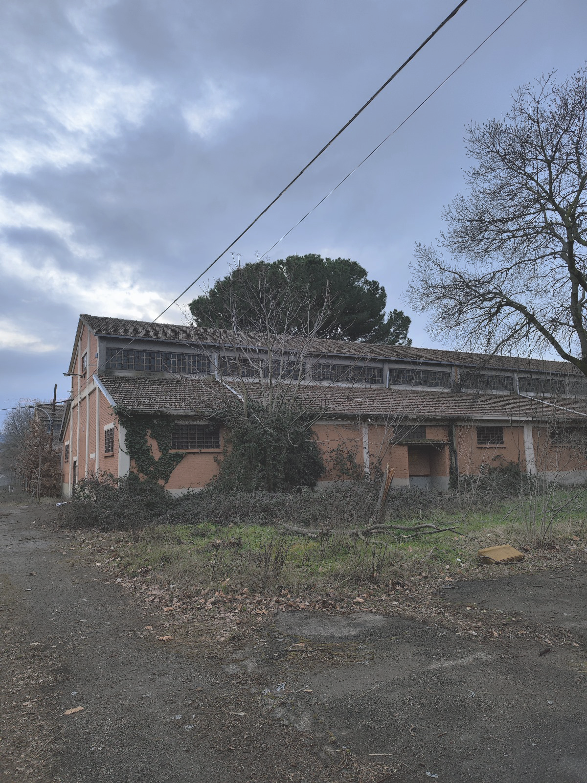
The area contains around 20 buildings, most of which are in an advanced state of decay. Some have partially or entirely collapsed over the years, while others still stand, albeit in a dilapidated condition. The only exception consists of two buildings facing Via Nanni Costa, currently in use by the Italian Red Cross—evidence of a residual function within an otherwise abandoned context.
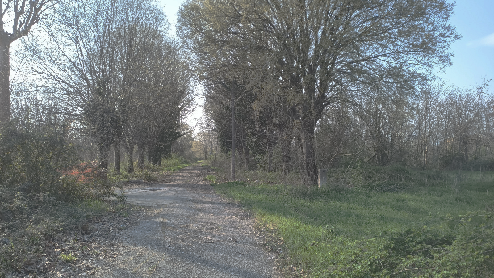
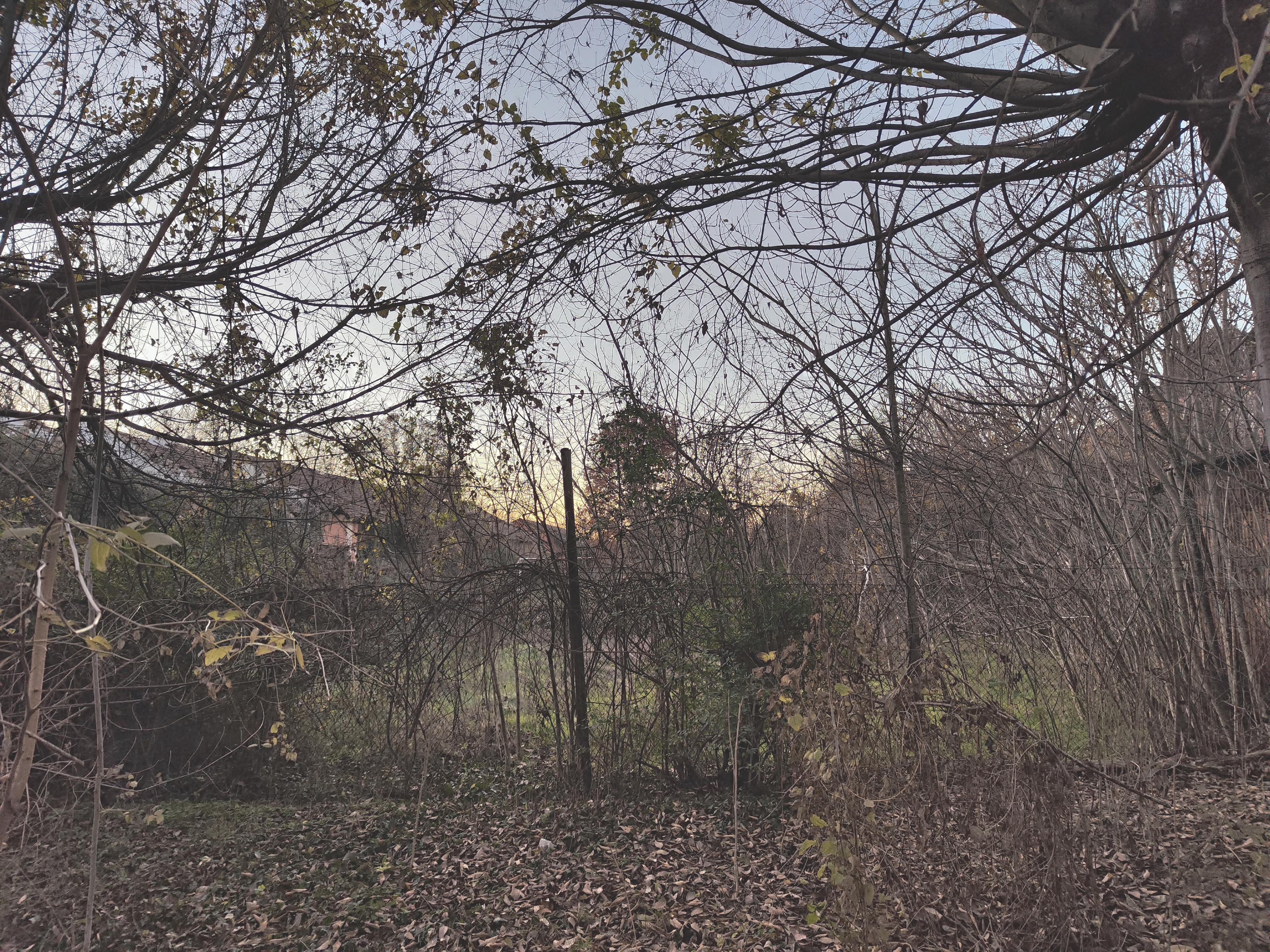
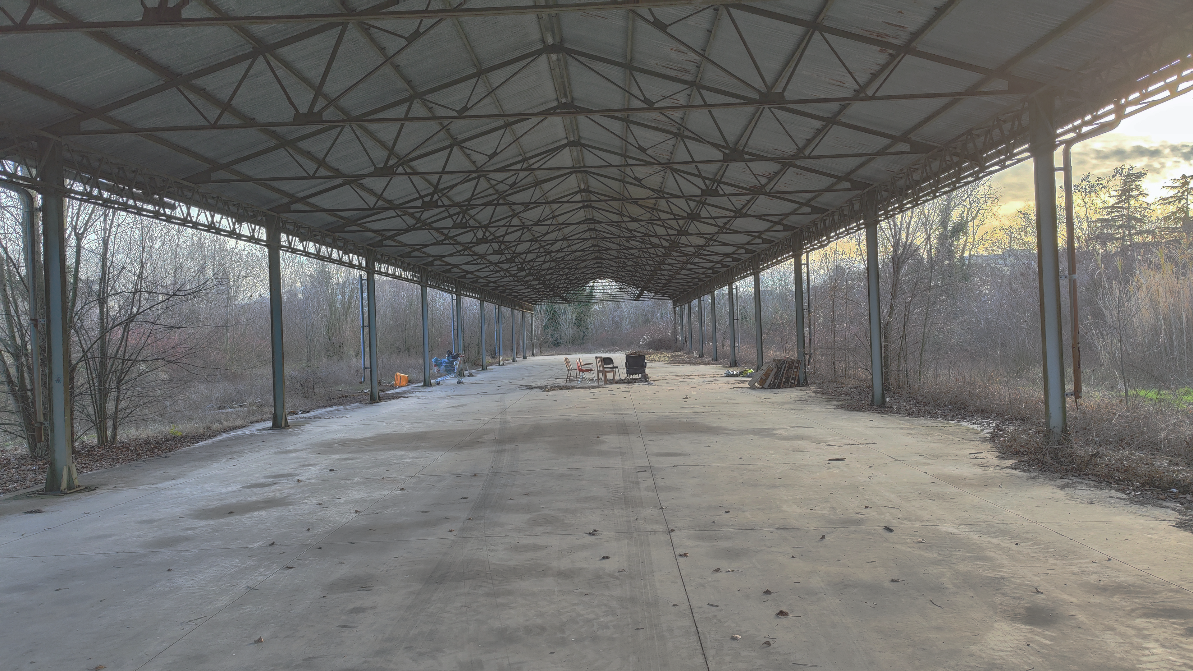
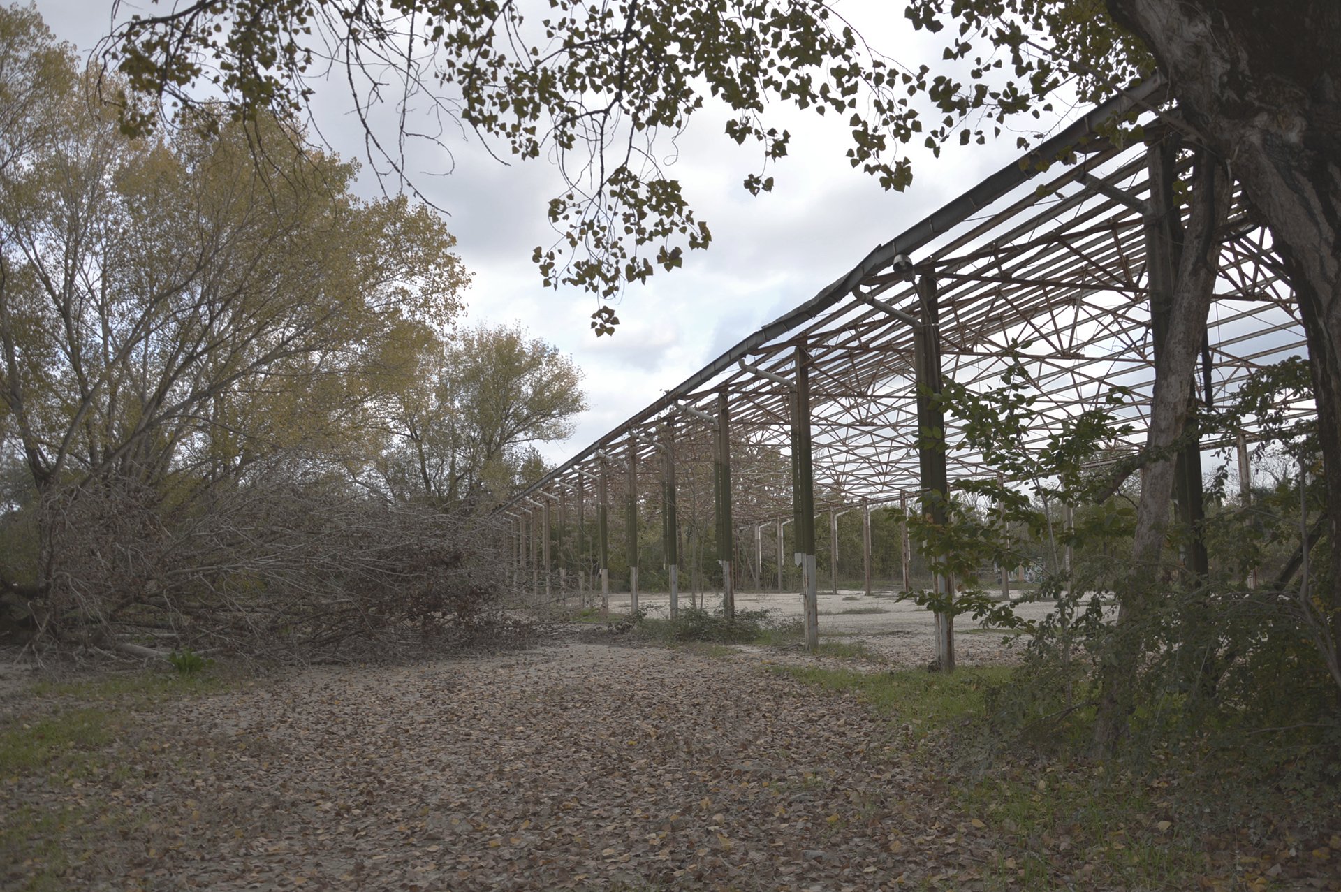
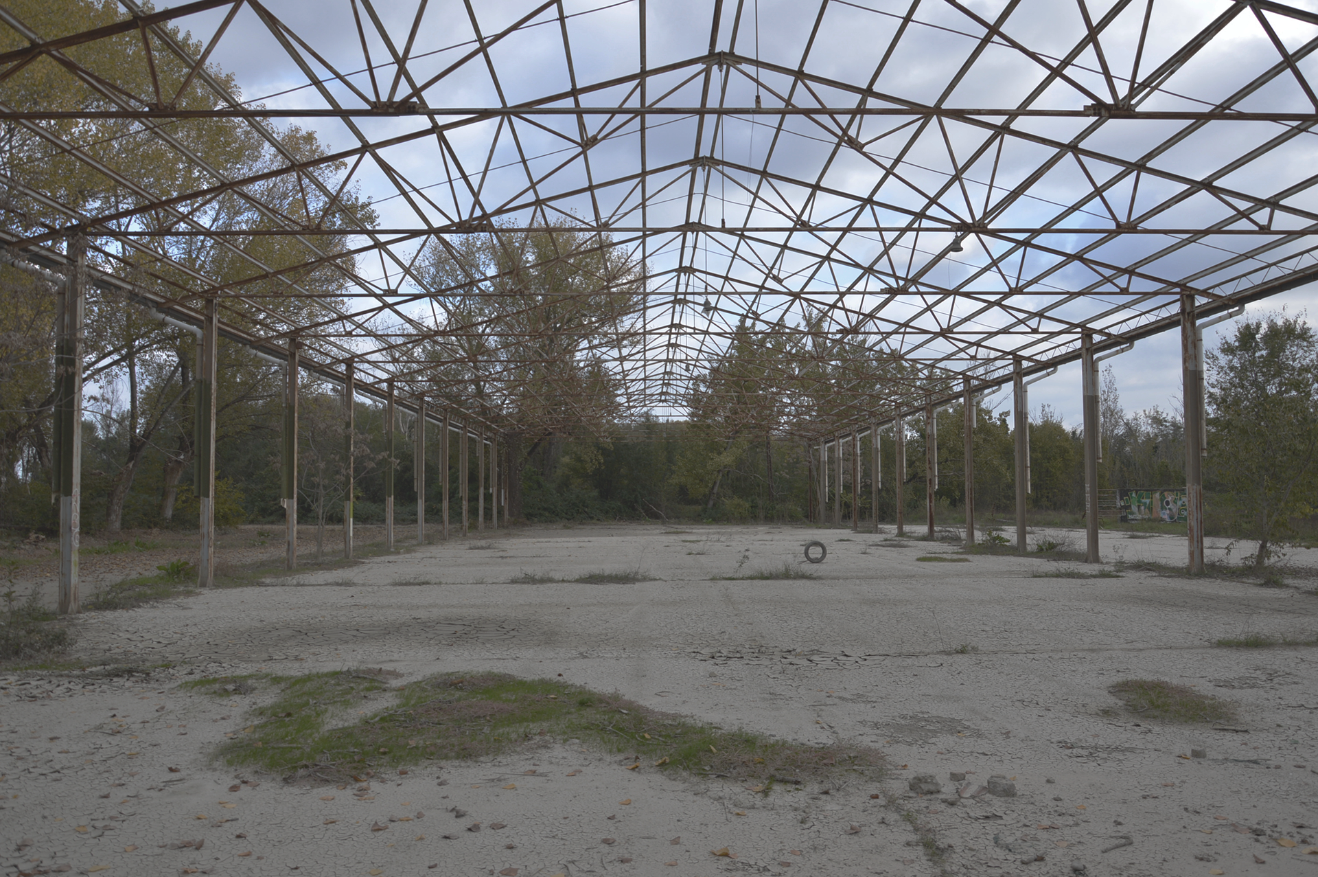
In the eastern part of the area stands the steel skeleton of a building, now entirely engulfed by spontaneous vegetation. The inaccessibility of the site has, in fact, fostered a process of spontaneous rewilding, which has transformed the area into a true urban ecosystem, where nature has gradually reclaimed built spaces.
Thanks to orthophotos provided by the Municipality of Bologna, it was possible to identify the outlines of the buildings and some original paths, still visible despite the encroaching vegetation. Additionally, during an occupation of the site in 2023, members of the local committee Rigenerazione No Speculazione documented the current state through a series of photographs, offering a direct testimony of the site’s present appearance.
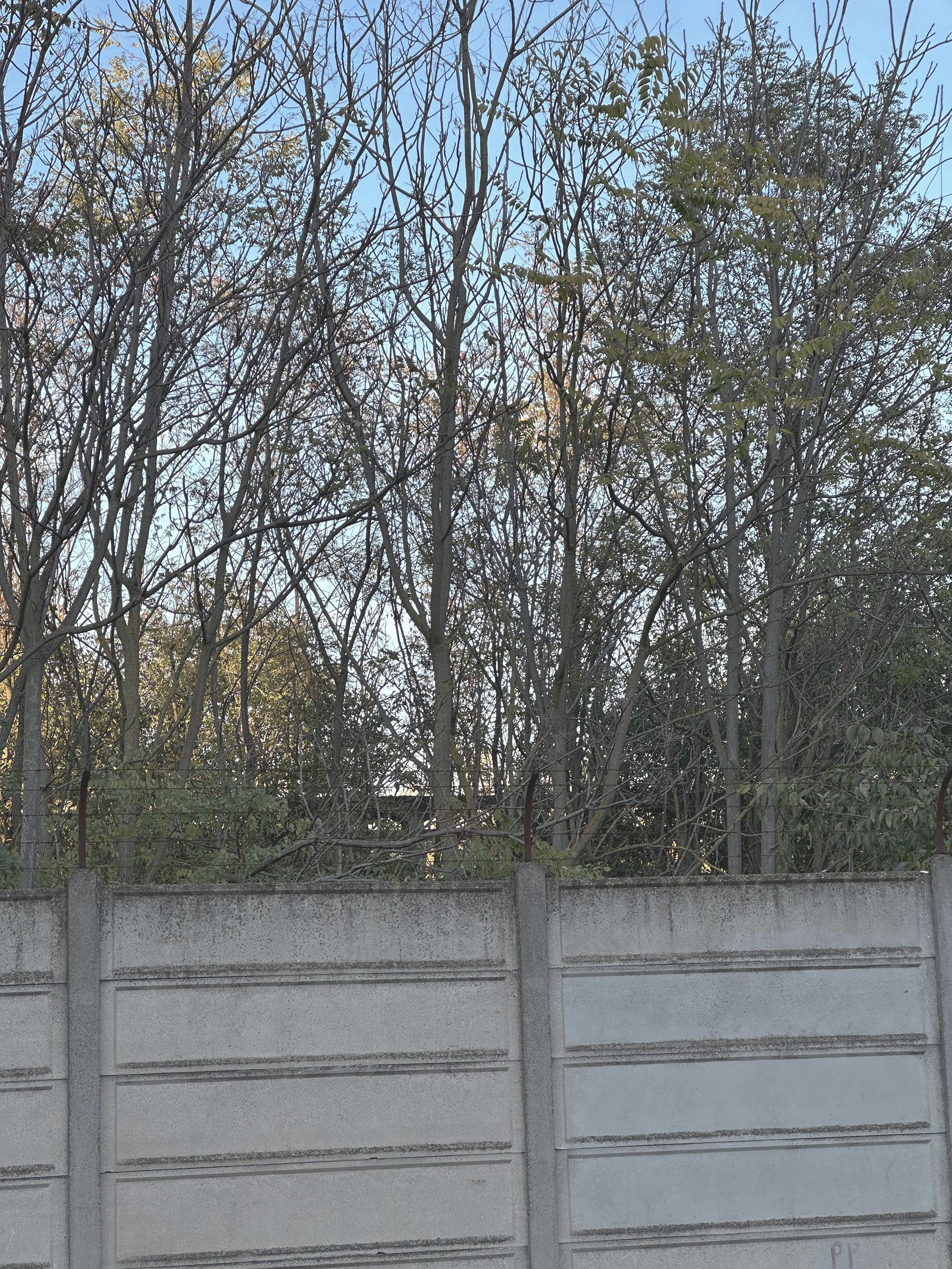
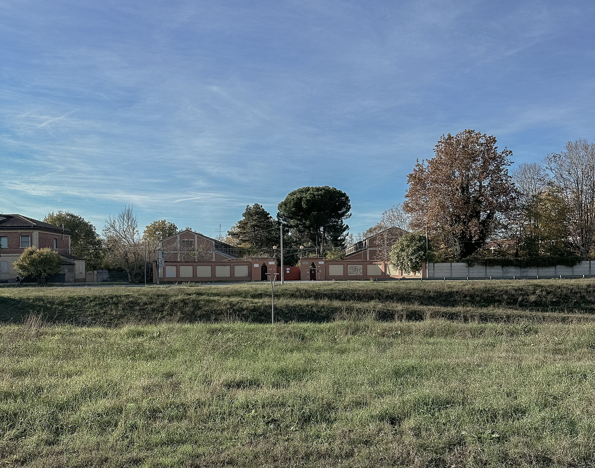
The entire area is enclosed by a concrete perimeter wall approximately 3 meters high, topped with barbed wire—a typical feature of former military facilities. The main entrance has a monumental design, with architectural elements that echo Bologna’s traditional porticoes, while several secondary, likely service-related access points are located along the site's perimeter.

Planivolumetric of the San Felice Military Facility
These images reveal a fascinating reality: vegetation has completely enveloped the structures, almost entirely obscuring their original military function and turning the former barracks into a hybrid landscape where architecture and nature merge.


Typological Classification of Buildings
The site analysis identified three main building types:
Planivolumetric
Typological Classification of Buildings
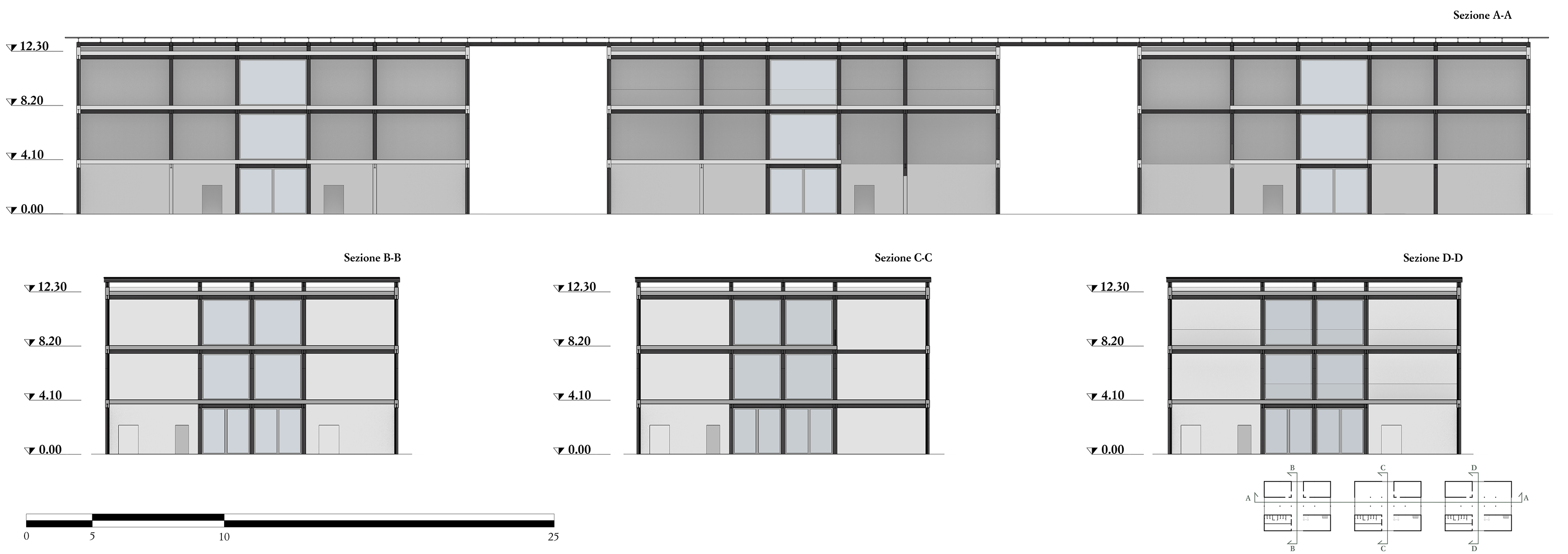
Sections A-A, B-B, C-C, D-D
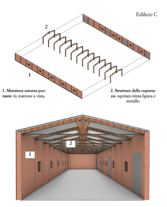
Type 1 Buildings
This category includes one-story masonry structures with an elongated rectangular plan. The walls along the longer sides are thickened where roof trusses or beams rest, forming structural pillars. Depending on size, the roof is supported either by wooden trusses (in smaller buildings) or by a central longitudinal column (in larger buildings) to reduce the span between load-bearing walls.
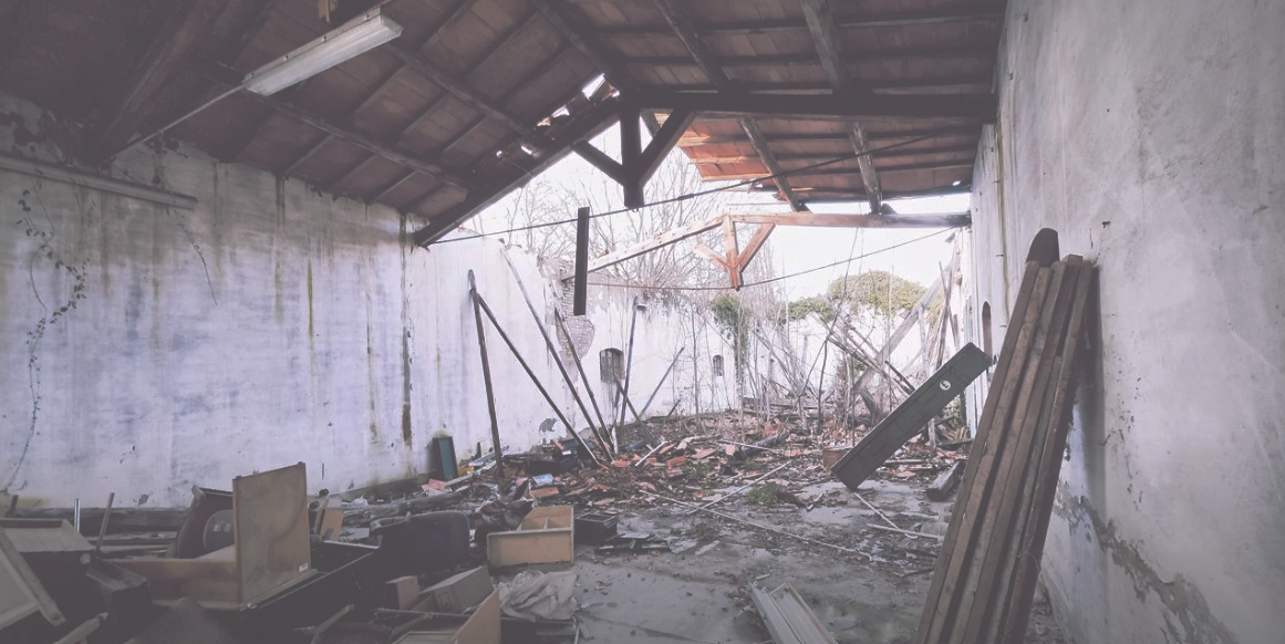
These buildings appear particularly vulnerable, as the photos clearly show collapsed roofs and structural damage. Three buildings of this type were reconstructed based on available images and labeled as A, B, and C:
- Buildings A and B are larger than C and appear to be made of masonry.
- Some structural elements feature paired arches used to support the timber roof structure.
- The material of the arches is uncertain: the smooth, plastered finish suggests reinforced concrete, but unplastered sections reveal brickwork, suggesting a possible mixed structure.
- Openings are small, generally wide and low.
Building C was reconstructed using both interior and exterior photos. It is likely that buildings D and E, adjacent to C, have similar structures, although no detailed images of them are available.
All three have a narrow, elongated layout with vertical structural elements in masonry. The absence of transverse elements is unusual, considering the distance between the load-bearing walls exceeds the typical 5 meters.
The roof features a combination of wooden and steel trusses, with a likely layering as follows: Wooden and steel trusses, Wooden beams, Support slats, Brick layer.
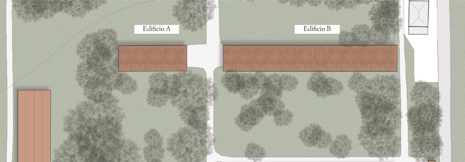
Planivolumetric and contextual integration of the two type 1 buildings referred to as A and B
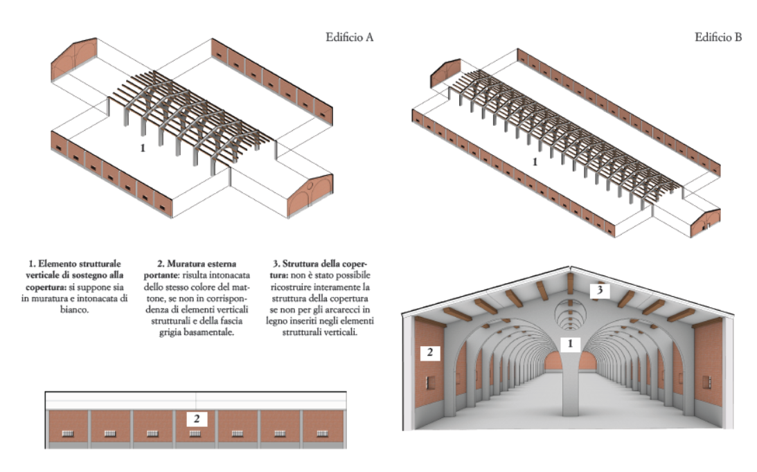
Exploded reconstruction views of Building A and B, Elevation of Building A and Interior of Building B
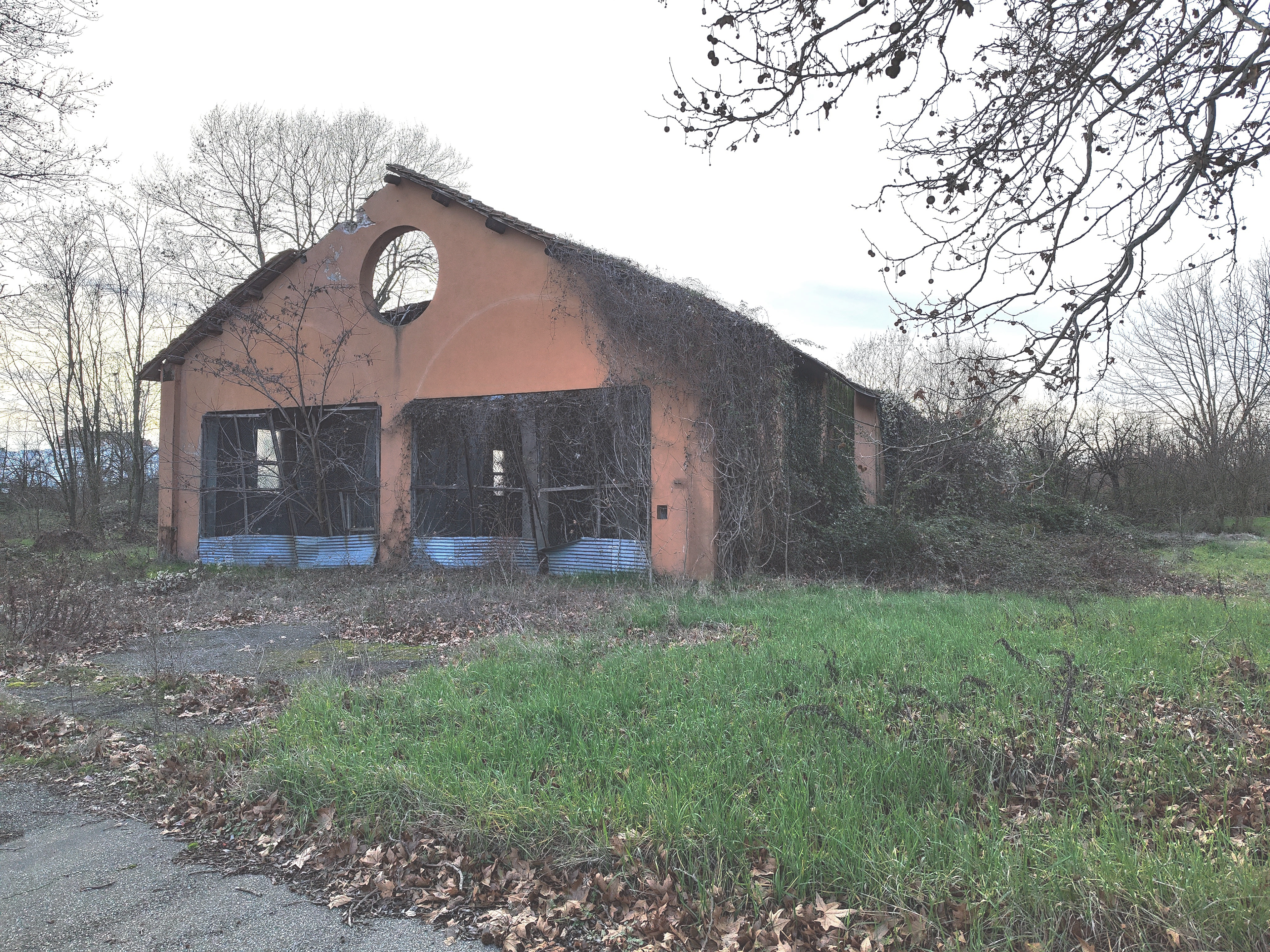
Photograph of Building A or B, kindly provided by the Comitato Rigenerazione No Speculazione

Photograph of the exterior of Building B

Photograph of the exterior of Building B
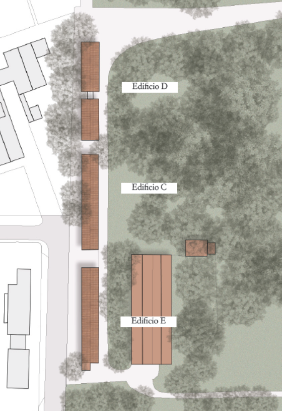
Planivolumetric and contextual integration of the type 1 buildings referred to as C, D, E
Exploded reconstruction view of Building C and Interior of Building C

Photograph of the interior of Building C

Photograph of another building referred to as C, kindly provided by the Comitato Rigenerazione No Speculazione

Photograph of the exterior of Building C
Planivolumetric and and contextual integration of the two type 2 buildings
Exploded view, Interior perspective and Perspective view of the interior of Building G
Exploded view, Interior perspective and Perspective view of the interior of Building H
Exploded view, Interior perspective and Perspective view of the interior of Building I
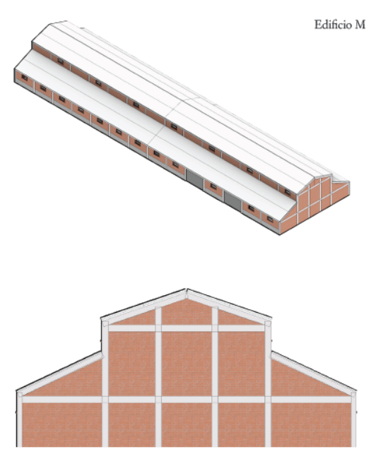
Three-dimensional reconstruction and Rear elevation of Building M
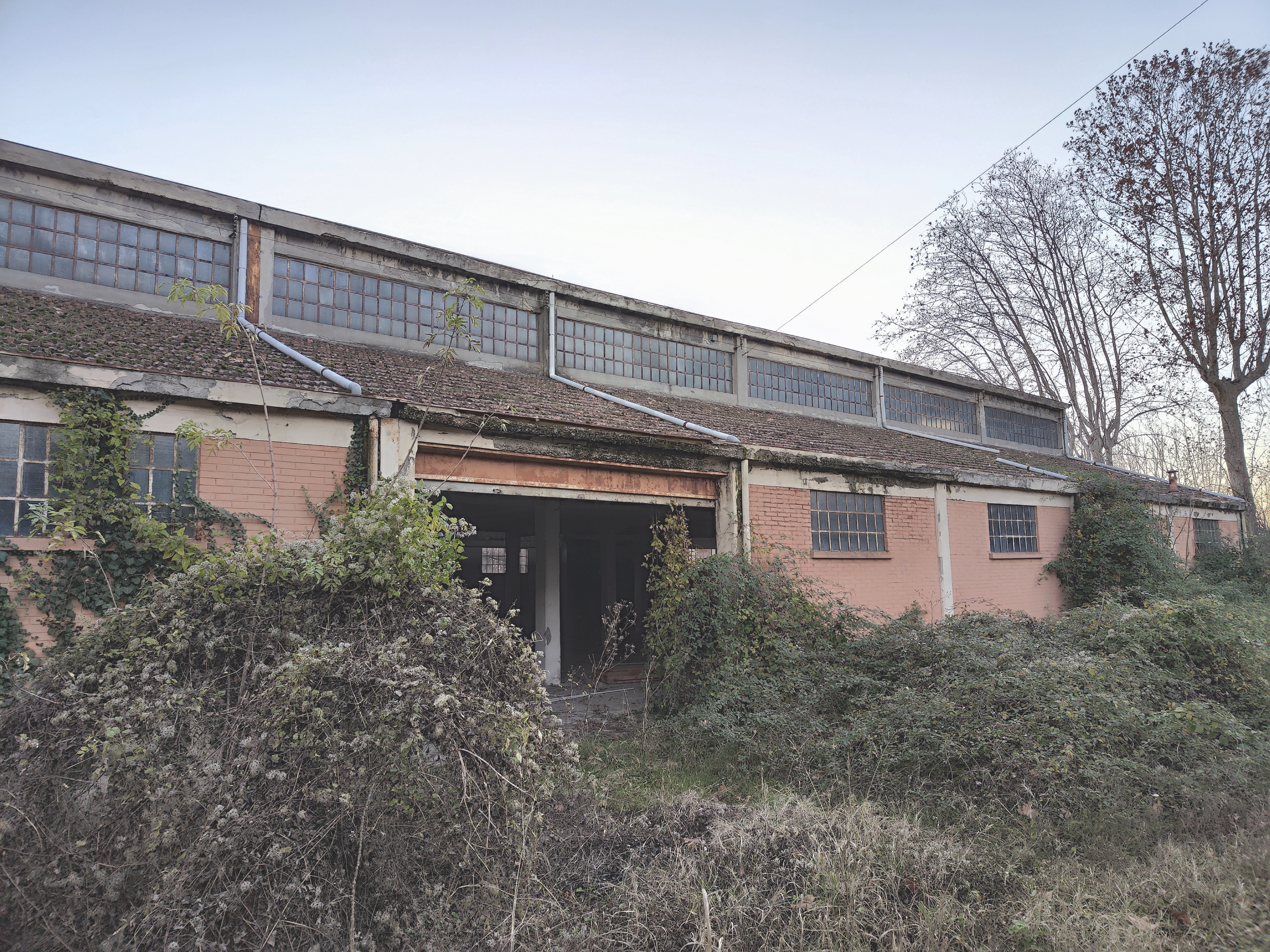
Photograph of a building classified as type 2
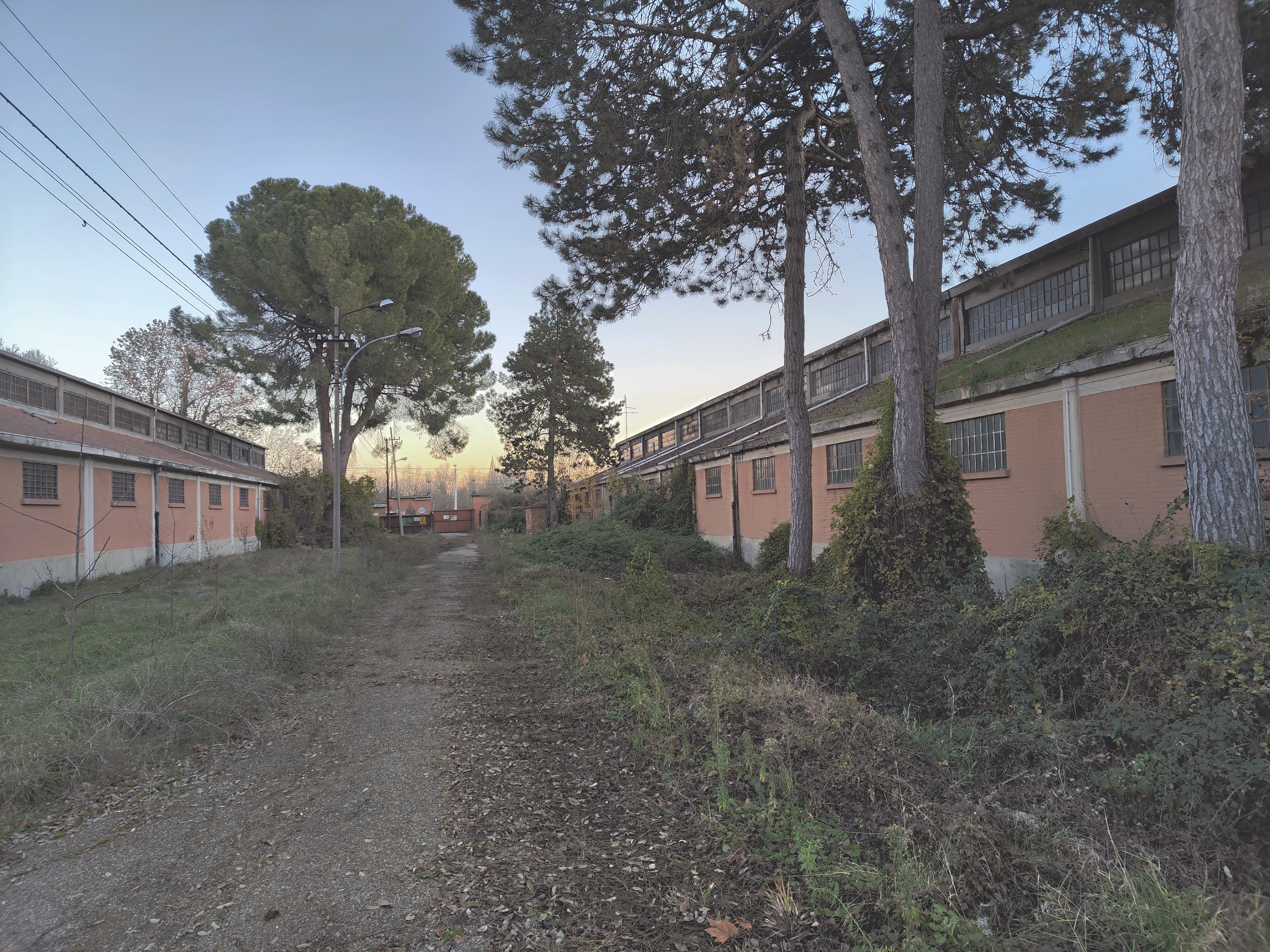
Photograph of two buildings classified as type 2

Photograph of the interior of a building classified as type 2

Photograph of the interior of a building classified as type 2

Photograph of the interior of a building classified as type 2

Photograph of two buildings classified as type 2
Photograph of the exterior of Building H
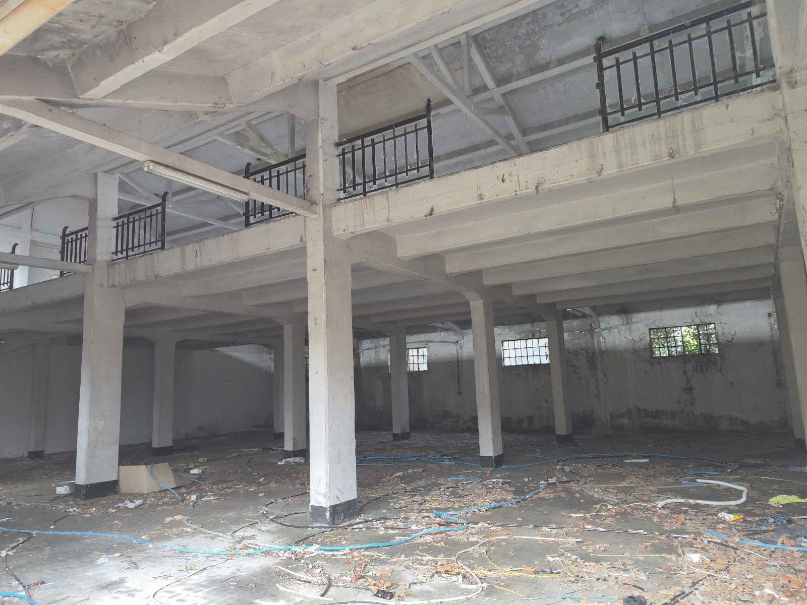
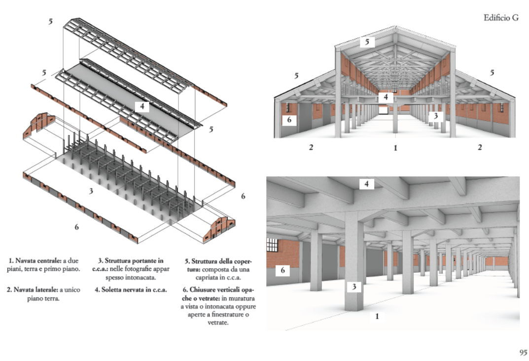
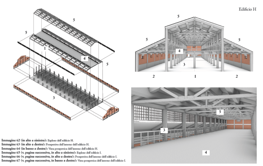
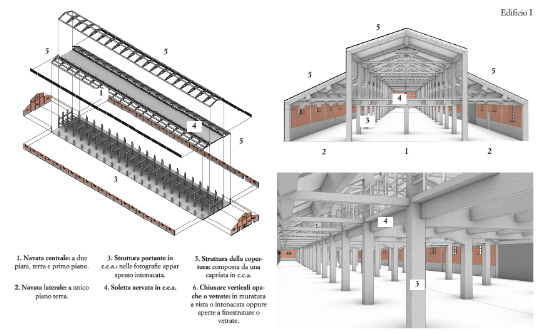
Type 2 Buildings
These are two-story buildings with a reinforced concrete frame, likely built in the second half of the 20th century. They are generally divided into three parts:
- Lateral aisles, limited to the ground floor, with reinforced concrete beams supporting half-trusses for single-pitched roofs.
- Central nave, often featuring rows of columns supporting the first-floor slab.
- First-floor slab, made of a ribbed reinforced concrete slab, possibly prefabricated.
The roof is pitched, with a supporting structure that varies but is generally made of reinforced concrete trusses. The enclosure walls are made of exposed or plastered masonry. The architectural layout gives the façades a resemblance to basilica-style structures.
Openings are generally located on the sides parallel to the building’s axis:
- Ground floor: low and wide windows
- First floor: varies among buildings. Some have large windows that also serve as walls, while others repeat the ground floor’s smaller openings.
The 3D reconstruction of this building type was mainly possible for the exteriors. Interior identification through photographs was more complex, leading to possible discrepancies between the digital reconstruction and reality. Nonetheless, the basic structural scheme remains consistent, with mostly formal differences.
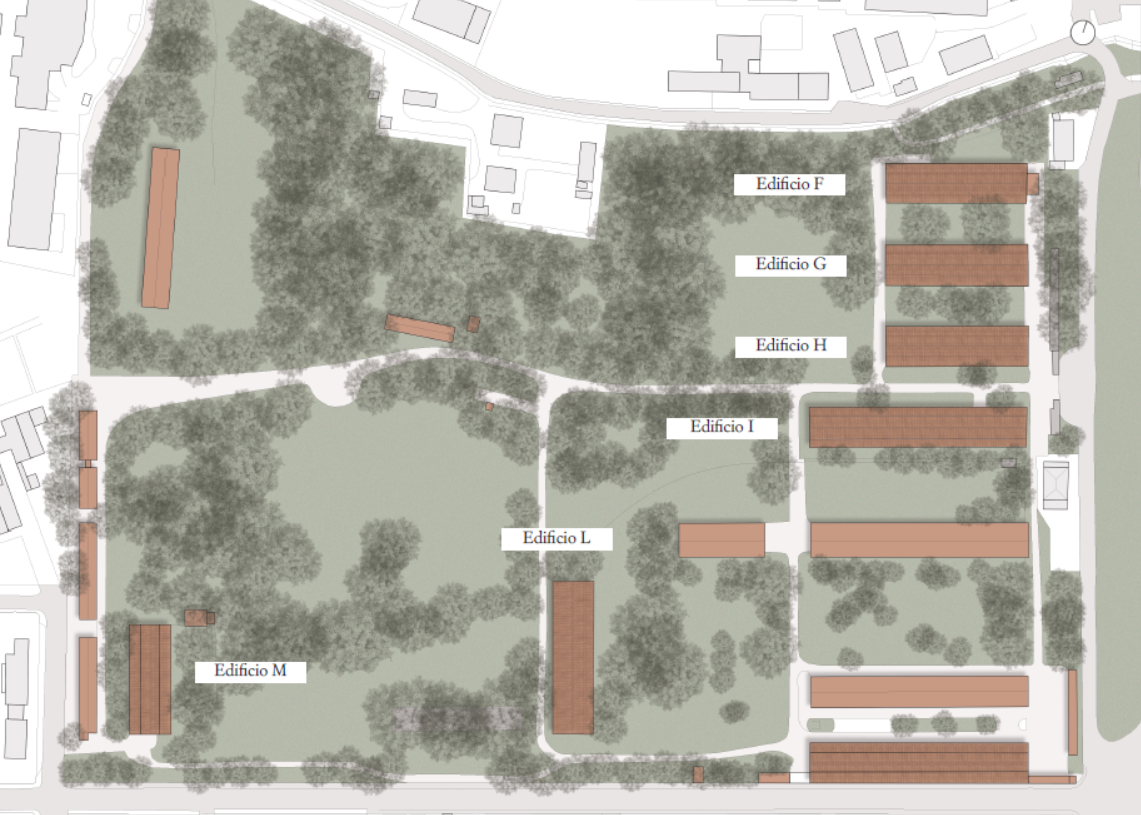
Buildings identified in this category include: F, G, H, I, L, M.
Reconstruction was not possible for buildings F and M due to the lack of detailed imagery and their immersion in vegetation, as visible on Google Earth. Buildings G, H, I, and L, on the other hand, are well documented both photographically and through satellite images, allowing for more accurate reconstructions. However, it's important to note that 3D models may not be completely faithful to reality.
Steel Structures
The site also features industrial sheds with steel structures and trussed roofs:
- One shed still has an intact roof.
- Another has lost its roof entirely, leaving only the supporting framework exposed.
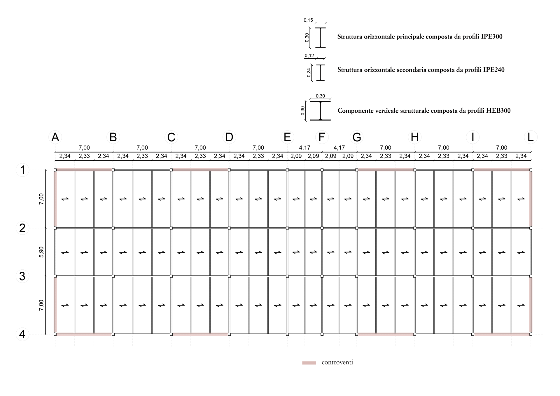
The vertical structures use HE profiles, while the trusses are composed of:
- IPE profiles as chords
- Composite profiles for the remaining structural elements.
Reinforced Concrete Skeleton
Lastly, the area contains a reinforced concrete skeleton—a unique, barely visible structure. It consists of a reinforced concrete frame without a roof or walls, likely never completed or heavily degraded. Vegetation has completely overtaken the structure, making it difficult to spot.
Planivolumetric contextual integration of the building O, P, Q
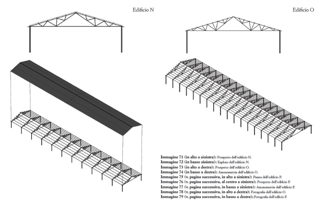
Elevation and Exploded view of Building N; Elevation and Exploded view of Building O
Photograph of the building O
Photograph of the building O

Photograph of the building N

Plan, Elevation and Exploded view of Building P

Photograph of the building P
Current Condition of The Urban Forest of Prati di Caprara
The urban forest of Prati di Caprara represents a unique ecosystem within the city of Bologna—an example of spontaneous green space that significantly contributes to biodiversity and the well-being of the local community. This chapter is based on the Scientific Dossier published by the Rigenerazione No Speculazione committee in June 2020, which offers a detailed description of the ecosystem and the ecosystem services provided by the urban forest.
First, it is important to summarize the constraints imposed by current regulations and the General Urban Plan of the Metropolitan City of Bologna. Most of the forested area of Prati di Caprara meets the criteria outlined for forest zones as defined in Legislative Decree 34/2018. As such, it is automatically protected under Article 142, paragraph 1, letter g) of Legislative Decree 42/2004 and its subsequent amendments. This protection is also confirmed by the regional forestry information system.
This study includes personalized elaborations based on the Protection Maps from the 2021 Urban Plan, focusing on the study area. These maps address:
- Water resources and hydrogeological system
- Slope stability
- Natural and landscape elements
- Historical and archaeological heritage
- Seismic risk
- Infrastructure, soil, and easements
- Air navigation infrastructure (1 & 2)
- Electromagnetic fields
Each map also contains a summary table listing the applicable restrictions on the Prati di Caprara area.
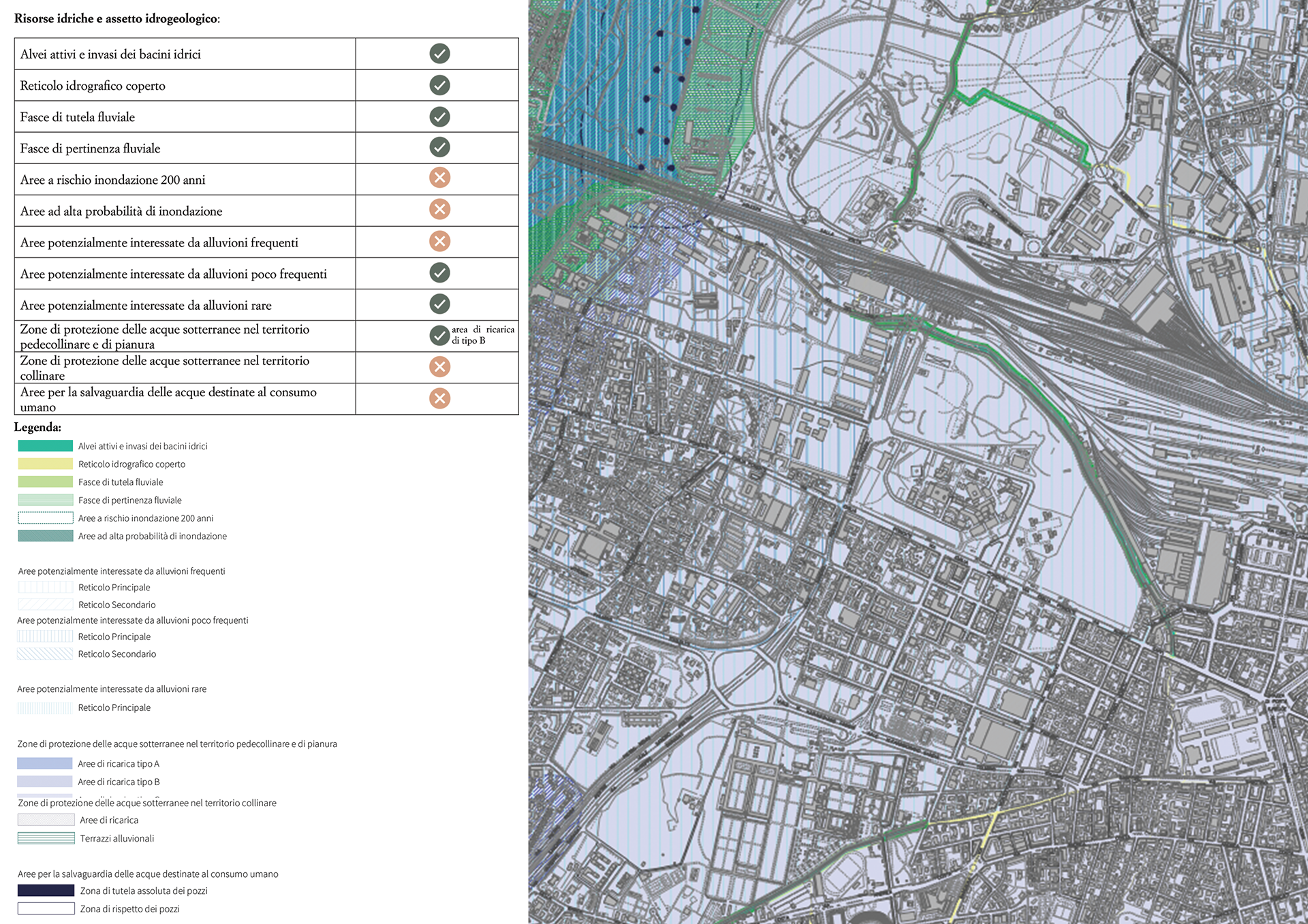
Water resources and hydrogeological system
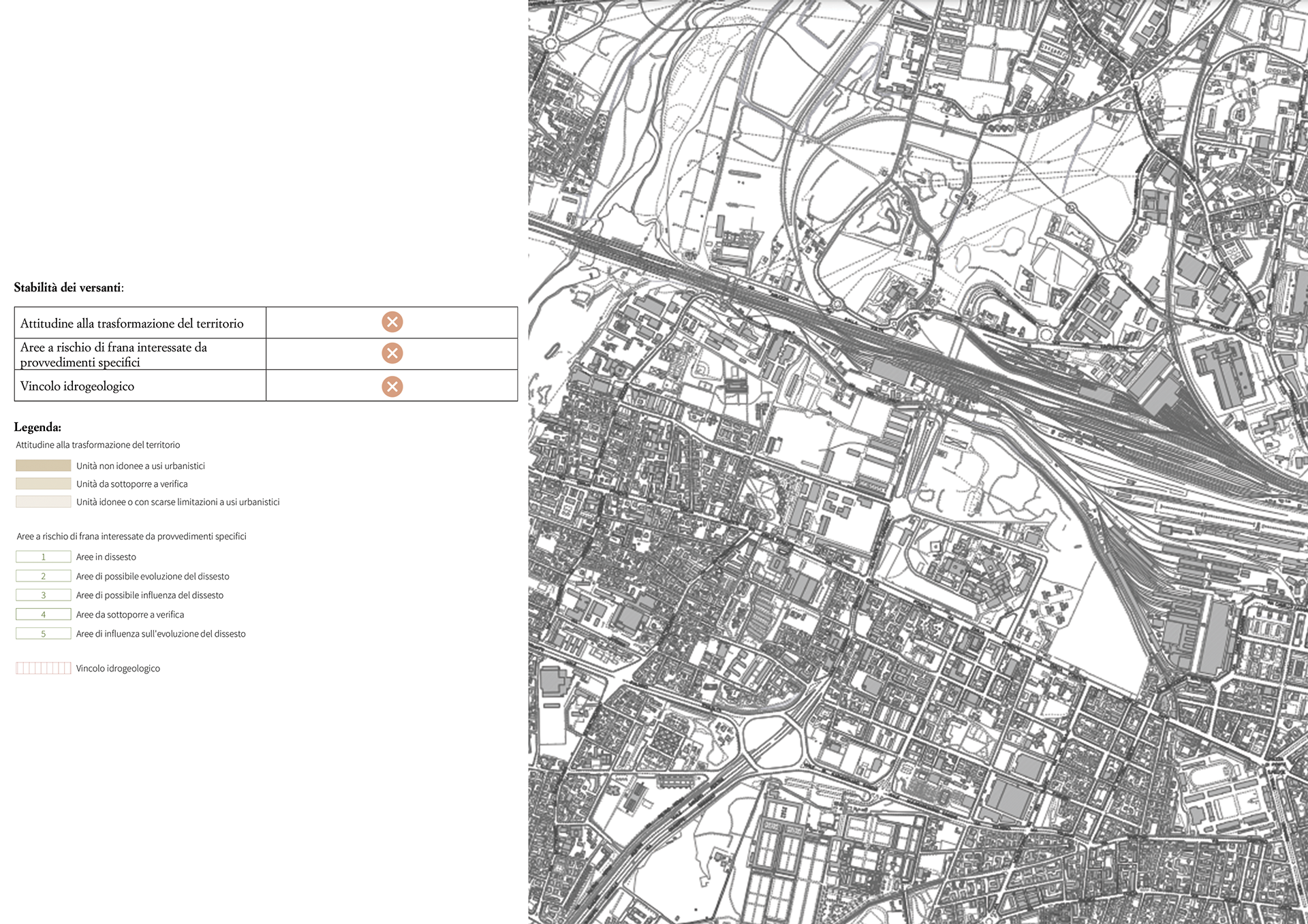
Slope stability

Natural and landscape elements
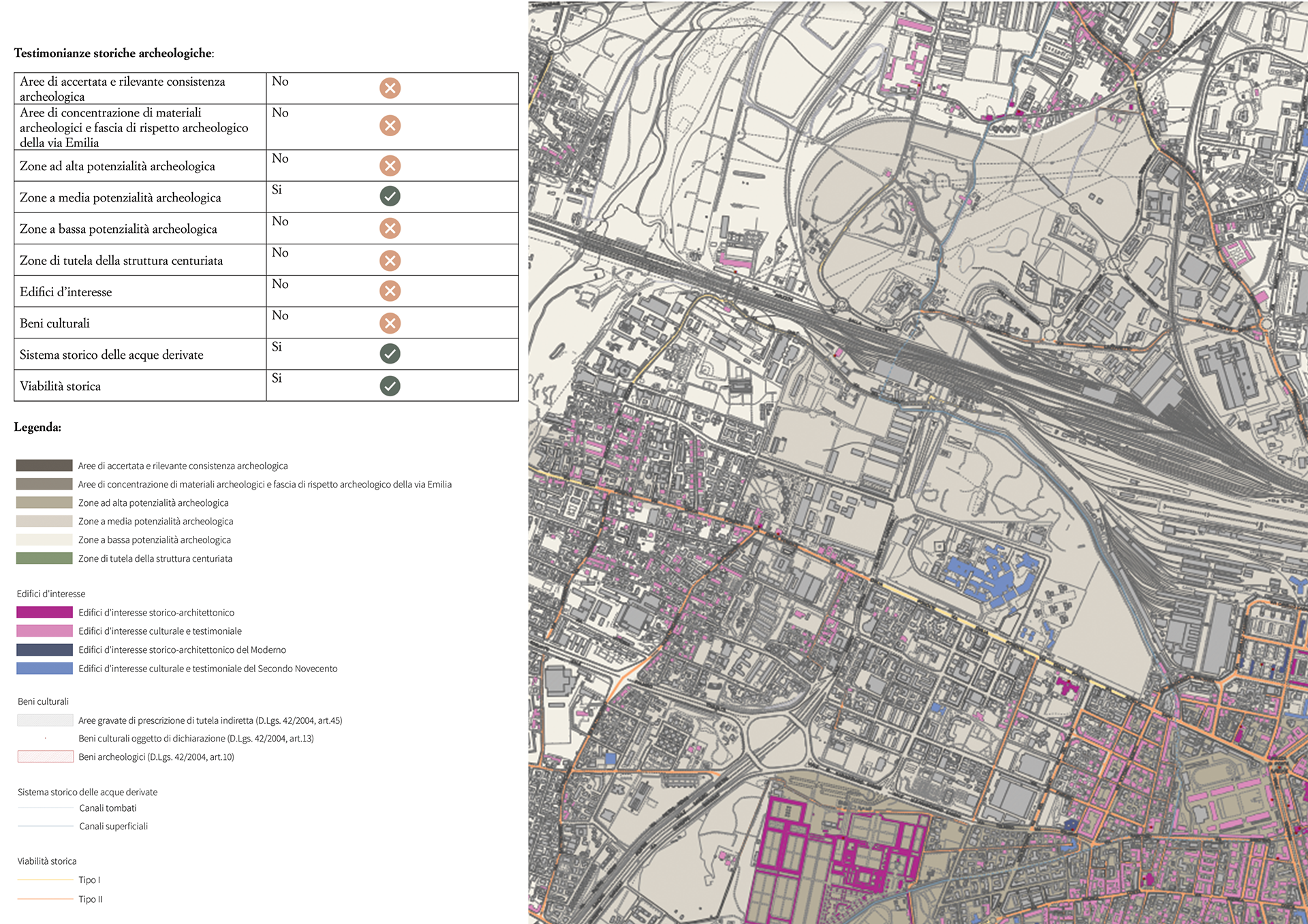
Historical and archaeological heritage
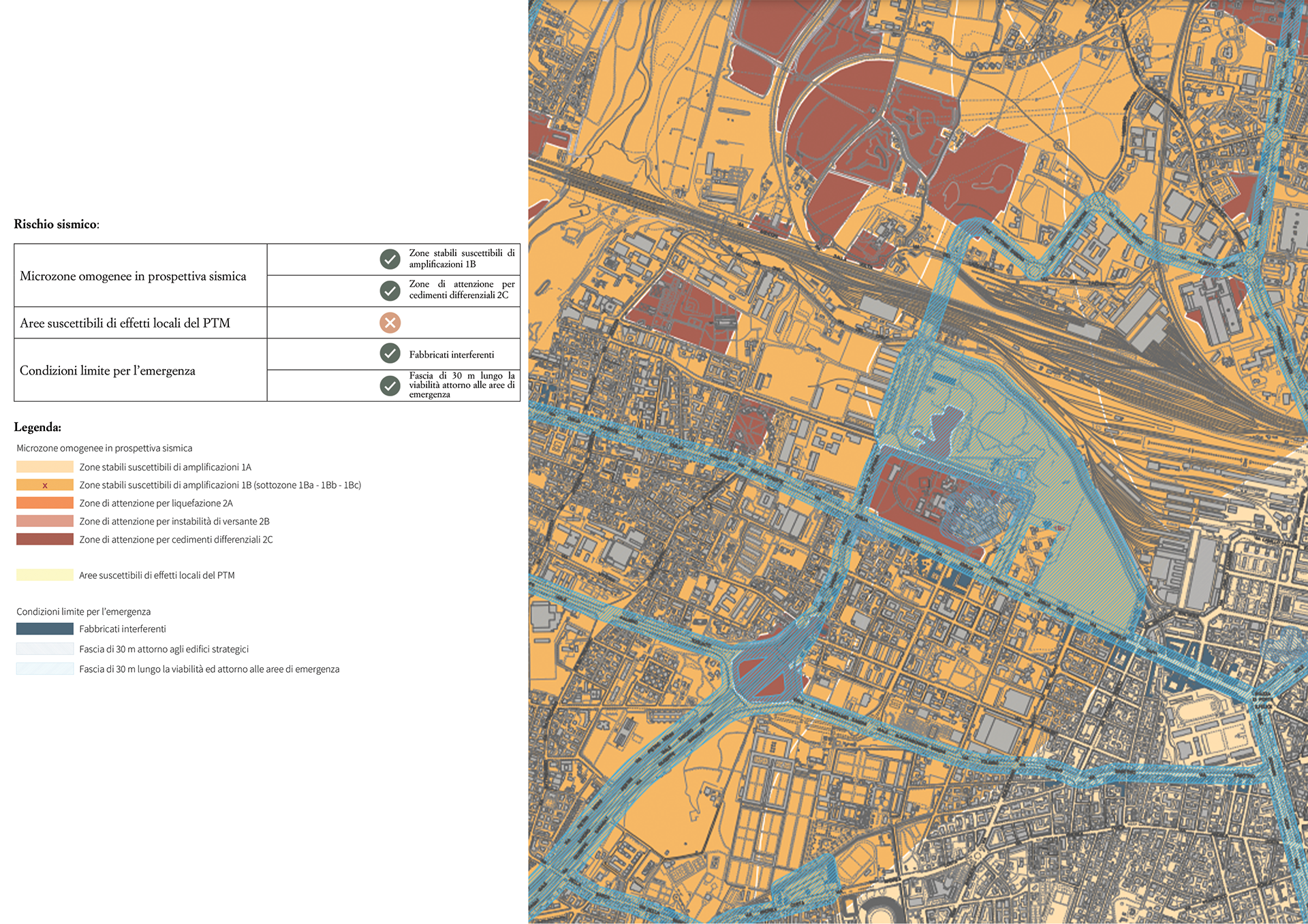
Seismic risk
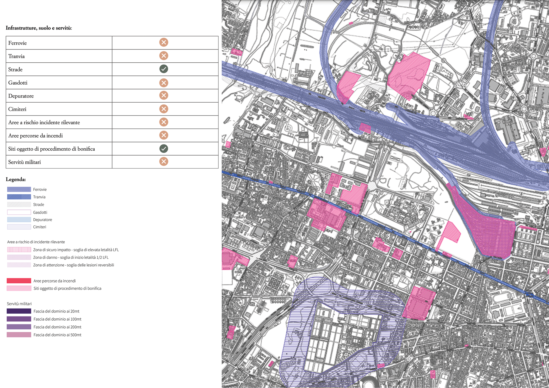
Infrastructure, soil, and easements
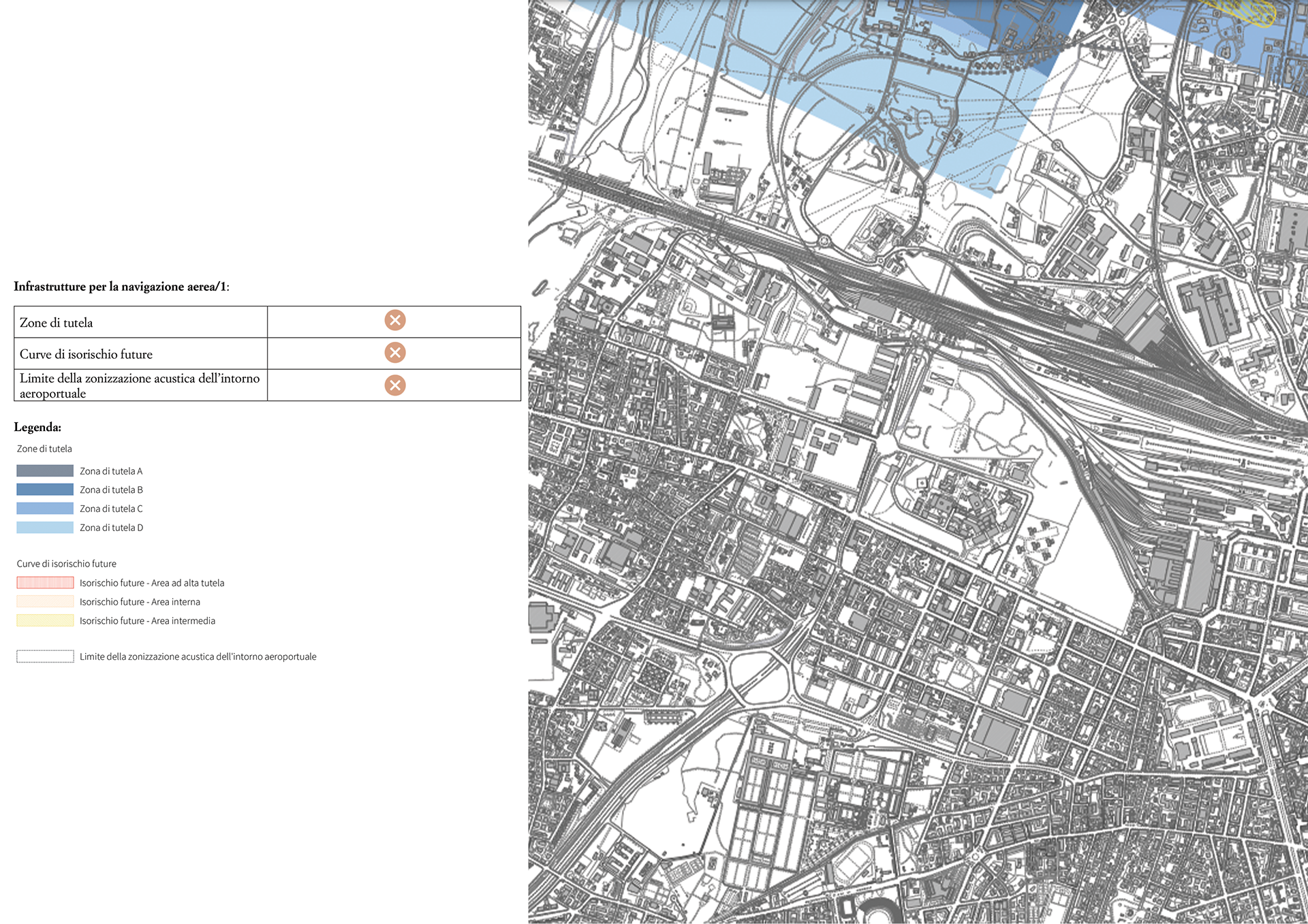
Air navigation infrastructure 1
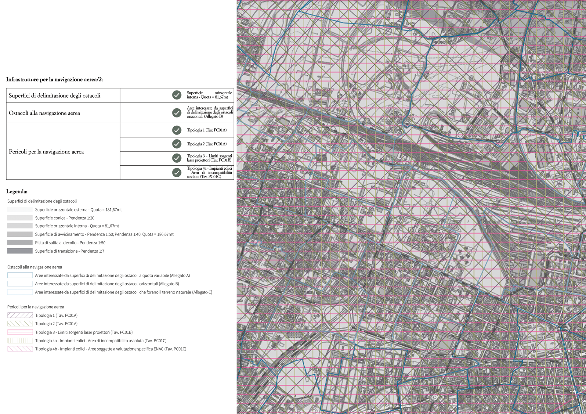
Air navigation infrastructure 2
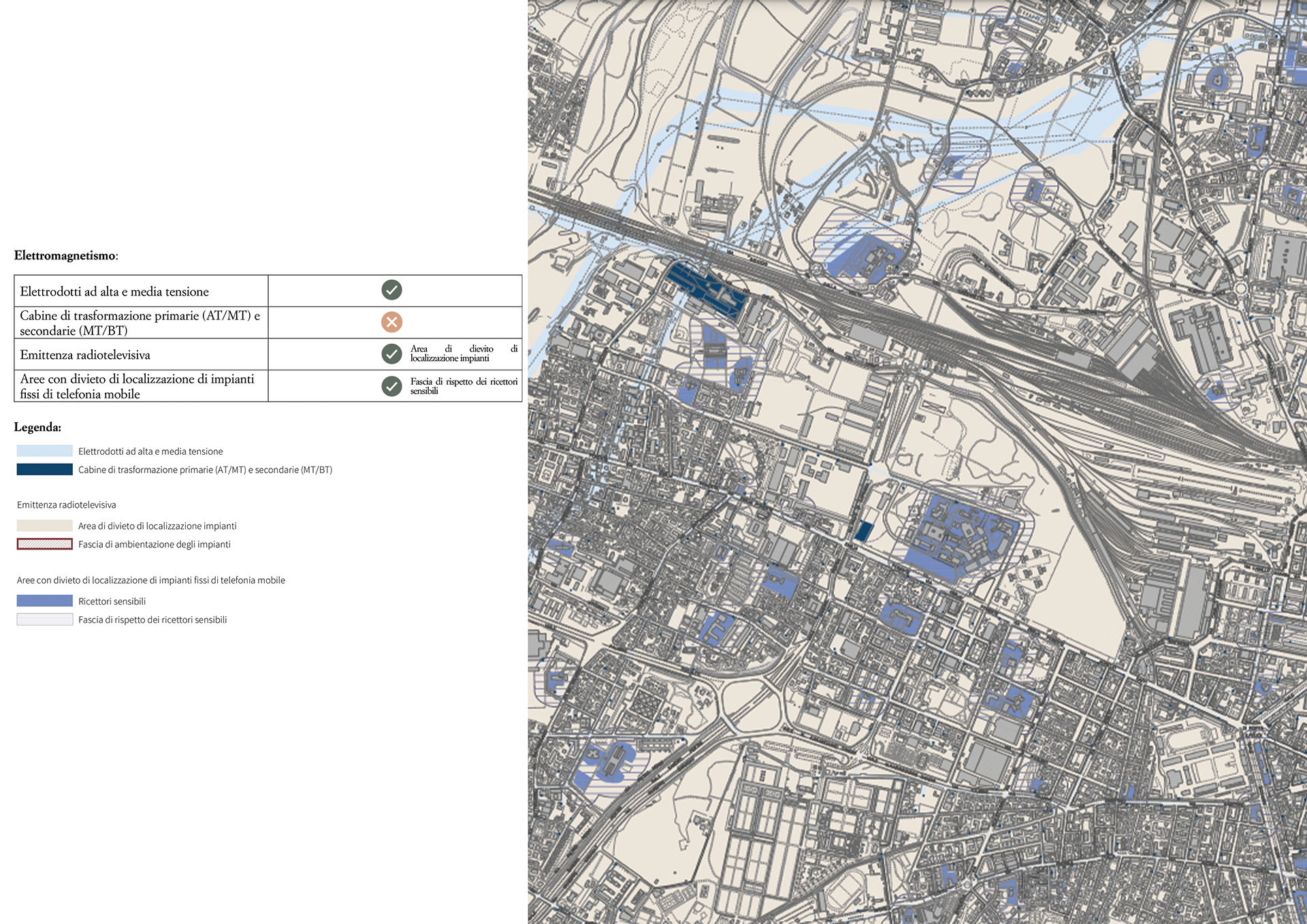
Electromagnetic fields
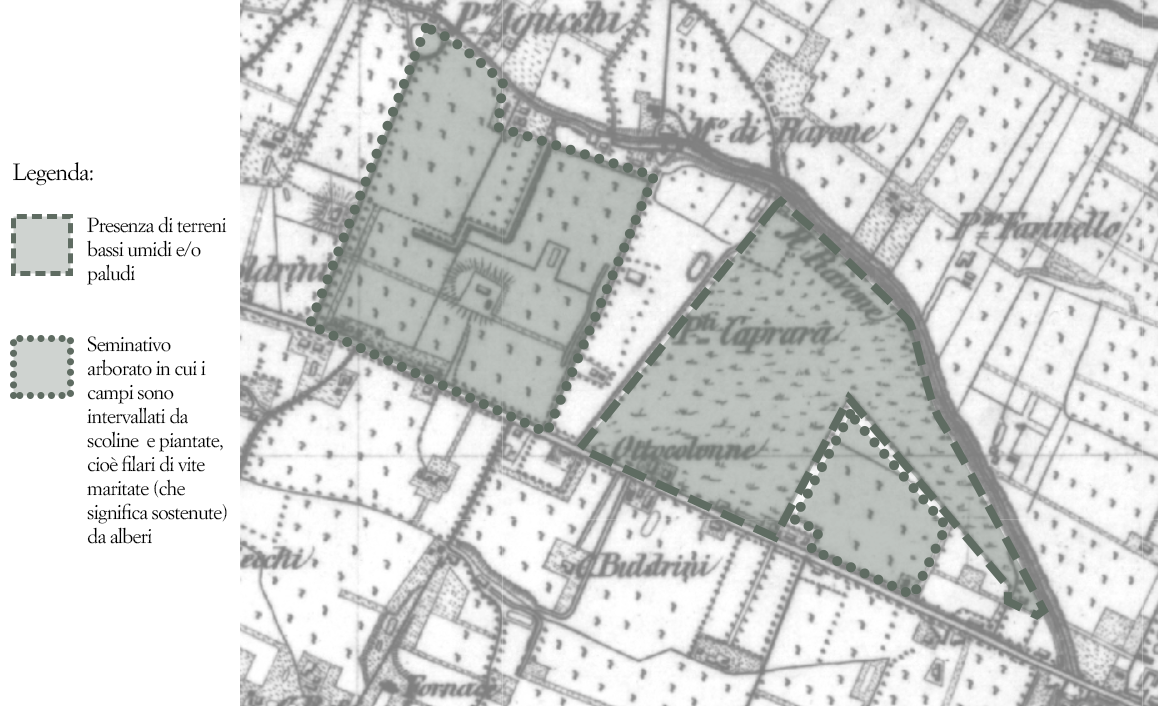
Over time, the area has undergone significant changes, both in land use and in response to its hydraulic fragility. As early as the 18th century, it was characterized by unstable water conditions due to its proximity to the Ravone stream, which frequently flooded. This made the area unsuitable for the widespread Emilian-Padanian farming model known as seminativo arborato—alternating cultivated fields, tree rows, and drainage ditches. In this context, the word "prati" referred to humid fields suited for forage crops.
In the 1700s, the land belonged to the Ghisilieri family, who had secured rights to divert water from the Canale di Reno via the Ghisiliera canal for irrigation and to power a mill. However, frequent floods from the Ravone and Canale Reno caused ongoing issues. In 1748, in an attempt to stabilize the terrain around their villa (likely located in the western part of Prati), the Ghisilieri planted a thousand poplar trees. But by 1759, another flood damaged the area, and the removal of 233 trees from the embankments was blamed for worsening soil erosion.
Water management remained a persistent challenge, often sparking conflicts between farmers and mill owners over access during summer droughts. Austrian cartography from the early 19th century shows the eastern part of Prati as swampy terrain, while the western side followed the seminativo arborato system, with rows of vines supported by elm and mulberry trees—also used for silk production. The field layout still reflected the ancient Roman centuriation, with rectangular plots called tornature, derived from the Latin iugerum.
By the late 1800s, farming shifted from the piantata model to the cavalletto or Bolognese system, alternating tree rows and deeper drainage ditches to improve water flow. However, during the 20th century, urbanization and military development largely erased the agricultural landscape.
The Scientific Dossier suggests that current hydrological and soil conditions still support the potential for wet grassland ecosystems and the preservation of historical agrarian features—such as residual rows of elms, mulberries, and vines.
Austrian topographic cartography dating back to the first half of the 19th century
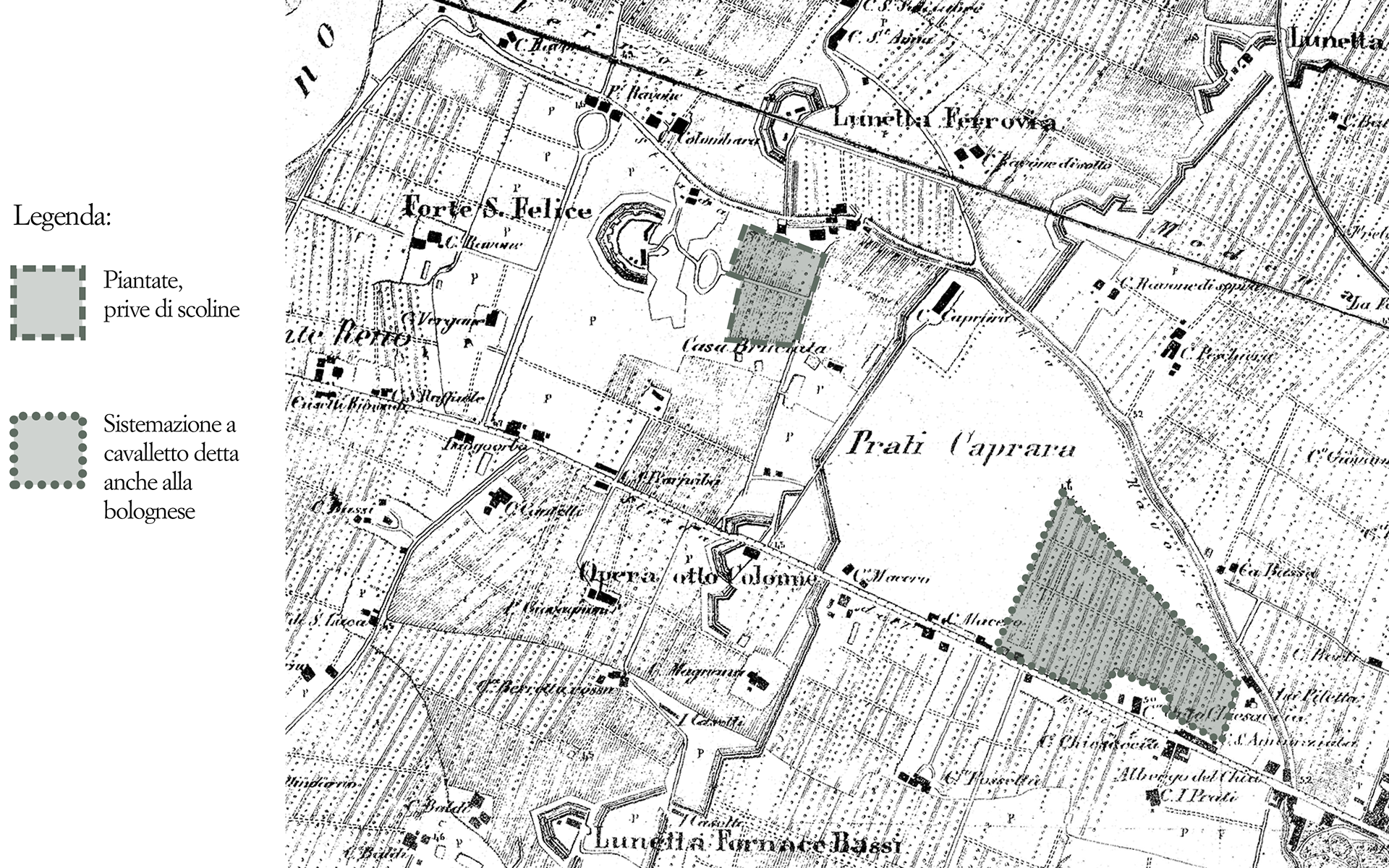
Topographic survey of the area, dated 1884
Ecosystem Services Provided by the Prati di Caprara Urban Forest
Cities are dominated by artificial surfaces, with high levels of air pollution and altered climatic conditions compared to surrounding natural areas. In this context, green urban spaces play a crucial role in mitigating the negative impacts of urbanization by improving air quality, regulating microclimates, and reducing greenhouse gas emissions. This section explores how the Prati di Caprara forest positively impacts both the surrounding neighborhood and the broader city of Bologna.
1) Regulating Ecosystem Services
The Prati di Caprara area represents a significant ecological asset for Bologna due to its size and biodiversity. Key ecological functions include:
1. Air purification and carbon capture: Vegetation improves air quality mainly through:
- Dry deposition: Pollutants adhere to leaves and branches, then are washed off by rain or absorbed by the plant. This is especially effective in reducing PM10 and PM2.5 particles. Estimates suggest the forest captures between 900 and 1800 kg of particulate matter annually.
- Carbon sequestration: Trees absorb CO₂ and store it in their biomass. As trees mature, their carbon capture increases. A single tree can sequester around 4.6 to 11 kg of CO₂ per year, depending on crown size, and reduce energy-related emissions by helping regulate building temperatures.
2. Urban climate regulation
Through shading and evapotranspiration, the forest reduces local temperatures. This effect helps lower the need for air conditioning and curbs smog formation. NO₂ absorption is also notable, with an estimated 720 kg absorbed annually by the forest.
Through shading and evapotranspiration, the forest reduces local temperatures. This effect helps lower the need for air conditioning and curbs smog formation. NO₂ absorption is also notable, with an estimated 720 kg absorbed annually by the forest.
3. Urban heat island mitigation
Cities tend to be hotter than rural areas due to artificial surfaces like asphalt. This "urban heat island" effect is worsened in summer, especially at night, increasing health risks. Studies show that vegetation is one of the most effective tools to counteract this phenomenon. According to thermal imagery analysis, surface temperatures in Prati di Caprara are up to 10°C lower than adjacent rail yards and 4–5°C lower than nearby urban averages, making it a genuine "cool island" in the city.
Cities tend to be hotter than rural areas due to artificial surfaces like asphalt. This "urban heat island" effect is worsened in summer, especially at night, increasing health risks. Studies show that vegetation is one of the most effective tools to counteract this phenomenon. According to thermal imagery analysis, surface temperatures in Prati di Caprara are up to 10°C lower than adjacent rail yards and 4–5°C lower than nearby urban averages, making it a genuine "cool island" in the city.
4. Water cycle regulation: Forests help manage rainfall through:
- Interception: Trees temporarily retain rain on leaves and branches.
- Infiltration: Water enters the soil, recharging aquifers.
- Evapotranspiration: Water returns to the atmosphere via plants and soil.
Forests help reduce surface runoff, slowing floodwaters and providing critical time for emergency response. However, during extreme rainfall events, their capacity can be overwhelmed.
Recent floods in Emilia-Romagna (in 2023 and 2024) demonstrated the growing frequency and intensity of such events, highlighting the importance of natural green buffers. The Ravone stream, which borders Prati di Caprara, has become particularly problematic during floods due to outdated culvert infrastructure. Originally sized for past climate conditions, these underground channels are now insufficient for today’s more extreme weather. In heavy floods, blockages caused by debris can lead to overflow and urban flooding.
da me ttere foto del ravoen flooded
2) Supporting Ecosystem Services
One of the key supporting ecosystem services provided by the Prati di Caprara urban forest is biodiversity protection, offering habitats for a wide range of plant and animal species, including pollinators, birds, and small mammals.
The Prati di Caprara forest is a typical example of an urban wild forest (sensu Kowarik, 2005)—a spontaneously formed forest community that emerged without human planning in an urban setting. The area includes various types of vegetation formations:
- ~17.5 hectares of forest
- 0.4 hectares of shrubland
- 2.1 hectares of grassland
- 2 hectares of mixed shrub-grassland
- 2.3 hectares of grassy embankments along the Ravone stream and the Ghisiliera canal
- 1.8 hectares of artificial surfaces, some of which host large, isolated trees, especially poplars
An additional 2-hectare area cleared in 2018 for construction is not included in these figures. Overall, the forested area spans over 25 hectares, creating a dense network of ecological relationships that fosters significant biodiversity in an urban context.
A preliminary vegetation analysis, conducted by the Rigenerazione No Speculazione committee using rapid surveys and three forest sample plots, allowed classification of the forest based on plant composition. The study aimed to compile a comprehensive list of plant species, including those along the Ghisiliera and Ravone waterways, given their ecological connectivity.
To date, nearly 200 plant species have been identified—an impressive number for an urban forest, reflecting a wide variety of flora typical of woodland and edge environments. This ecological value becomes particularly significant considering the generally limited biodiversity in urban settings.
Interestingly, if compared with Bologna’s historic center, which hosts around 500 plant species, the Prati di Caprara show an exceptionally high level of biodiversity relative to their size. Quantitatively, most species are concentrated along forest edges, in open areas and meadows, where light availability is higher. These zones typically host many annual herbaceous species—common elements in urban flora.
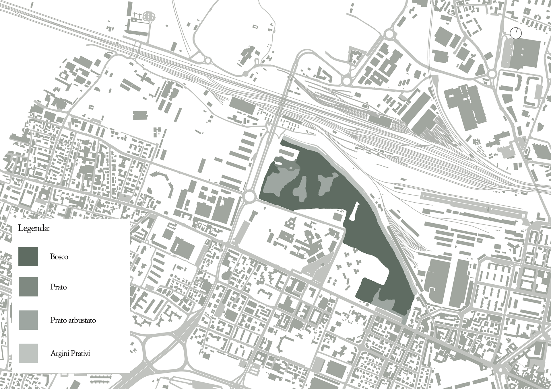
Ecosystem of the Prati di Caprara
Forest categories identified through surveys and sample plots
Elements of ecological value (point and linear) in the Prati di Caprara urban forest
3) Cultural Ecosystem Services
Cultural ecosystem services are the intangible benefits people derive from ecosystems through spiritual enrichment, cognitive development, reflection, recreation, and aesthetic experiences (MEA, 2003; Plieninger et al., 2013). According to the Millennium Ecosystem Assessment (MEA), these include:
- Inspiration for culture, arts, spiritual and educational values, and identity: Ecosystems serve as sources of inspiration for art, folklore, national symbols, and architecture. They also play a role in both formal and informal education. Many religions assign spiritual value to specific ecosystems or their elements, creating a strong "sense of place" tied to familiar landscapes.
- Aesthetic values: Natural and scenic landscapes provide visual enjoyment and influence choices about where people live, recreate, and relax. The aesthetic value also includes: the beauty of the landscape, the appeal of outdoor natural spaces, the historical and cultural importance of certain places, the educational and scientific significance of species and landscapes.
- Recreational values: Natural environments offer endless opportunities for leisure, tourism, and outdoor activities like walking, hiking, camping, fishing, and nature observation. These activities are heavily influenced by the perceived beauty and cultural significance of the landscape.
The value of cultural services can vary widely among individuals and communities, influenced by social, economic, and political contexts. In general, natural environments promote physical and psychological well-being, enhancing cognitive capacity and offering restorative experiences (Kaplan, 1996). According to the European Commission (2016), contact with nature improves quality of life and health.
The Common International Classification of Ecosystem Services (CICES) defines cultural functions as including both recreational and symbolic services, recognizing the spiritual, historical, and ethical importance many cultures place on nature.
Cultural Services in the Prati di Caprara
As an urban forest, Prati di Caprara provides a variety of cultural ecosystem services:
- Historical and cultural significance: The area has a rich history, having hosted Buffalo Bill’s famous 1906 show, served as Bologna’s first military airfield (Fausto Pesci Airport), and even functioned as the first playing field for the early Bologna Football Club.
- Educational and aesthetic value: The forest is a biodiversity hotspot and a natural reserve, making it an ideal site for environmental education. Its size and ecological richness contrast with the surrounding urbanization, enhancing its visual and experiential appeal.
- Community engagement: The local group Comitato Rigenerazione No Speculazione has led guided walks to raise public awareness and demonstrate the area’s value to both residents and local authorities. The committee also mapped walkable trails, highlighting the site’s potential for recreation and fitness activities.
However, the area suffers from neglect and abandonment, especially in its eastern section, which has been occupied by unauthorized groups. This has led to waste accumulation and a perception of insecurity, which in turn diminishes its cultural and social value.
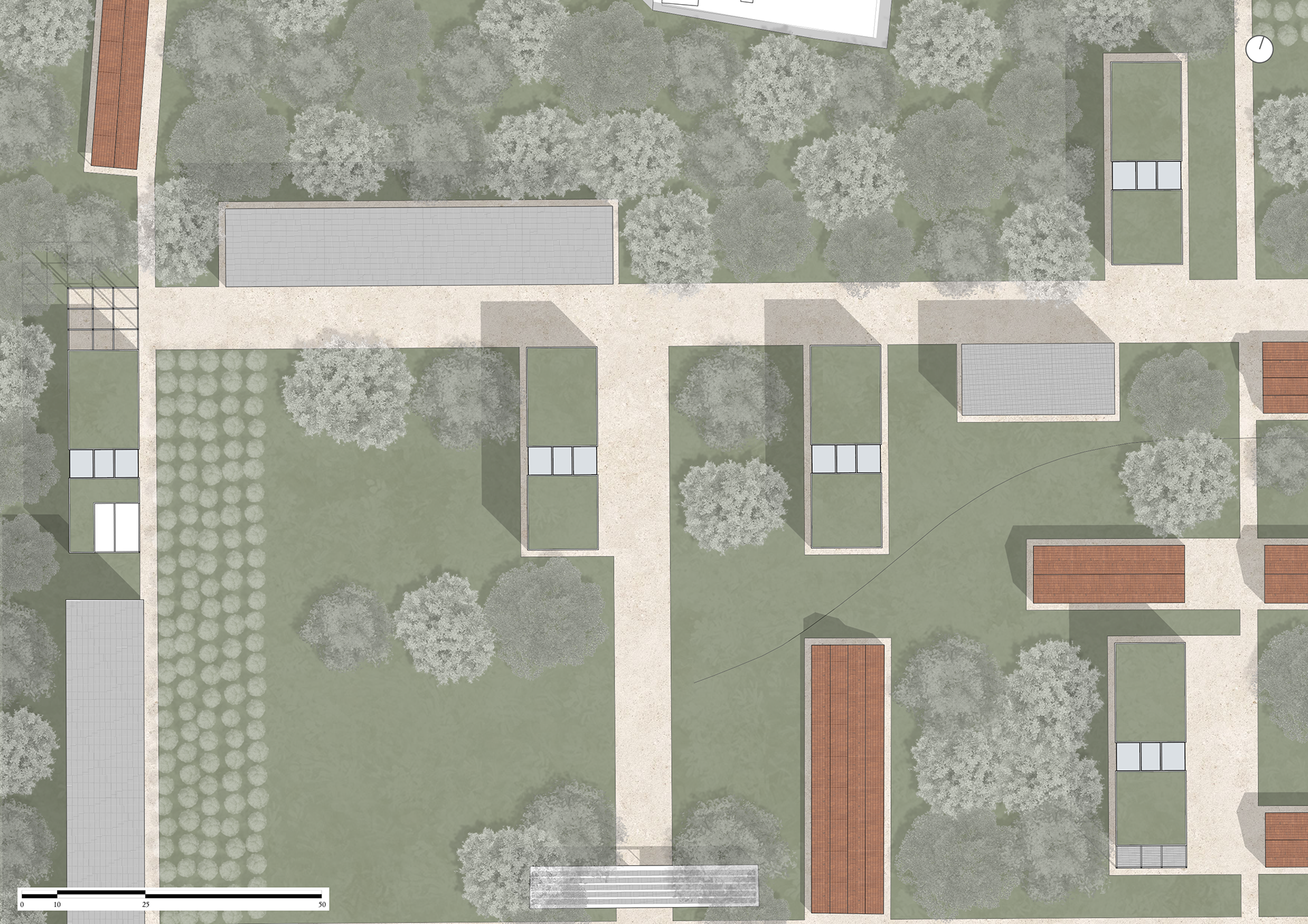
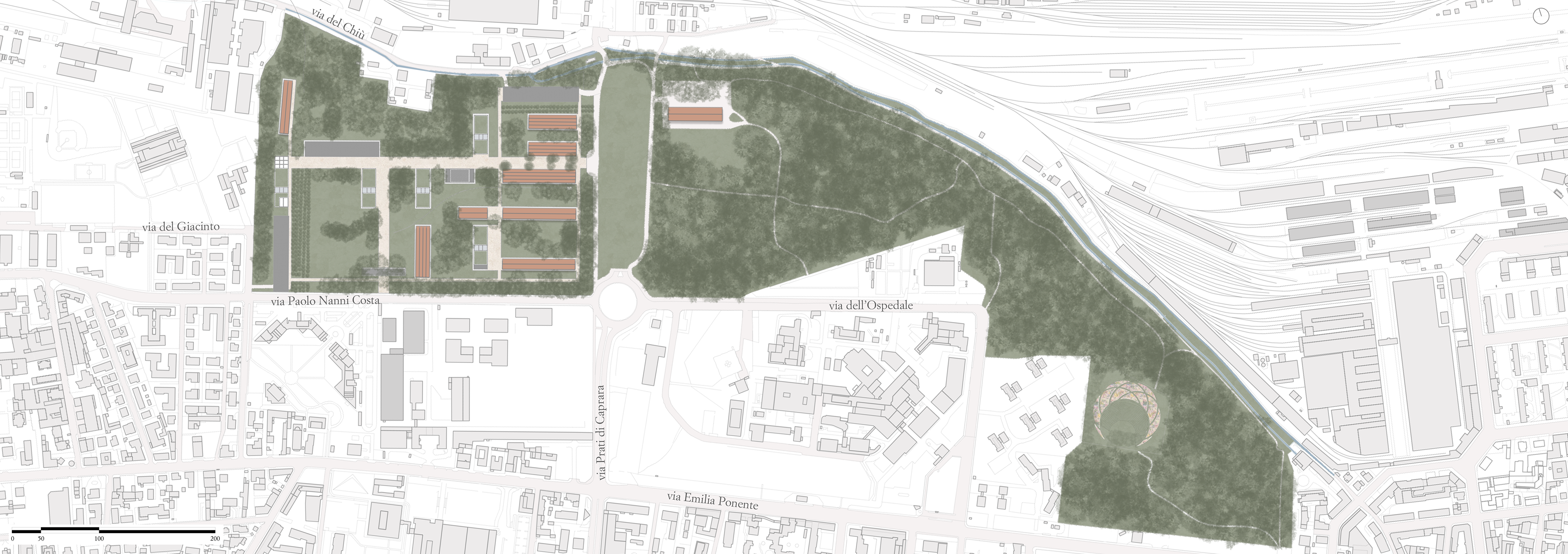
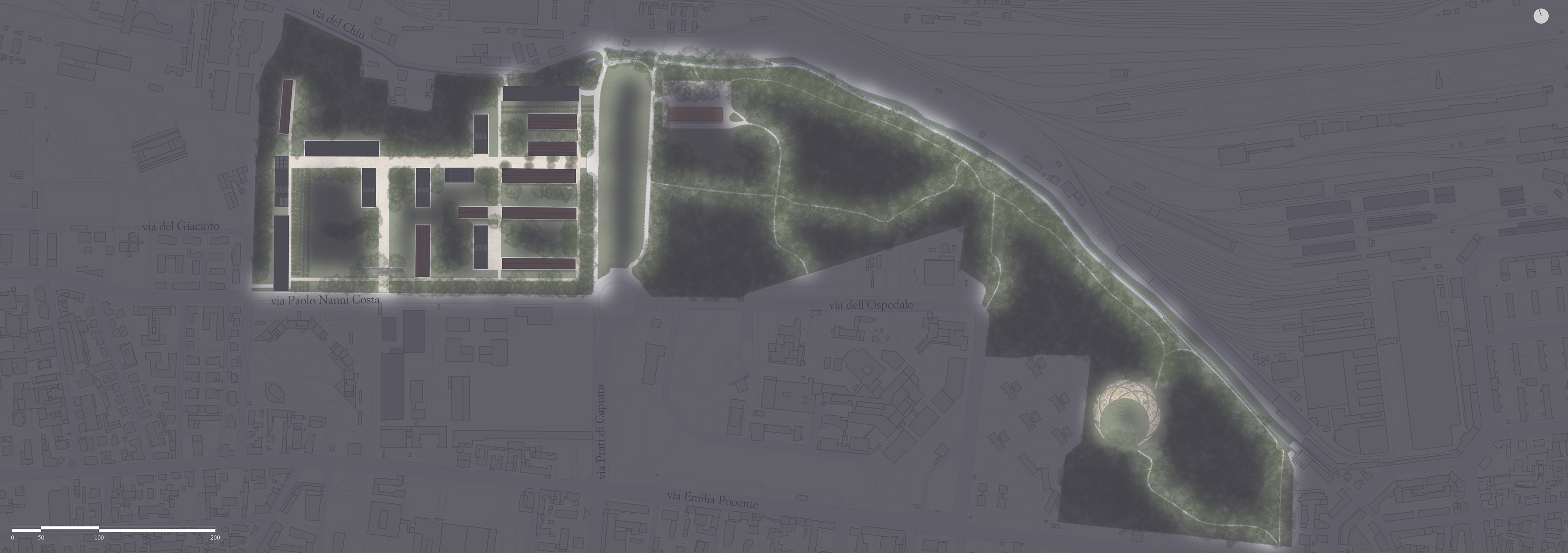
Masterplan
A masterplan has been developed at the urban scale to connect the Prati di Caprara to Bologna’s historic center and to the city’s main parks and gardens, integrating it fully into the city’s green infrastructure network. To achieve this, the plan leverages Bologna’s existing tree-lined boulevards and proposes adding a new green boulevard along Via Saffi, linking the tree-lined avenues that currently circle the historic center. These avenues already connect major green areas like the Giardini Margherita (near Porta Santo Stefano, south of the center) and Parco della Montagnola (to the north, between Porta Galliera and Porta Mascarella).
The proposed new boulevard would also extend connectivity toward the Bolognese hills to the south of the city, enhancing ecological and visual continuity.
Another key point of the masterplan is to assign a new cultural function to the Prati di Caprara, particularly the former San Felice Barracks. Given the nearby presence of educational, artistic, and exhibition-oriented institutions, the idea is to create a Biennale of Art, inspired by Venice’s Architecture Biennale, hosted within the area.
Additionally, to reconnect the two parts of the Prati currently divided by Viale Vittoria Sabena, the plan includes burying the road and covering it with a green lawn, allowing for uninterrupted green space.
Masterplan
SWOT analysis: Strenghts
SWOT analysis: Weaknesses
SWOT analysis: Opportunities
SWOT analysis: Threats
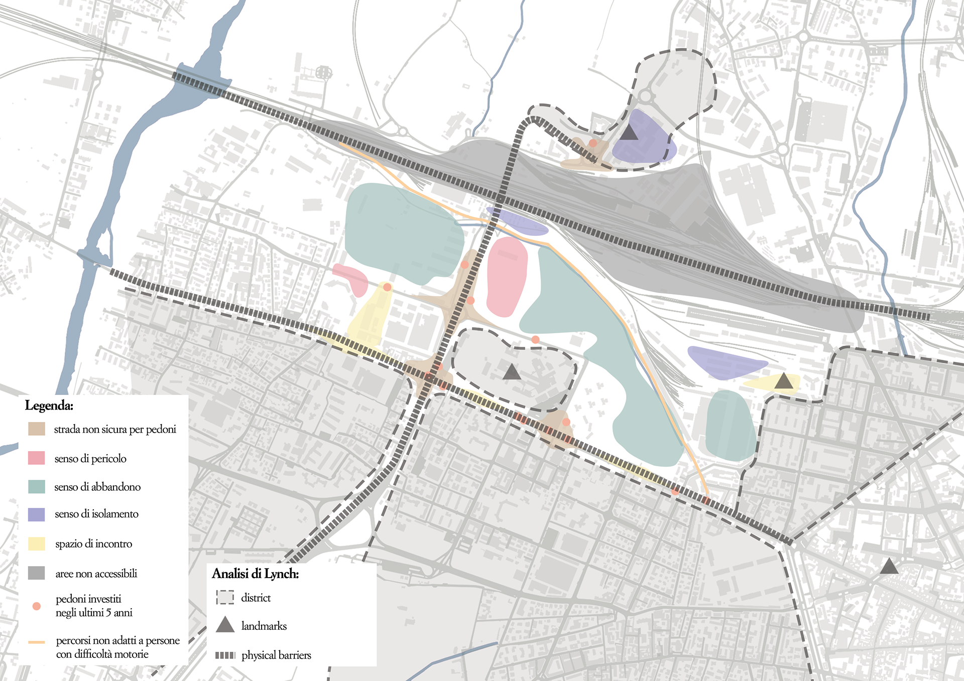
Perceptive analysis
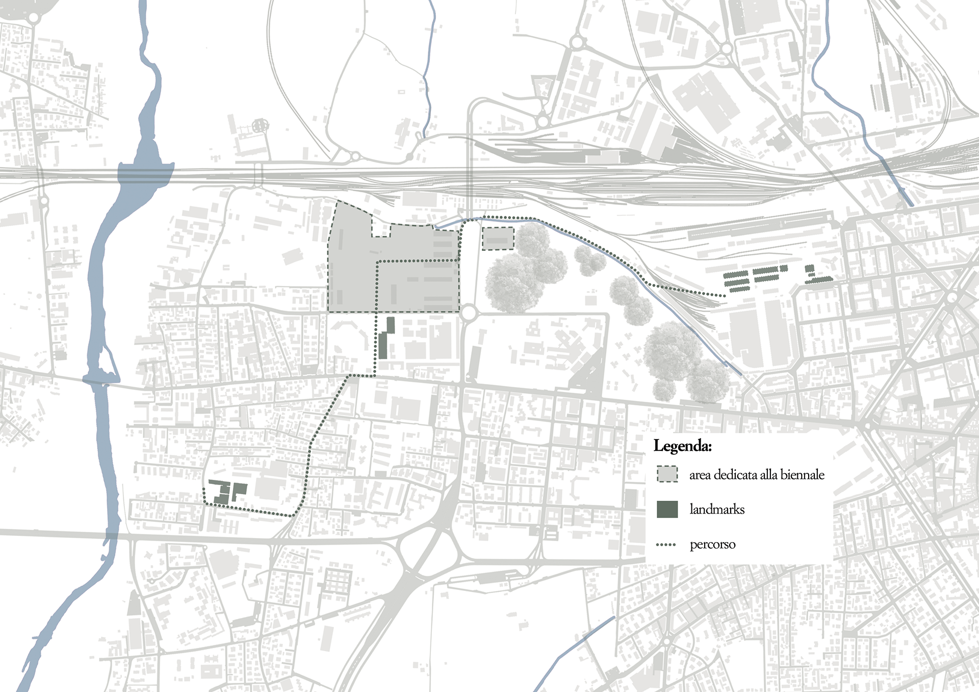
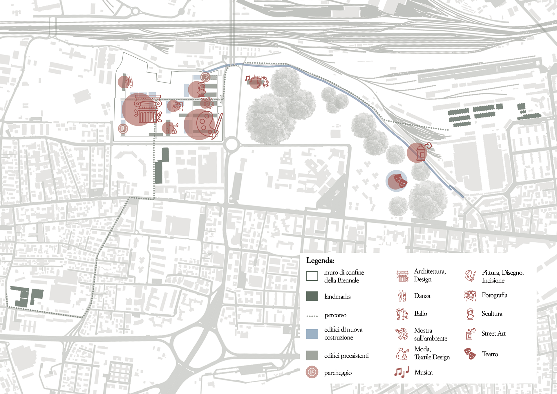
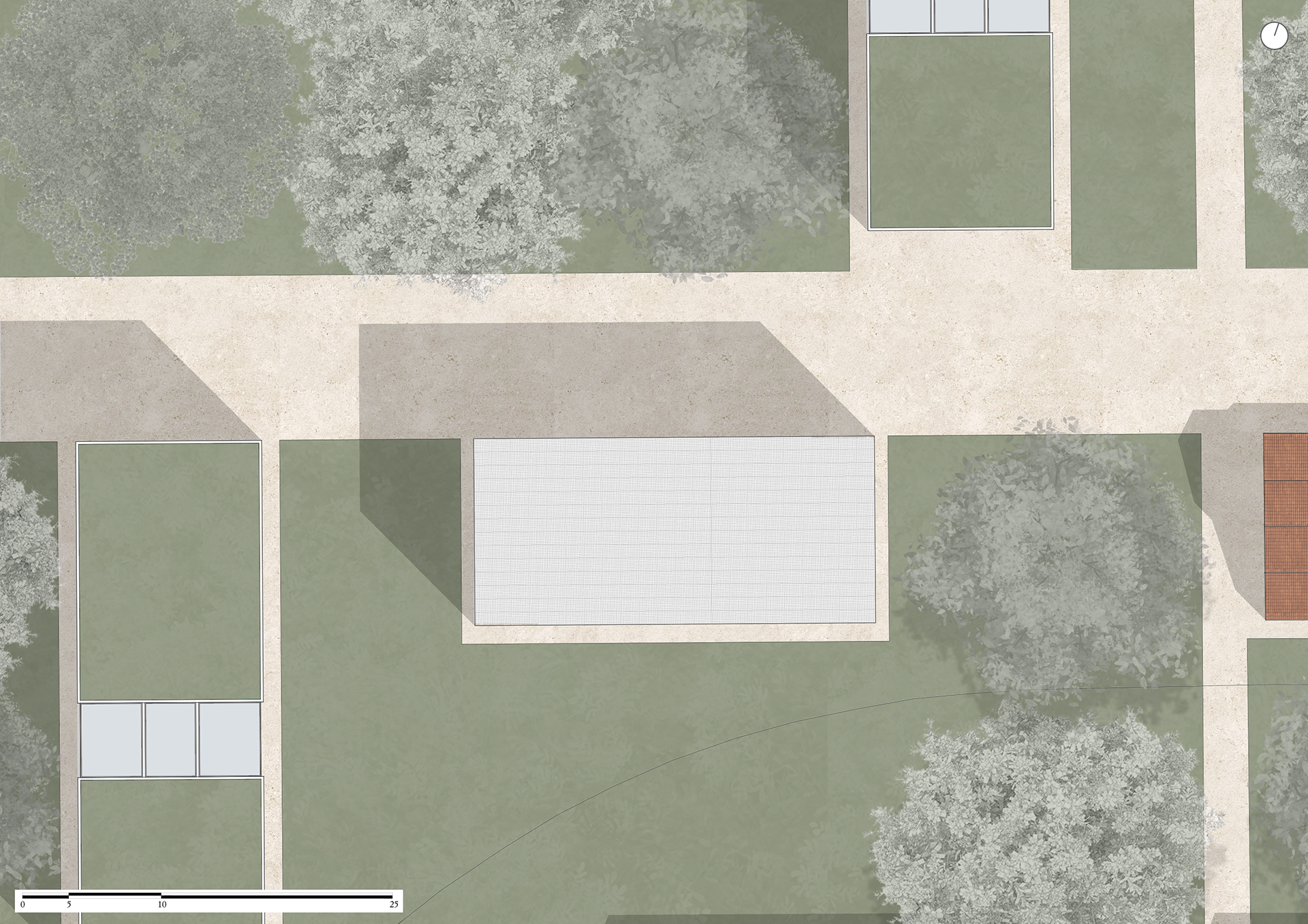
From the previous analyses—especially the SWOT analysis—it became clear that the Prati di Caprara could be part of a pedestrian route connecting major landmarks in the surrounding area. Considering the future cultural role of the former barracks, it is essential to trace a path that links MAST, Opificio Golinelli, the Prati Biennale, and DumBO.
The route, which can be walked in either direction, starts at MAST and follows Via Vittoria to reach the GD factory, then continues along Via Battindarno. This stretch offers a pleasant walk through early suburban neighborhoods, giving an authentic glimpse of local life.
The route then reaches Via Emilia Ponente, where the construction of the future Red Tram Line is reshaping the urban layout. From there, a pedestrian path lined with young trees leads to Opificio Golinelli’s parking lot. To access the main entrance of the future Biennale, the path skirts the Opificio building—an opportunity to appreciate its distinctive modern design and innovative architecture.
Passing the Opificio, one enters the Biennale area, where architecture merges with nature. At the eastern entrance, a wide green field opens up, revealing the treetops of the urban forest. Looking south across the meadow, the Sanctuary of the Madonna di San Luca comes into view, perched on Bologna’s hillside—an iconic reference point throughout the walk.
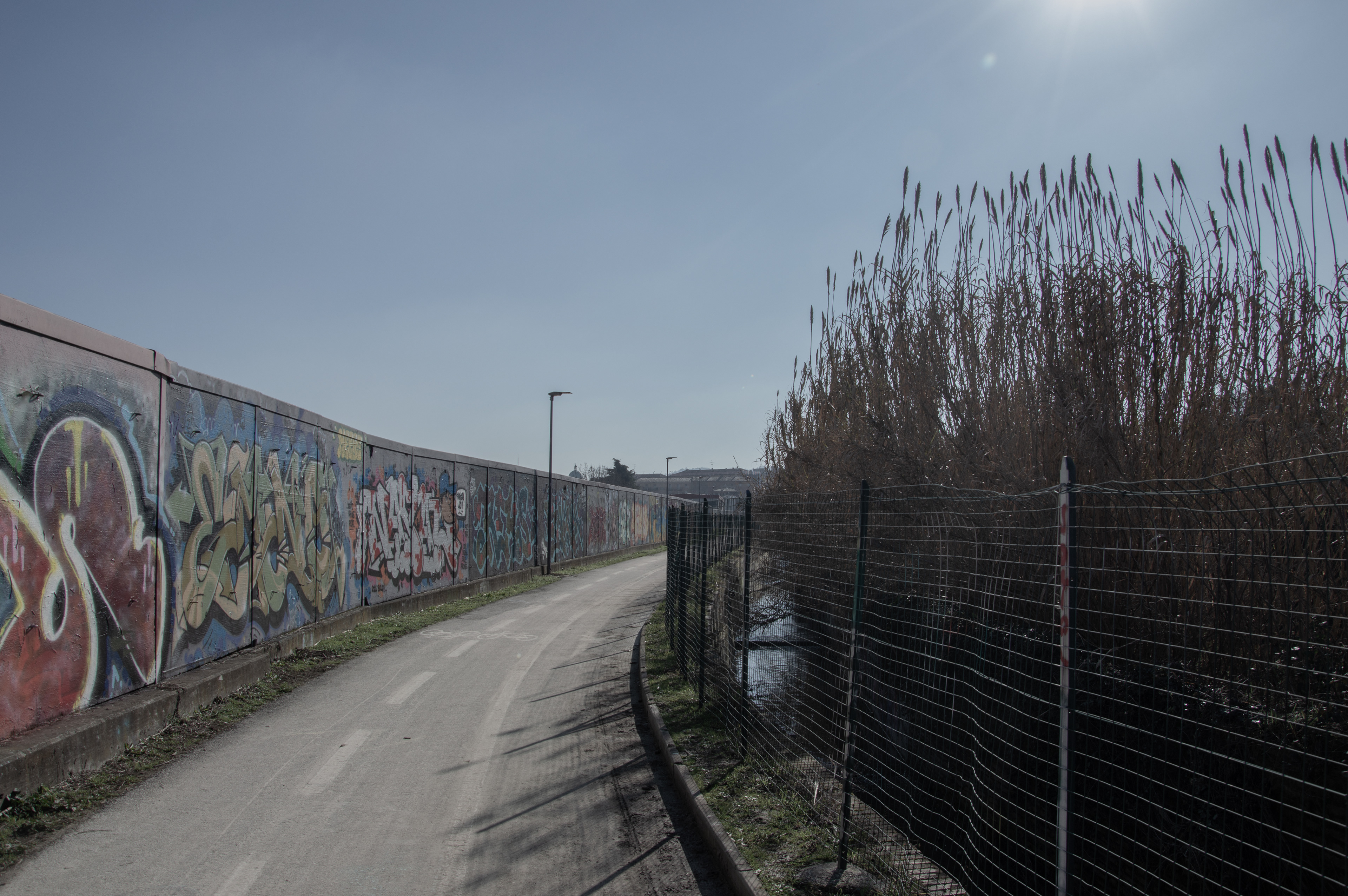
The route continues along a bike-pedestrian path that follows the Ravone stream and the Ghisiliera canal, offering full immersion in the tranquil sounds, scents, and colors of the urban woodland.
As the path approaches Via del Chiù, a long street art wall comes into view, where graffiti artists actively paint new works, turning the surface into a dynamic urban canvas that tells stories through shapes and colors.
The final part of the route reaches the former railway yards, a striking post-industrial space reimagined as a passage leading to DumBO, Bologna’s creative and cultural hub in constant evolution.
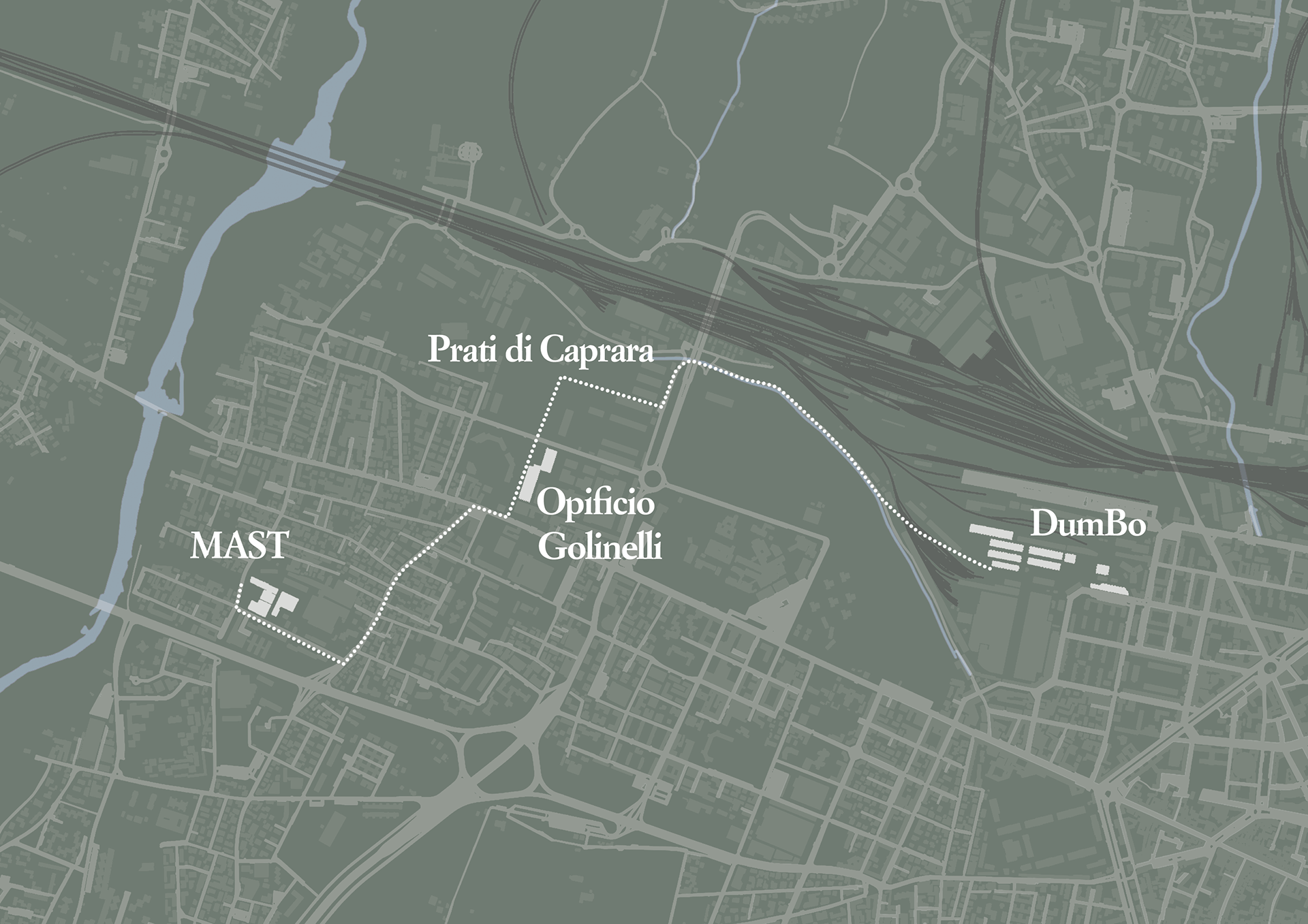
Path that links MAST, Opificio Golinelli, the Prati Biennale, and DumBO
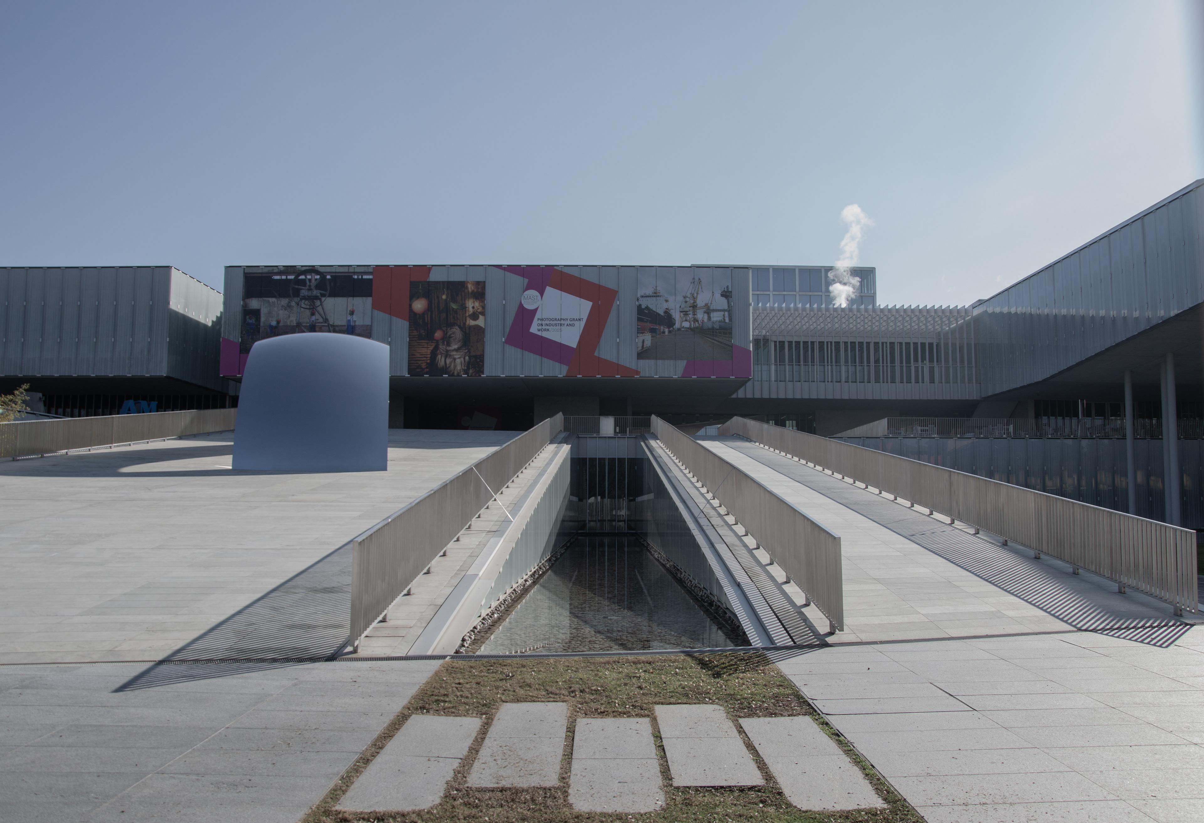
MAST
MAST
GD
Via Battindarno
Via Emilia Ponente
Opificio Golinelli
Opificio Golinelli
San Felice Military Facility
Viale Vittorio Sabena

Prati di Caprara
Prati di Caprara
Via del Chiù
Prati di Caprara
Via del Chiù

San Felice Military Facility
DumBo
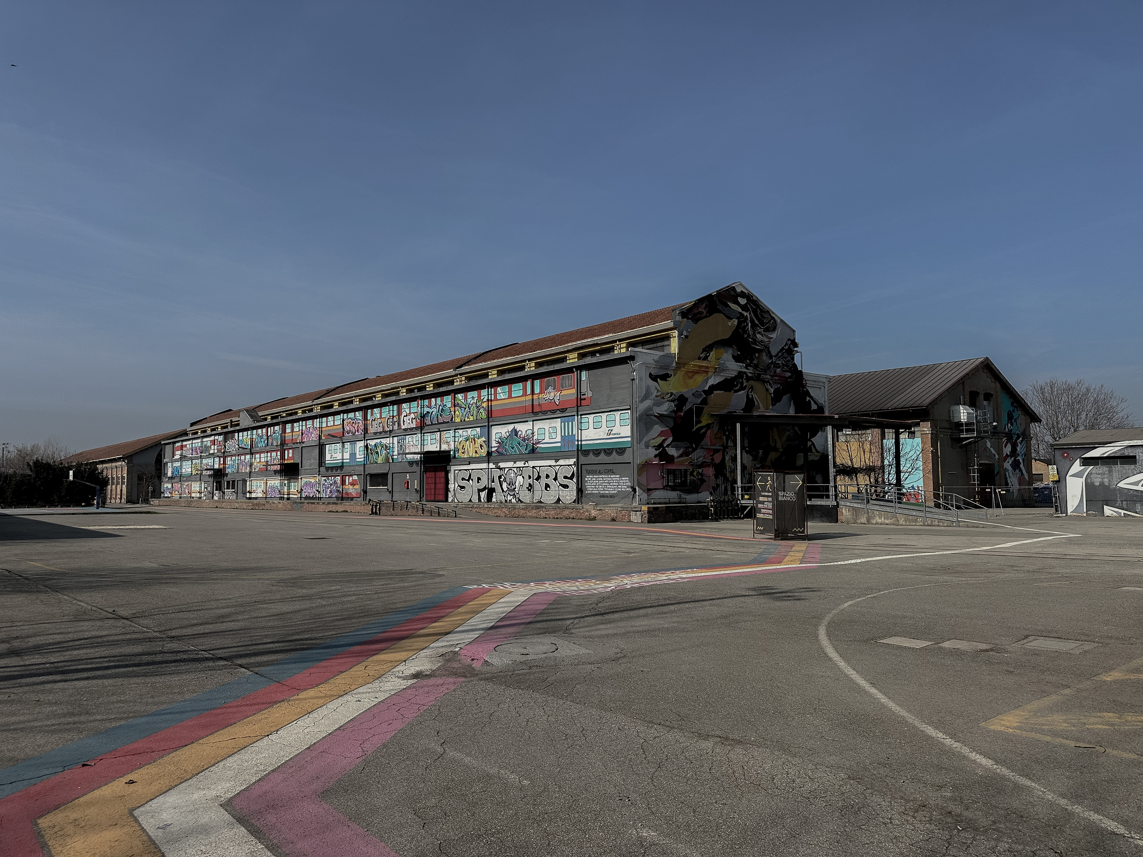
DumBo
Project Status
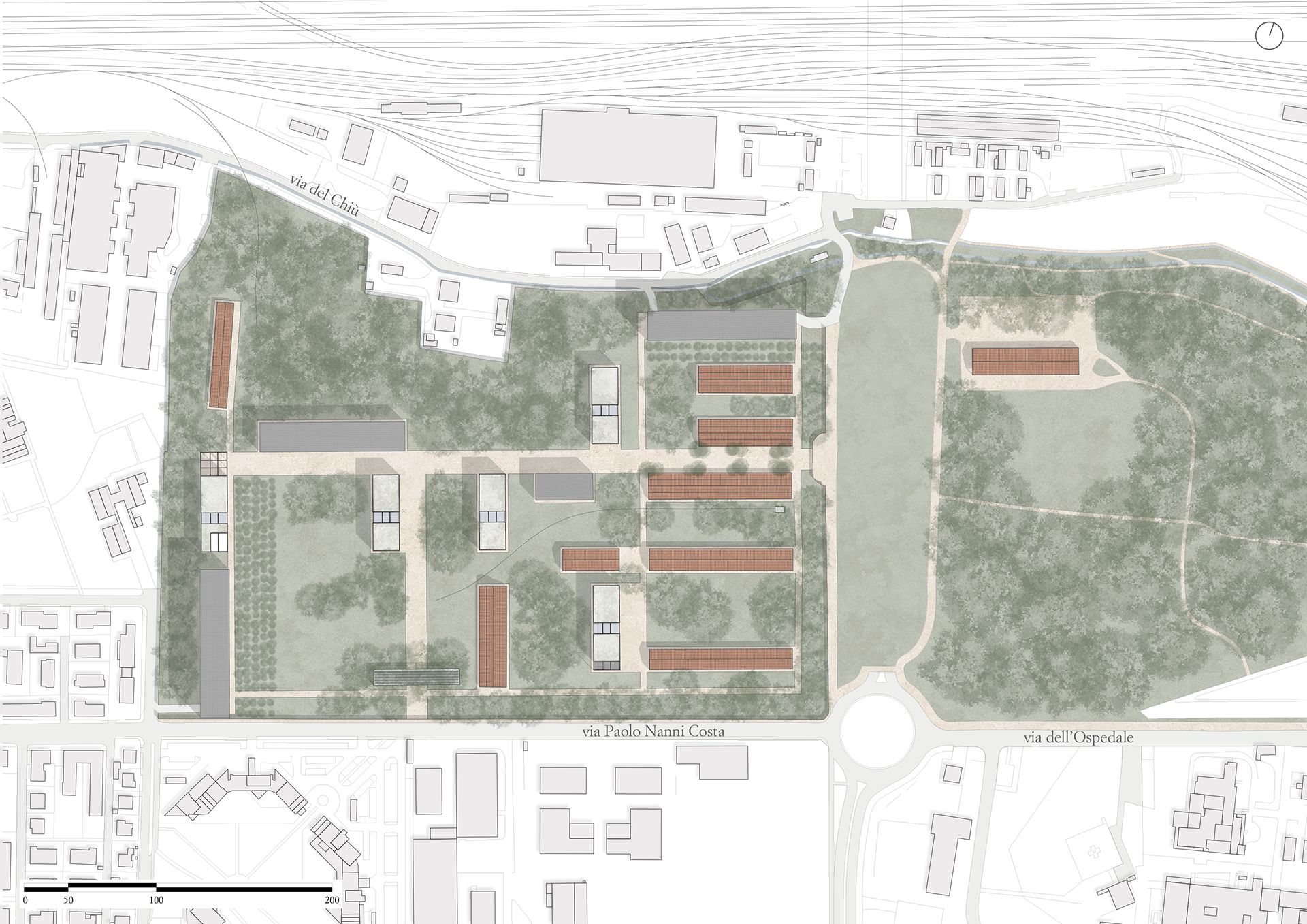
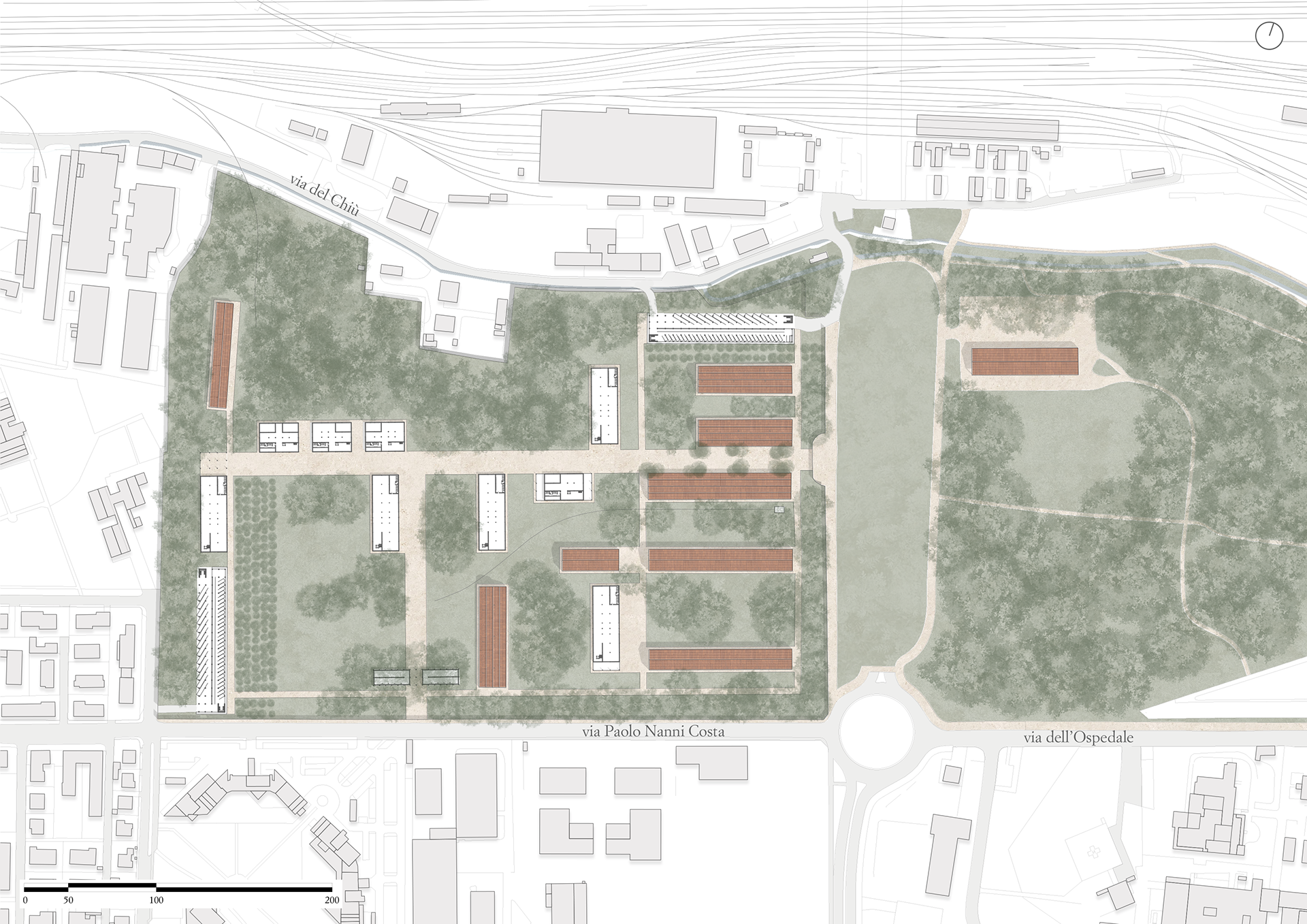
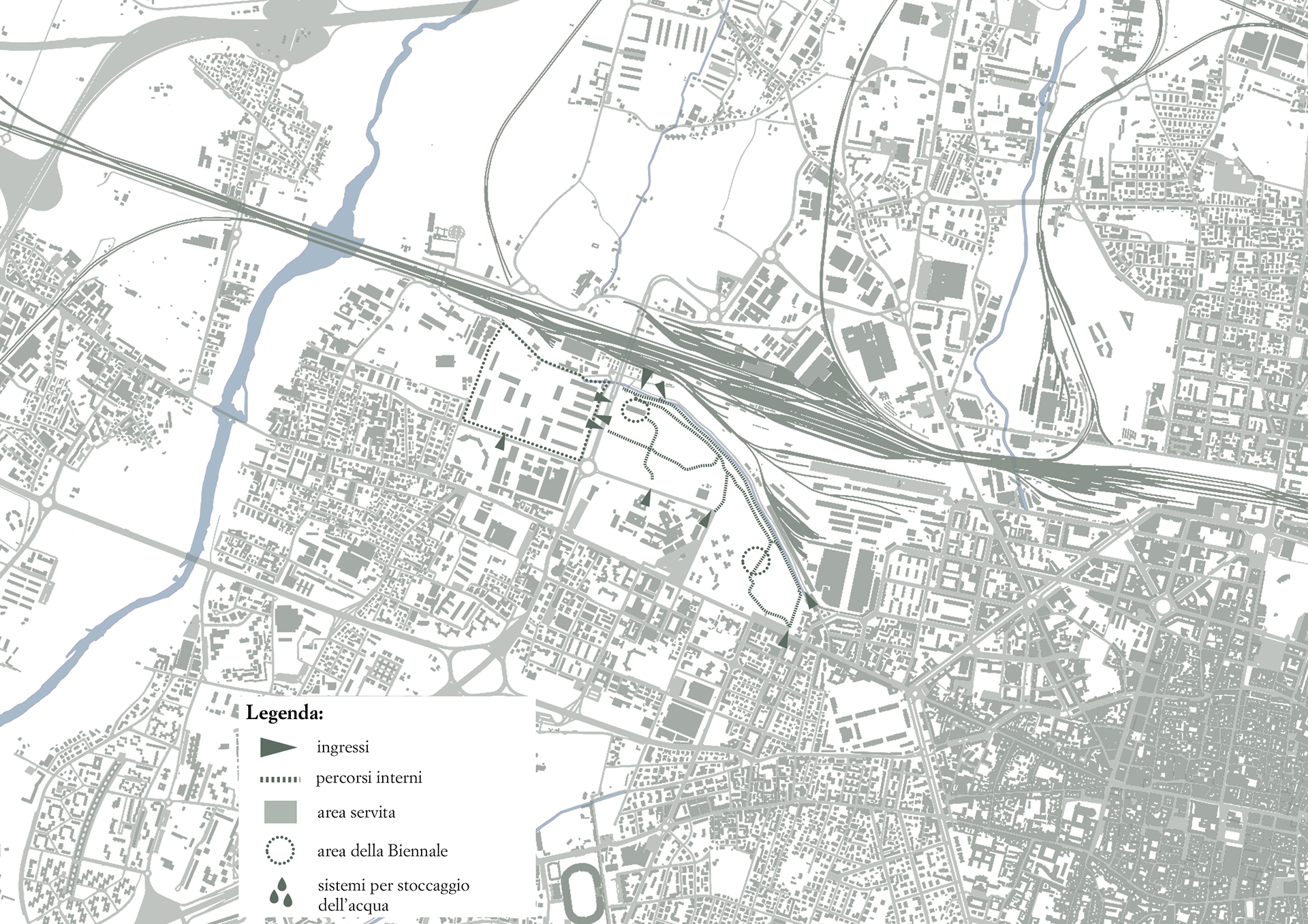
In light of the Masterplan considerations, the first step was to define the spatial distribution, identifying the areas designated for exhibitions, which will host the actual construction works. The project envisions the creation of a Biennale encompassing all forms of art—music, dance, architecture, sculpture, painting, photography, and graffiti. Given the environmental focus of the project and the presence of the urban forest at the Prati di Caprara, a permanent exhibition space dedicated to themes such as climate change was also included to raise awareness among visitors. Therefore, the entire area of the former San Felice Barracks is allocated to the Biennale and its various exhibition spaces. Additionally, the steel structure located in the eastern section of the Prati will be incorporated as an external but related exhibition space. The urban forest itself will not undergo any change of use or substantial modifications, apart from minor interventions discussed in the following chapter.
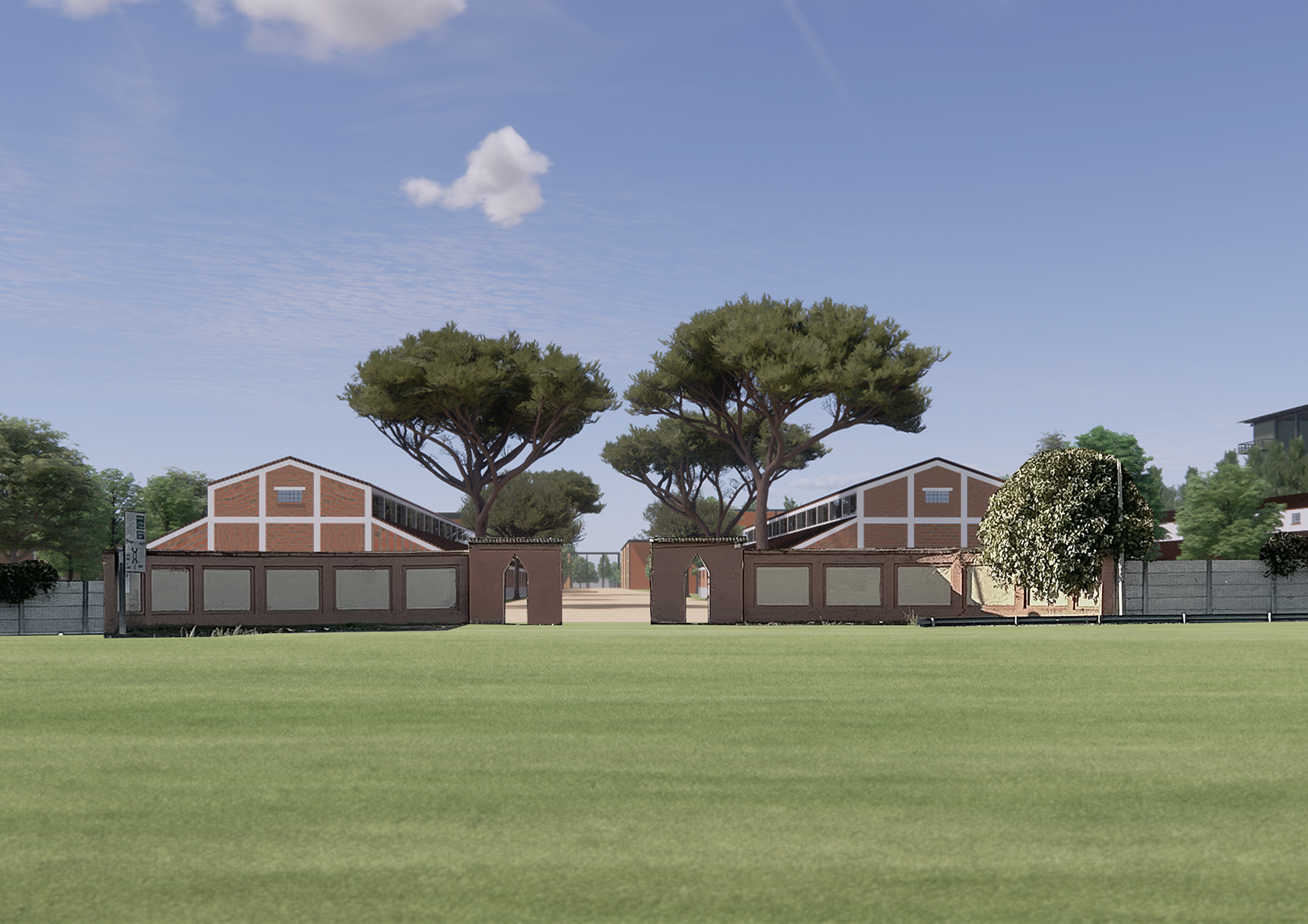
Secondly, a selection was made between the buildings to be preserved and those to be demolished. Most of the buildings along the perimeter wall were removed, except for two structures that, while maintaining their position, will be rebuilt in a different form. This decision was driven by the character of the boundary wall, which, as is common in military compounds, stands at a minimum height of three meters. This height prevents visual access to the interior, enhancing a sense of mystery. Therefore, the removal of perimeter-adjacent buildings aims to emphasize this effect and attract curiosity. Smaller buildings without photographic or archival documentation were also removed, especially those that didn’t match the architectural characteristics of the main structures.
Relationship between the Biennale area and the landmarks within the context of the Prati di Caprara
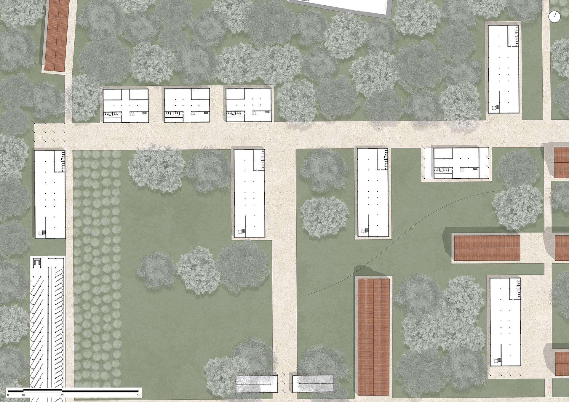
Distribution of the intervention area
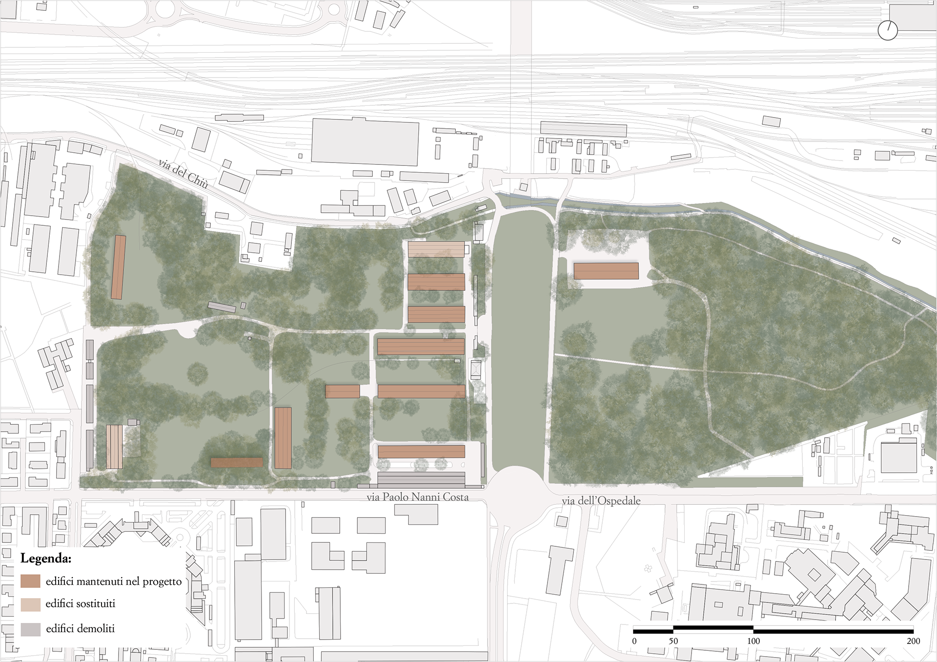
Selection between the buildings to be preserved and those to be demolished
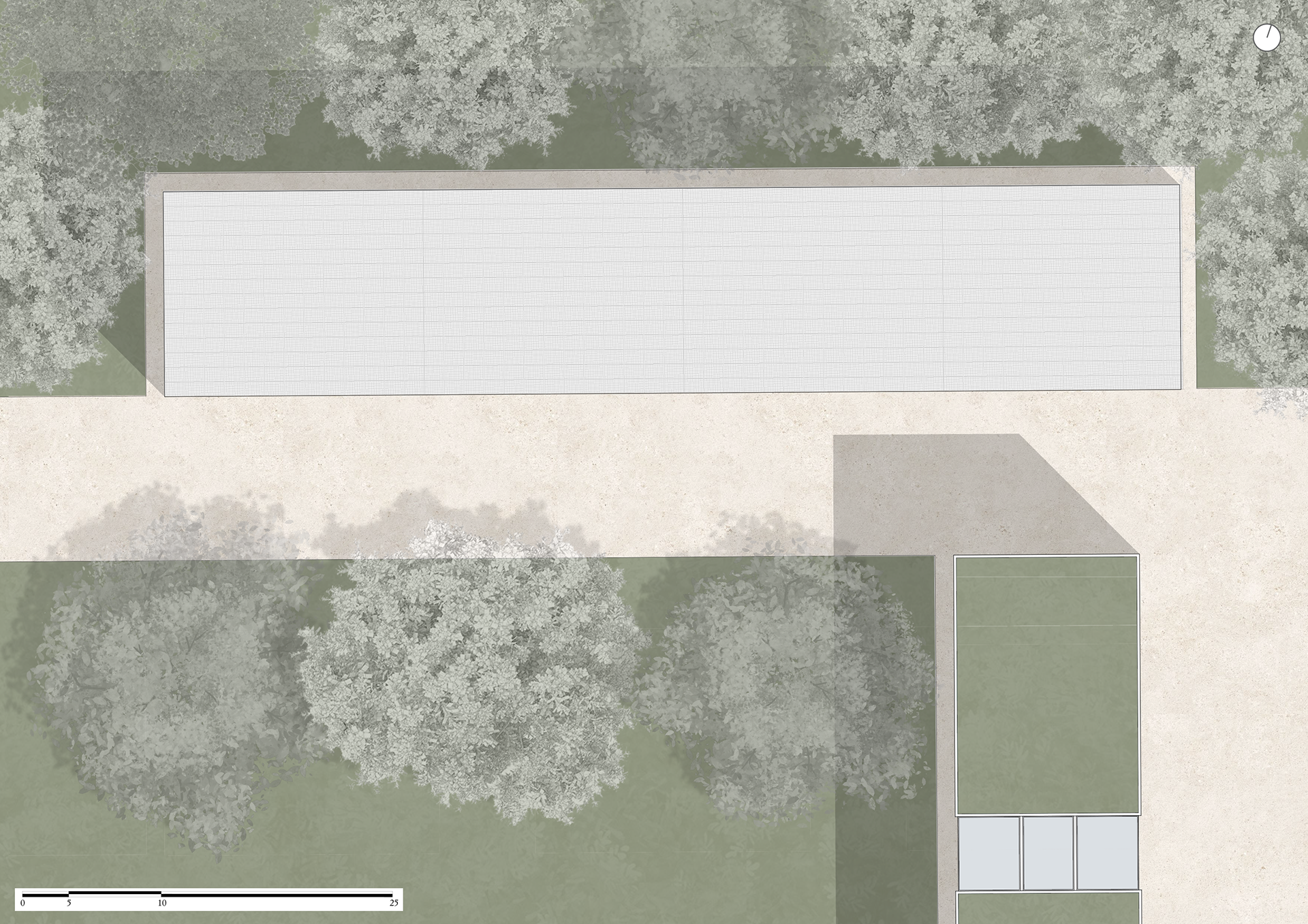
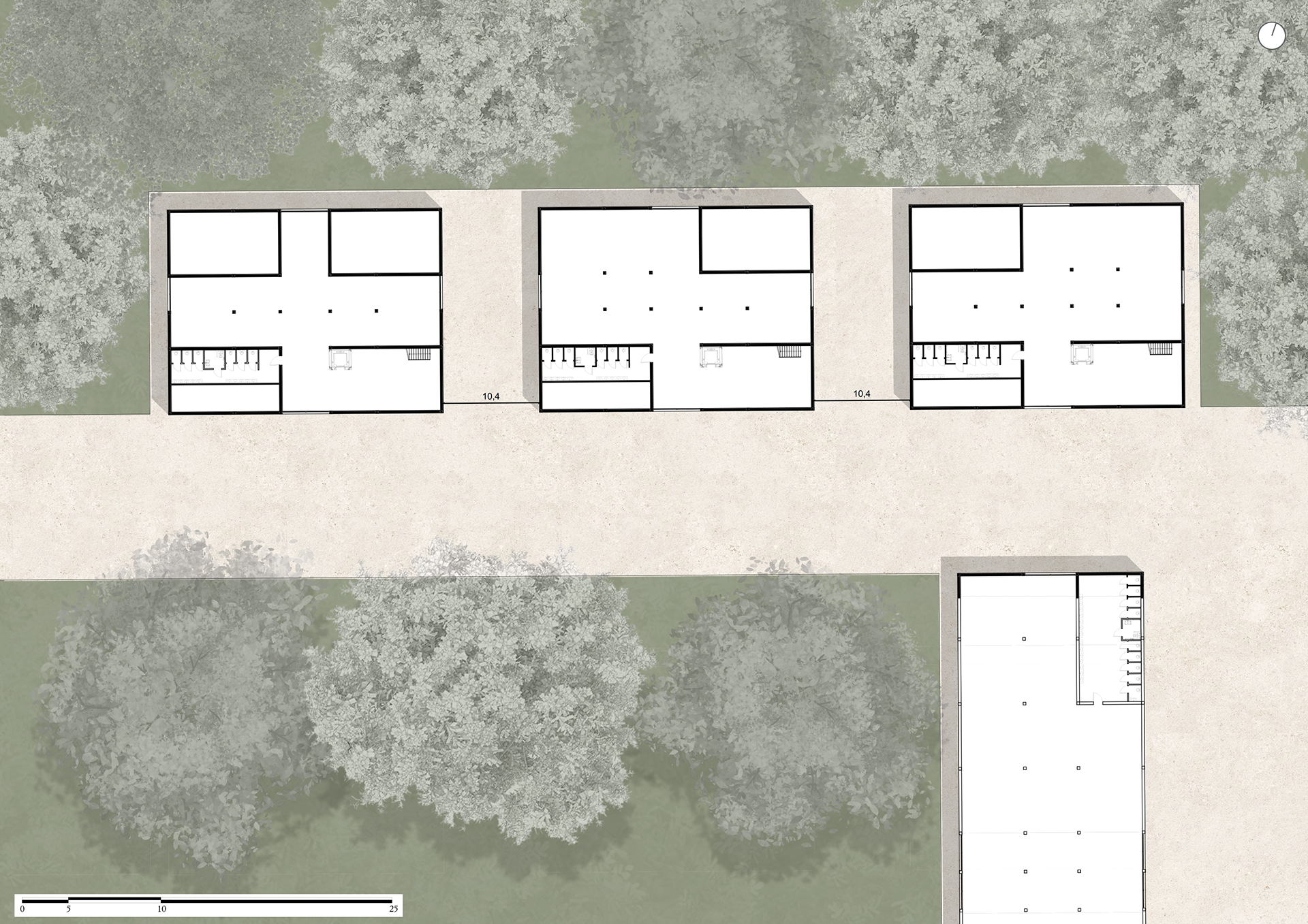
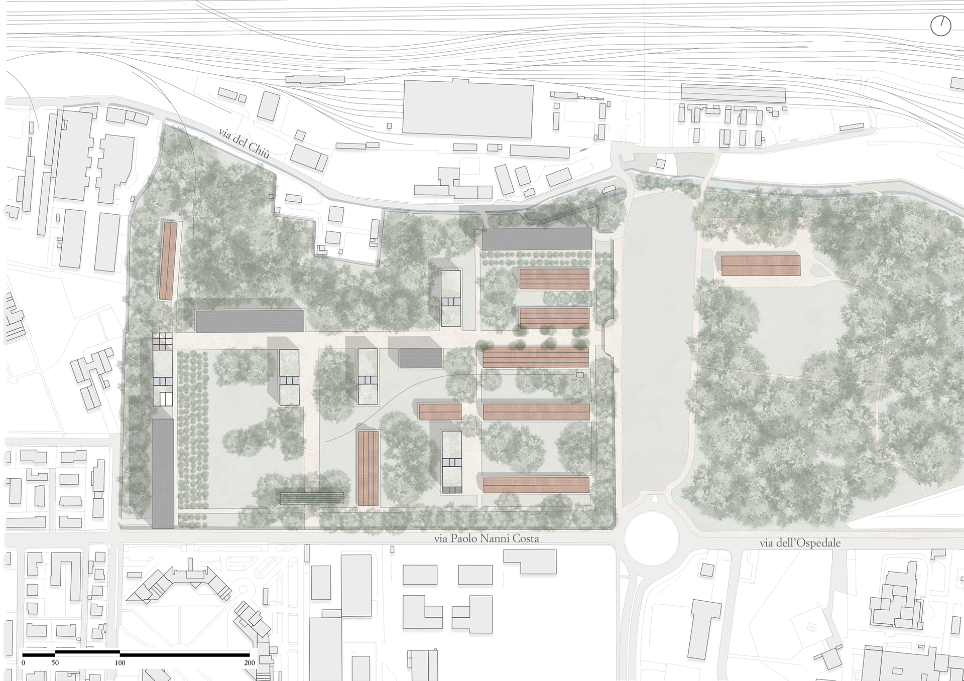
Following this, an analysis of existing structures was conducted to identify appropriate locations for new constructions. The axes of the existing buildings were traced, based on their longest sides, which defined two main orthogonal directions—vertical and horizontal—forming the backbone of the design. These axes guide the two internal boulevards that also align with the masterplan's defined path. This allowed for the identification of two main entrances: the original entrance to the former barracks will serve as the main East entrance, and a new South entrance has been added at the intersection between the vertical boulevard and the exterior fence. This ensures visitor flow in both directions through the Biennale.
Next, a detailed study of solids and voids—particularly in elevation—was carried out to integrate new buildings without significantly altering the four external façades. The goal is to create a respectful intervention that maintains the historical identity of the military facility while allowing seamless integration of the new structures. Special attention was given to the existing volumes, using them to shield the view of the new constructions and create an element of surprise for visitors. However, instead of hiding them completely, the intention is to allow glimpses that spark curiosity.
The solids (existing building fronts) along both main axes were mapped. By overlapping them, darker areas indicate where a new building would be hidden from multiple viewpoints, while lighter areas suggest partial visibility. Gaps in the overlaps mark the voids where new buildings would be fully visible. This mapping helped identify possible locations for the new structures. The new buildings were designed to partially reflect the dimensions of the existing ones—rectangular in shape, with short sides similar in size (15–20 meters) and longer sides reminiscent of military warehouses. Four versions of the layout were tested to achieve the most balanced and goal-aligned solution.
At this point, with the positions and dimensions of the buildings finalized, it was decided that the two buildings replacing the former structures will serve as internal parking facilities for the Biennale. Consequently, two vehicle entrances have been added in correspondence with these buildings.
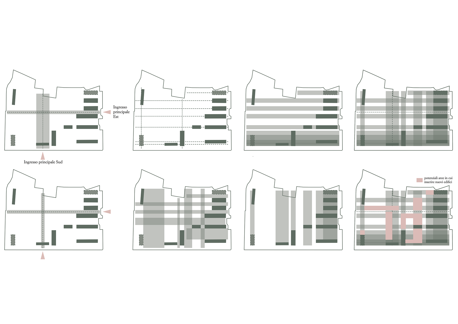
Axes, Voids, Definition of the main directional lines, Definition of the main internal avenues, Horizontally oriented built-up areas , Vertically oriented built-up areas
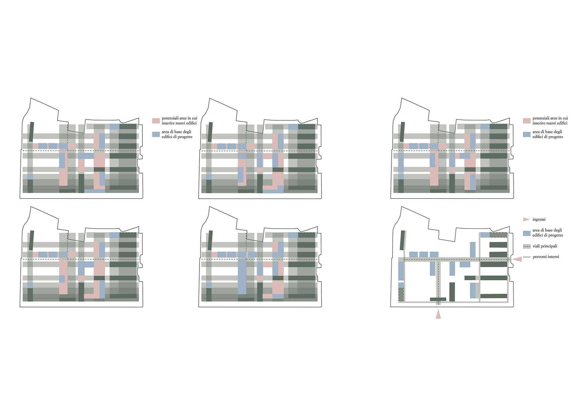
Tests 1-2-3-4, Final compositional version and schematic site plan
Urban layout
Axonometric view
Planivolumetric
Furthermore, the entire area was divided into thematic zones, each dedicated to a different art form:
- Visual Arts: Painting, Sculpture, Drawing, Photography, Printmaking, Street Art, Artistic Installations.
- Architecture and Design: Architecture, Industrial Design, Interior Design, Landscape Art.
- Fashion and Textile Design.
- Performing Arts: Theatre, Dance.
- Music.
Thematic zones
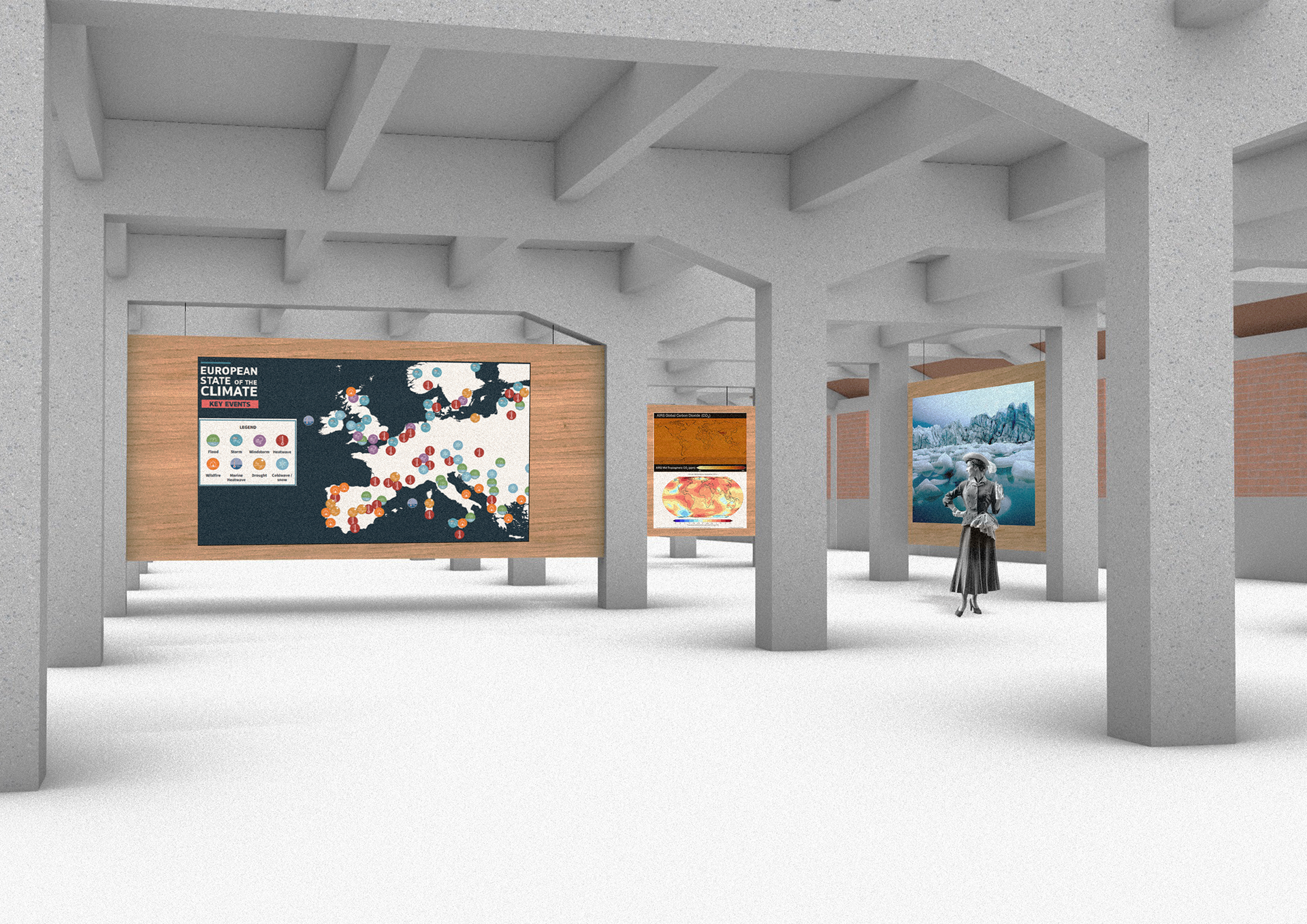
The Visual Arts represent the most space-consuming category and are primarily housed in the buildings on the right side of the area. This section also includes a building dedicated to a permanent exhibition on the environment and climate change, with a special focus on the Prati di Caprara urban forest. The aim is to raise awareness and foster a deeper understanding of environmental issues and the value of the urban forest.
As mentioned earlier, the Architecture and Design section also extends into the open grass areas, allowing for the installation of large-scale artworks and nature-integrated projects aligned with environmental themes.
The Performing Arts are distributed across several locations, including a pre-existing steel structure, completely open and located within a dense cluster of trees, which can serve as a natural stage setting. Another area inside the urban forest is also designated for performances, with more details provided in the following chapter.
Music is located in the steel skeleton structure outside the Biennale’s perimeter wall, making it accessible even beyond the event’s opening hours. While it belongs to the Biennale, it also functions as an independent zone.
Street Art already exists in the area along Via del Chiù, where an entire wall has been dedicated to this form of expression, allowing graffiti artists full creative freedom.
Each pavilion—both pre-existing and newly built—has been given a name corresponding to the type of Visual Art it hosts. For the Architecture section, the names chosen are:
- Mies Pavilion, honoring Ludwig Mies van der Rohe, a master of modernism and structural purity.
- Wright Pavilion, in tribute to Frank Lloyd Wright and his organic architecture, seamlessly integrated with nature.
- Barragán Pavilion, dedicated to Luis Barragán, known for his use of light, color, and the fusion of architecture and landscape.
- Kahn Pavilion, in honor of Louis Kahn, whose work emphasizes natural light and monumentality in harmony with the environment.
- Piano Pavilion, inspired by Renzo Piano, renowned for his use of natural light and elegant, lightweight structures that dialogue with the environment.
For the Painting section:
- Monet Pavilion, inspired by Claude Monet, whose impressionist work captures the essence of light and nature.
- Turner Pavilion, in honor of J.M.W. Turner, known for atmospheric and natural landscapes.
- Van Gogh Pavilion, inspired by Vincent Van Gogh, for his strong connection to nature and vibrant use of color.
- Friedrich Pavilion, dedicated to Caspar David Friedrich, who expressed the human-nature relationship through evocative, contemplative landscapes.
The Photography section includes:
- Ghirri Pavilion, in honor of Luigi Ghirri, an Italian photographer celebrated for his poetic and sensitive view of landscapes.
- Weston Pavilion, in tribute to Edward Weston, who explored the beauty of natural forms with a sculptural approach.
The Sculpture section includes:
- Canova Pavilion, honoring Antonio Canova, master of Neoclassicism, known for grace and balance in marble sculpture.
- Moore Pavilion, dedicated to Henry Moore, who explored the relationship between form and space, inspired by organic and natural structures.
- Brancusi Pavilion, in honor of Constantin Brancusi, whose sculptural forms evoke a deep connection to the natural world.
The Dance pavilion will be named Isadora Pavilion, inspired by Isadora Duncan, pioneer of modern dance, deeply connected to nature and freedom of movement.
The Fashion pavilion will be called Vionnet Pavilion, in tribute to Madeleine Vionnet, who revolutionized fashion with the bias cut and fluidity of fabrics.
An outdoor pavilion named Vivaldi Pavilion, honoring Antonio Vivaldi—the composer of The Four Seasons, who masterfully translated nature into music—will be situated outside the main exhibition area.
The open-air theater located near the rain garden will be called Shakespeare Pavilion, inspired by William Shakespeare, who explored the depths of the human soul through drama and poetry.
Lastly, the building dedicated to environmental themes and climate change will be named Mother Earth.
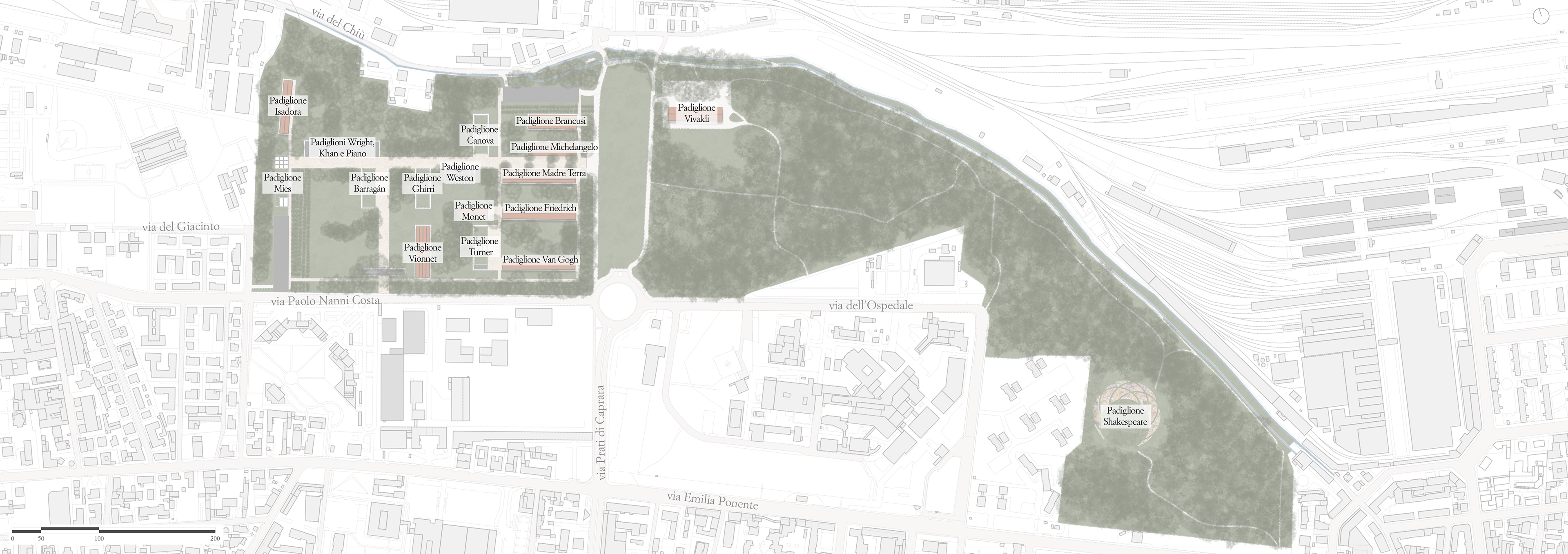
Pavillion names
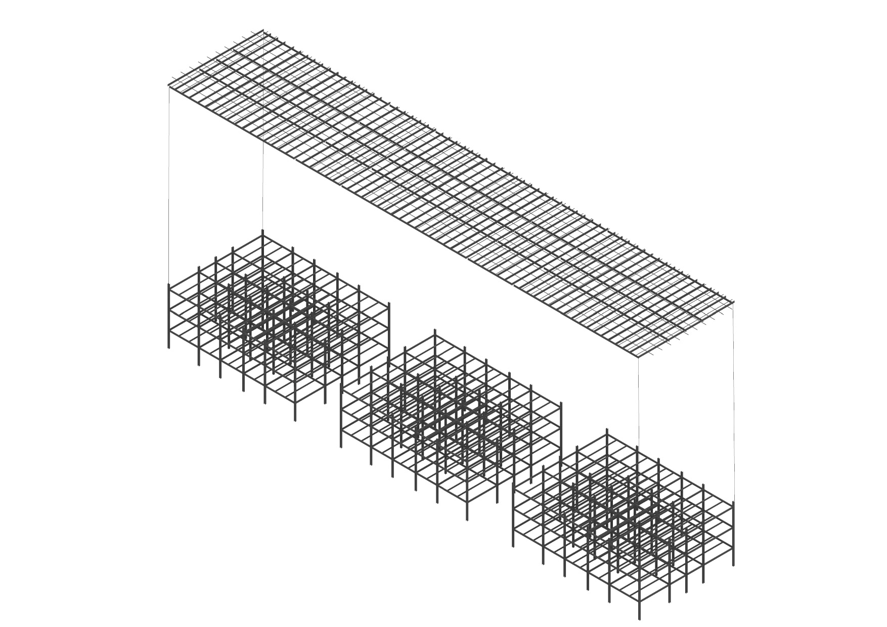
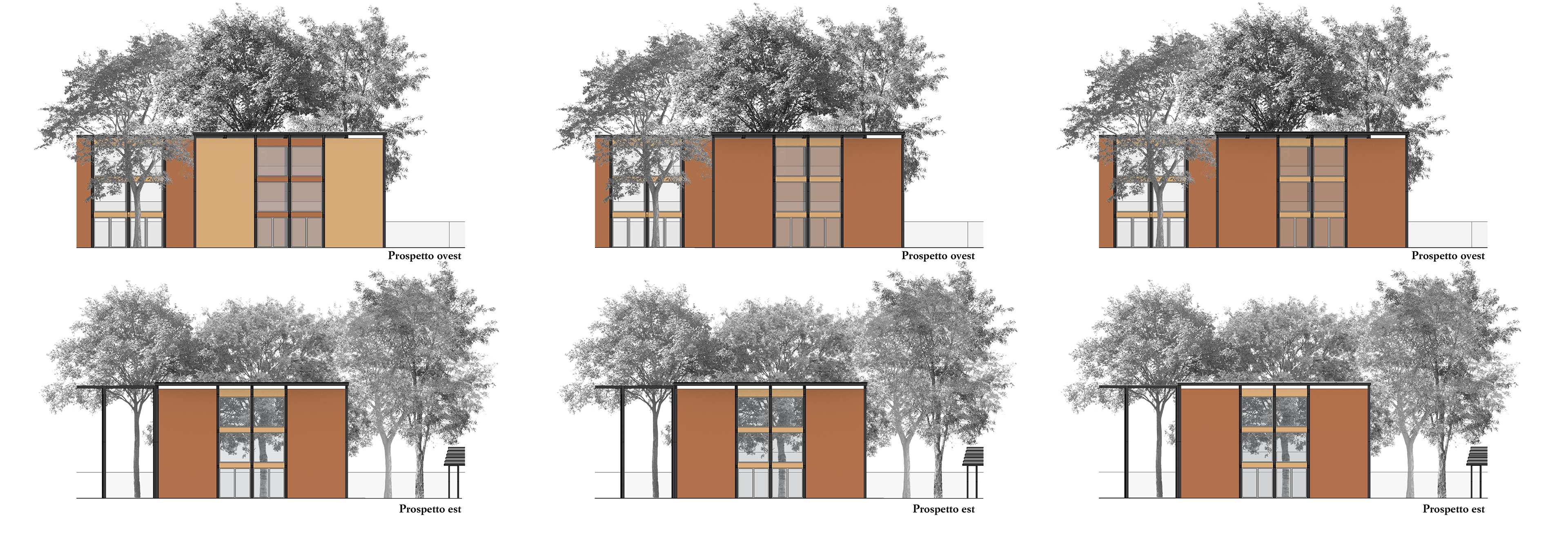
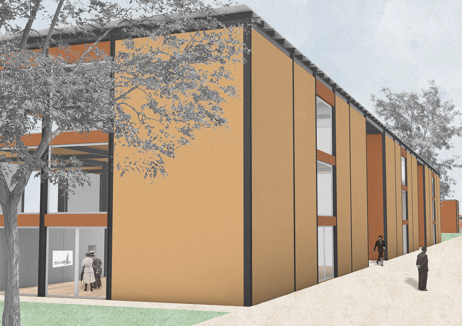
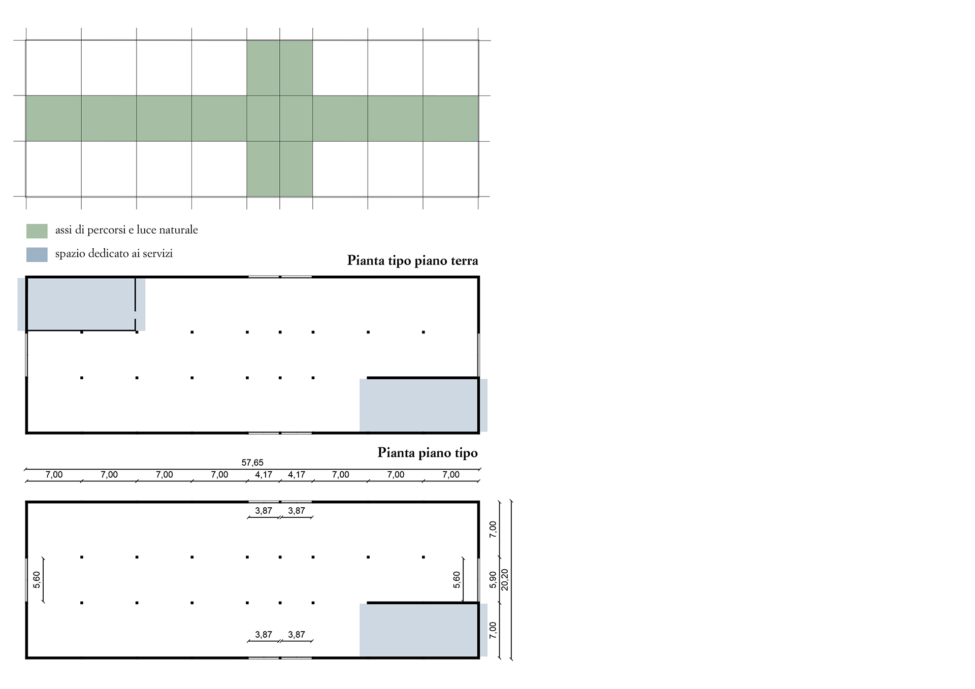
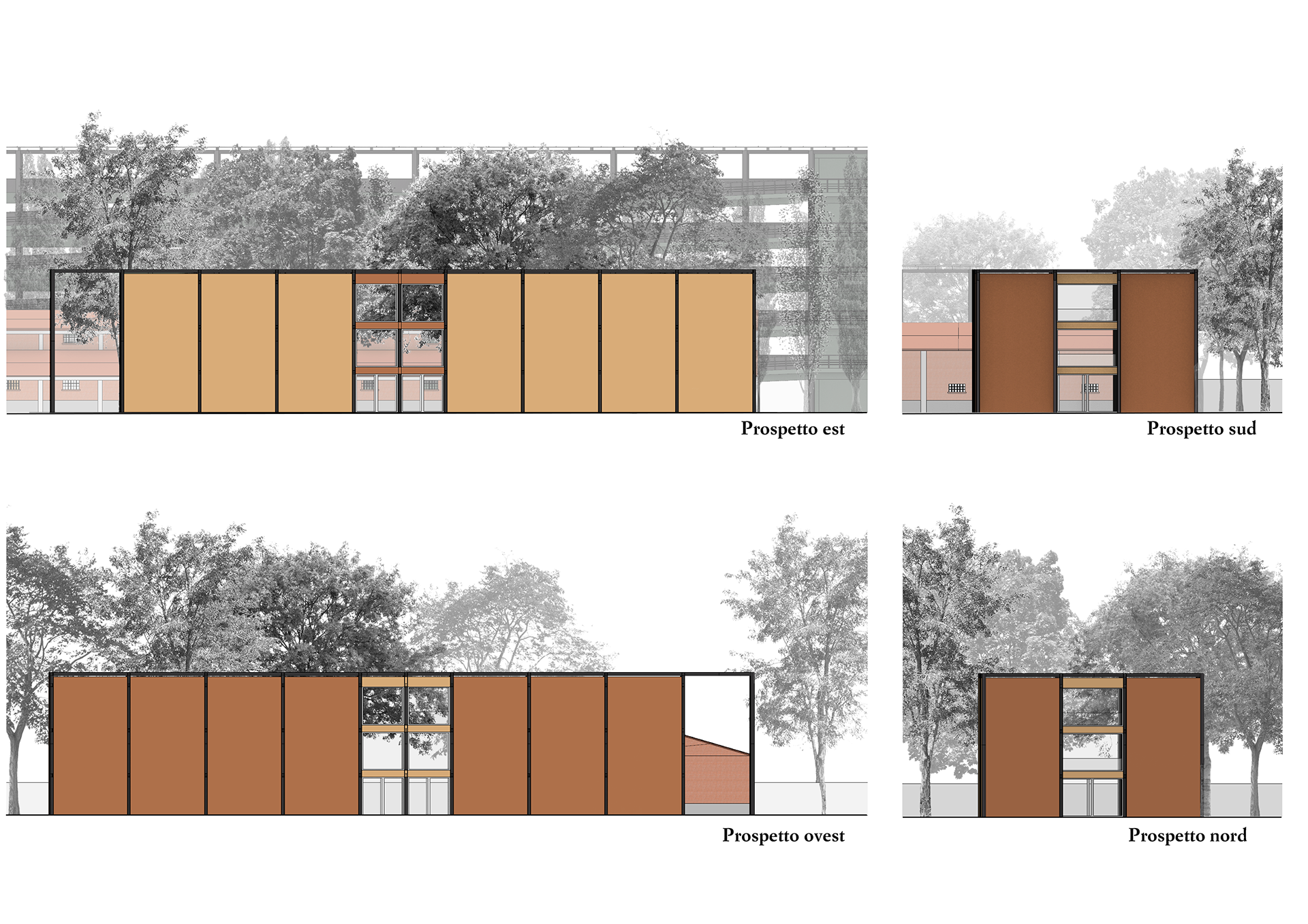
The construction project consists of three main types of buildings, with some variations. The first type is represented by the three twin pavilions (Kahn, Wright, Piano), with one variation including two porticoes. A second type includes five similar buildings with slight differences, like added porticoes. The third type involves two identical structures used as parking areas, differing from the others in structure, materials, and function.
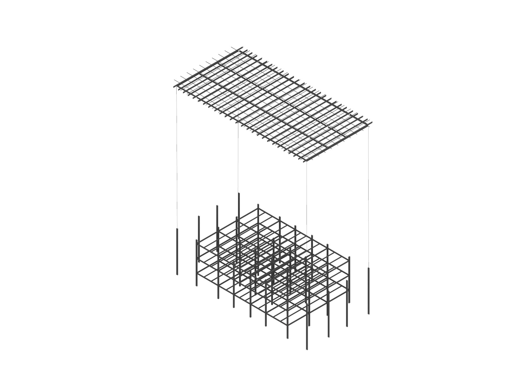
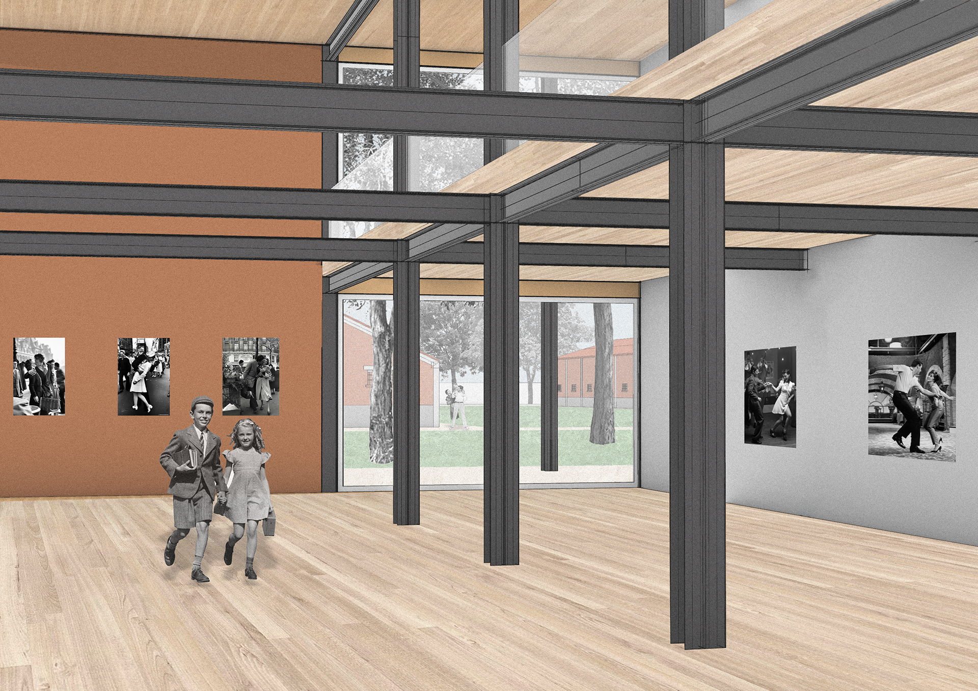
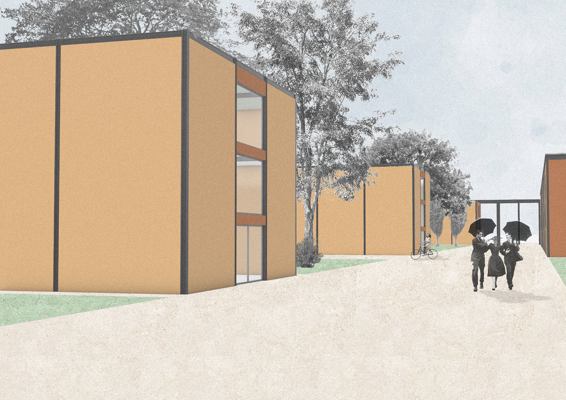
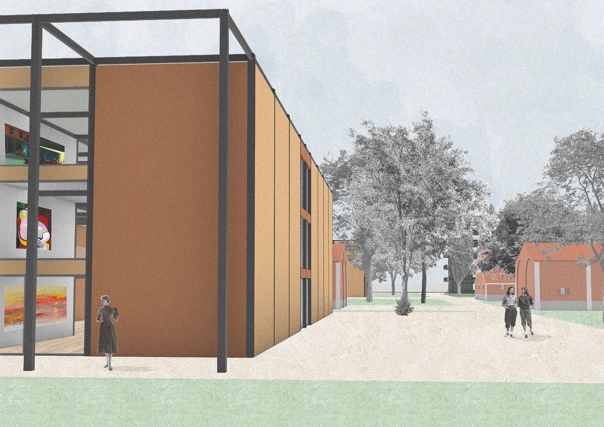
The architectural concept is rooted in simplicity, modularity, and flexibility, inspired by the existing military warehouses on the site, known for their structural grid and prefab logic. The goal was to create adaptable, symmetrical buildings with consistent column spacing. Steel and wood were chosen as the primary materials—steel for flexibility and large spans, and wood for warmth and sustainability. Some buildings have green roofs and steel porticoes for climbing plants, promoting a natural integration over time.
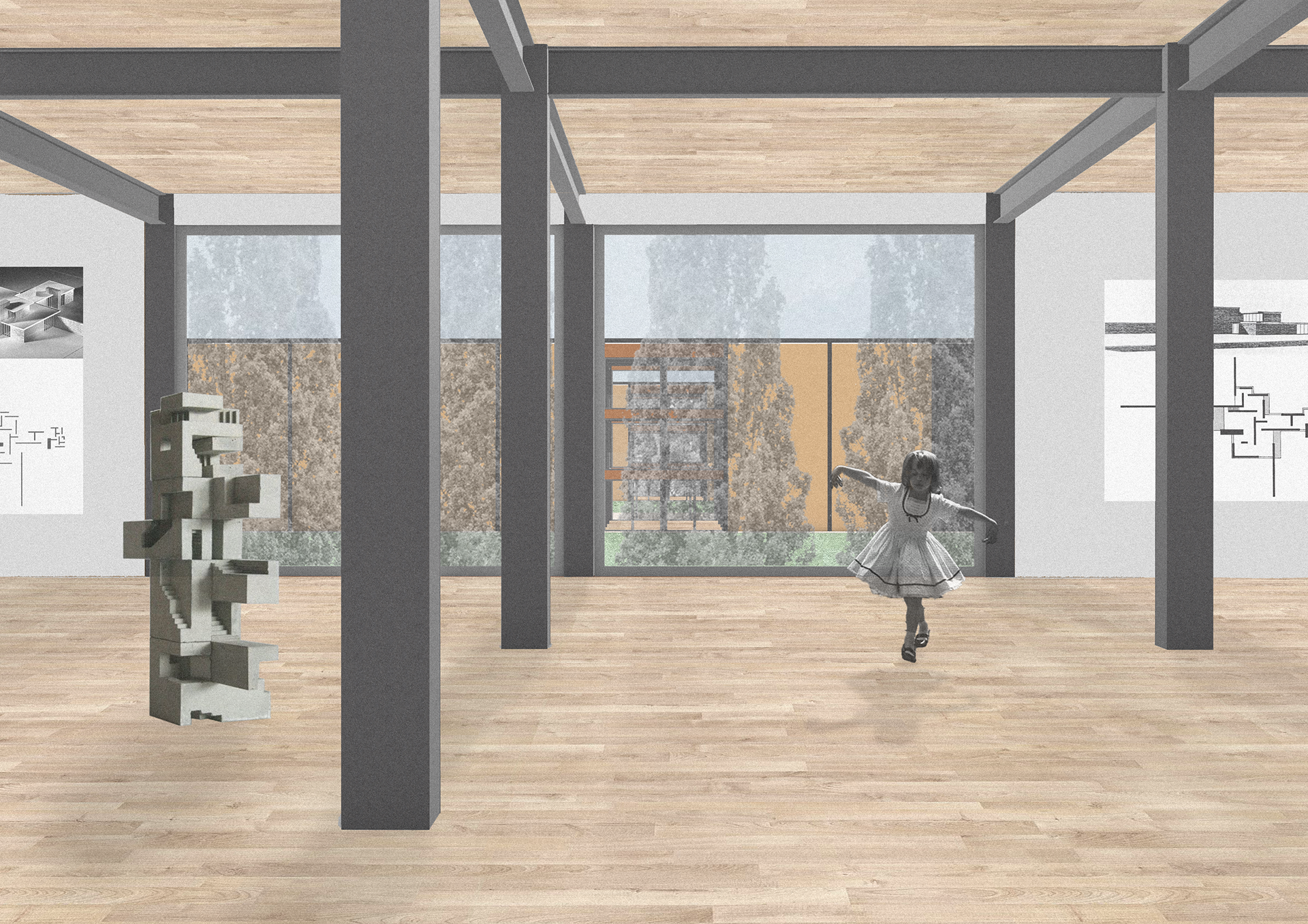
Spaces are designed to avoid rigid internal layouts, allowing exhibitions to define the visitor's experience. This approach creates dynamic, reconfigurable environments where artworks attract attention freely. Only service areas maintain fixed layouts. Large windows were strategically placed for natural light, with some zones adaptable to specific exhibition needs.
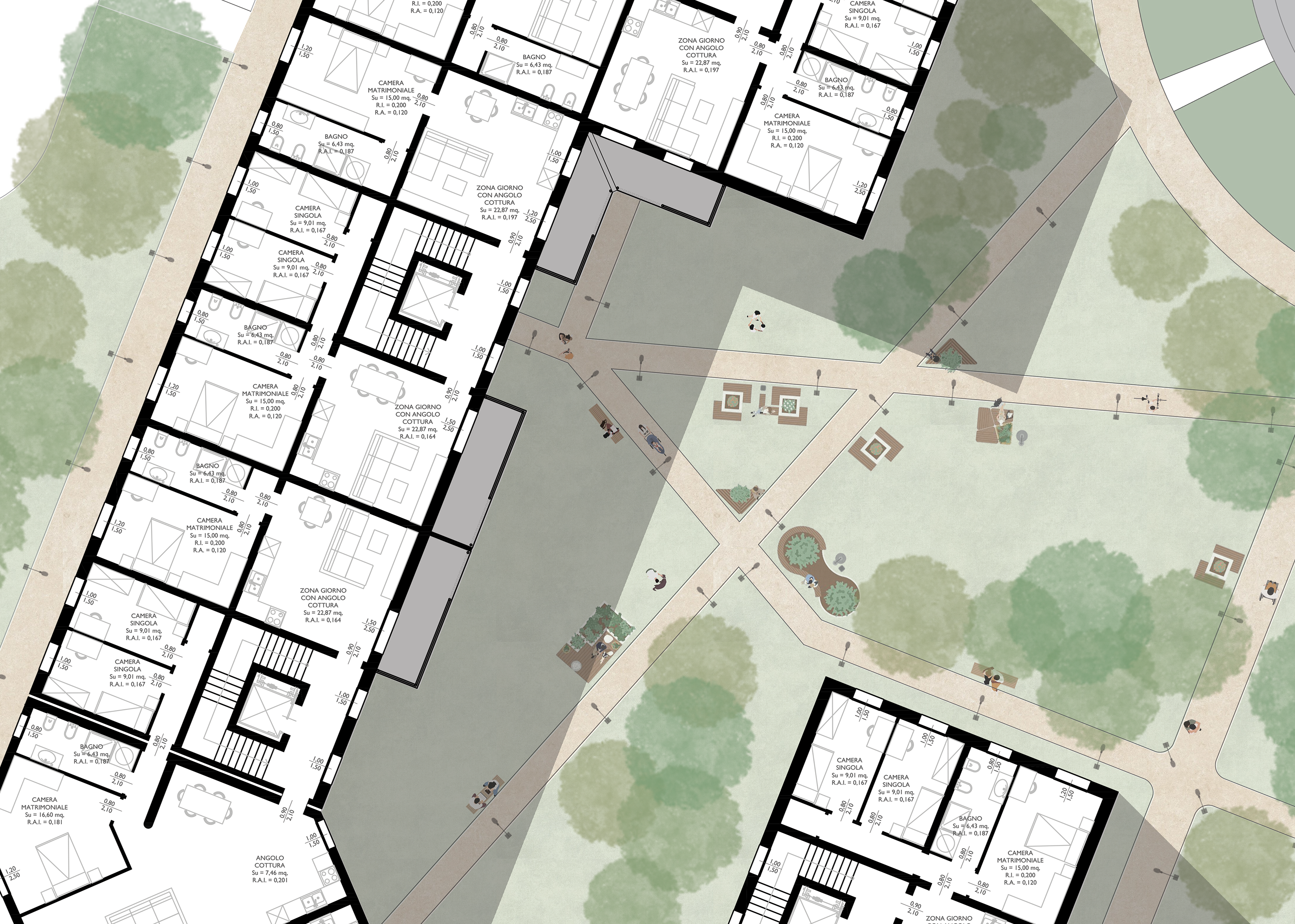
Planivolumetric view of the ground floor of the new buildings

Urban layout of the ground floor of the new buildings
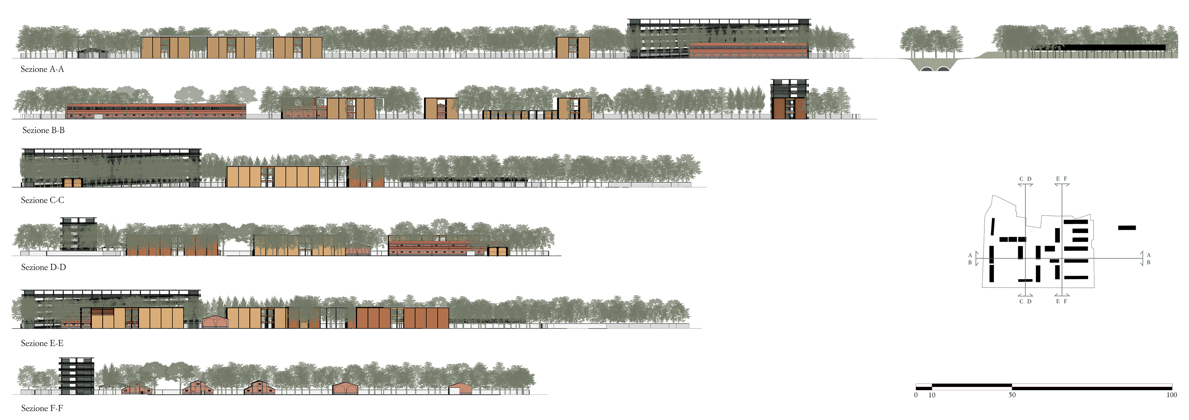
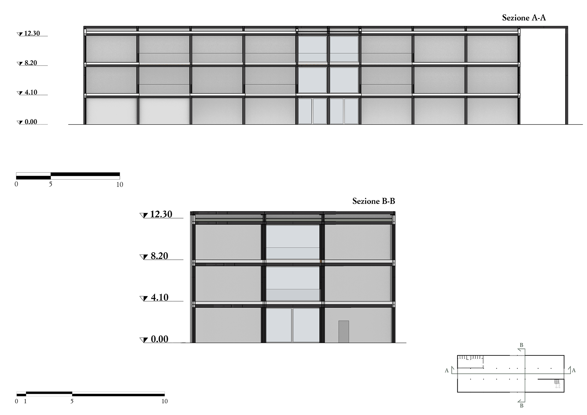
Sections A-A, B-B, C-C, D-D, E-E, F-F
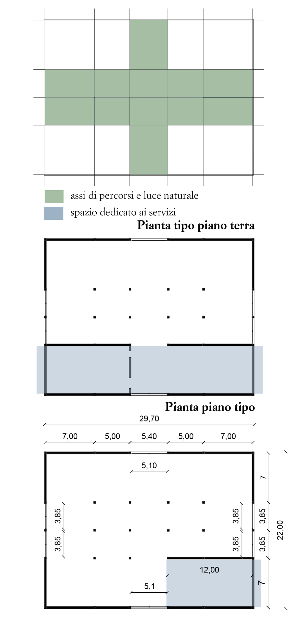
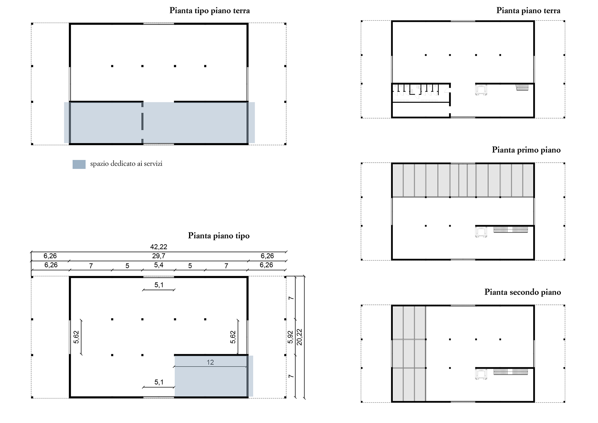
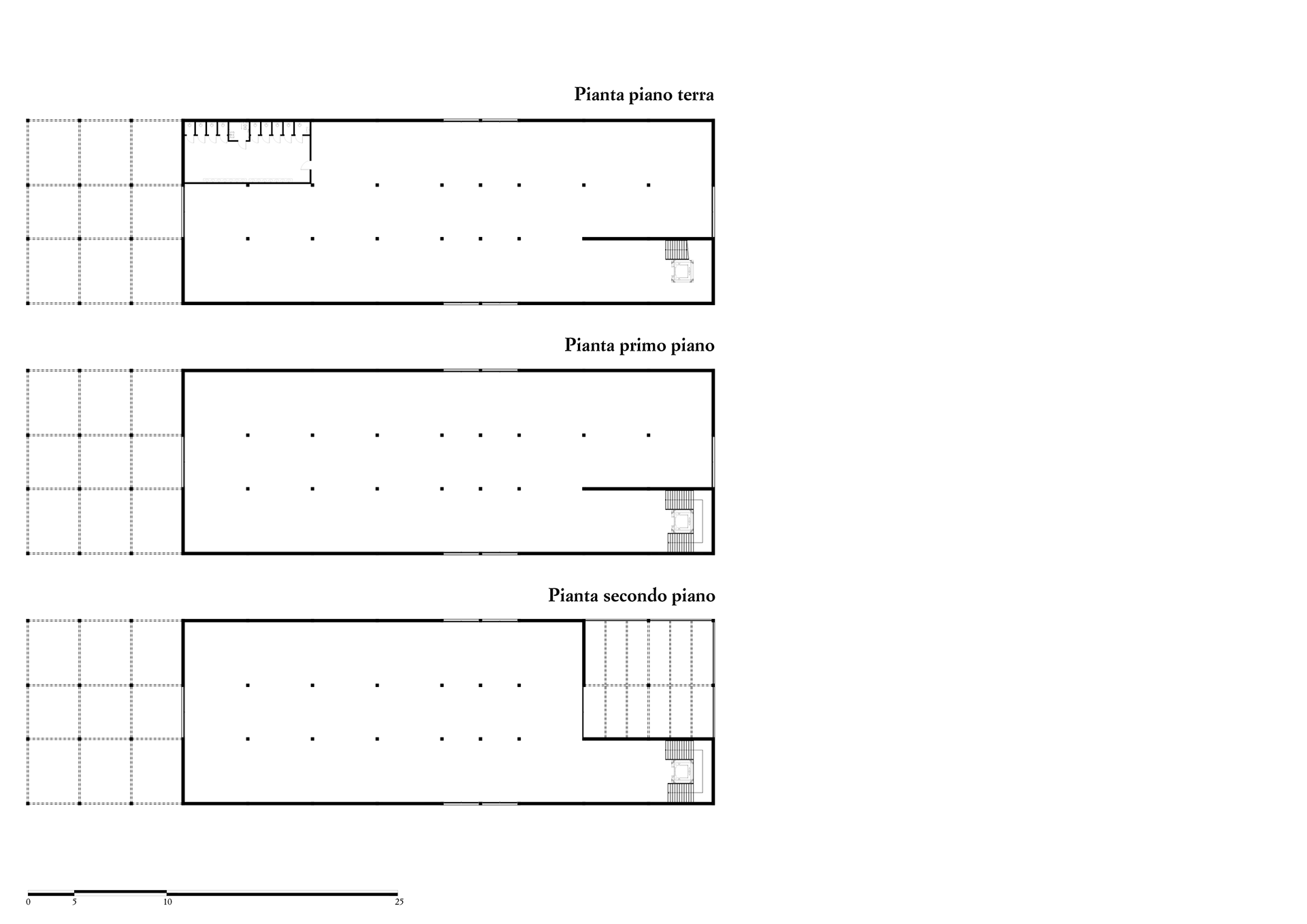
Building Type 1
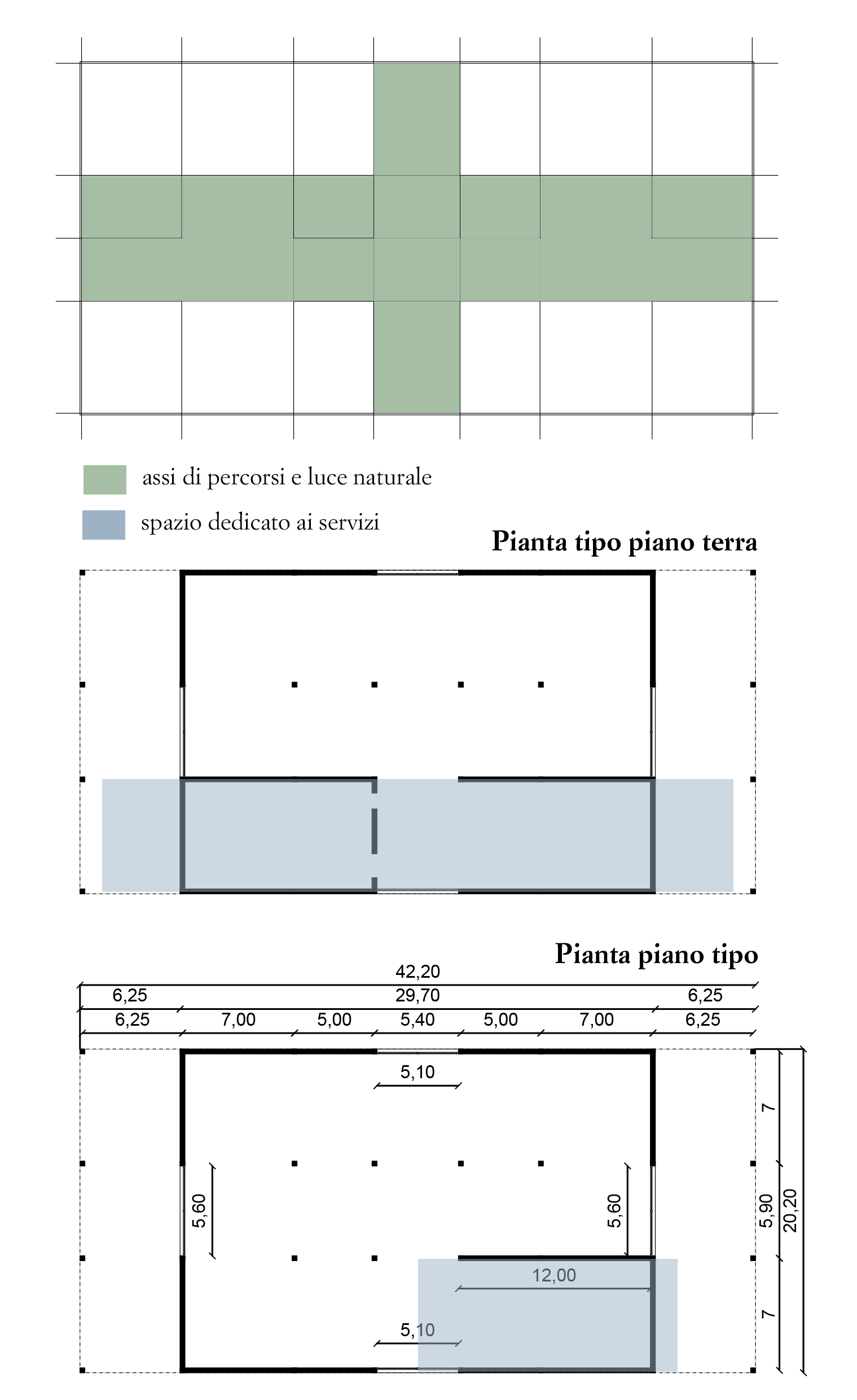
Type 1 buildings have smaller footprints and are defined by structural modularity and symmetry. French doors are uniformly placed for cross-accessibility. Ground floors include vertical circulation (stairs, elevators) and restrooms.
Twin Pavilions – Kahn, Wright, Piano
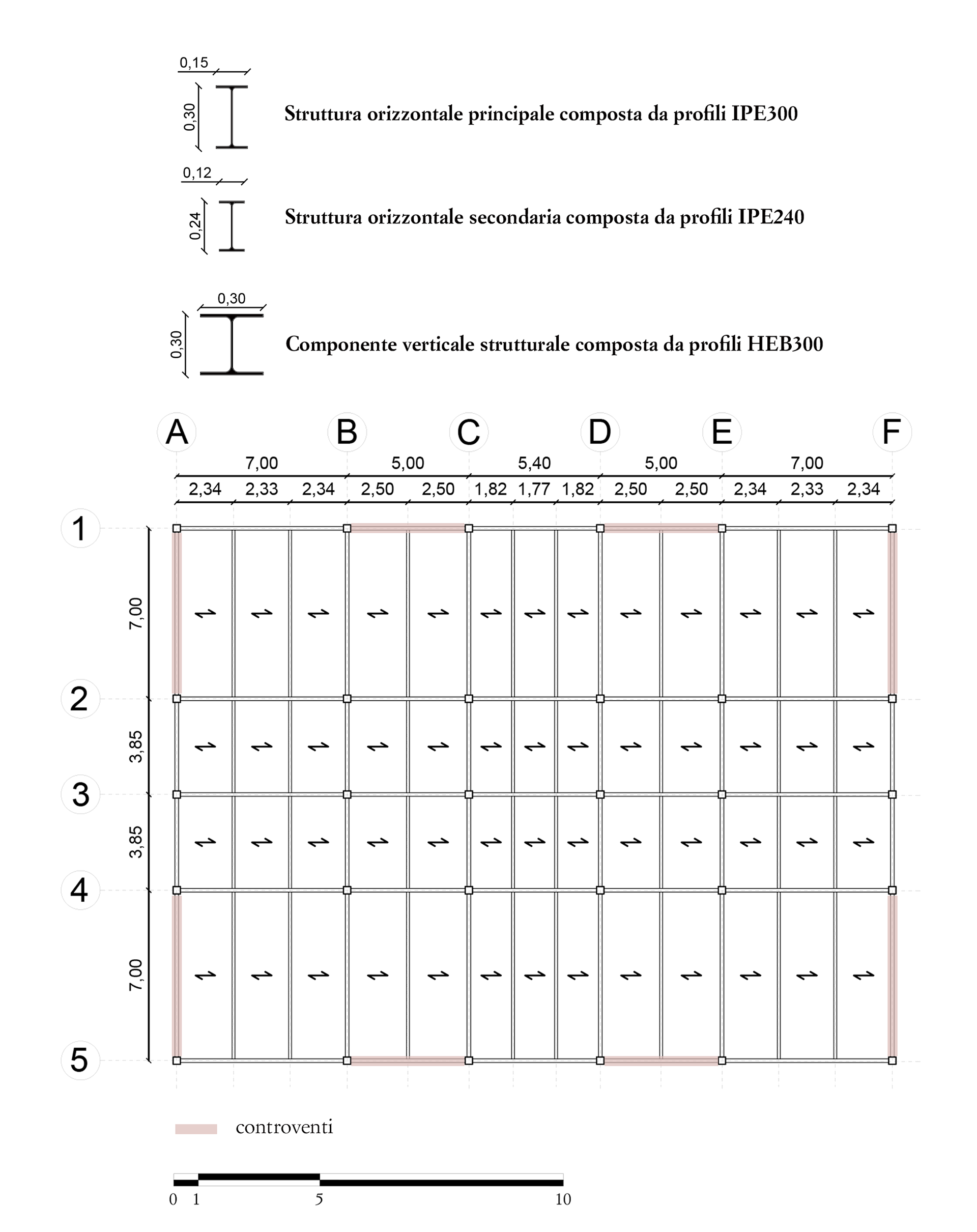
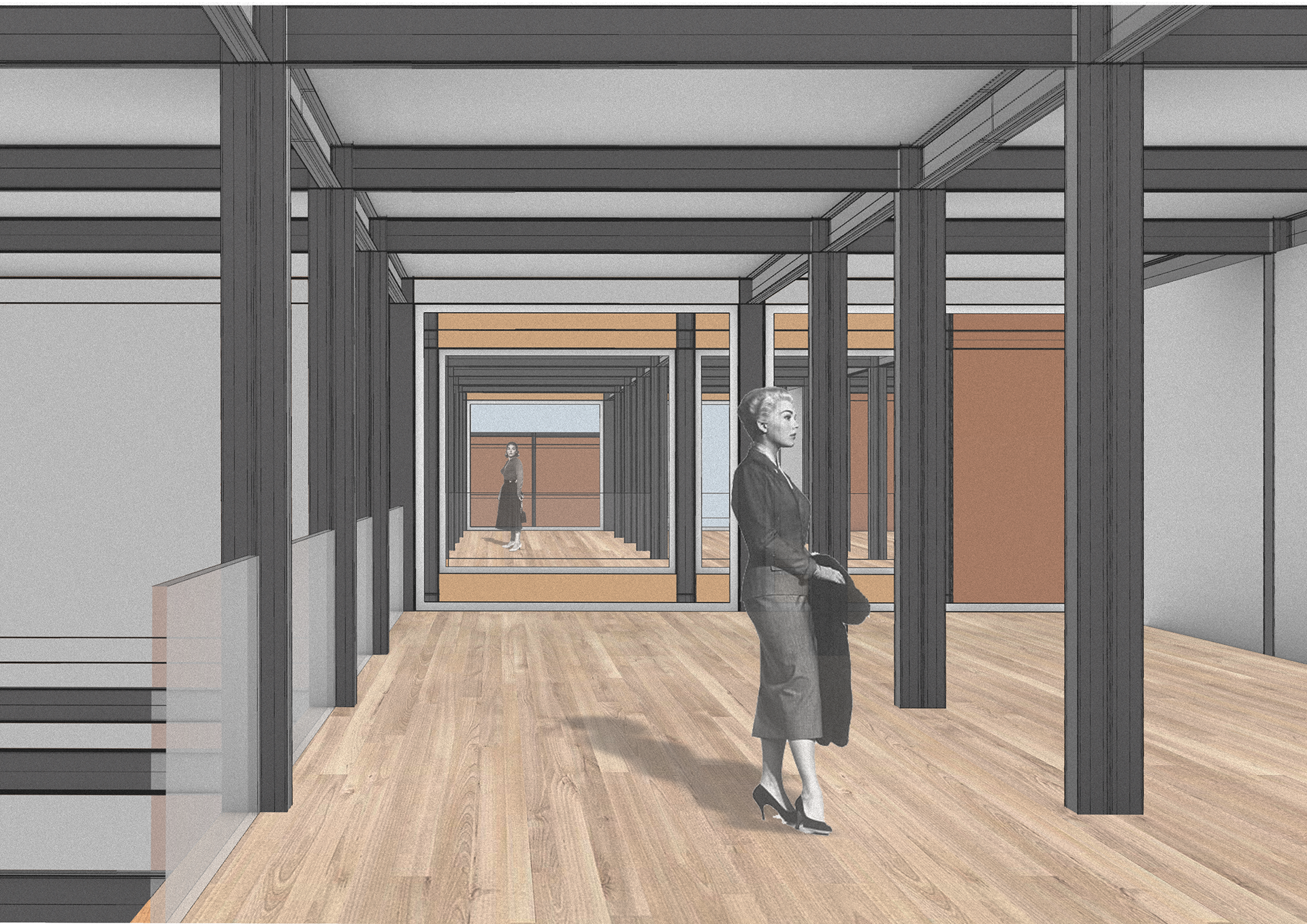
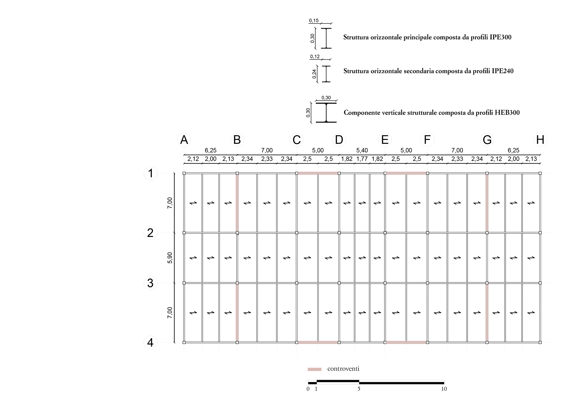
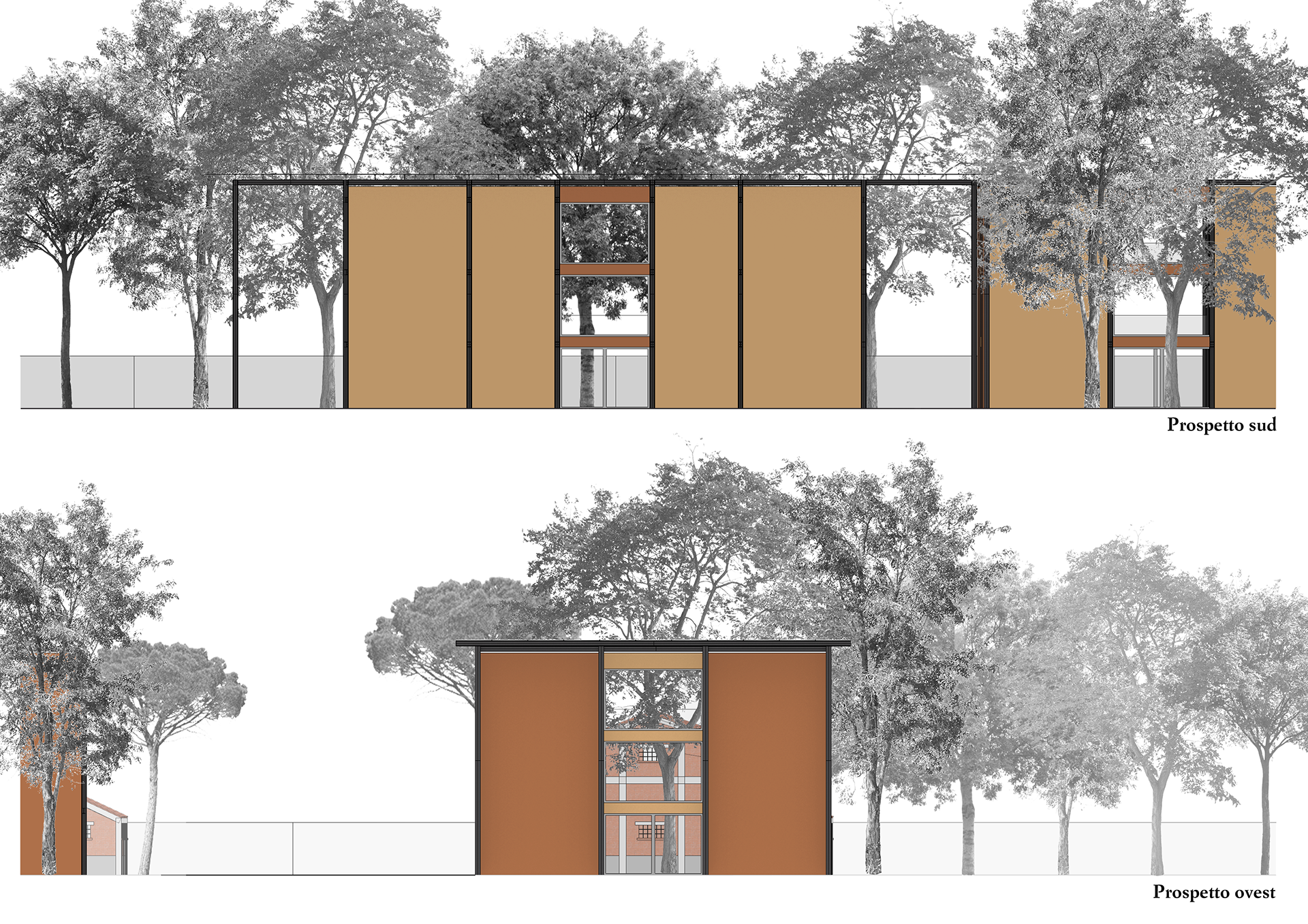
These buildings share a single solar-panel-covered roof and steel structure (HEB300 columns, IPE300/IPE240 beams). They are connected at the top, forming two covered plazas for fluid movement. The design allows for visual and spatial continuity across floors via vertical voids. Their height harmonizes with the surrounding buildings, respecting local museum regulations.
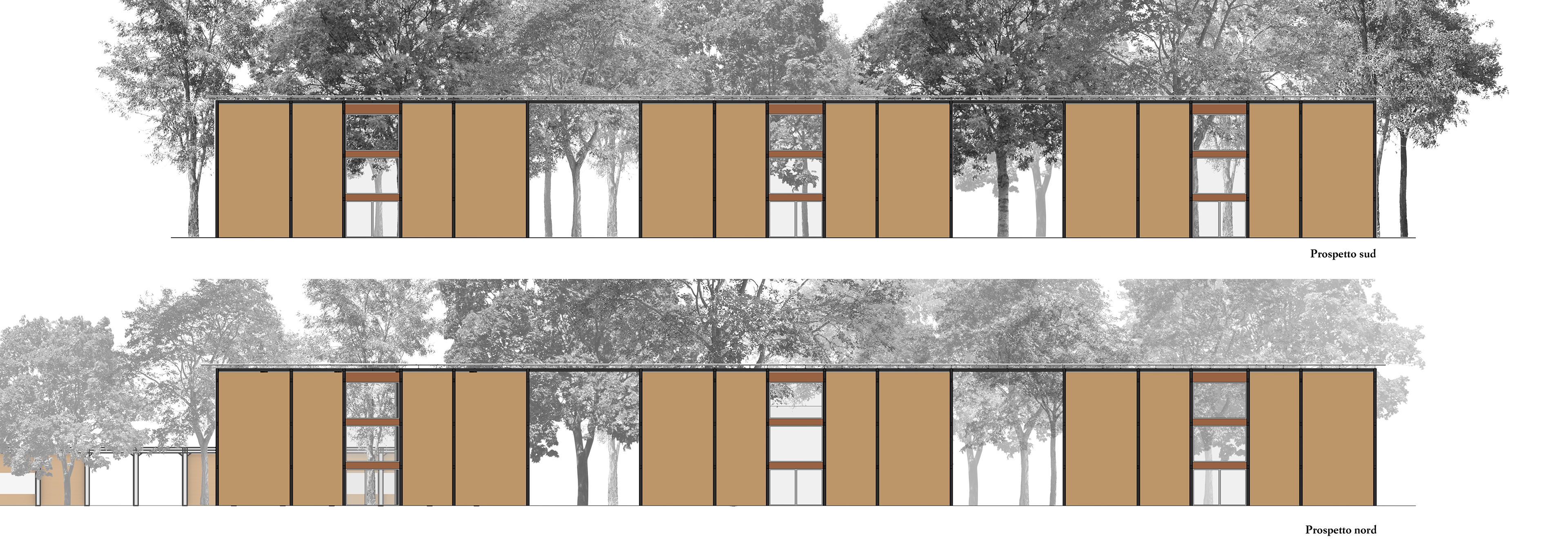
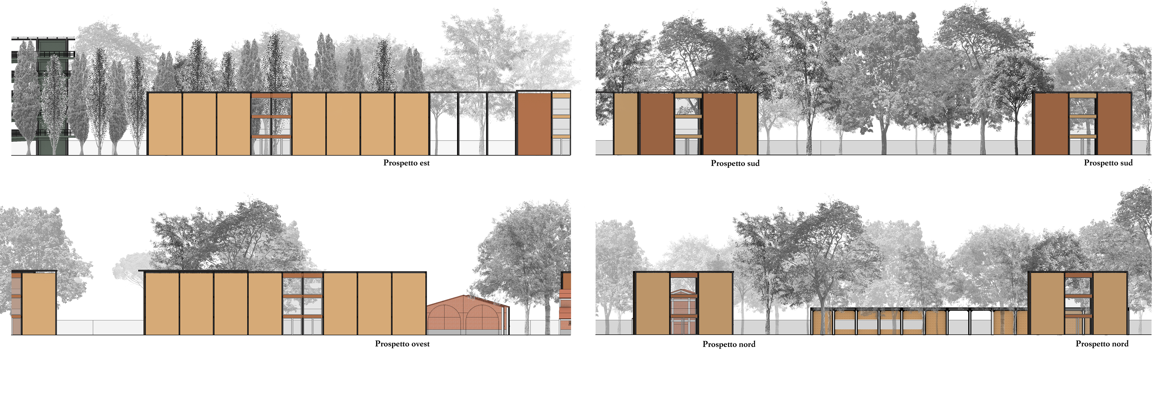
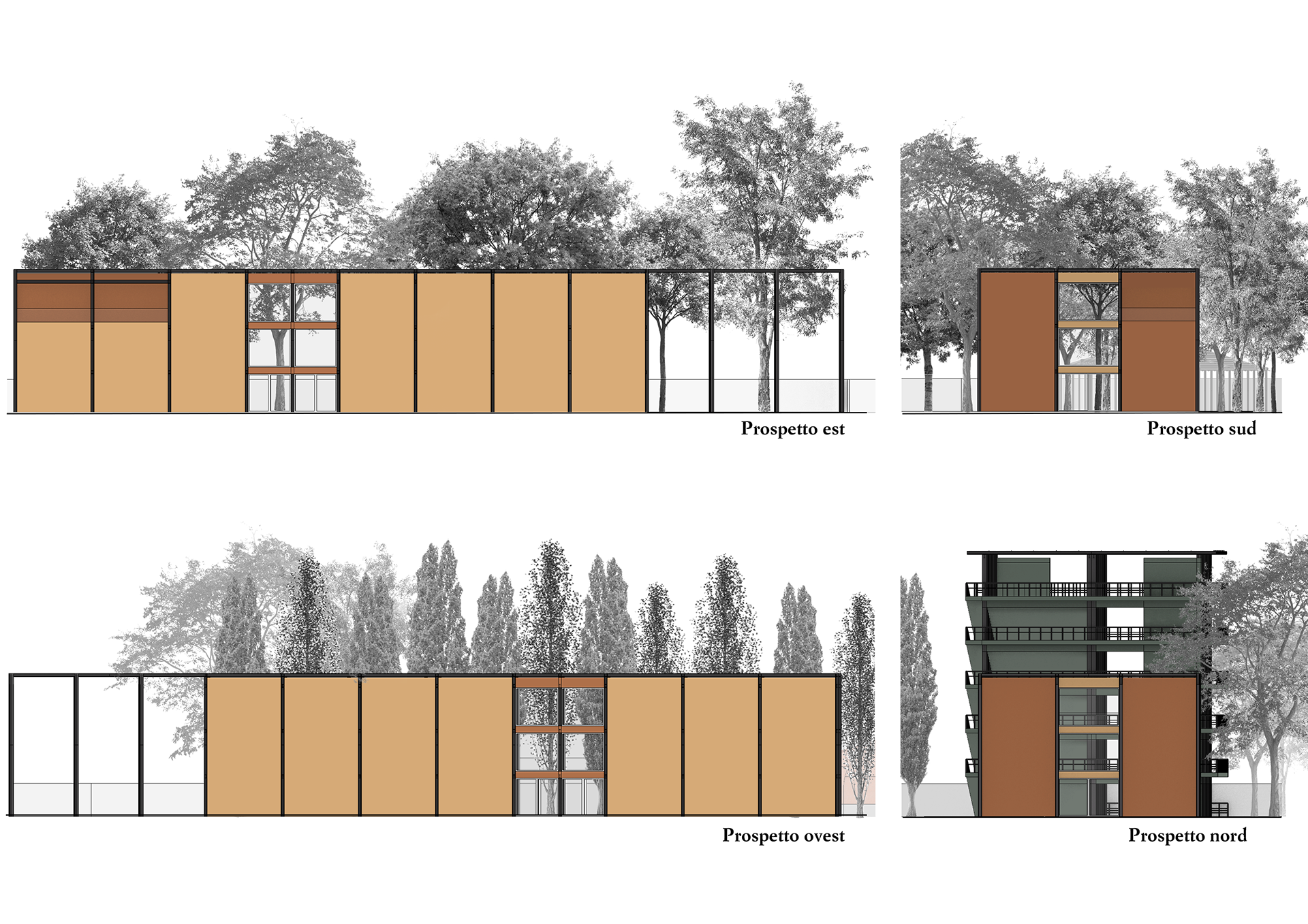
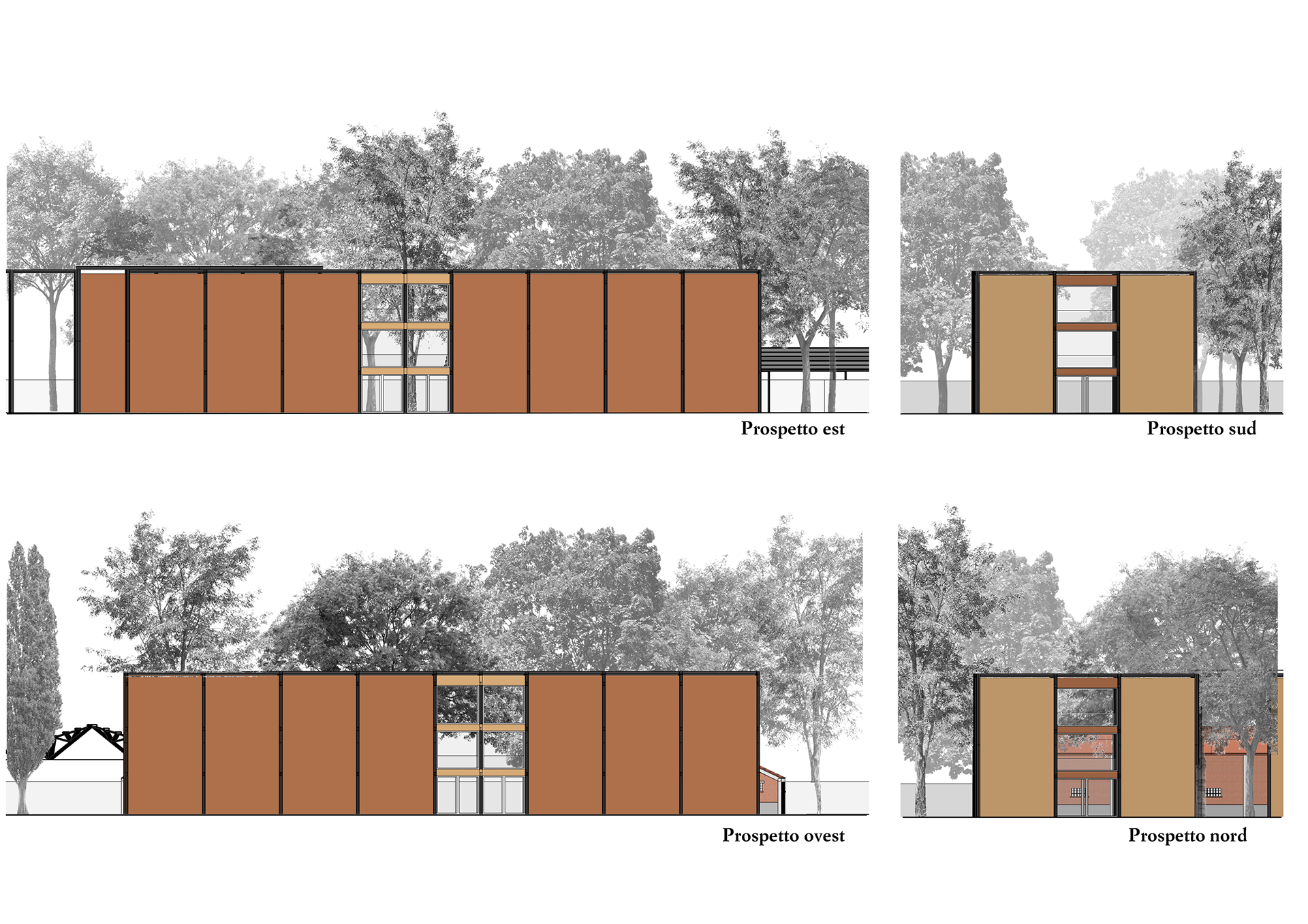
Interior finishes favor wood, while glass staircases and elevators enhance spatial permeability. Structural elements are exposed on the façades, giving rhythm. The color scheme reflects Bologna's architectural palette, using tones sampled from the Sanctuary of San Luca. Lighter colors are used on main façades; darker tones are reserved for those facing nature or adjacent to existing brick structures.
Weston Pavilion
A variant of Type 1, the Weston Pavilion also includes vertical voids for visual connection between floors and with the surrounding area. It features solar panels and two full-height porticoes as open-air extensions. Located near dense pre-existing structures, its height follows the logic established for this building type. Like the twin pavilions, it uses wood for interiors, glass for stairs and lifts, and visible steel structure for coherence. The façade color aligns with the established palette: light on main routes, dark where it faces older buildings or green areas.
Overall, the architecture is designed to adapt and evolve, ensuring a harmonious dialogue with its surroundings, both built and natural.
Compositional diagrams of the floor plans of Type 1 buildings
Roof site plan of the Wright, Kahn, and Piano pavilions
Ground floor site plan of the Wright, Kahn, and Piano pavilions
Architectural floor plans of the Wright, Kahn, and Piano pavilions
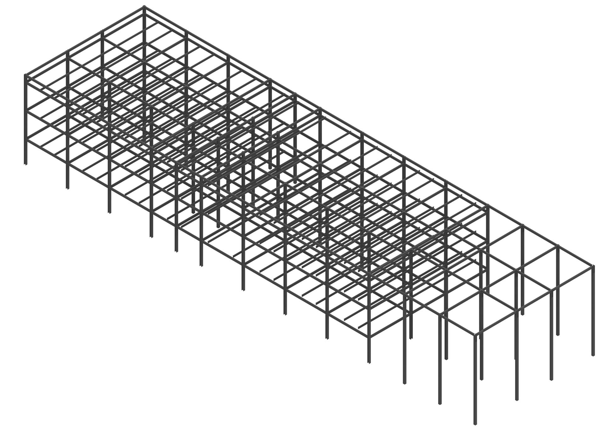
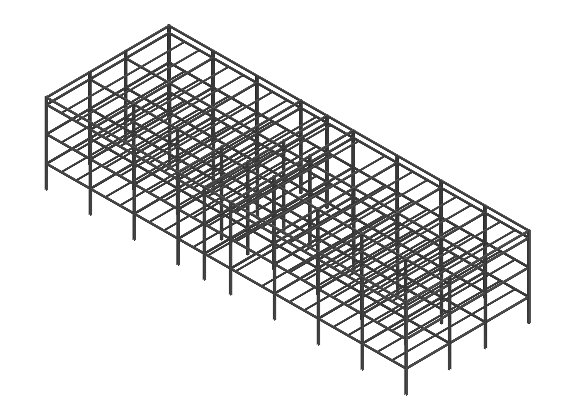
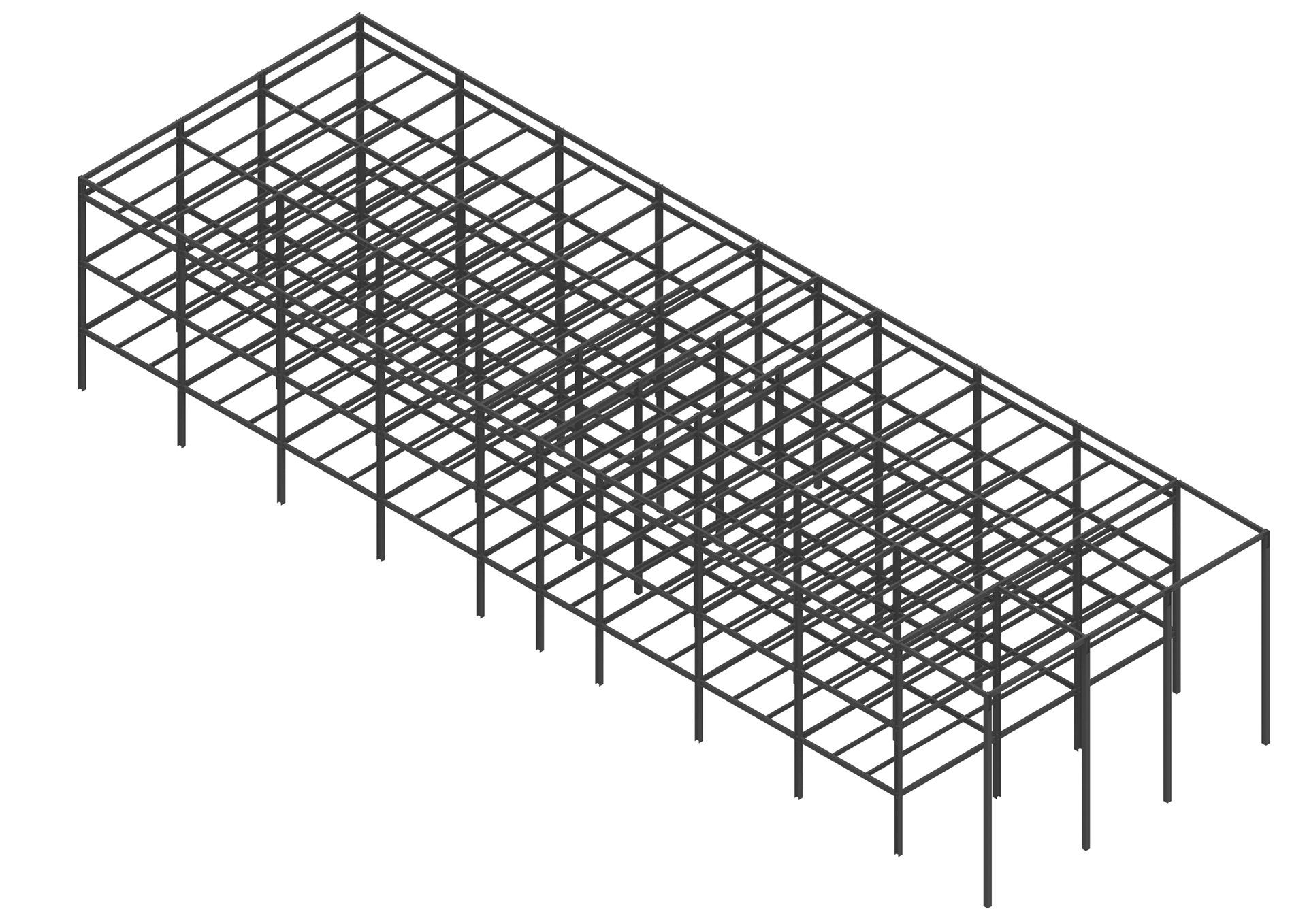
Typical floor framing and profile scheme used for Type 1 buildings
Perspective view of the structure of the Wright, Kahn, and Piano pavilions
Sections A-A, B-B, C-C, D-D of the Wright, Kahn, and Piano pavilions
Main elevations of the Wright, Kahn, and Piano pavilions
Side elevations of the Wright, Kahn, and Piano pavilions
Second floor plan view of the Wright, Kahn, and Piano pavilions
Exterior view of the Wright, Kahn, and Piano pavilions
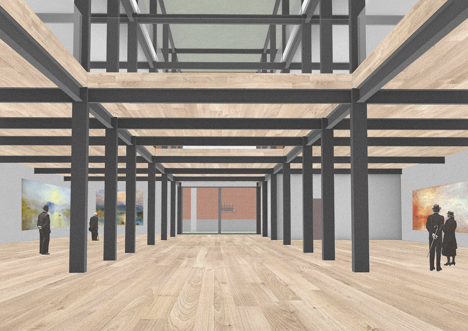
Interior view of the Piano pavilion
Compositional diagrams of the floor plans of Type 1 buildings
Roof site plan of the Weston pavillion
Ground floor site plan of the Weston pavillion
Architectural floor plans of the Weston pavillion
Typical floor framing and profile scheme used for the Weston pavillion
Perspective view of the structure of the Weston pavillion
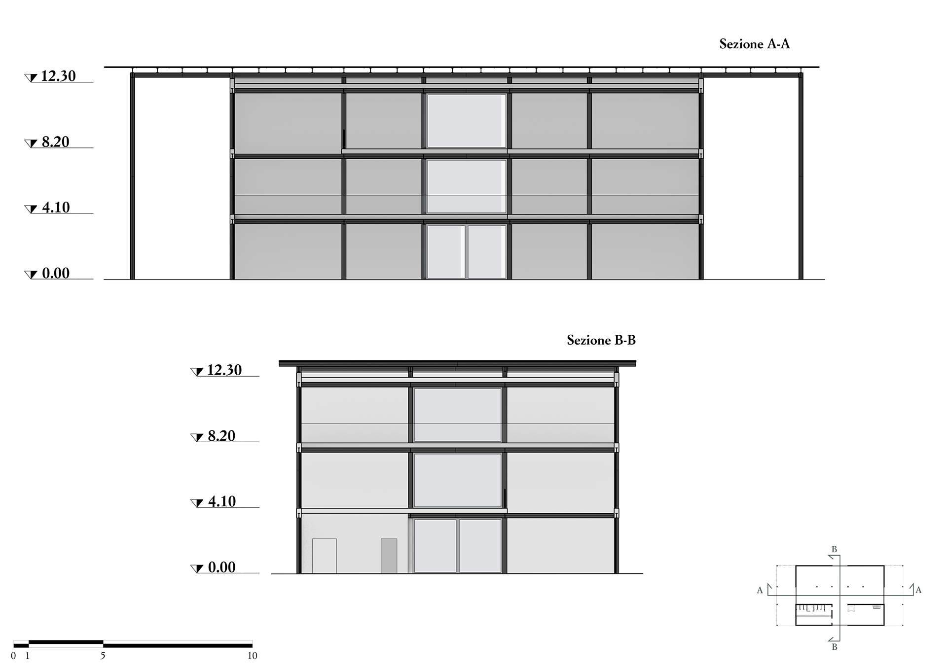
Sections A-A, B-B of the Weston pavillion
Elevation of the Weston pavillion
Elevation of the Weston pavillion
Interior view of the Weston pavillion
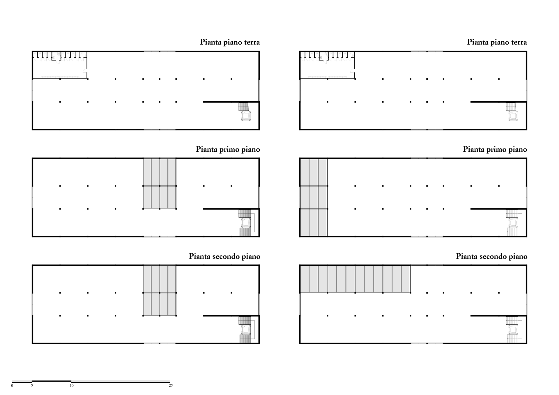
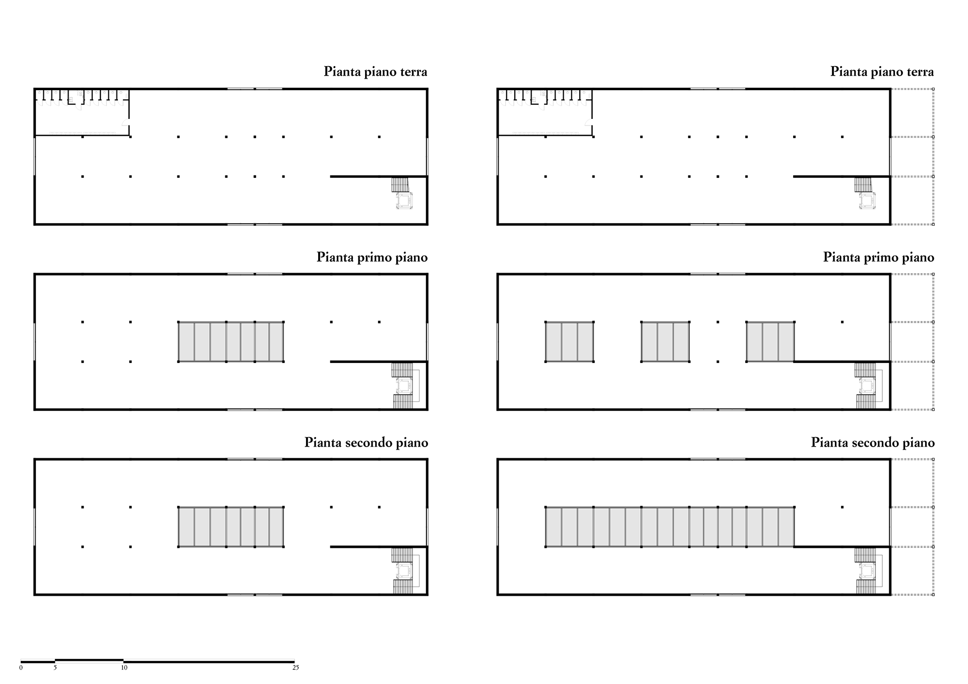
Type 2 Buildings
Type 2 buildings are larger than Type 1 and follow modular design principles, with a structural grid ensuring symmetry and regular spacing. As shown, this grid defines the position of French doors along the perimeter, creating clear circulation paths. These openings are consistent across all five Type 2 variants. A key feature is the extensive use of glass, both on façades and roofs. Unlike Type 1, these roofs host green roofs instead of solar panels, enhancing environmental integration. Services are on the ground floor, with stairs, elevators, and bathrooms placed symmetrically at both ends of the plan rather than in a single strip, ensuring functional balance. Type 2 buildings reflect a balance between modularity and spatial flexibility, with natural materials, landscape integration, and thoughtful lighting design enhancing visitor experience.
Mies Pavilion
The modular structure offers high flexibility across floors. Openings support movement and visual connections between spaces and nature. Glass surfaces provide views of the Biennale, linking old and new elements. Built with a dry system, the steel structure includes HEB300 columns and IPE beams. Building height is calibrated to respect the context and Italian museum regulations. Interiors feature wood for warmth, contrasting with steel, while glass stairs and elevators maintain transparency. The visible structure adds rhythm to the façades, which use colors inspired by Bologna’s traditional palette, especially from the Portico of San Luca. The lightest shade faces main paths, the darker faces side paths. The Mies Pavilion is the essential Type 2 version, with a northern portico forming a semi-covered square—an evolving green space meant for rest and gathering.
The modular structure offers high flexibility across floors. Openings support movement and visual connections between spaces and nature. Glass surfaces provide views of the Biennale, linking old and new elements. Built with a dry system, the steel structure includes HEB300 columns and IPE beams. Building height is calibrated to respect the context and Italian museum regulations. Interiors feature wood for warmth, contrasting with steel, while glass stairs and elevators maintain transparency. The visible structure adds rhythm to the façades, which use colors inspired by Bologna’s traditional palette, especially from the Portico of San Luca. The lightest shade faces main paths, the darker faces side paths. The Mies Pavilion is the essential Type 2 version, with a northern portico forming a semi-covered square—an evolving green space meant for rest and gathering.
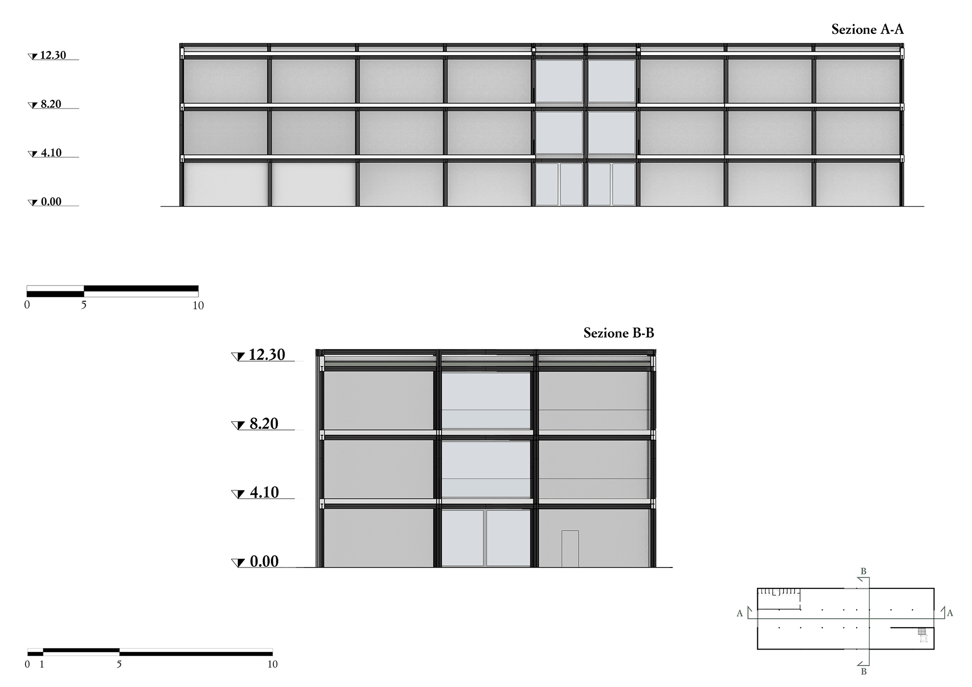
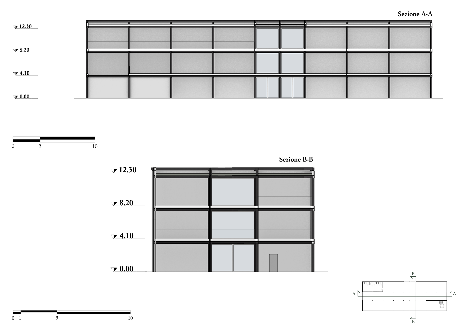
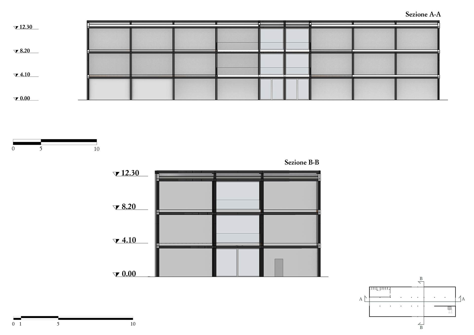
Barragán, Ghirri, and Canova Pavilions
These are Type 2 variants, differing mainly in interior layout. Voids in the plan improve natural light and visual connections. Openings follow the same logic as other Type 2s. Barragán and Ghirri sit opposite each other along the main vertical path, with glass façades creating visual continuity. Structures remain steel-based, with green roofs enhancing integration and sustainability. Interiors continue the Biennale’s material palette—wood and glass for bright, inviting spaces. Their height aligns with the masterplan’s proportions. Unlike Mies and Turner, these have no external porticoes.
These are Type 2 variants, differing mainly in interior layout. Voids in the plan improve natural light and visual connections. Openings follow the same logic as other Type 2s. Barragán and Ghirri sit opposite each other along the main vertical path, with glass façades creating visual continuity. Structures remain steel-based, with green roofs enhancing integration and sustainability. Interiors continue the Biennale’s material palette—wood and glass for bright, inviting spaces. Their height aligns with the masterplan’s proportions. Unlike Mies and Turner, these have no external porticoes.
Turner Pavilion
Similar to the Mies Pavilion, Turner includes an external portico that mediates between inside and out, transforming with light and weather. Natural light plays a central role, reducing artificial lighting and creating dynamic interiors. Materials match the rest of the project: steel structure, wood and glass interiors, and a green roof to blend into the landscape.
Similar to the Mies Pavilion, Turner includes an external portico that mediates between inside and out, transforming with light and weather. Natural light plays a central role, reducing artificial lighting and creating dynamic interiors. Materials match the rest of the project: steel structure, wood and glass interiors, and a green roof to blend into the landscape.
Compositional diagrams of the floor plans of Type 2 buildings
Roof site plan of Mies, Barragan, Ghirri, Canova and Turner pavillion
Ground floor site plan of Mies, Barragan, Ghirri, Canova and Turner pavillion
Architectural floor plans of the Mies pavillion
Architectural floor plans of Barragan and Ghirri pavillions
Architectural floor plans of Canova and Turner pavillions
Typical floor framing and profile scheme used for Type 2 buildings
Perspective view of the structure of the Mies pavillion
Perspective view of the structure of the Barragan, Canova and Ghirri pavillions
Perspective view of the structure of the Turner pavillion
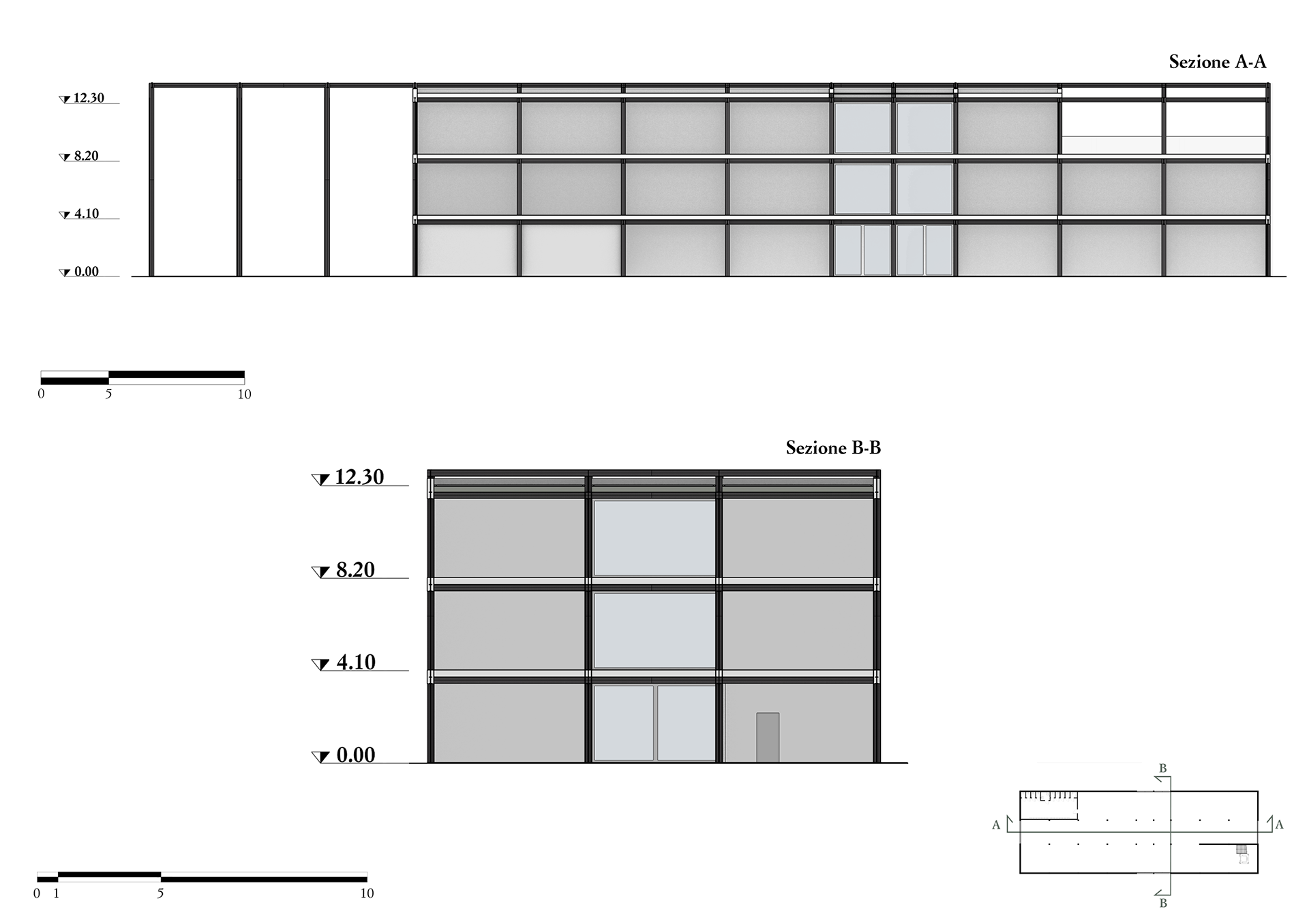
Sections A-A and B-B of the Mies pavillion
Sections A-A and B-B of the Barragan pavillion
Sections A-A and B-B of the Ghirri pavillion
Sections A-A and B-B of the Canova pavillion
Sections A-A and B-B of the Turner pavillion
Elevations of Barragan and Ghirri pavillions
Elevations of Mies pavillion
Elevations of Canova pavillion
Elevations of Turner pavillion
Exterior view of the Barragan and Mies pavillions
Exterior view of the Turner pavillions
Interior view of the Mies pavillion
Interior view of the Turner pavillion
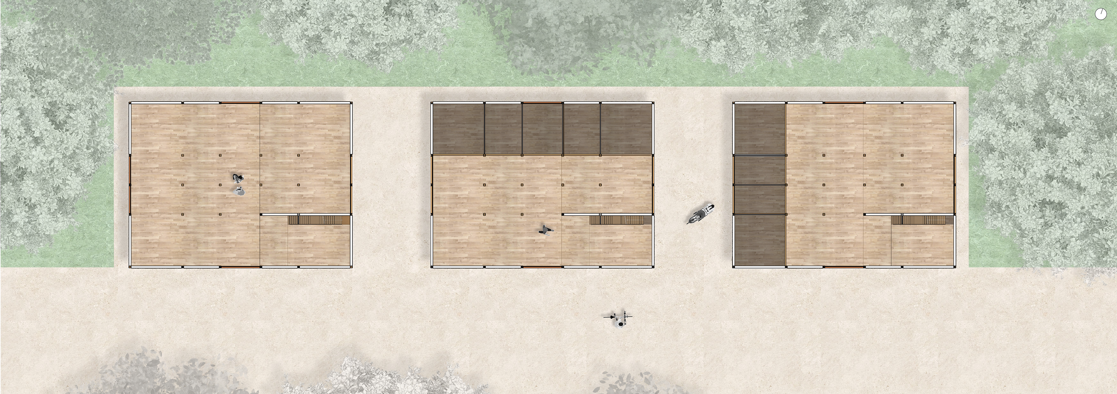
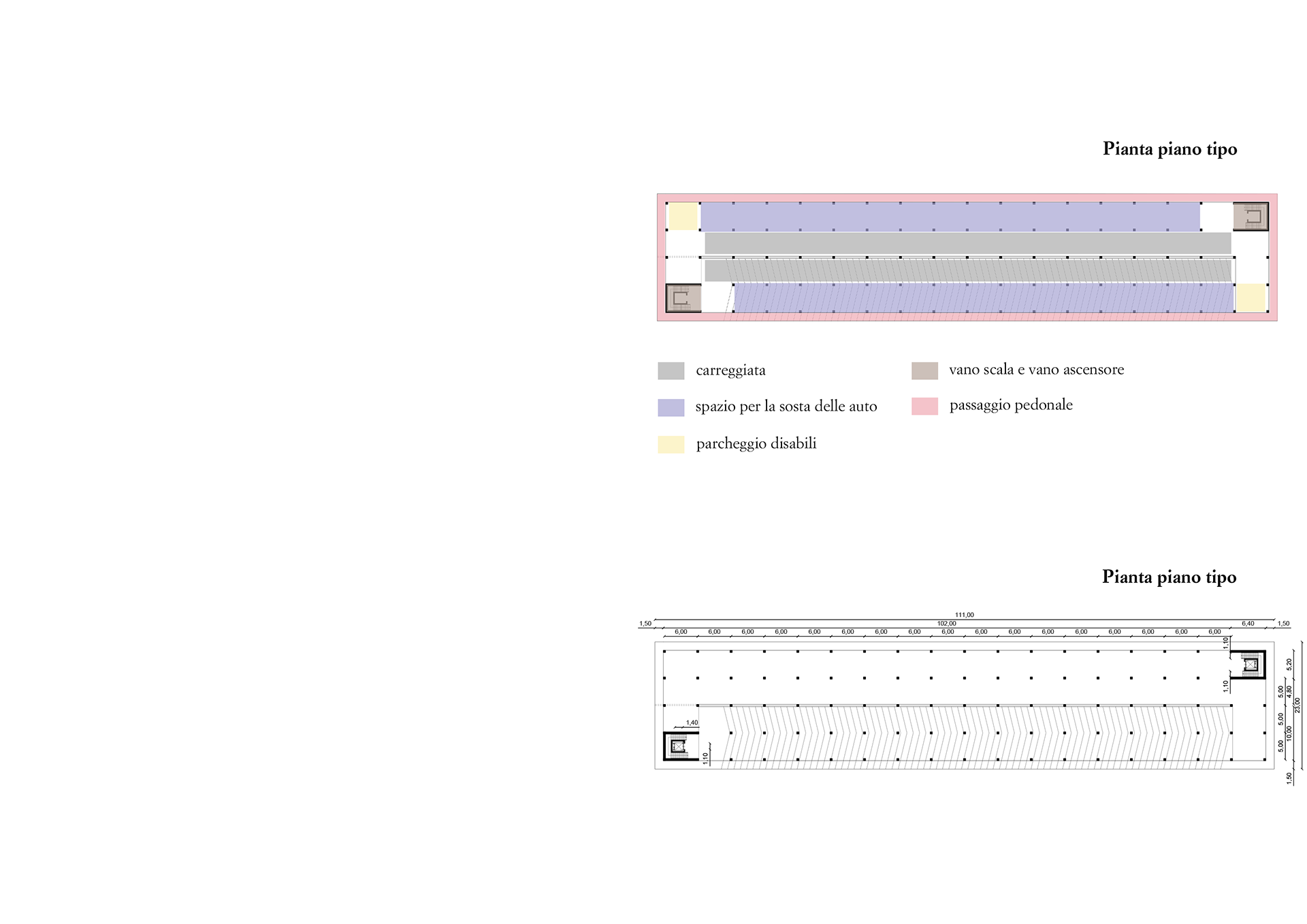
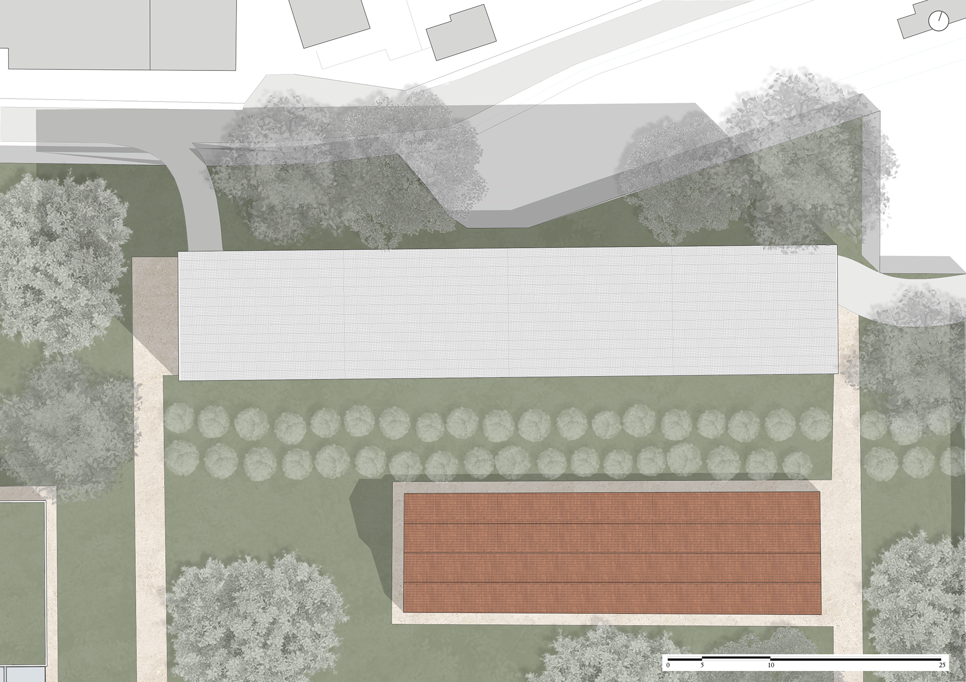
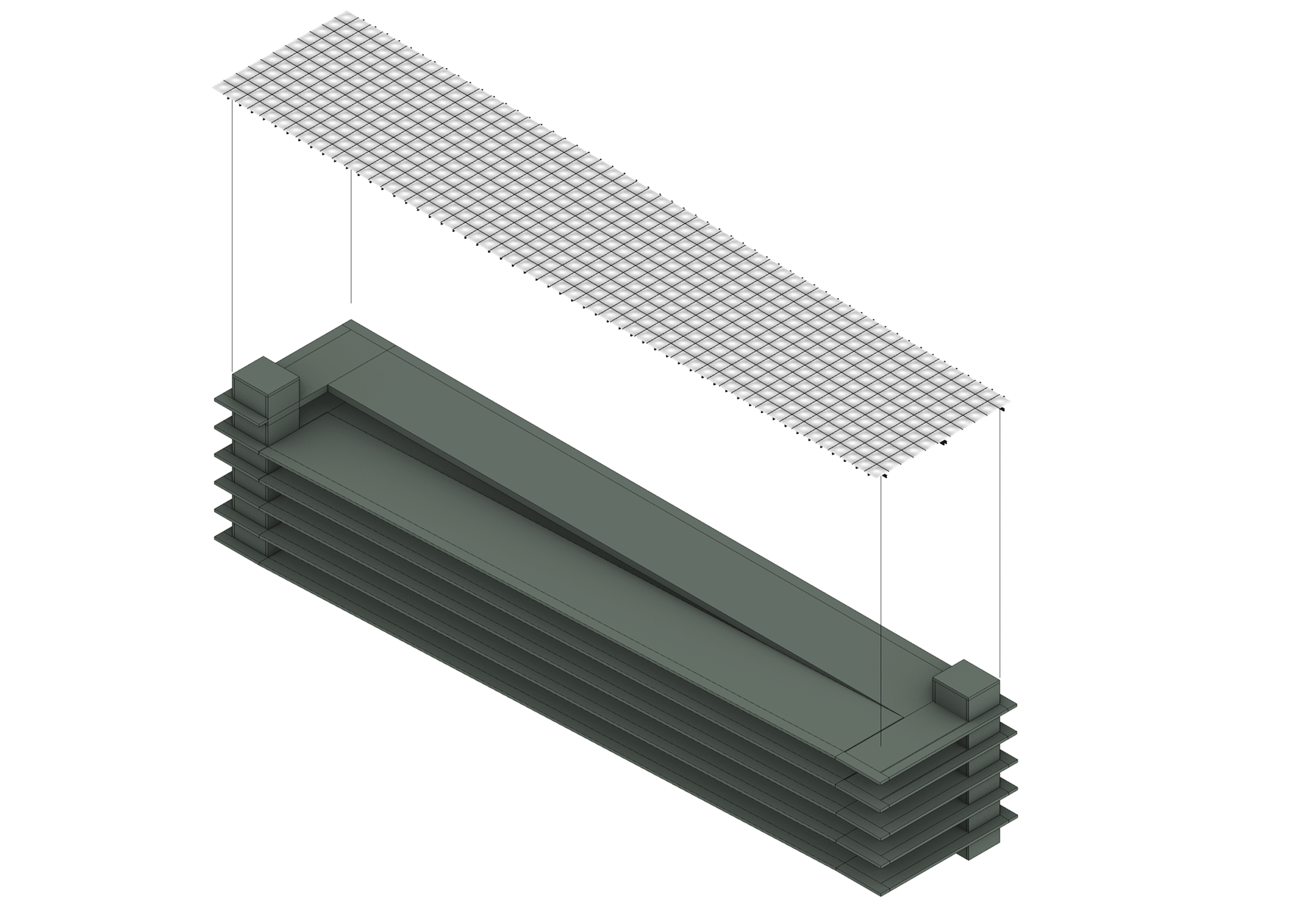
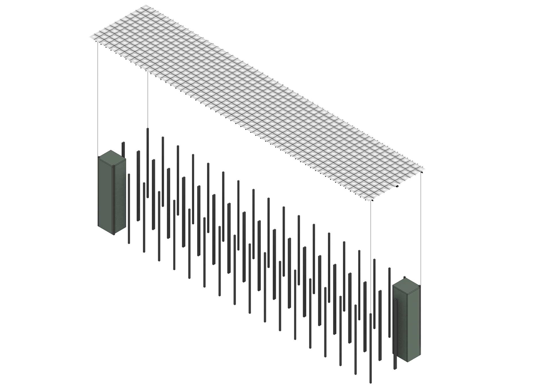
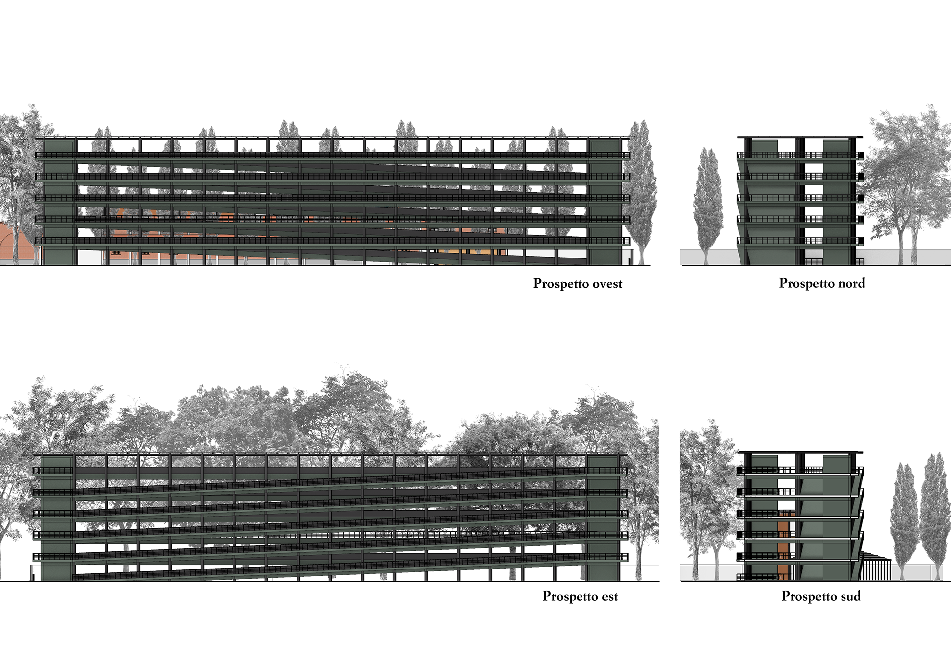
Type 3 Buildings: Parking Structures
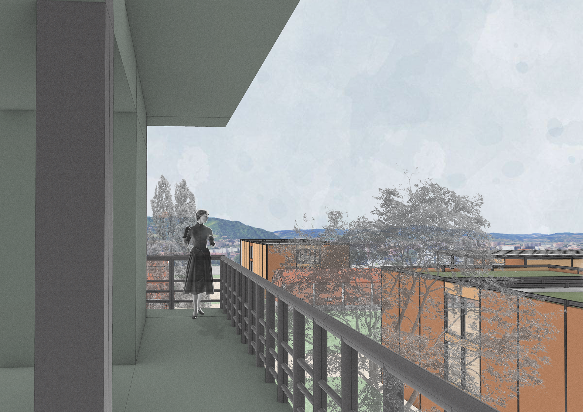
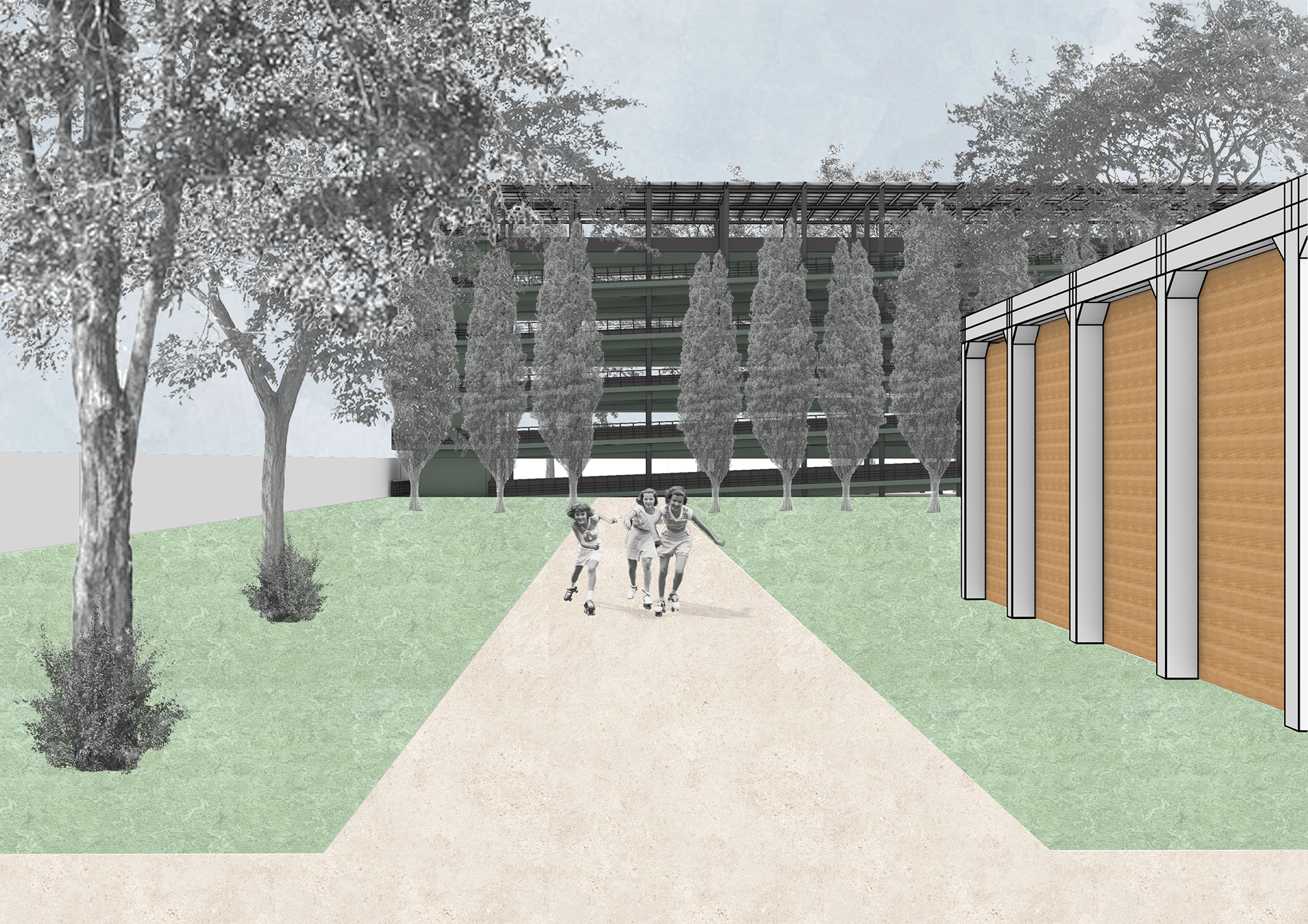
The two parking buildings differ structurally from Types 1 and 2 but retain symmetry and a simple grid of pillars. Made of prefabricated reinforced concrete, they follow dry construction logic. The layout includes flat decks for parking and sloped decks (max 20% gradient) for ramps. A flat roof with solar panels caps the structure. Pedestrian paths circle the perimeter, offering safe access and panoramic views of the Biennale and city. Ramp gradients are limited to 4%, ensuring accessibility. Each floor holds 60 car spaces plus 2 for disabled users; the ground floor adds 30 car spots and 12 for buses. Vertical connections via stairwells with elevators ensure full accessibility. These five-story structures exceed height limits of other building types due to parking regulations but are visually softened with green façades, sampled from the vegetation of San Luca hill, enhancing integration with the natural surroundings.
Compositional diagrams of the floor plans of parkings
Roof site plan of the NE parking
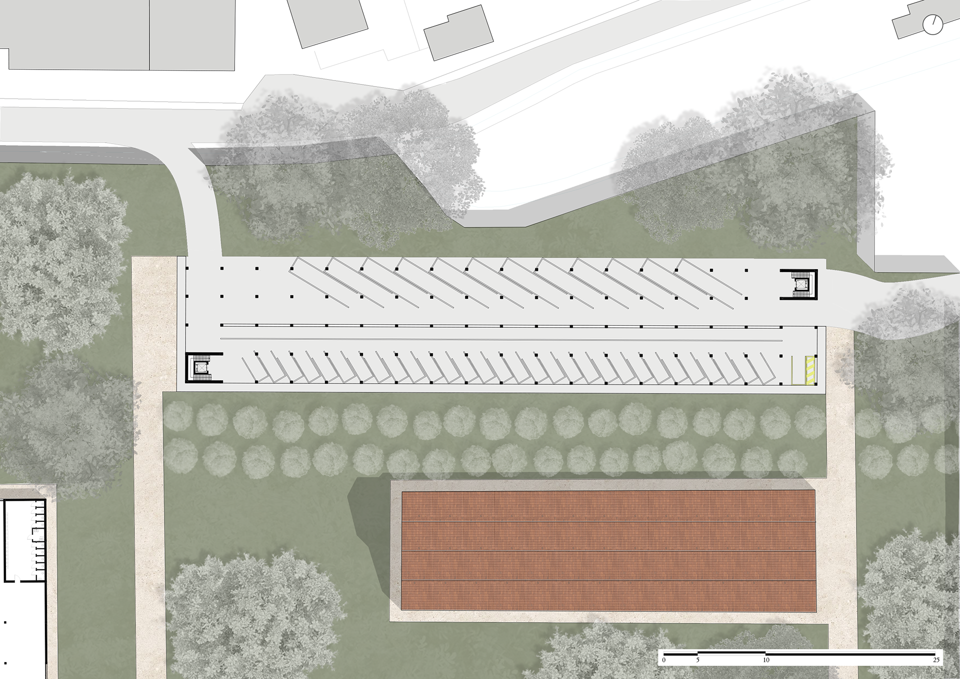
Ground floor site plan of the NE parking
Roof site plan of the SW parking
Ground floor site plan of the SW parking
Architectural floor plans of the parkings
Perspective view of the structure of the parkings
Perspective view of the structure of the floors of the parkings
Perspective view of the pillars of the parkings
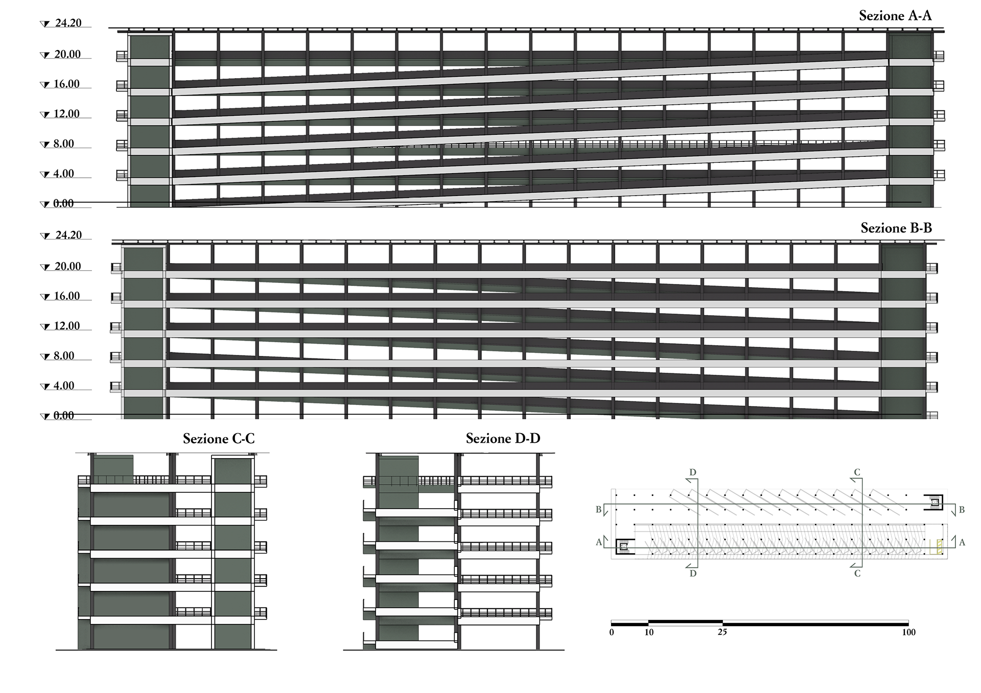
Sections A-A, B-B, C-C, D-D
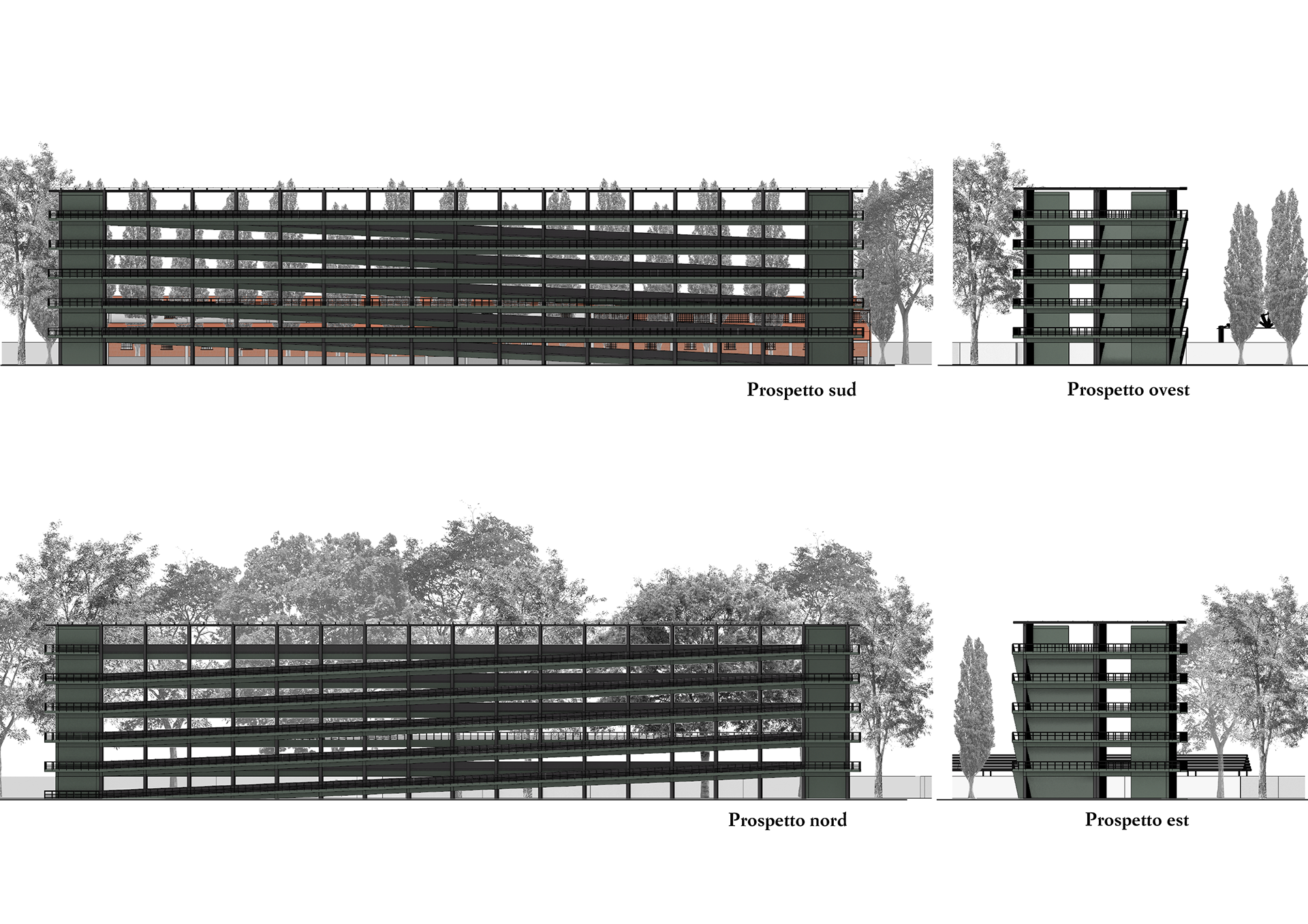
Elevations of the NE parking
Elevations of the SW parking
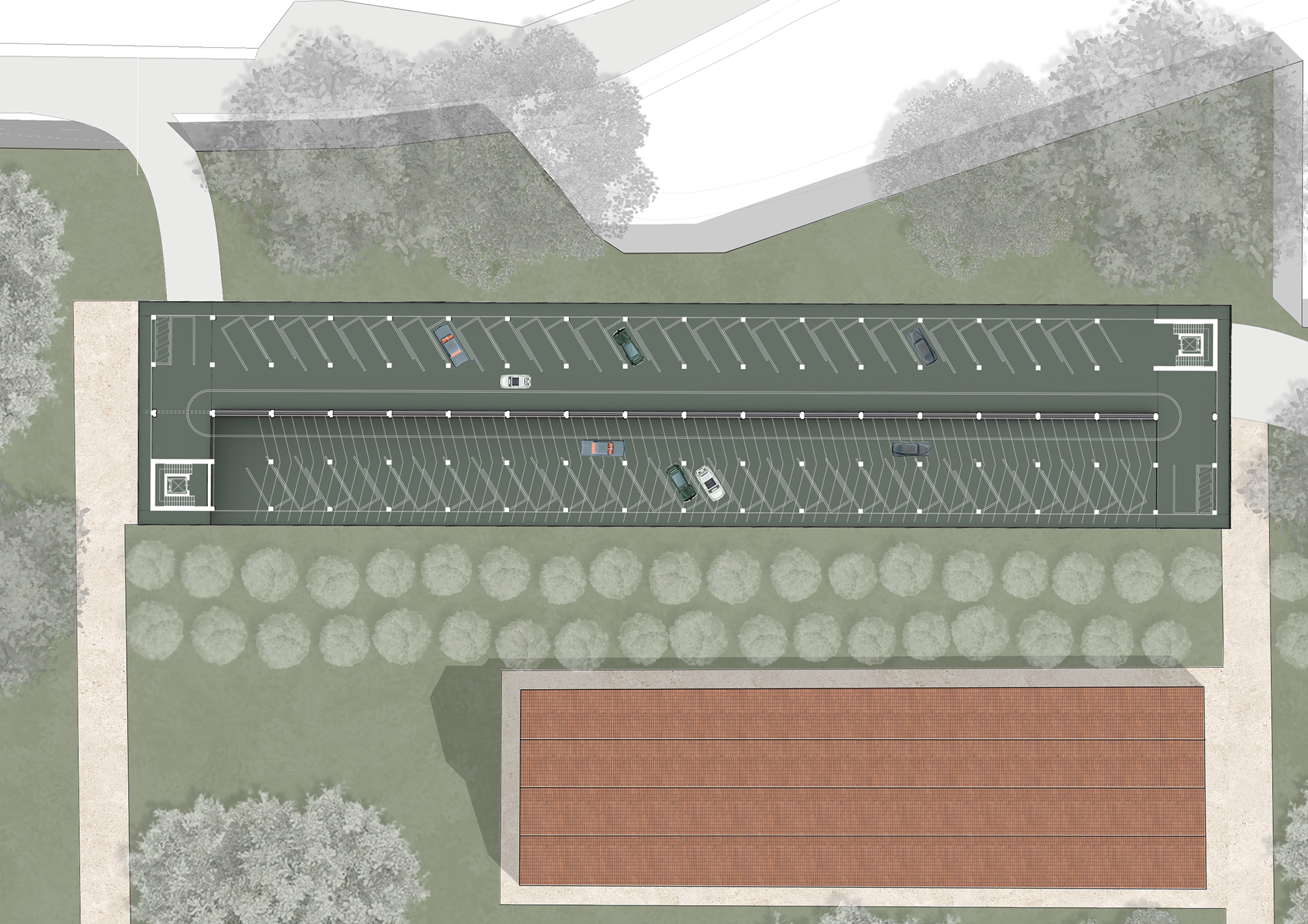
Floor plan view of the NE parking
View of the NE parking
View of the SW parking
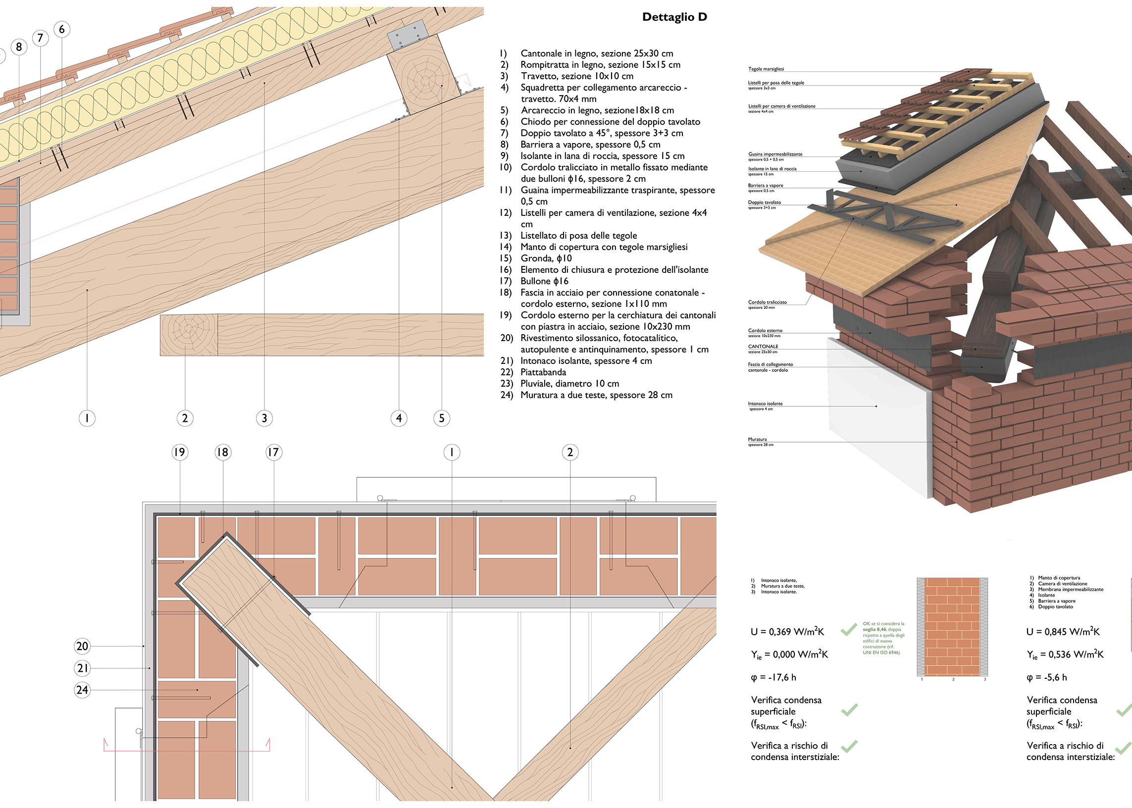
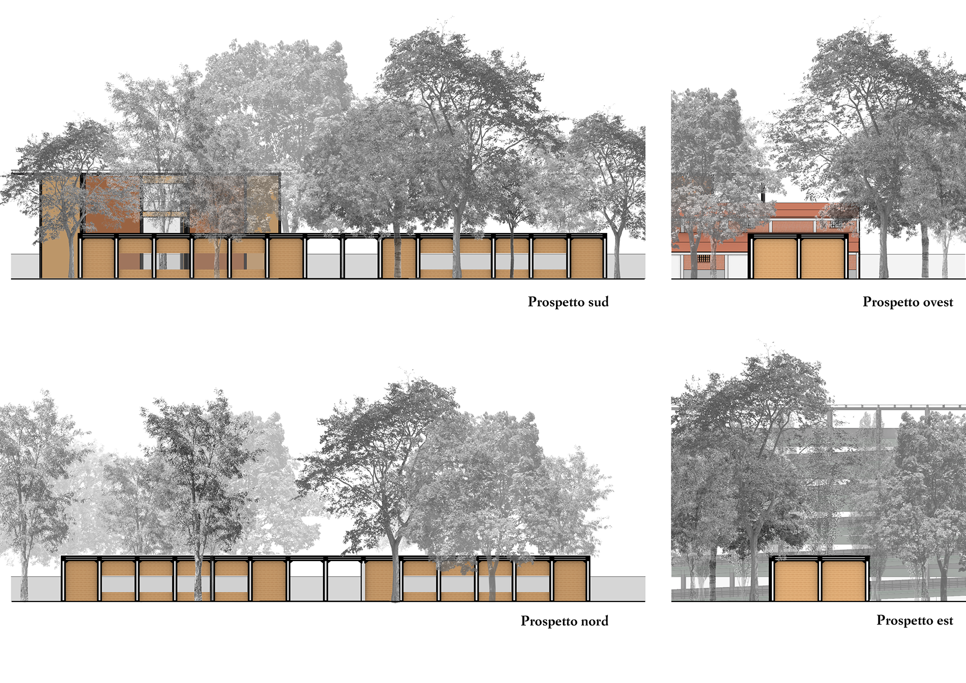
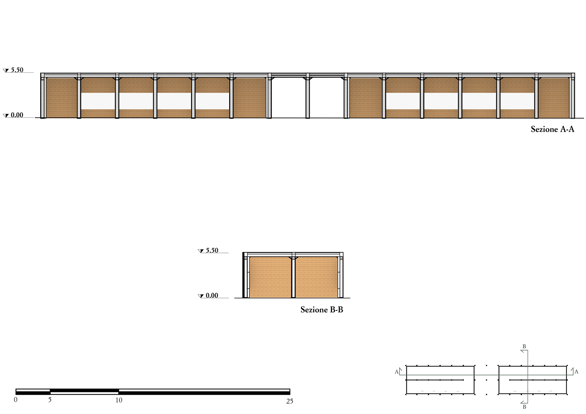
Recovery of Existing Structures
This section outlines diagnostic surveys and possible restoration strategies for the reinforced concrete structures found in many buildings of the former Caserma San Felice, emphasizing their reuse as an integral part of the project. As previously noted, the most critical structural issues affect the roofs of these buildings. Moreover, many 20th-century concrete structures show durability problems due to poor construction practices—such as high water-to-cement ratios and inadequate concrete cover over steel reinforcements, which has led to corrosion.
To recover these elements, careful assessment is essential. Techniques like pacometry help measure cover thickness and locate steel bars, while phenolphthalein tests detect carbonation depth. Chloride content, a key corrosion factor, is measured via core sampling, and electrochemical potential mapping pinpoints vulnerable zones. Concrete strength is evaluated through pull-out and compression tests.
Depending on the level of deterioration, interventions may include removing damaged concrete, cleaning or replacing corroded reinforcements, applying anti-corrosion coatings, and reconstructing with suitable repair mortars. Surface treatments such as hydrophobic agents, organic binders, or polymer-based coatings improve durability. Where needed, consolidating treatments using silicates strengthen the concrete matrix.
Thermal insulation is also key but must preserve the historic brickwork; thus, solutions avoid covering exterior walls. Internal insulation or insulating plasters are preferred. For roofs, the main timber trusses can be kept, while the roof layers are replaced using wood and natural insulation. In single-story buildings, special attention is given to the junction between roof beams and structural walls, as failures here have been observed. A reinforced wooden roofing system will be used for structural consistency and sustainability.
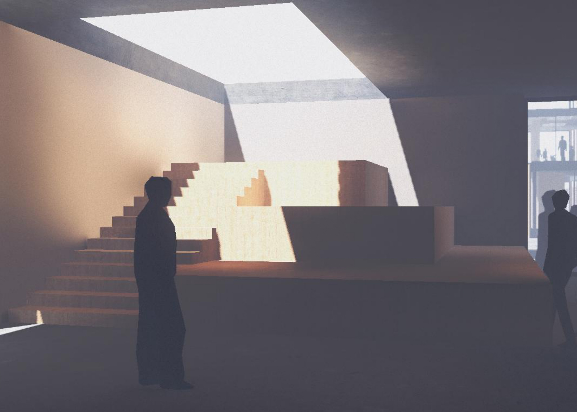
Interior view of the Friedrich pavillion
Interior view of the Mother Earth pavillion
Interior view of the Michelangelo pavillion
Interior view of the Brancusi pavillion
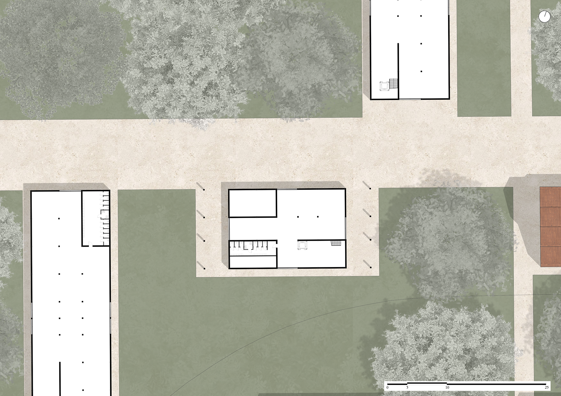
South Entrance
This intervention focuses not on new construction but on adaptive reuse. The area features a reinforced concrete frame that, although not clearly visible in photos or satellite imagery, has been reconstructed based on available data. The structure will undergo the same diagnostic and repair treatments as other preexisting buildings.
Wooden panels will partially enclose the frame to form two enclosed ticket office spaces, while two central bays will remain open to preserve a clear pedestrian passage along the main vertical axis. This intervention highlights sustainability, respecting the site's character while introducing a new function as the Main South Entrance.
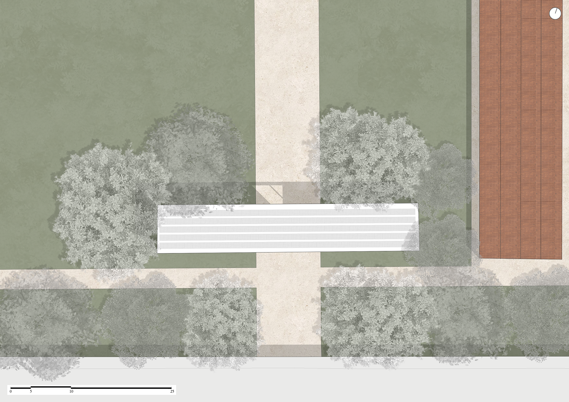
Roof site plan
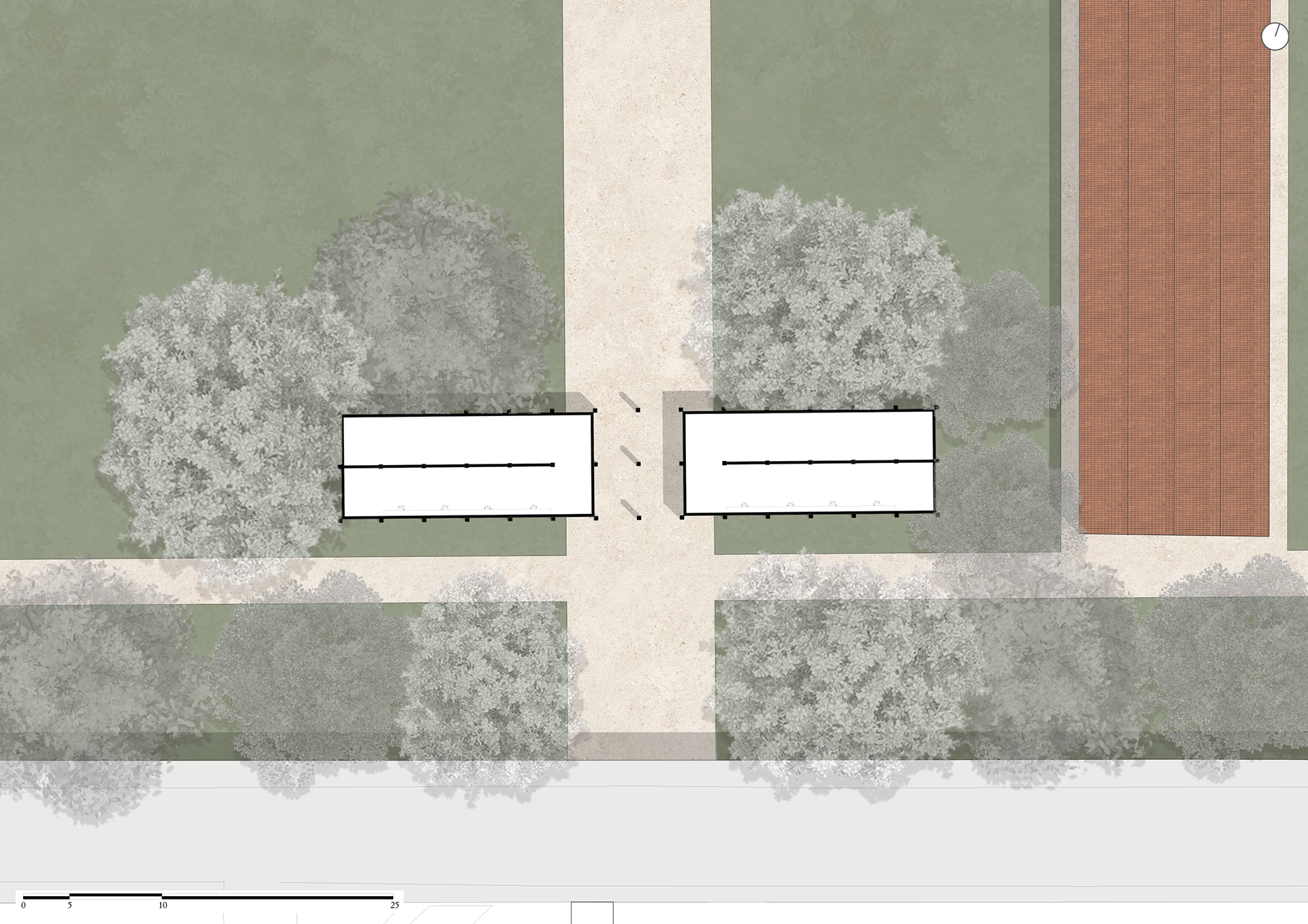
Ground floor site plan
Elevations
Sections A-A and B-B of the South Entrance
View of the South Entrance
Site plan of the Prati di Caprara
Nightview site plan of the Prati di Caprara

Existing condition of the South Entrance
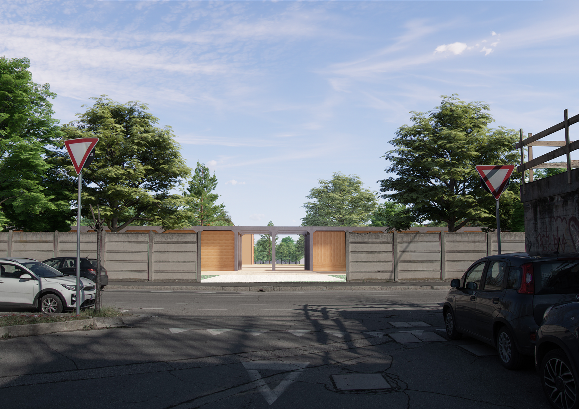
Design proposal for the South Entrance
Existing condition of the East Entrance
Design proposal for the East Entrance
Project Status of The Urban Forest of Prati di Caprara
Soil consumption has a significant local impact, especially as it worsens the effects of climate change. Cities must adopt integrated strategies to reduce land consumption and environmental impact while improving urban quality of life. Green infrastructure plays a crucial role in this process, helping to mitigate climate effects and promoting biodiversity. Urban areas, dominated by artificial surfaces and pollution, risk becoming unhealthy environments. Therefore, expanding urban greenery is essential.
In Bologna, the Prati di Caprara area presents a unique mix of built structures and spontaneous ecosystems. The project aims to enhance this natural value, particularly through the burial of Viale Sabena (discussed in the masterplan), now turned into a green-covered tunnel. This reconnects two previously divided ecosystems, forming one large, unified park.
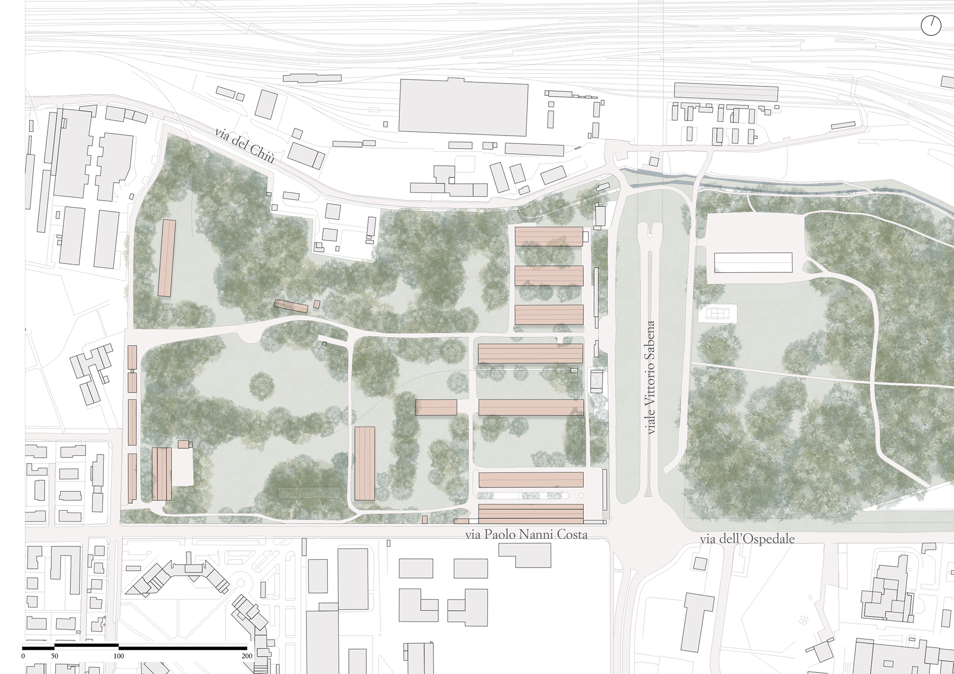
The interventions are divided between East and West areas. In the West, new construction reduced green space, including the removal of some trees, though precise CO₂ impacts remain unquantified. Mitigation strategies include green roofs on five buildings, tree planting with native species, and rows of poplars to reduce visual impact and integrate the structures within the landscape.
The project emphasizes green space as both an ecological and symbolic element, buffering sound pollution, improving air quality, and visually screening new buildings. The goal is to create an immersive, calm space, disconnecting visitors from urban chaos.
Vegetation site plan – existing condition
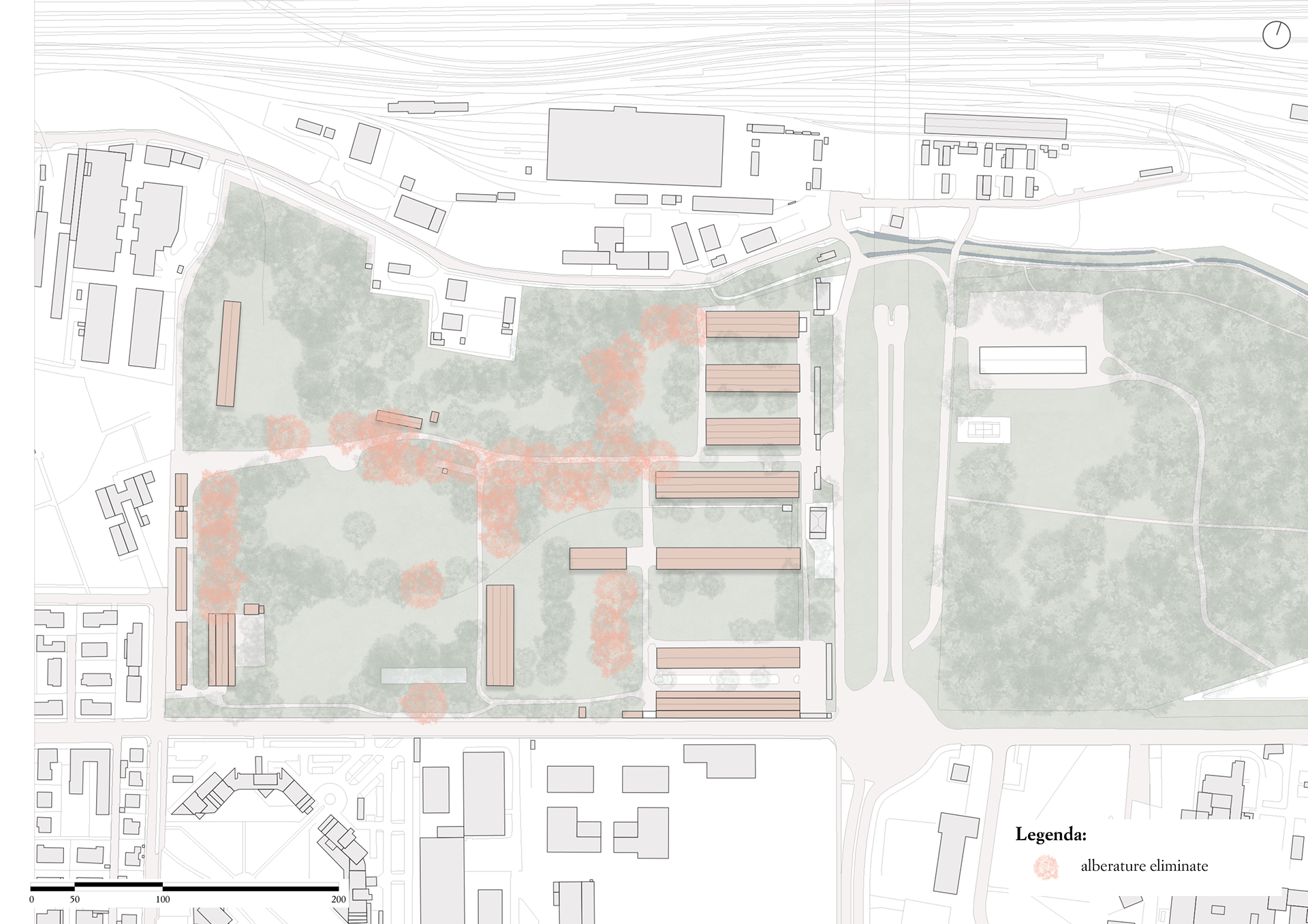
Removed vegetation
Additional vegetation
Vegetation site plan – design proposal
In the West area, the urban forest will remain untouched, but accessibility will improve with seven new entrances and raised wooden walkways that follow existing paths—allowing mobility access while preserving the soil and vegetation. Some forest parts will stay completely inaccessible to protect biodiversity.
The southeastern portion of the forest, previously cleared for a school (per the 2016 public redevelopment plan), is now reimagined. Originally, the POC allocated 475,000 m² of land for over 1,100 housing units and 50,000+ m² of commercial space. However, community opposition (via the "Rigenerazione No Speculazione" committee) highlighted the threat of overbuilding on green areas, pushing for full preservation and reforestation.
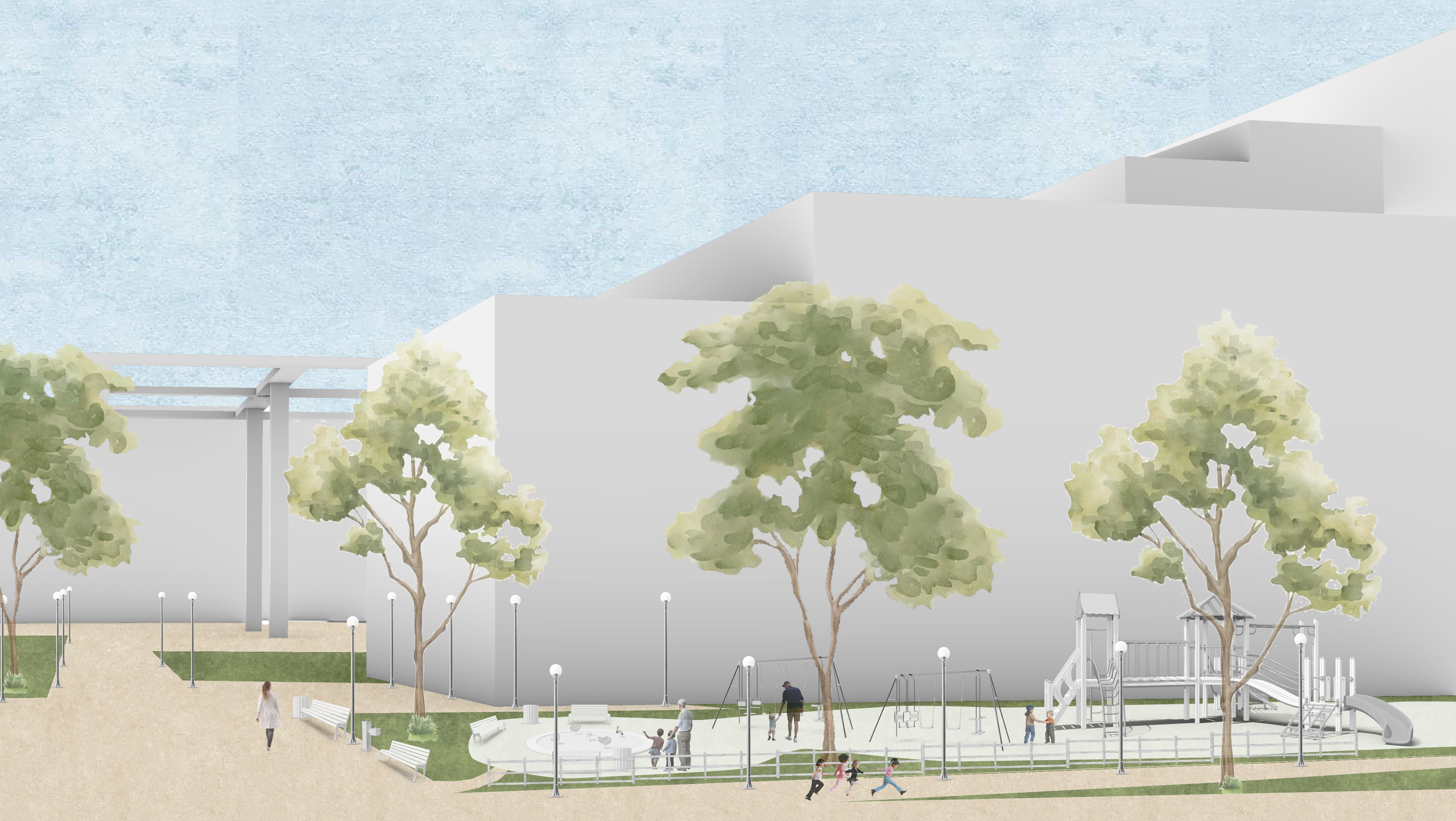
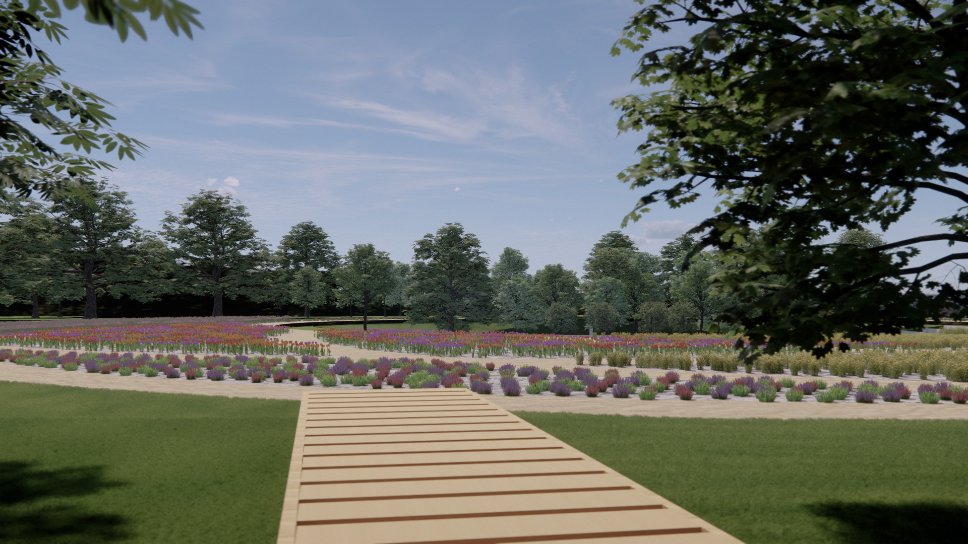
In response, the project includes a rain garden—a shallow, planted basin to manage stormwater runoff from urban surfaces. Positioned strategically, it slows water infiltration, helps prevent flooding, and enriches the landscape. A nearby open-air arena, inspired by Greek theaters, uses vegetation as the scenic backdrop and doubles as a stormwater detention basin.
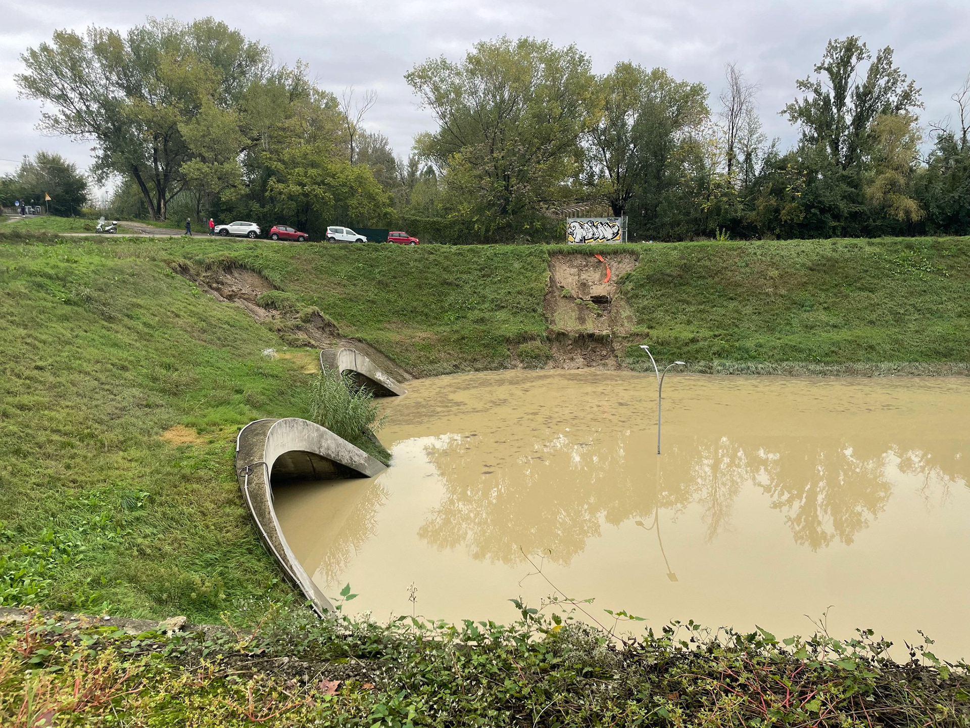
This solution addresses flooding risks linked to the Ravone stream, which overflowed in October 2024, causing widespread damage. During that event, Prati di Caprara’s lower elevation helped contain some of the water, acting as a natural buffer. However, the event exceeded the stream’s designed capacity, highlighting the need for new solutions.
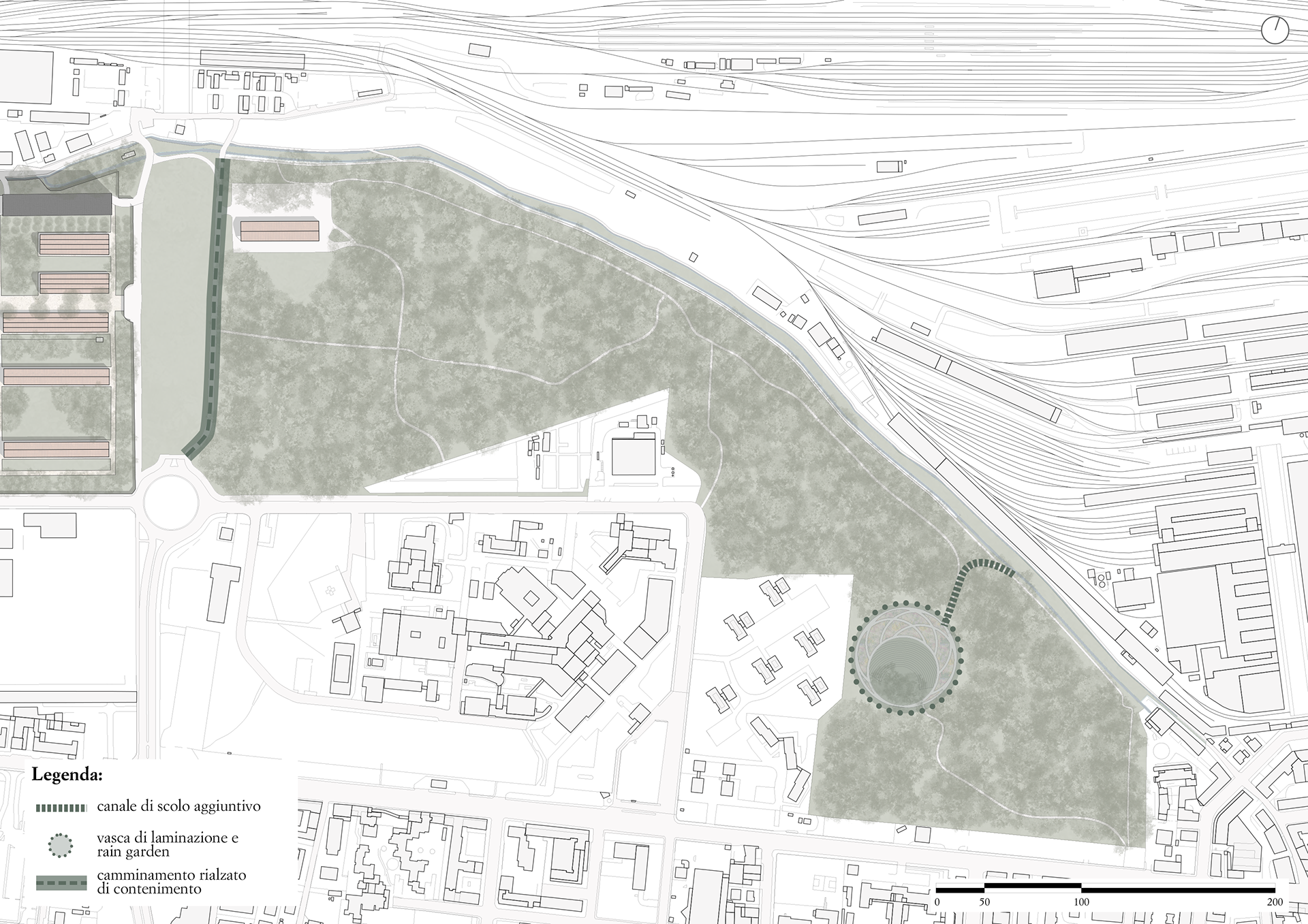
Calculations estimate that the Viale Sabena underpass (422 m long, semicircular section) could hold around 8,120 m³ of water when flooded. In comparison, the new retention basin (designed as a truncated cone) holds approximately 4,791 m³—less than needed, but still significant.
To improve flood control, an overflow channel will divert excess water from the Ravone and Ghisiliera canals into the rain garden. Additionally, soil excavated from construction will be used to build a raised path along the urban forest’s edge, protecting the green roof atop the buried Viale Sabena. The forest itself, with its lower elevation and dense vegetation, is conceived as a natural retention area, helping slow and absorb excess rainwater.
Urban forest site plan
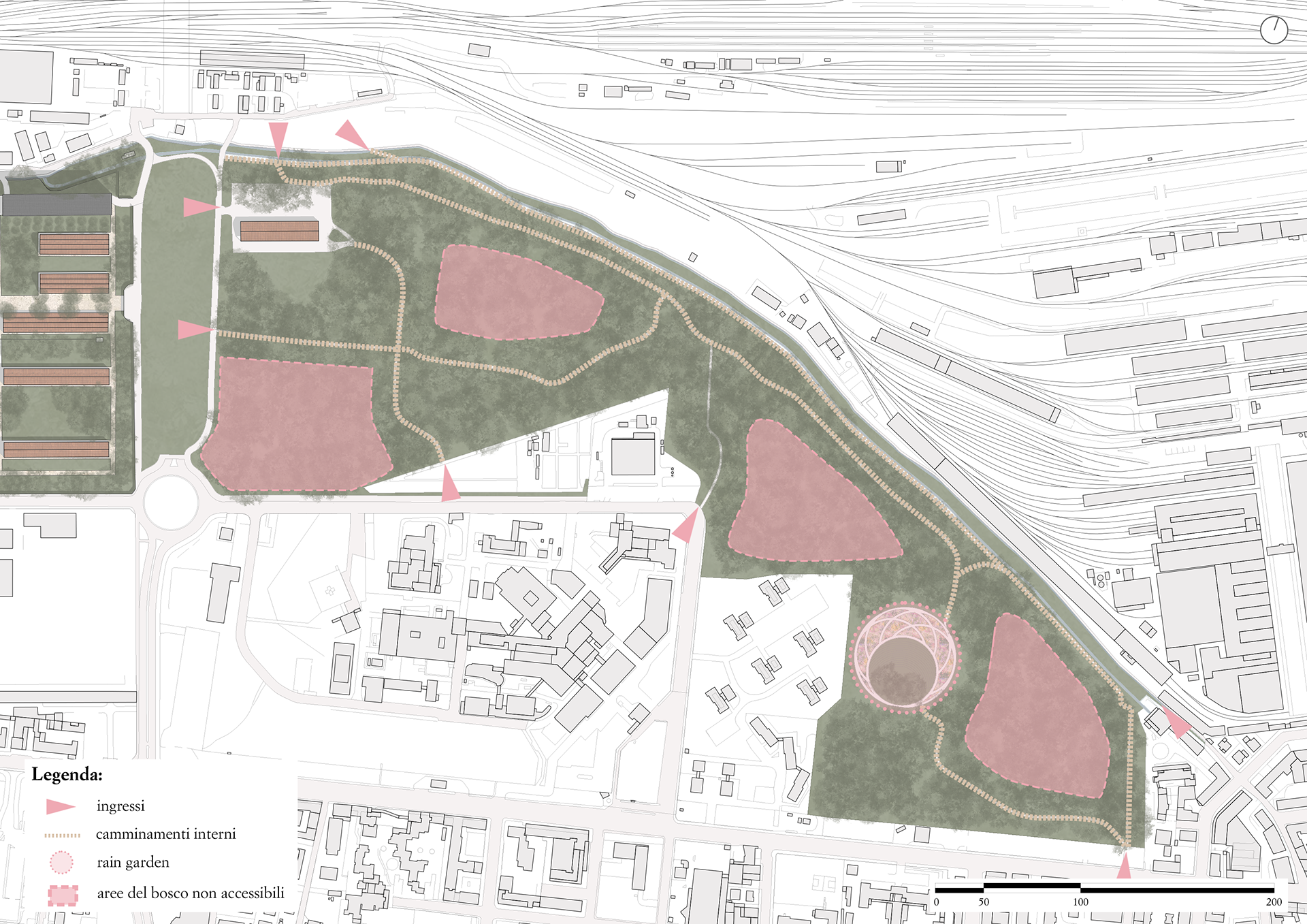
Entrances and internal paths of the forest
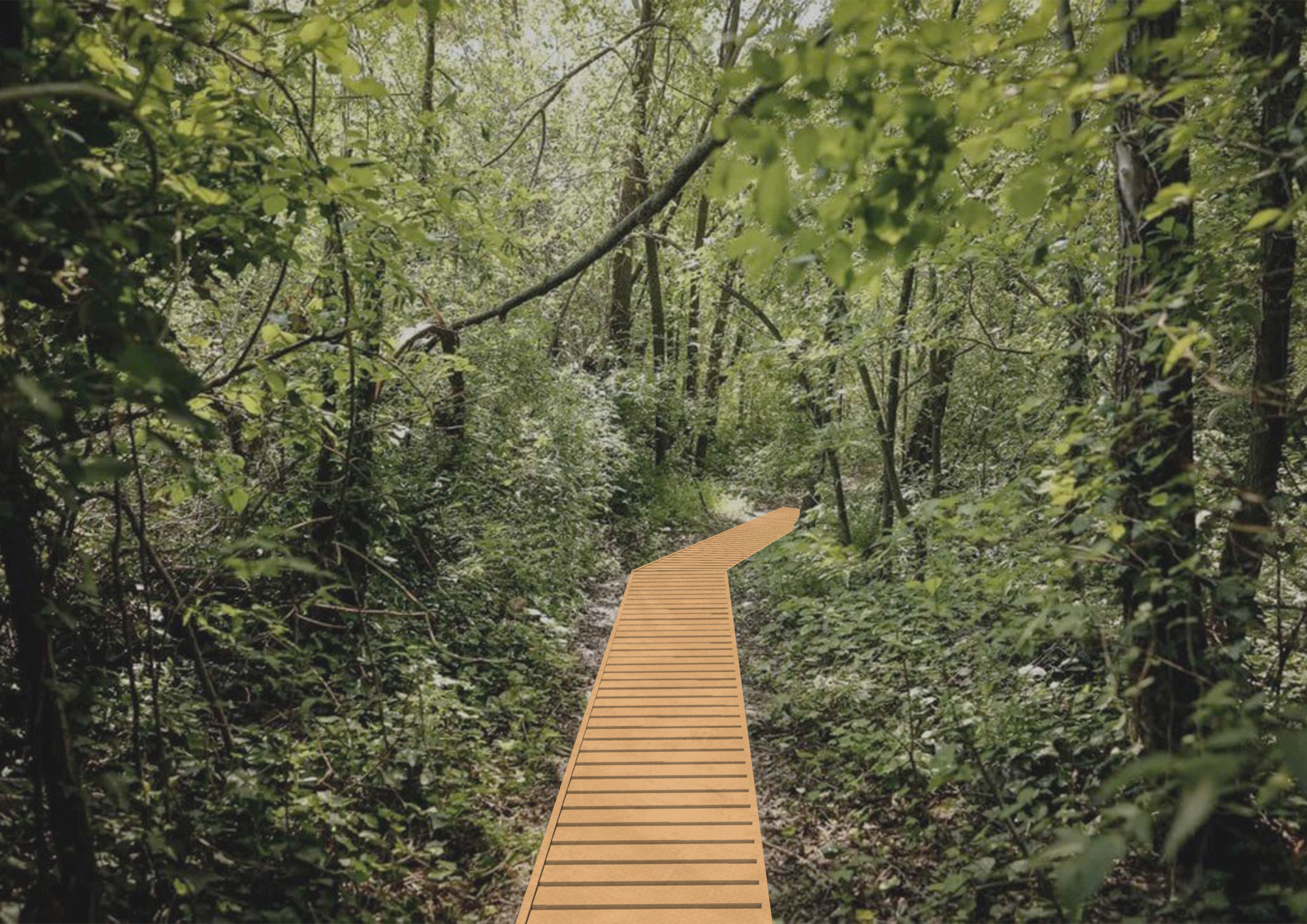
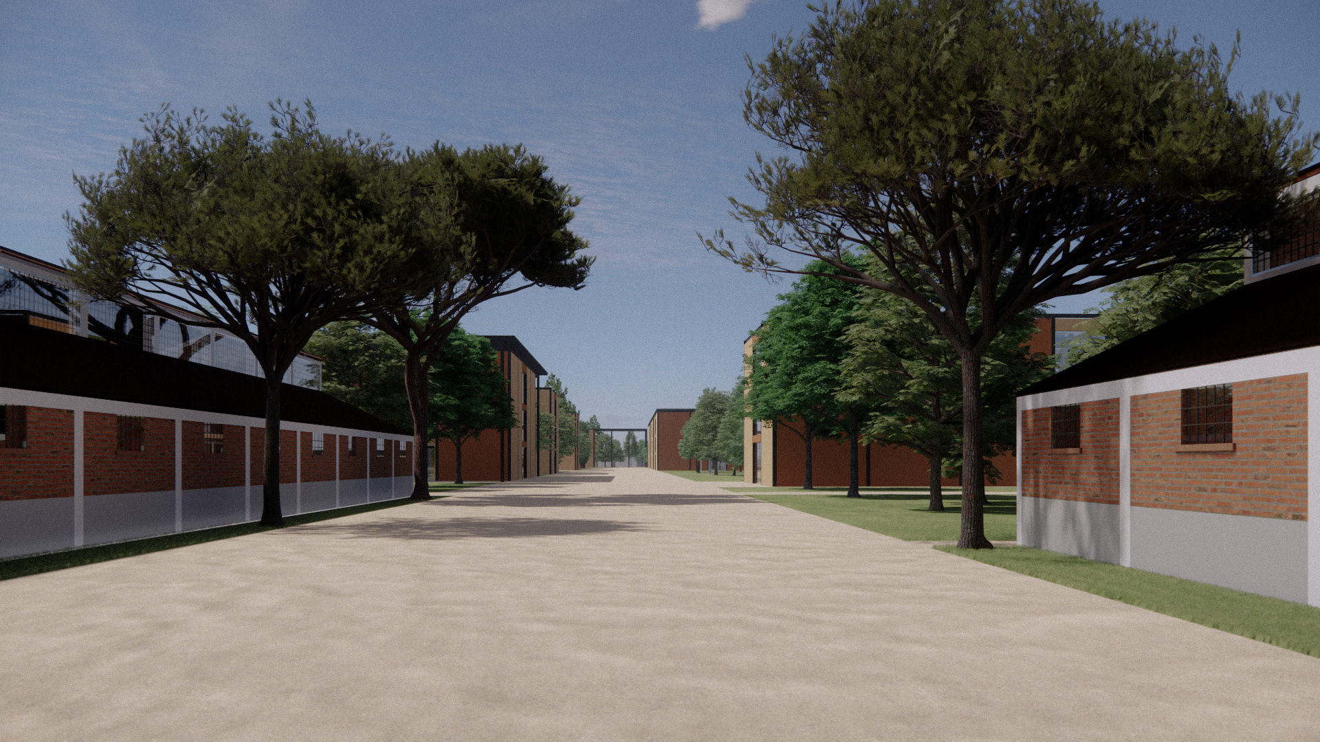
View of a wooden walkway through the urban forest of the Prati di Caprara
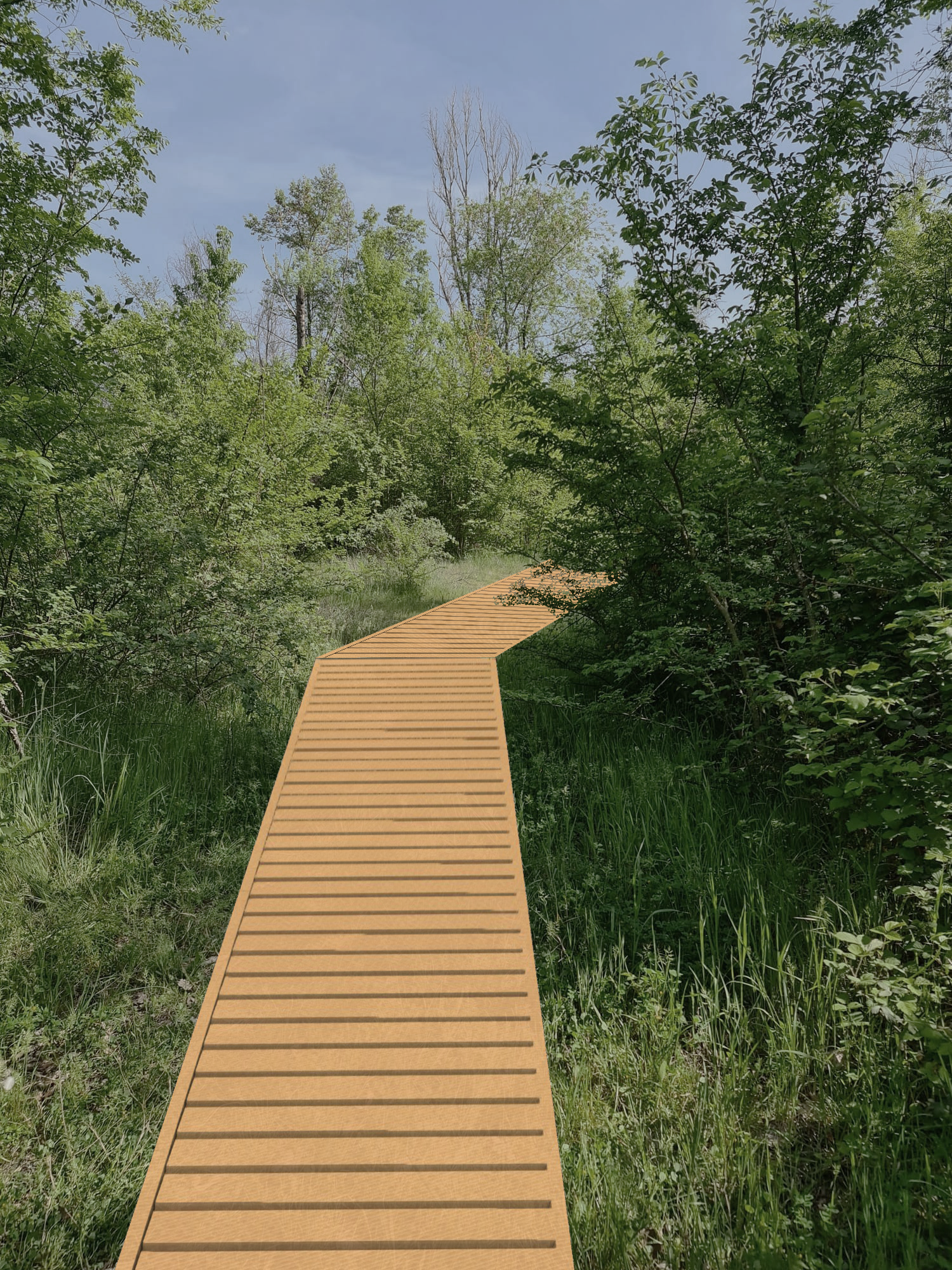
View of a wooden walkway through the urban forest of the Prati di Caprara

Flood and inundation risk: october 2024 flood
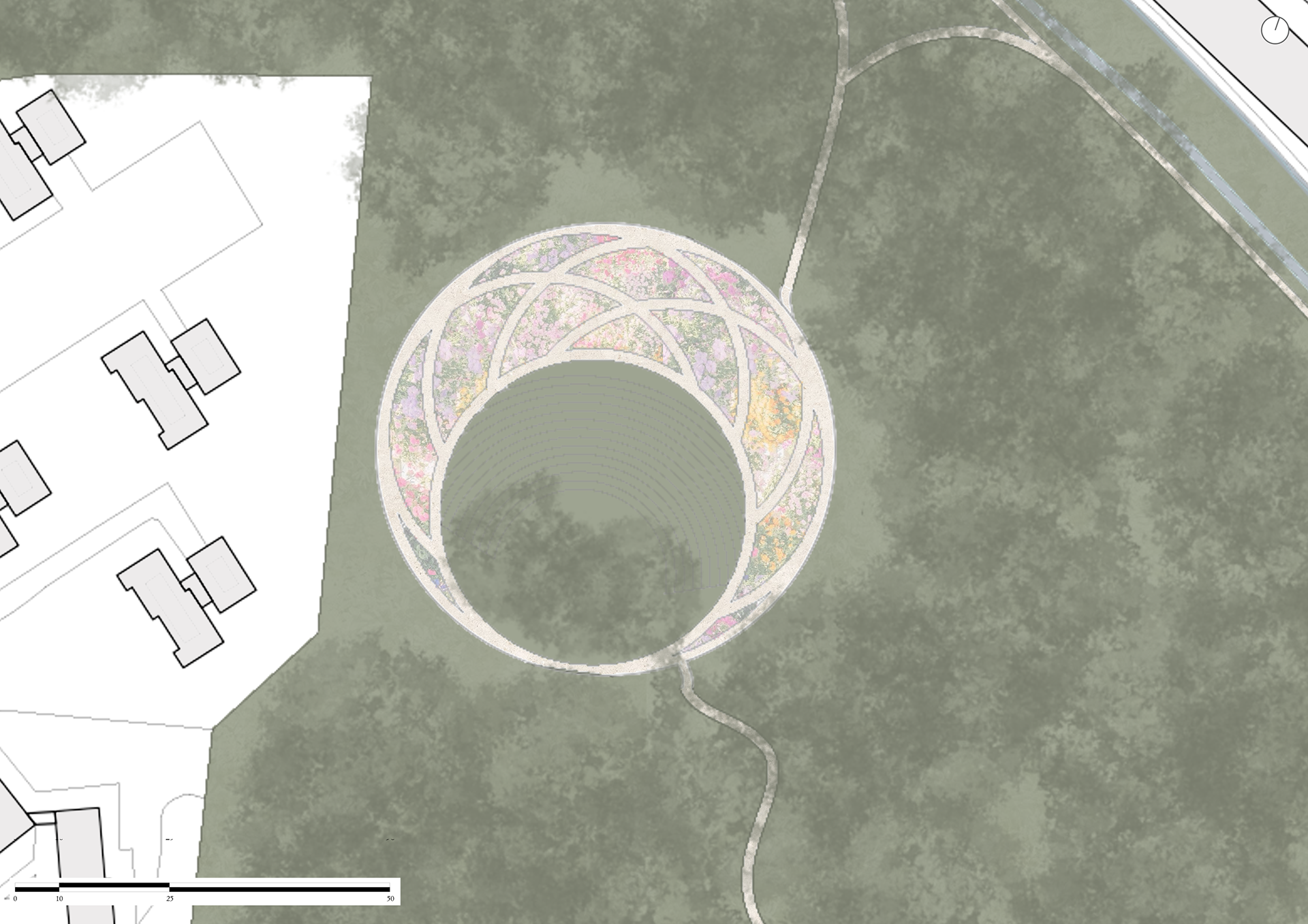
Rain garden site plan
Water flow diagram
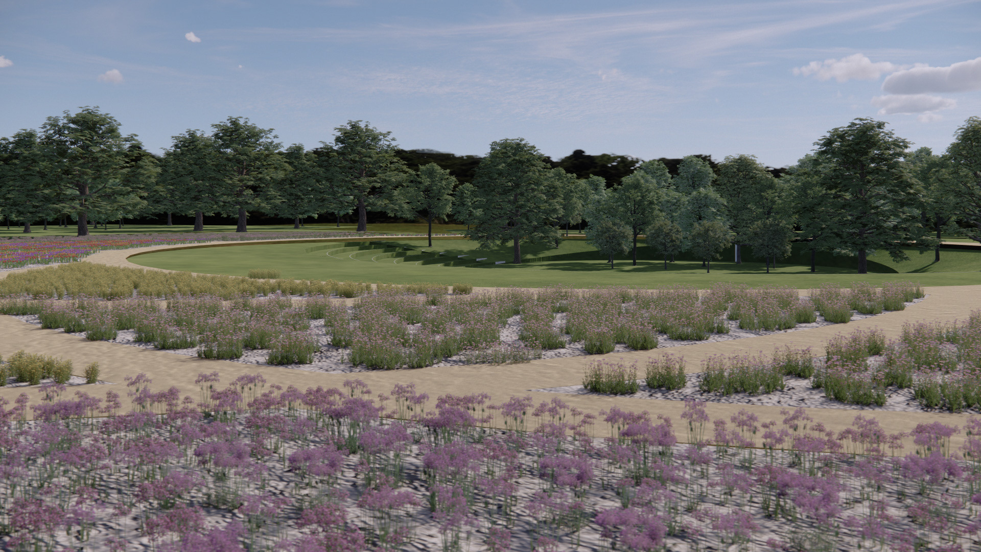
View of the Arena and Shakespeare Pavilion
View of the Arena and Shakespeare Pavilion
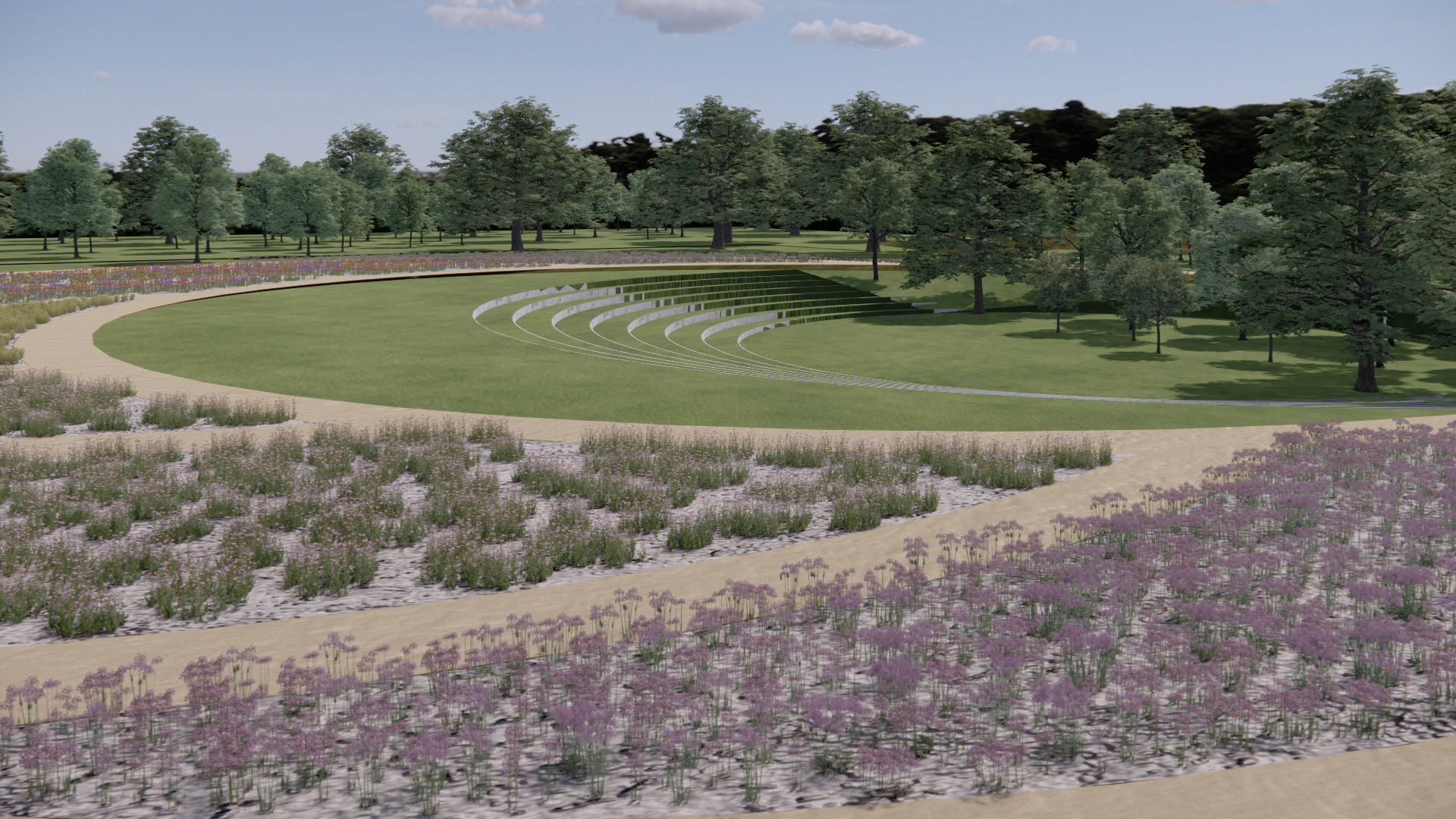
View of the Arena and Shakespeare Pavilion
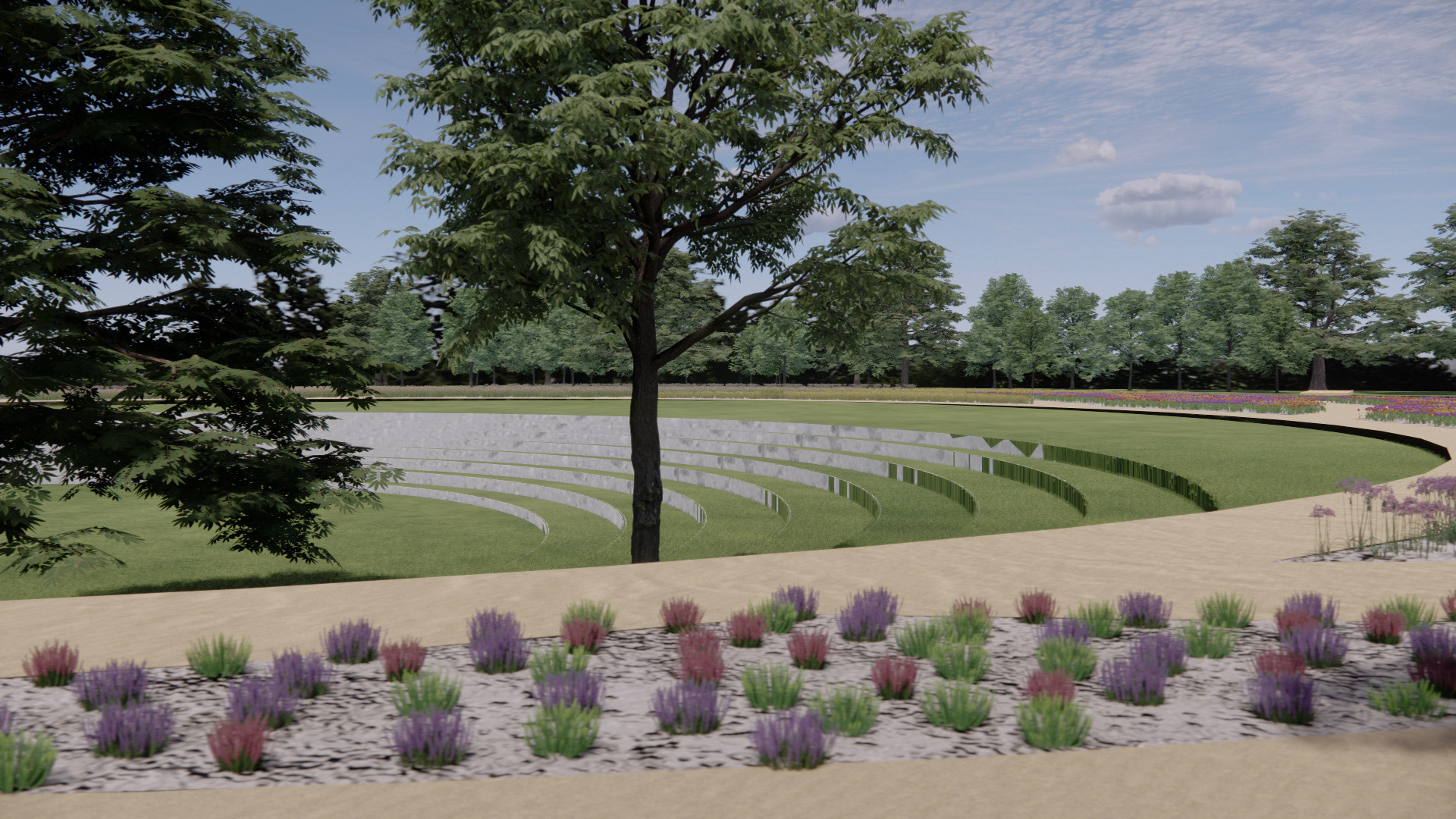
View of the Arena and Shakespeare Pavilion

Comitato Rigenerazione No Speculazione, The Ravone stream broke through the wall separating it from the Ghisiliera canal, October 20, 2024
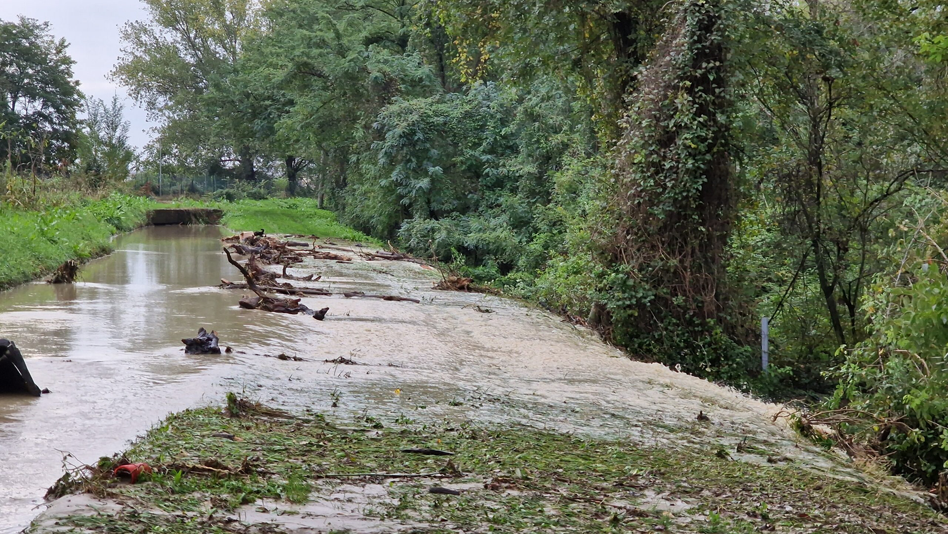
Image from video published by DiRE, National News Agency, The canal overflows towards the Prati di Caprara East area, October 20, 2024
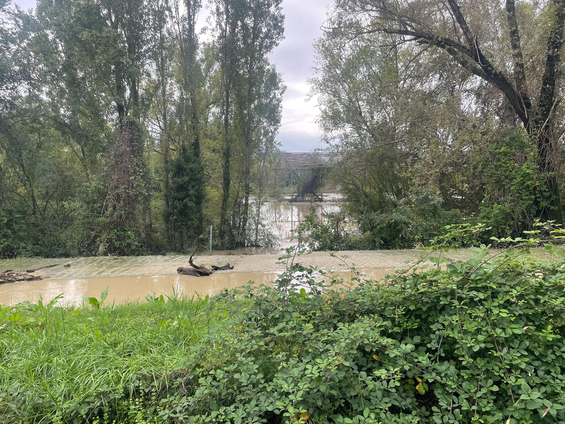
Comitato Rigenerazione No Speculazione, The waters of the Ravone flood the shelter area in Prati di Caprara East, October 20, 2024
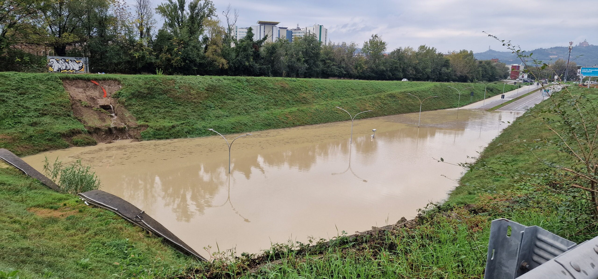
Image from video published by DiRE, National News Agency, The underpass on Viale Sabena flooded, October 20, 2024
Comitato Rigenerazione No Speculazione, The overflowed water of the Ravone, after flooding Prati di Caprara East, flows down Via Sabena, October 20, 2024
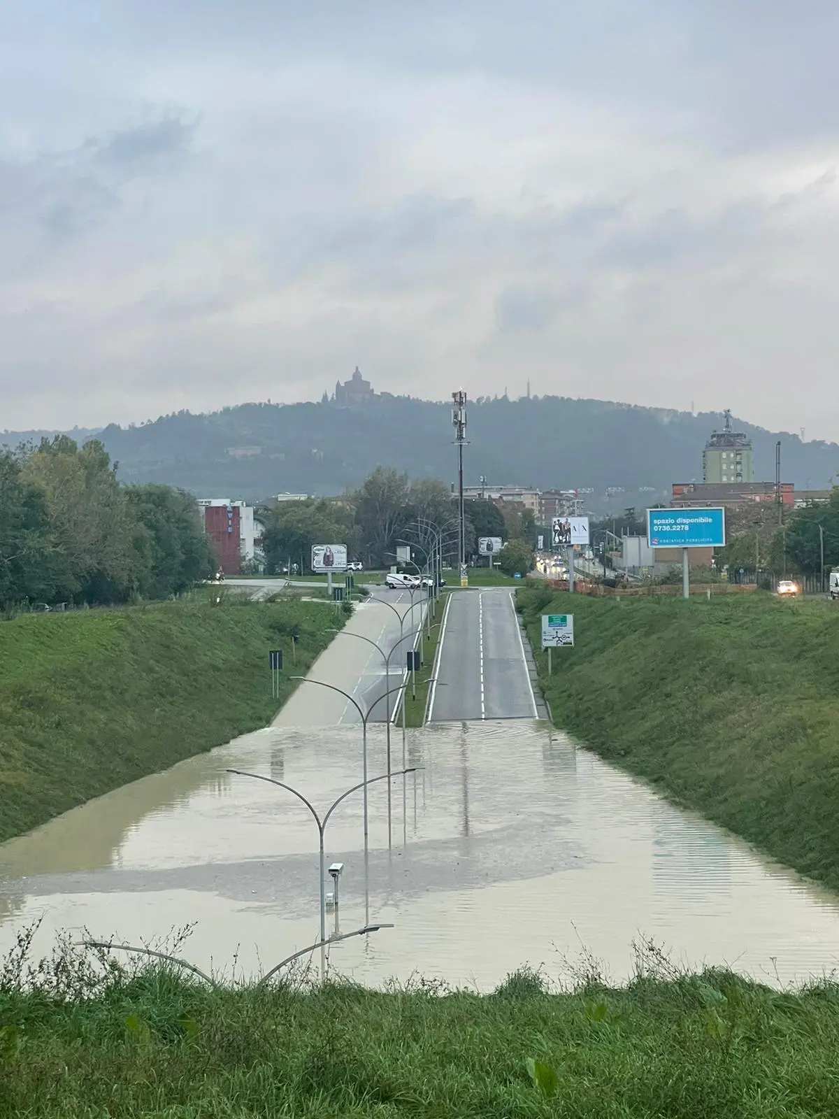
Il Resto del Carlino, Bologna, The underpass on Viale Sabena flooded, October 20, 2024
Assessment of Cultural Ecosystem Services
Introduction
Urban green ecosystems provide essential benefits to humans, enhancing wellbeing, quality of life, and urban sustainability (De Groot et al., 2002). These ecosystem services (ES) emerge from interactions between natural and social components and influence ecological, economic, and cultural dimensions. The first official classification of ES was proposed by the Millennium Ecosystem Assessment (MEA) in 2005, followed by updates from the TEEB initiative and the Common International Classification of Ecosystem Services (CICES) by the European Environment Agency (Haines-Young & Potschin, 2013). ES are commonly grouped into four categories:
- Regulating Services: e.g., climate regulation, waste recycling, air and water purification.
- Supporting Services: provision of habitats, biodiversity support, and ecological processes.
- Provisioning Services: supply of food, raw materials, and energy from autotrophic organisms.
- Cultural Services (CES): intangible benefits such as aesthetic value, recreation, psychological wellbeing, and artistic inspiration.
CES are particularly valued for their non-material contributions to human wellbeing. However, their measurement and integration into decision-making are still limited (Tandaric et al., 2020), largely because they are shaped by human perception and environmental interactions (Fish, Church & Winter, 2016). Their value depends not only on the physical characteristics of green and blue infrastructures (GBI) but also on user expectations (Hegetschweiler et al., 2017). Contextual variability is key—similar environments may yield different experiences depending on user interaction (Satterfield et al., 2013). Socio-cultural factors like income, ethnicity, age, and gender influence access to green spaces and can deepen social inequalities (Wolch, Byrne & Newell, 2014; Jennings, Larson & Yun, 2016). Ensuring equitable access to CES is increasingly seen as essential to building more resilient and sustainable cities (Van Herzele & Wiedemann, 2003; Baycan-Levent & Nijkamp, 2009). CES are also recognized as co-produced services, emerging from participatory and community-led processes (Andersson et al., 2015; Colding & Barthel, 2013). Nonetheless, managing urban ES sustainably remains a major challenge in land-use planning (Rockström, 2015).
Several methods exist to assess CES, including economic approaches like willingness to pay (van Berkel & Verburg, 2014), travel cost methods (Ruiz-Ballesteros & Cáceres-Feria, 2016), and qualitative methods such as perception surveys, expert interviews, and stakeholder workshops (Subiza-Pérez et al., 2019; Schubert et al., 2018).
Data
The Prati di Caprara area is located between the Porto-Saragozza and Borgo Panigale-Reno districts in northwest Bologna. These districts lie just outside the historic center and are mainly residential, with some industrial zones. Borgo Panigale-Reno has about 61,000 residents; Porto-Saragozza has over 69,000. The specific zones within the study area—Santa Viola and Porto—house 13,412 and 18,383 inhabitants respectively.
The Ex Caserma area of Prati di Caprara spans approximately 47 hectares, bordered by Via Emilia Ponente, the Ravone stream, and the Ghisiliera canal. It is divided into East and West sections by Viale Vittorio Sabena. The East zone has become a spontaneous woodland rich in biodiversity, with walking paths. The West section hosts the ruins of the former San Felice military barracks, mostly abandoned except for a few buildings still in use. The area has historical and cultural significance, having hosted Buffalo Bill’s show in 1906 and the city’s first military airport. However, degradation and informal settlements limit its usability.
Method
The analysis evaluates the potential for CES delivery, especially outdoor recreational and educational services, by comparing current and planned scenarios. “Proximity” is assessed via network analysis using the street network (Comber et al., 2008; Martins & Nazaré Pereira, 2018). This approach reflects how well UGS (Urban Green Spaces) are geographically distributed and accessible.
QGis software was used to model a 1000-meter walking distance from all access points to the Prati di Caprara. Though the WHO recommends 300 m, a longer distance was chosen due to the site's unique value and in line with De Luca’s previous work on Bologna’s UGS. Hierarchical distance categories were adapted for Bologna’s size, differing from those used for large metropolitan areas.
The analysis considered:
- Access points: comparison between existing and proposed entrances.
- Service area: modeled via public access points and road network analysis.
- Sport infrastructure: availability of walking/running paths, accessibility for people with reduced mobility.
- Cultural facilities: presence of spaces for environmental education and local history.
- Green stewards: community actors and organizations supporting social-educational activities (Andersson et al., 2017; Ferreira et al., 2020).

Accessability
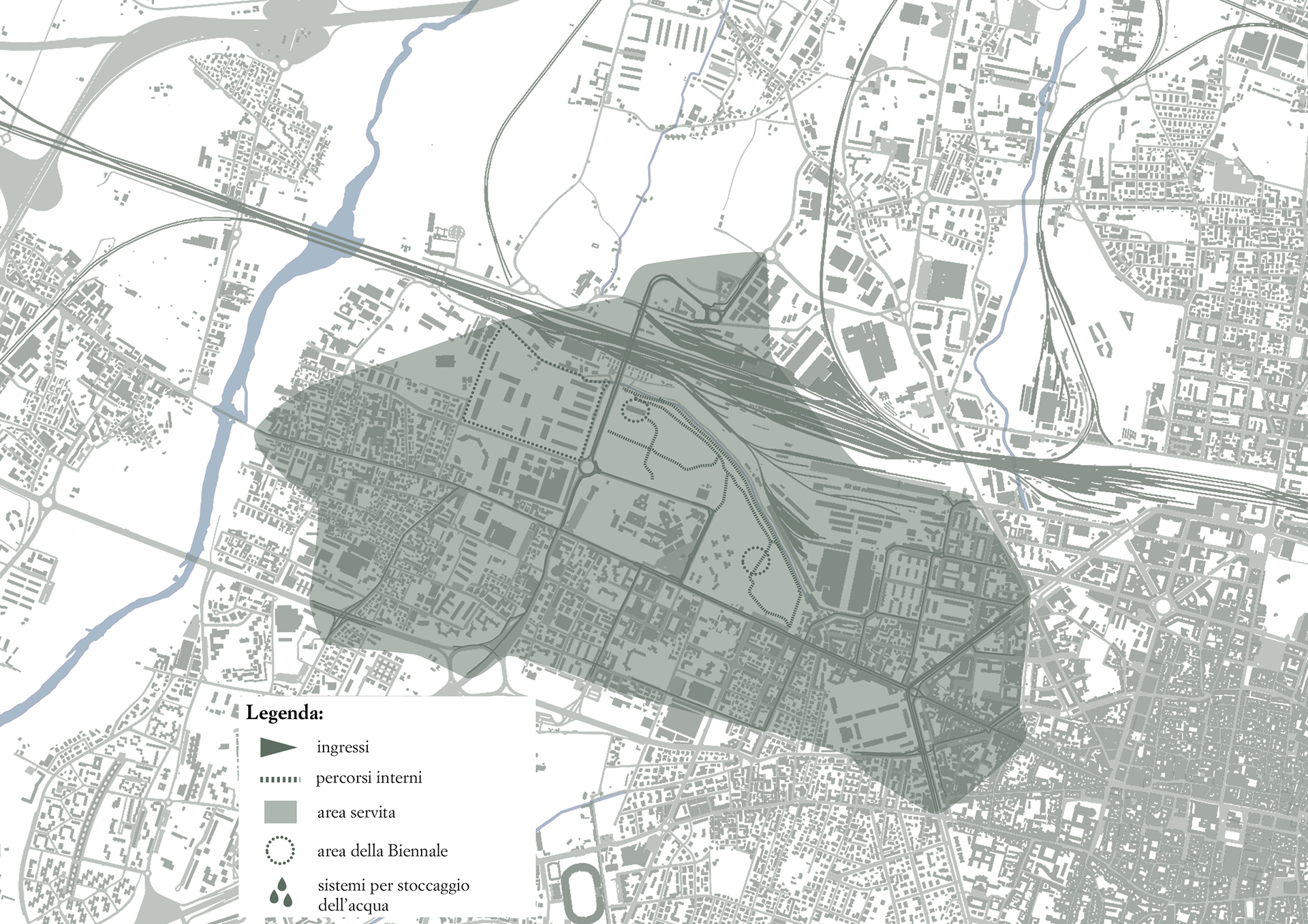
Service area
Sports infrasturctures
Results
Current state:
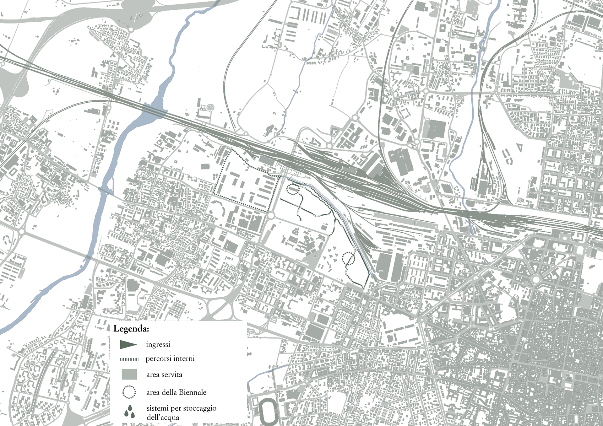
Access: The West zone is inaccessible. The East has only one permanent and one informal, often closed entrance.
Service area: Limited to nearby streets; Viale Vittorio Sabena is not pedestrian-friendly.
Sports infrastructure: Existing trails are informal and not suitable for people with disabilities.
Cultural infrastructure: No cultural or environmental education facilities currently exist.
Green stewards: The "No Speculation Regeneration Committee" has promoted awareness and community engagement through events, petitions, and a participatory design forum called Parteciprati. Initiatives include public hearings, data collection, protests, clean-up events, and collaboration with parent associations on air quality monitoring.
Accessability
Service area
Sports infrasturctures
Proposed scenario:
Access: Increased from 1 to 8, plus 2 additional for the Biennale.
Service area: Expanded to cover more of the city, even reaching the historic center.
Sports infrastructure: New wooden paths improve accessibility for pedestrians and cyclists.
Cultural infrastructure: The former barracks will host a new art Biennale, with cultural pavilions inside the woodland, including one focused on the area’s history and environmental awareness.
Green stewards: The project is expected to attract organizations and foster more events like outdoor sports and educational activities, enhancing the area's cultural ecosystem services.
Conclusion
The proposed project significantly enhances the CES potential of the Prati di Caprara. The increase in access points, improved infrastructure, and inclusion of cultural and educational facilities integrate the area more fully into Bologna’s urban fabric. It transforms a neglected space into a multifunctional green infrastructure with the potential to boost wellbeing, promote environmental awareness, and support inclusive urban regeneration.
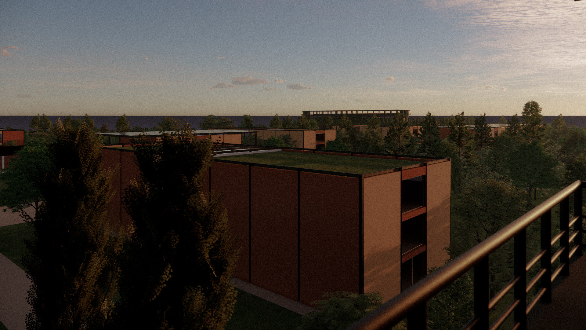
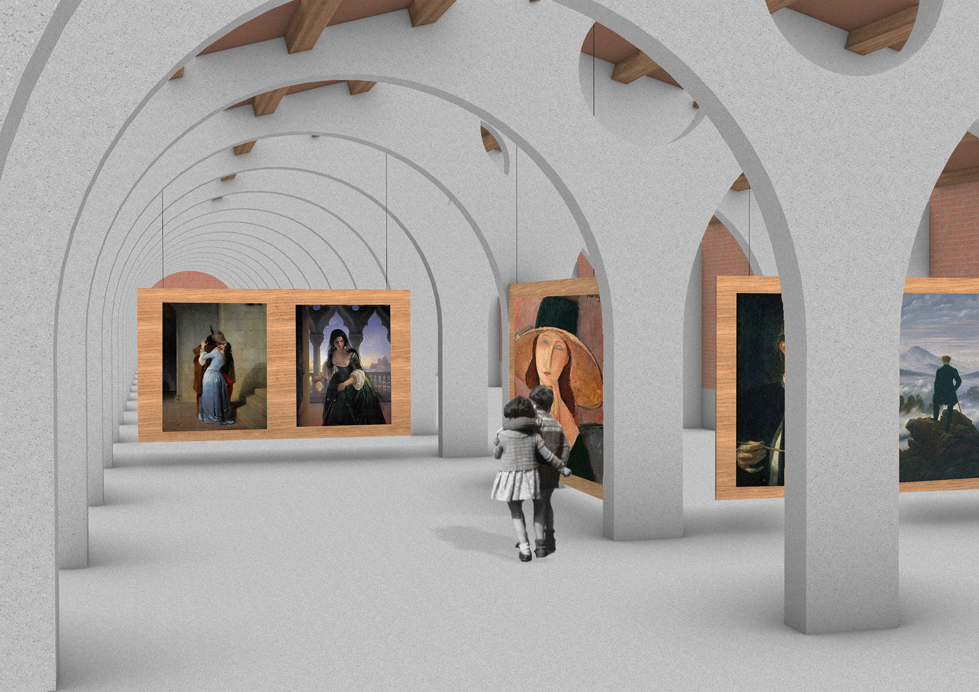
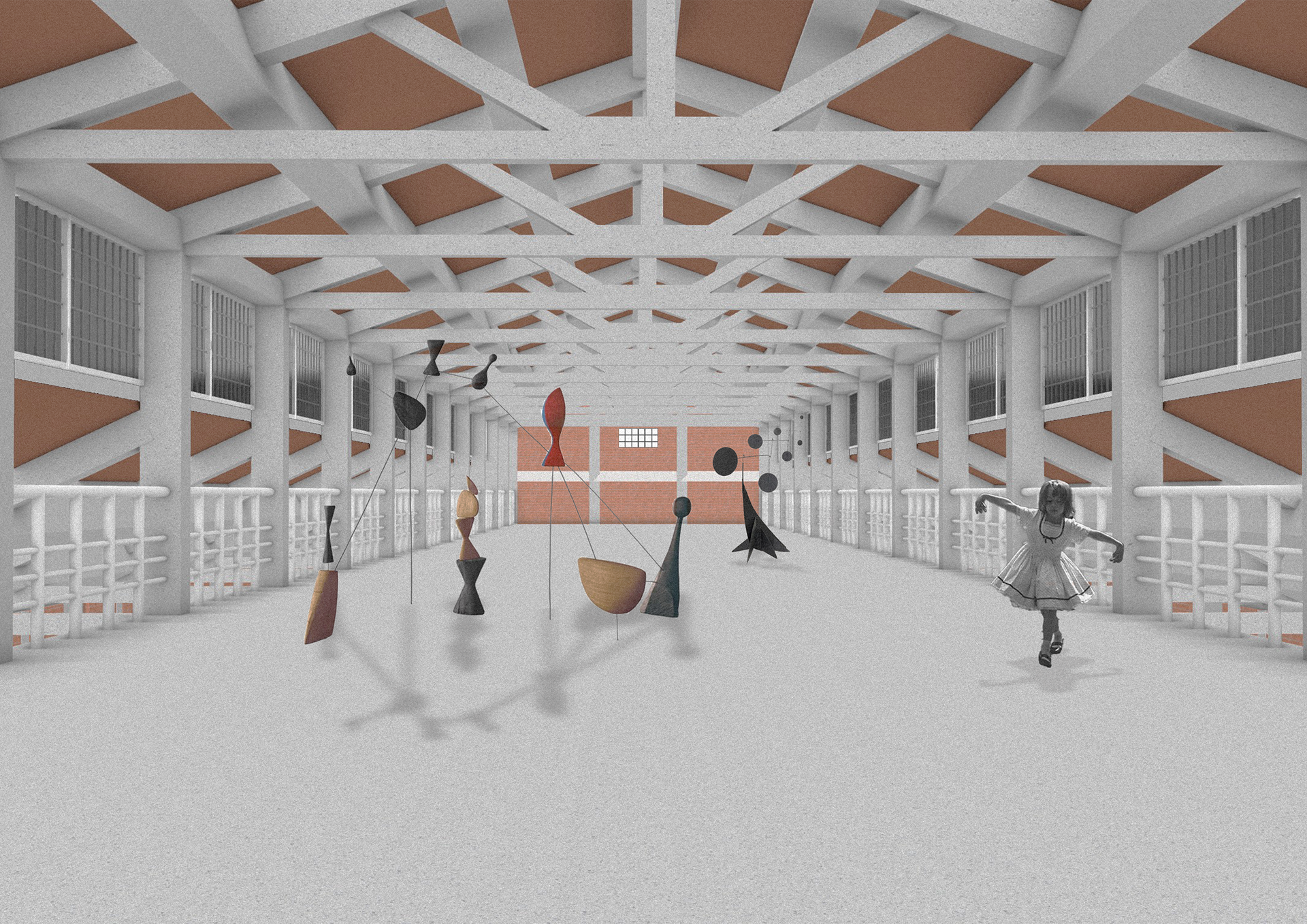
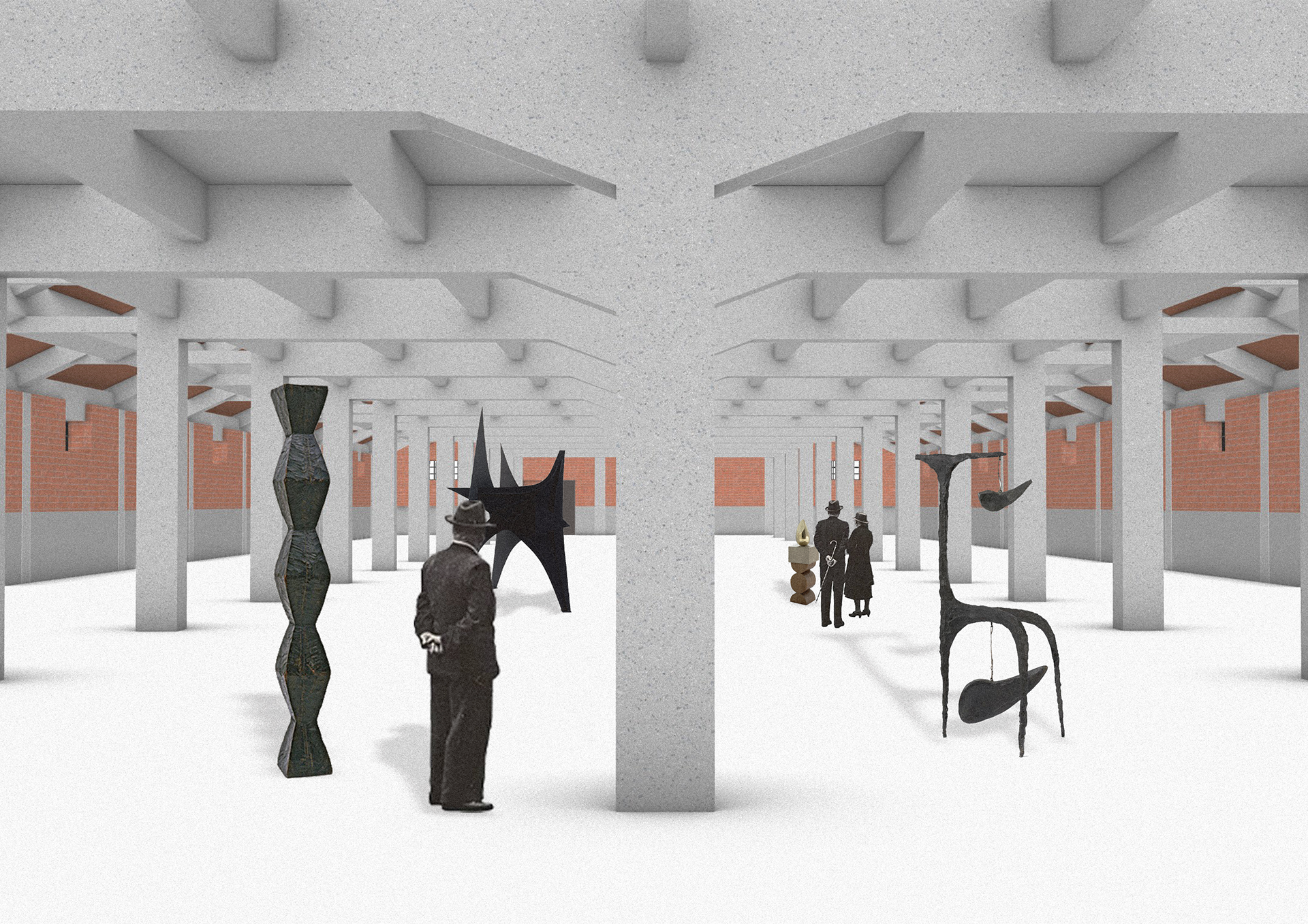
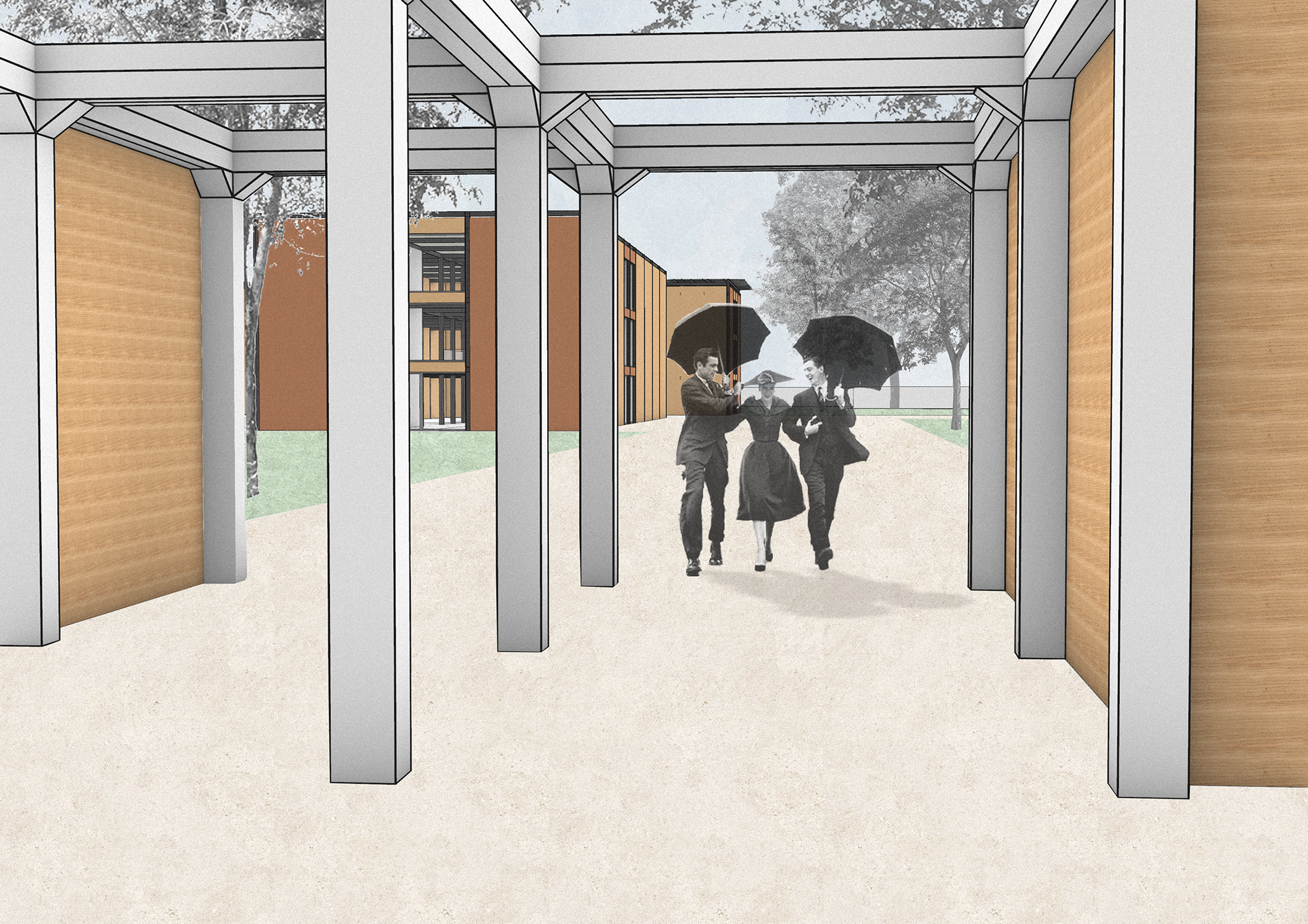
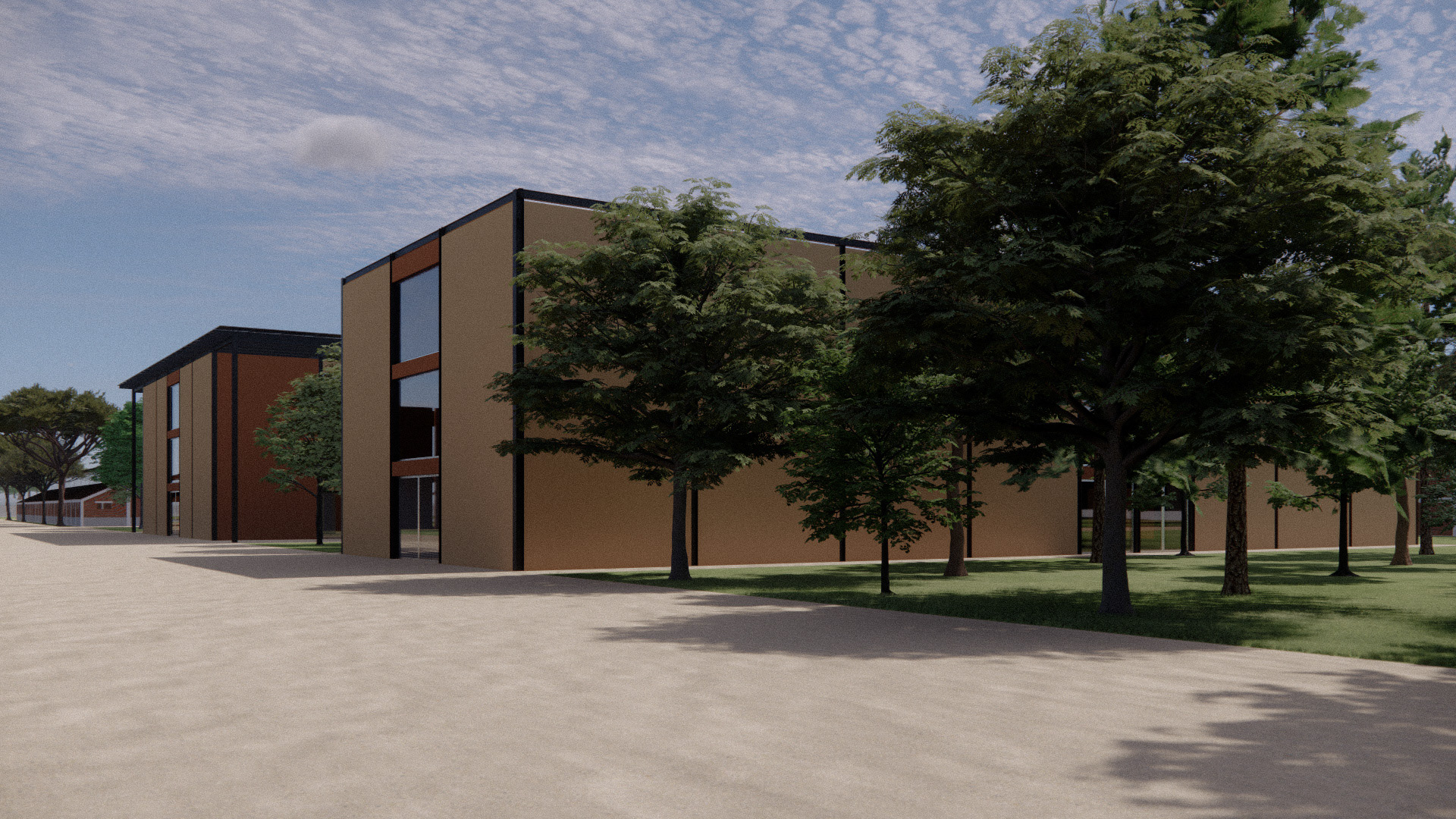
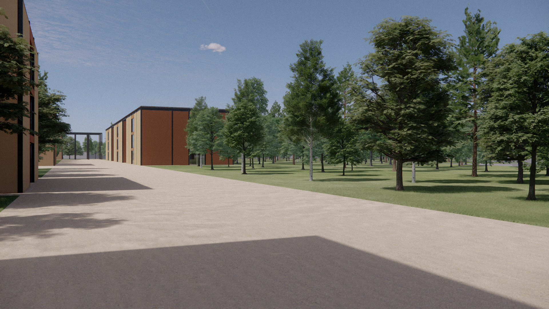
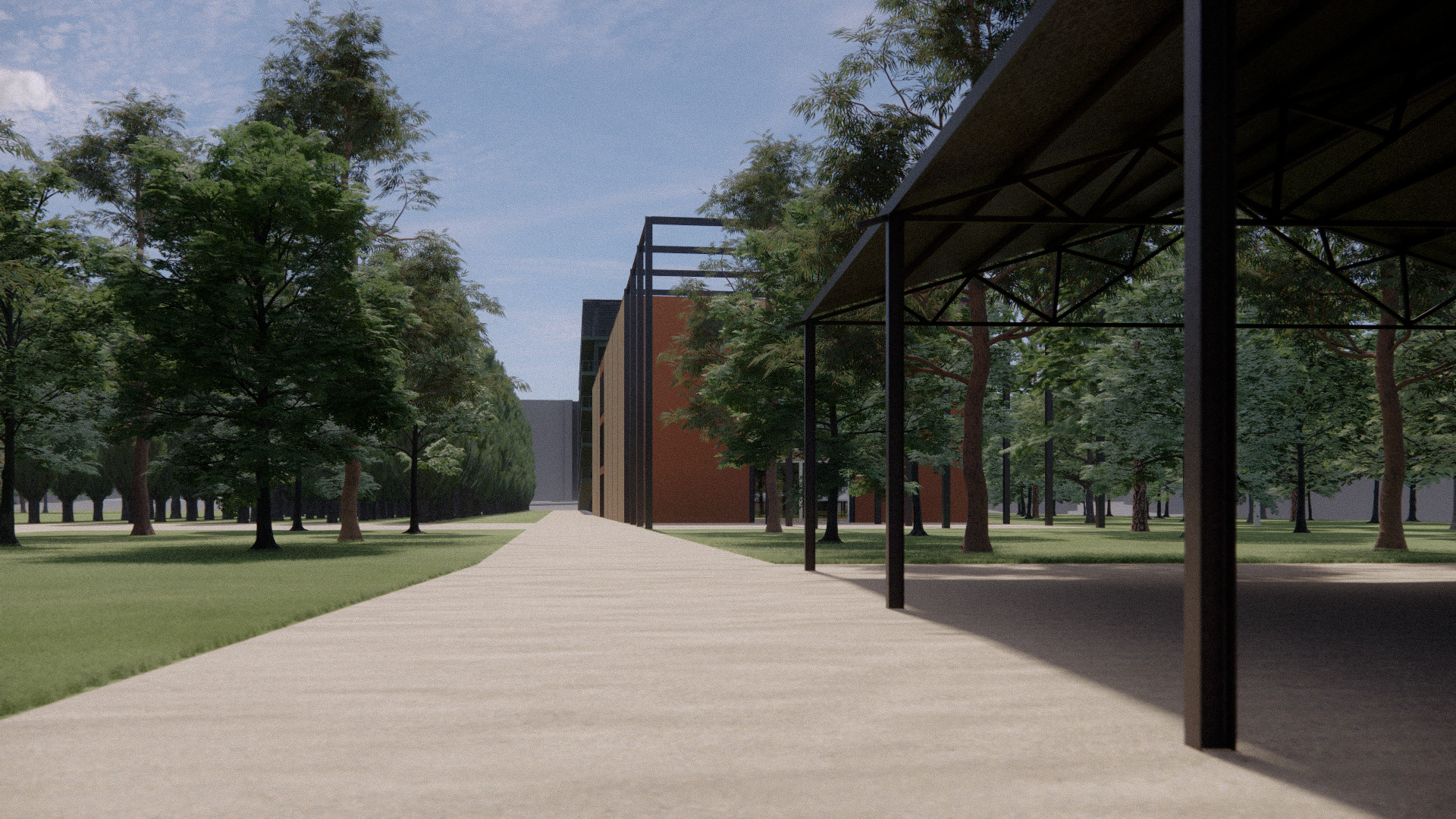
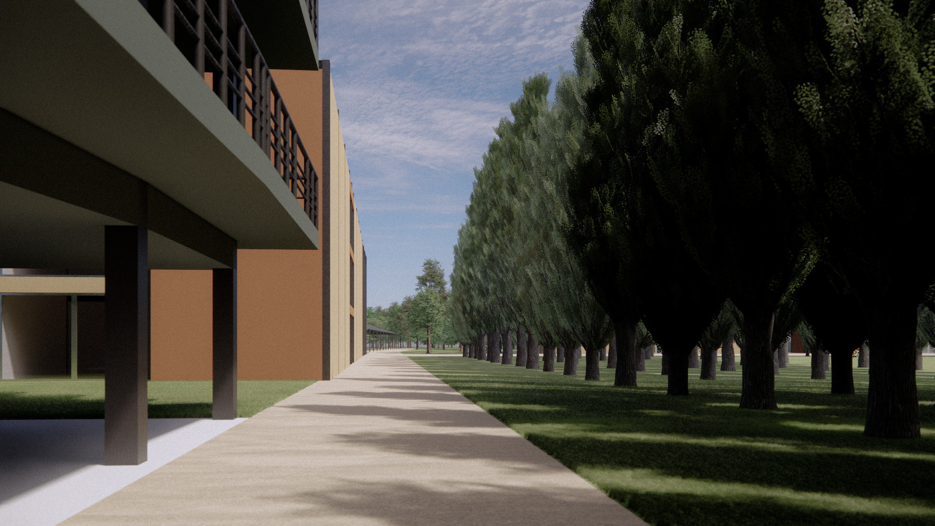
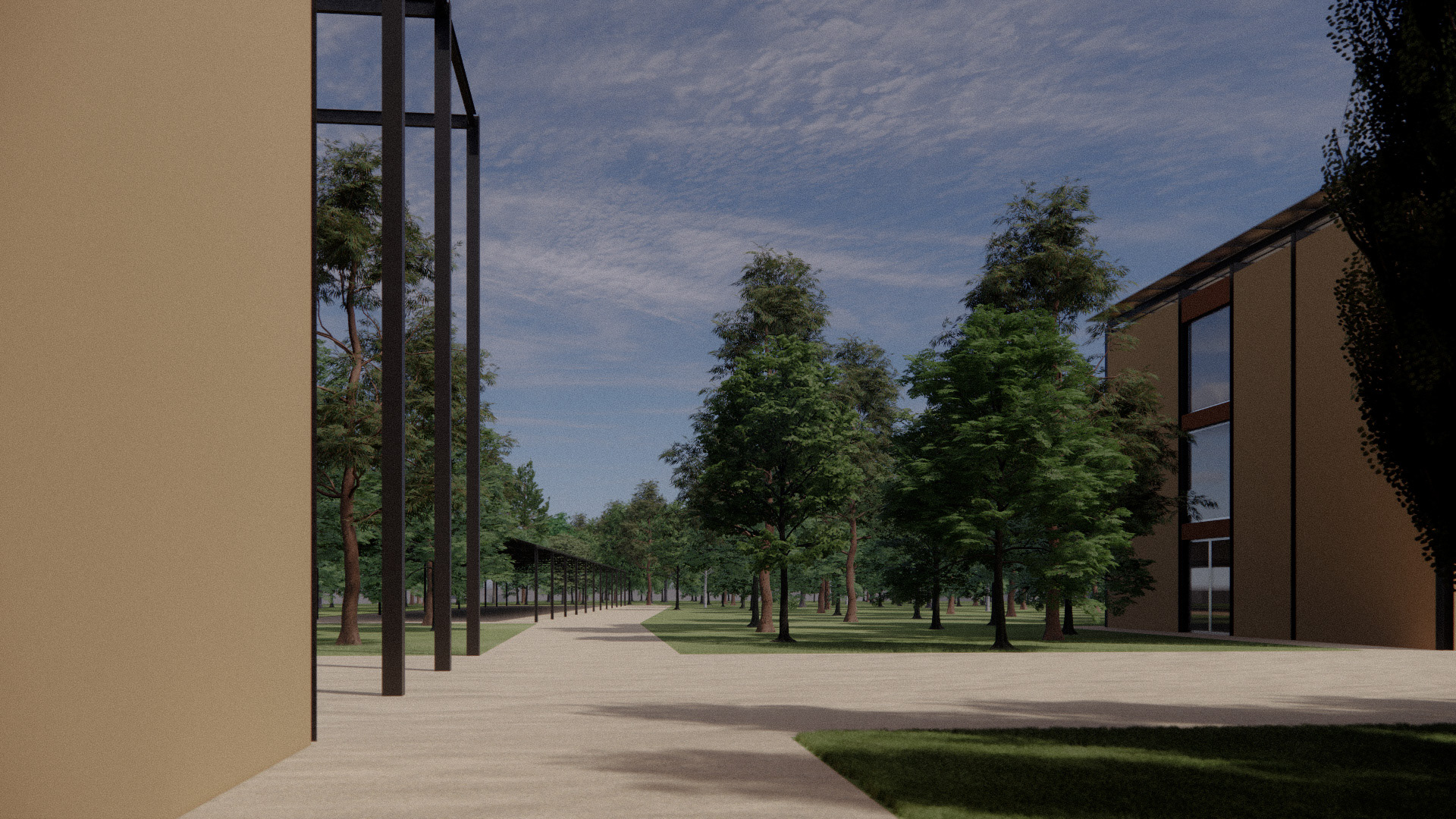
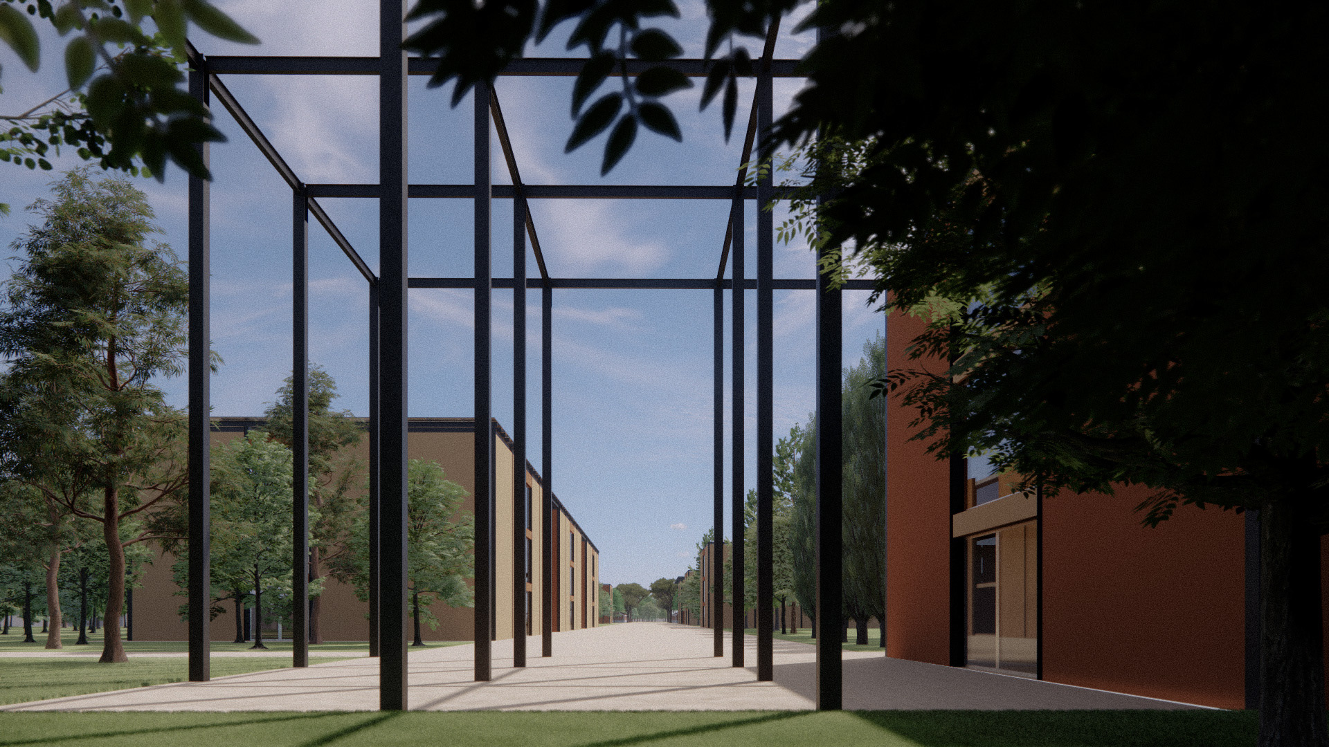
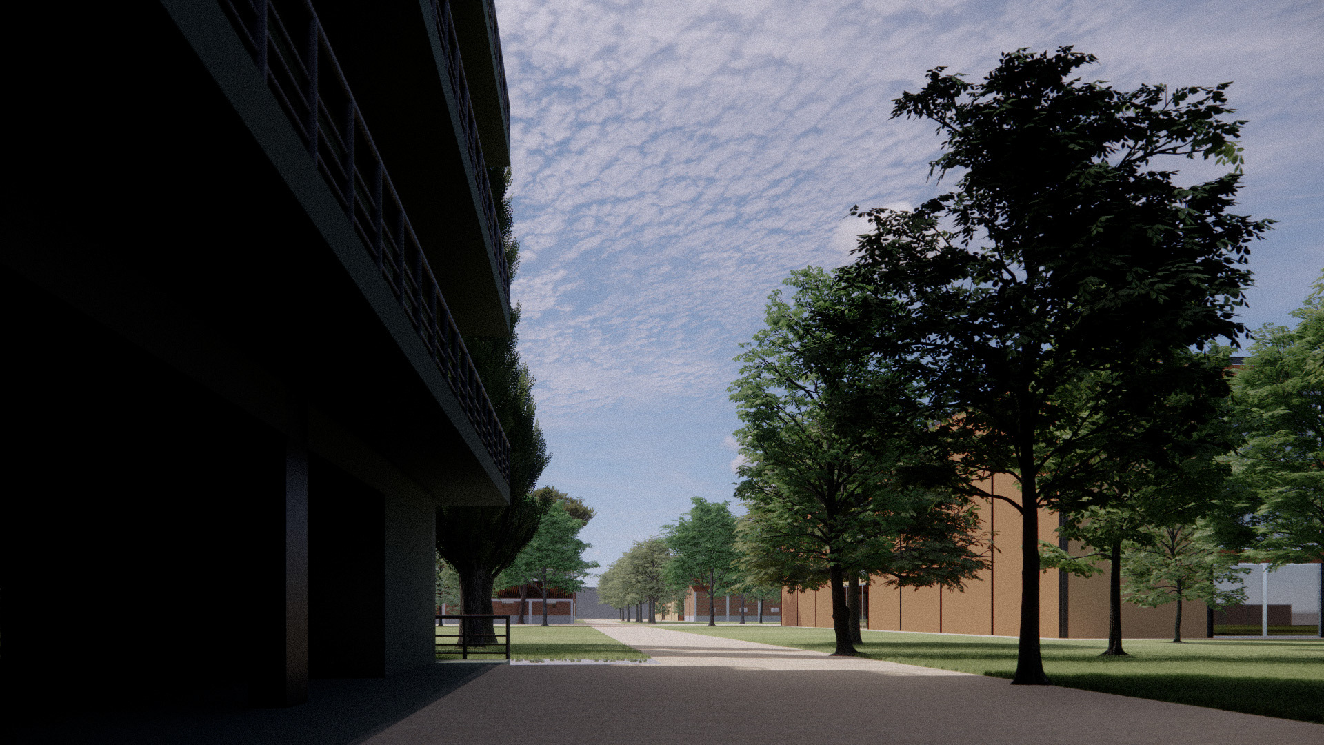
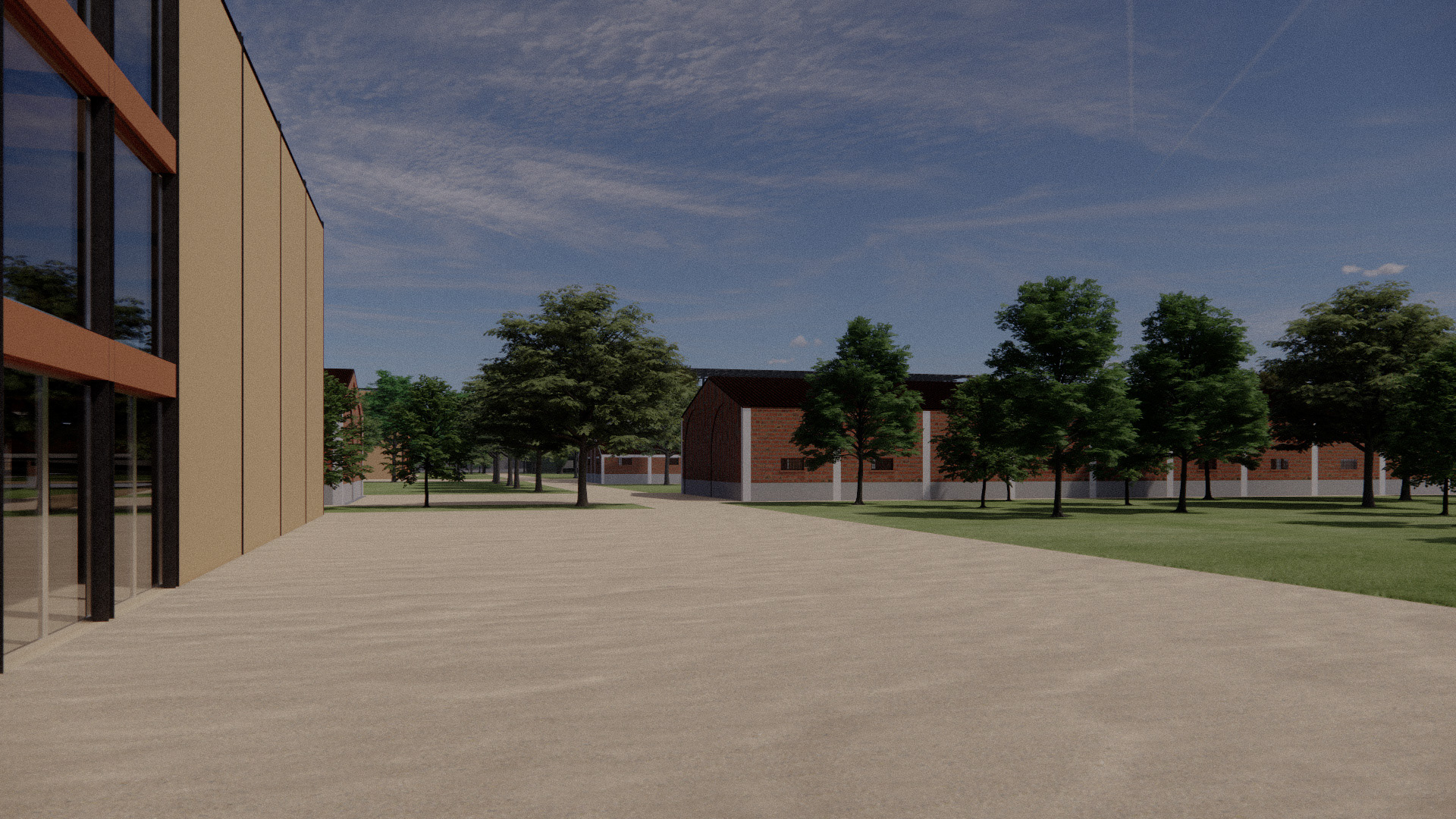
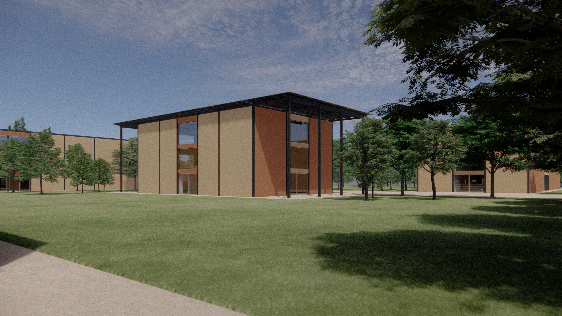
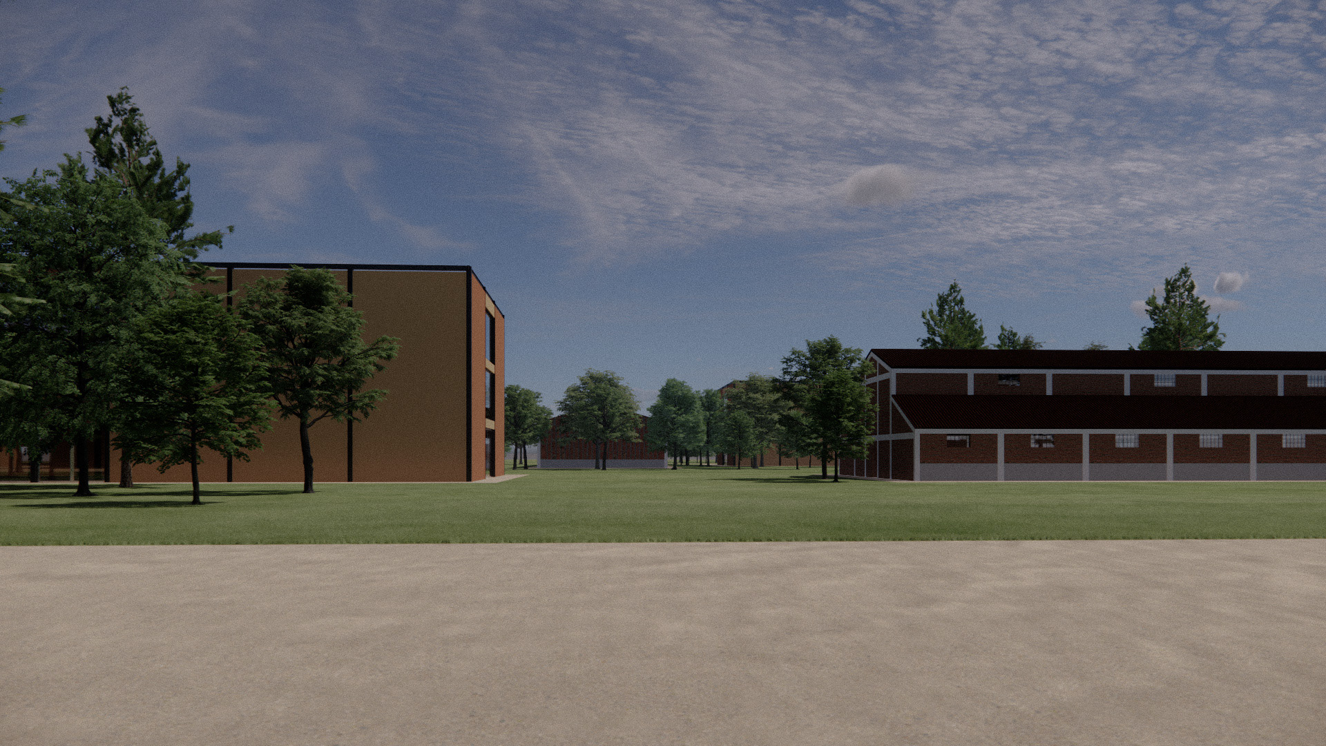
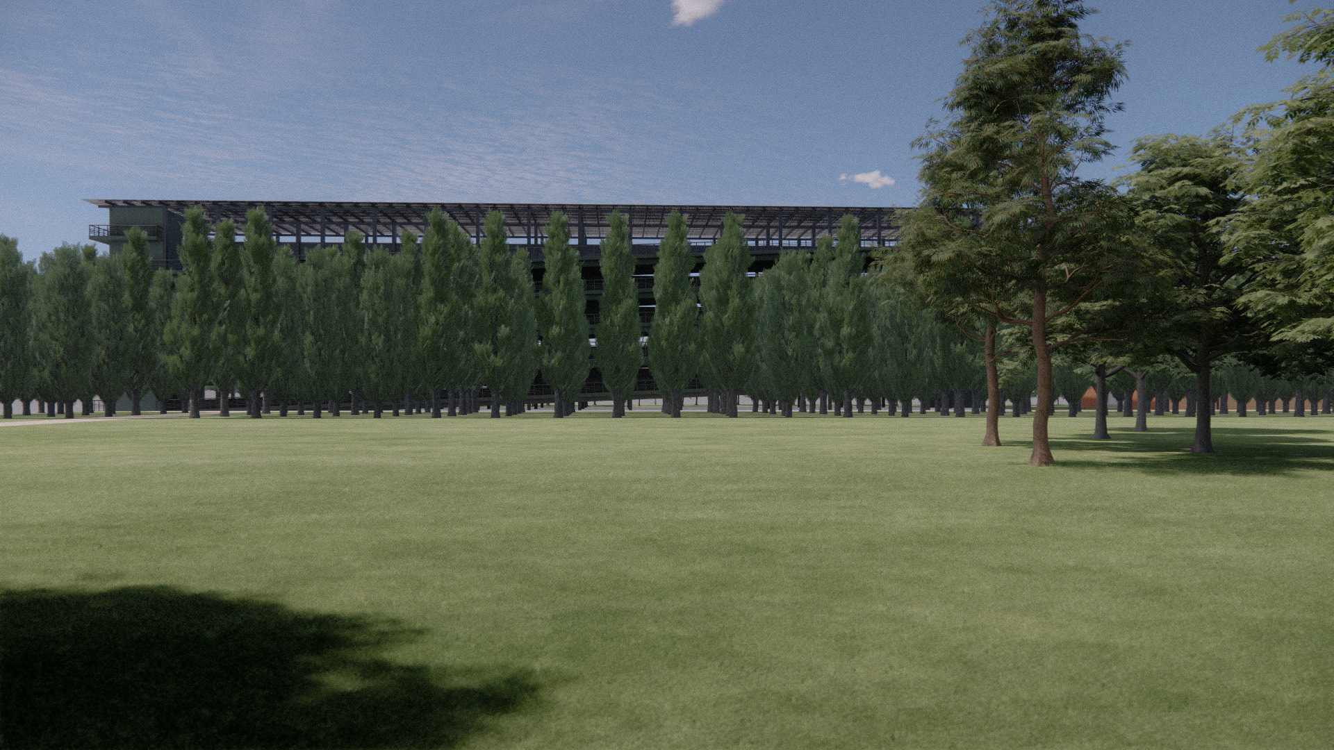
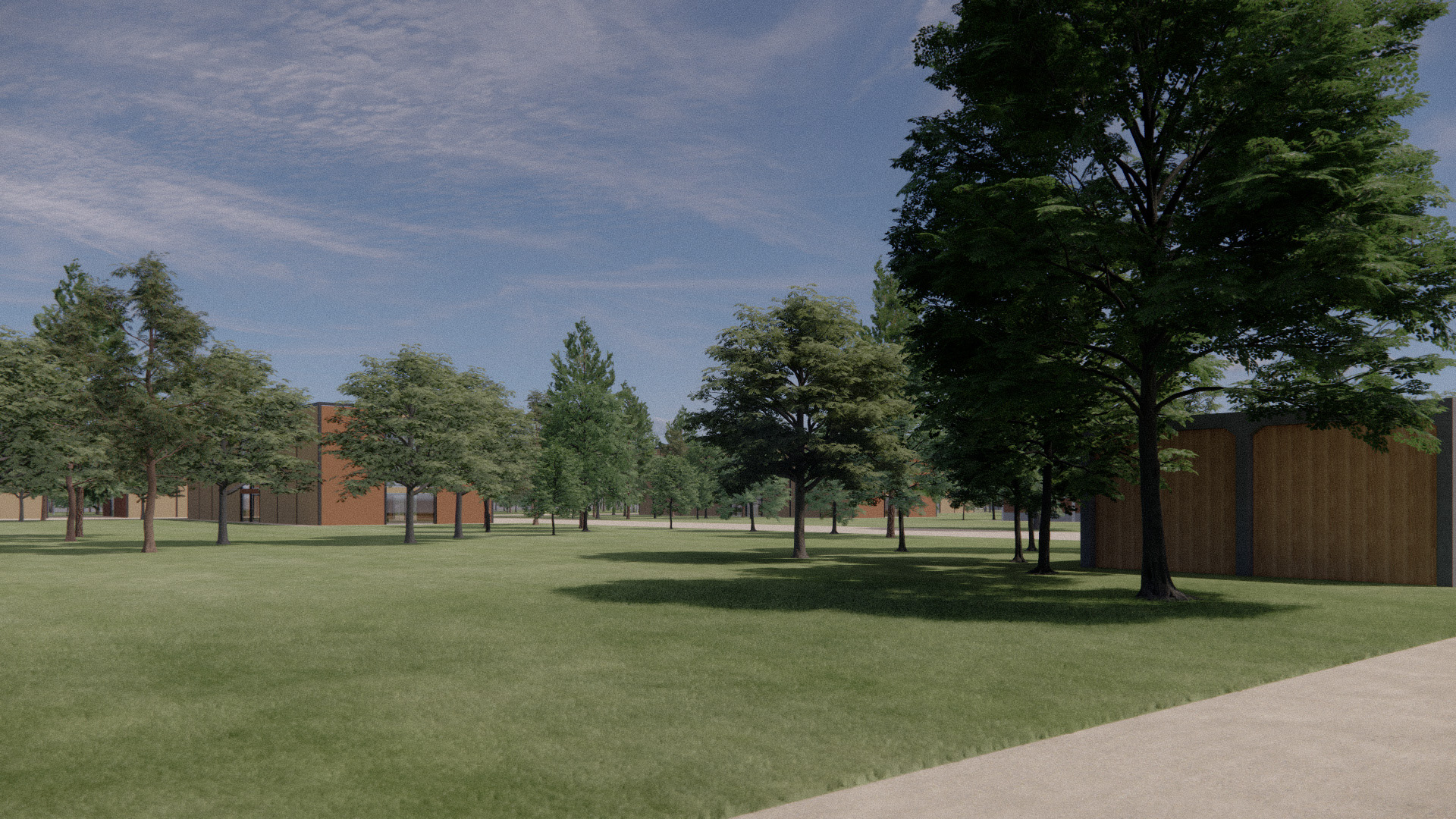
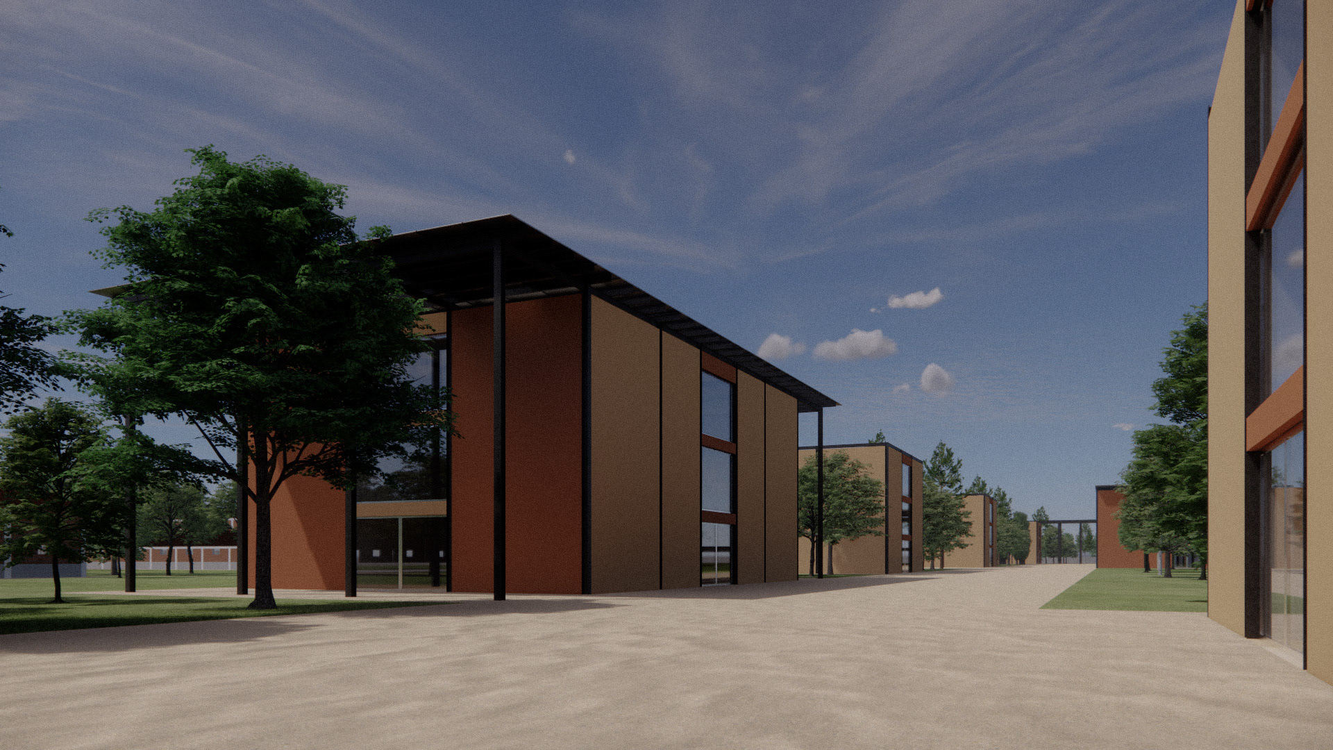
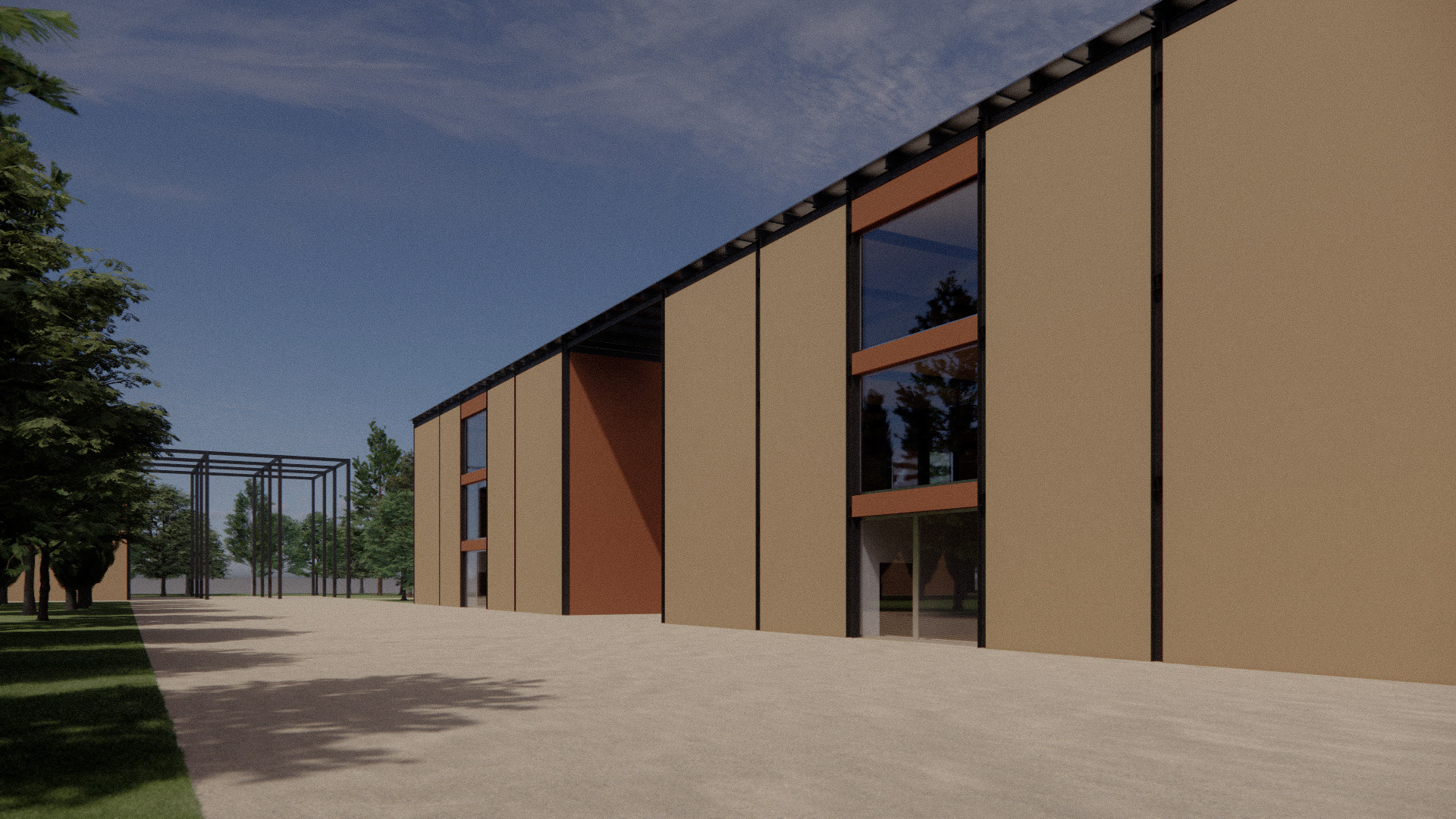
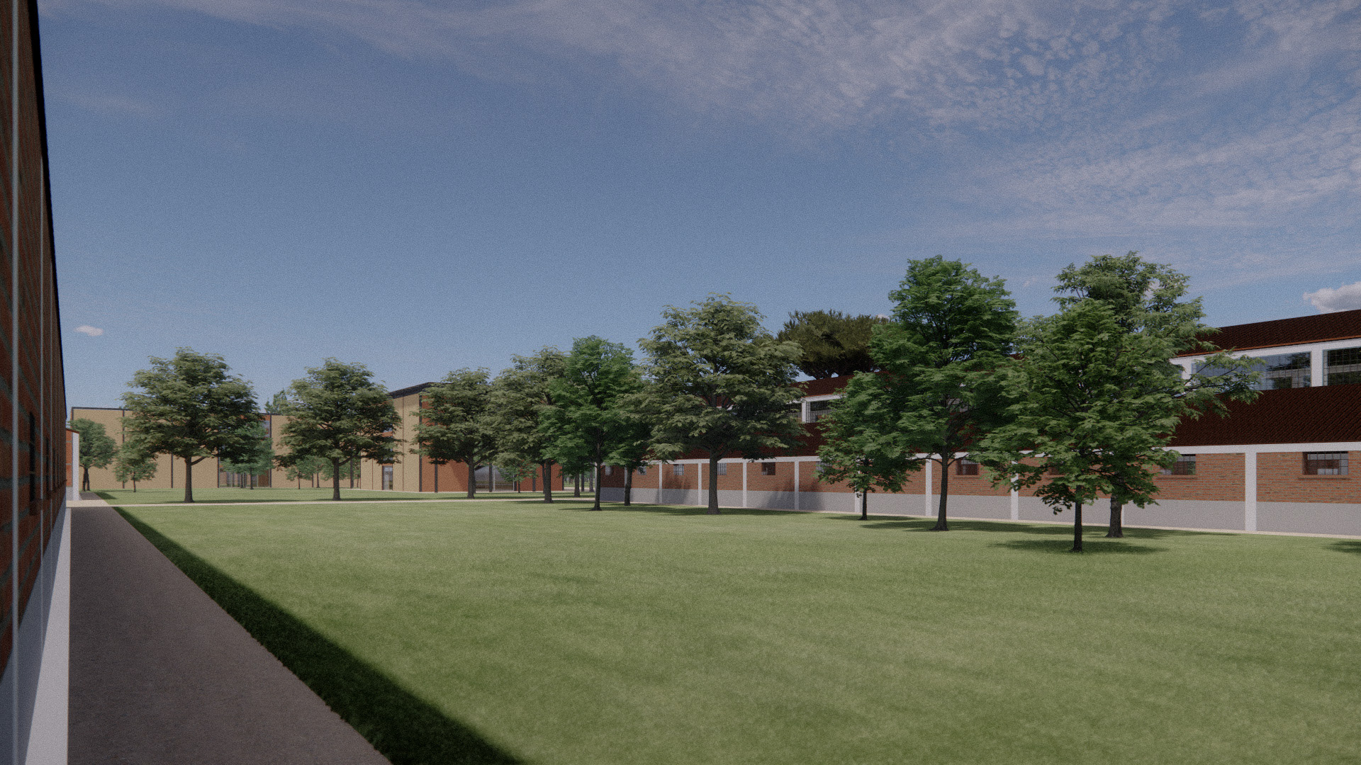
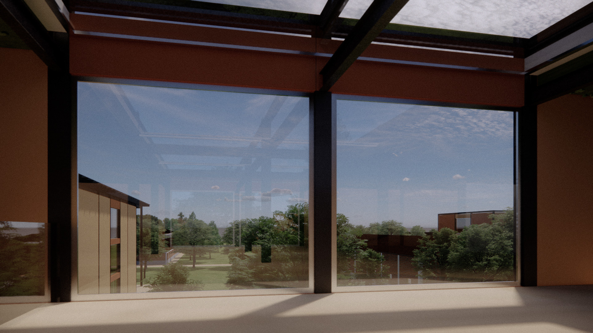
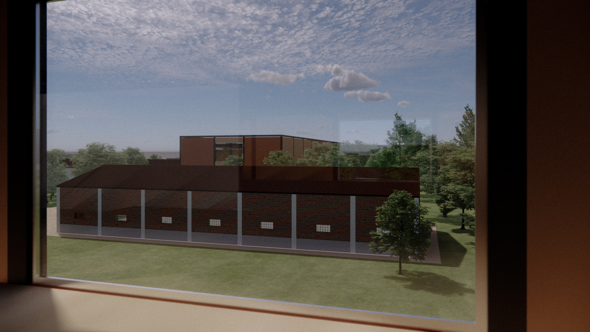
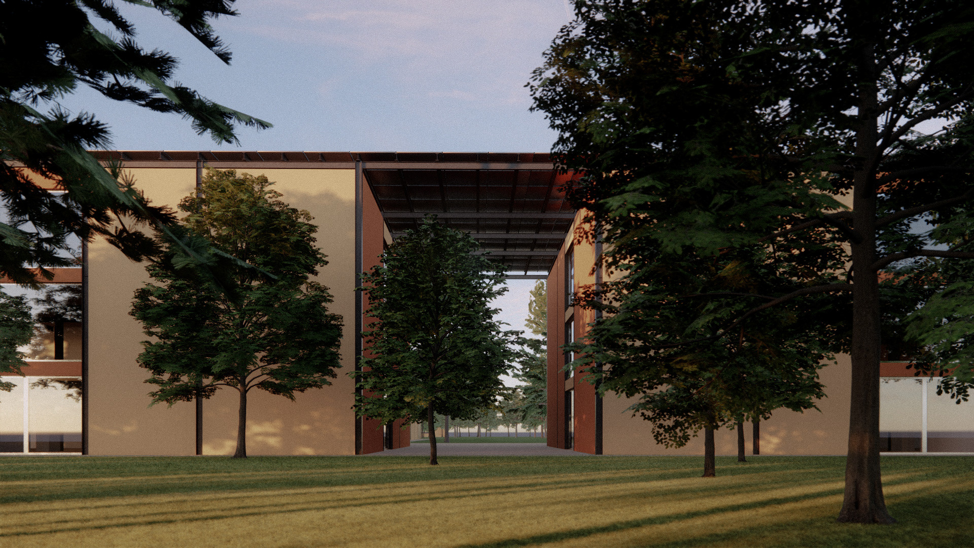
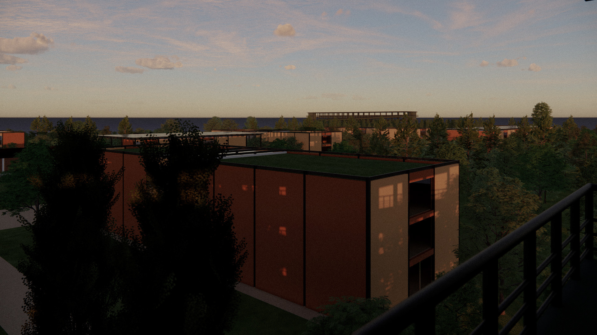
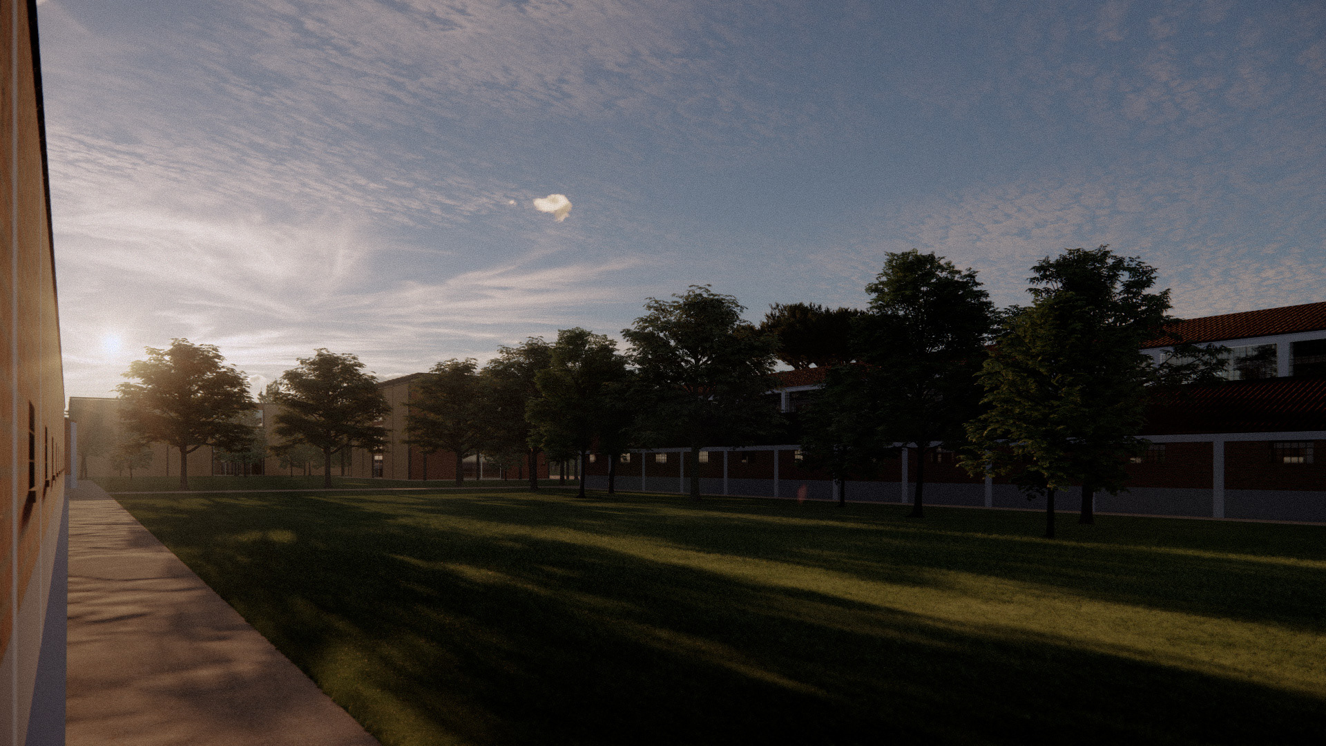
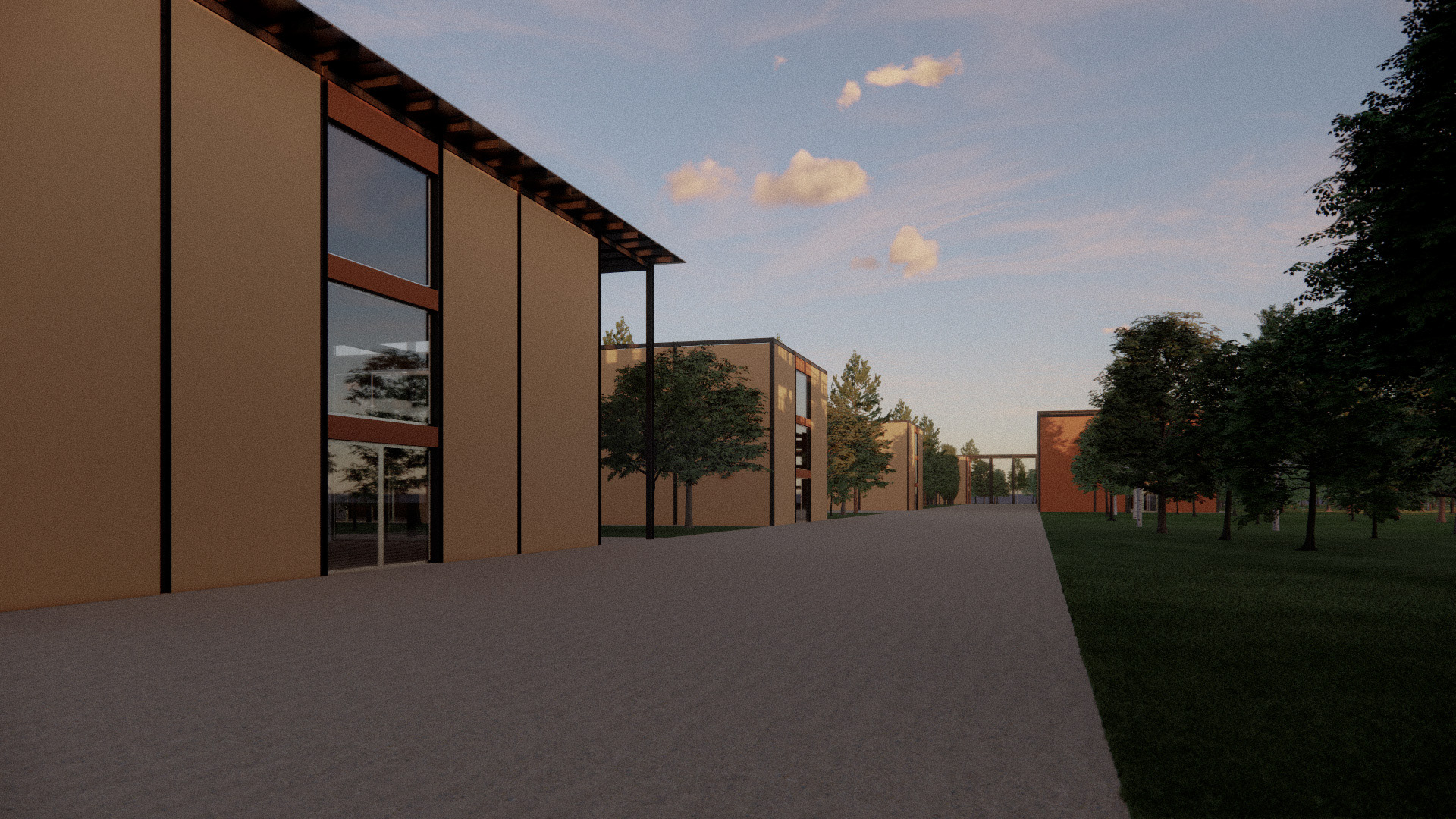
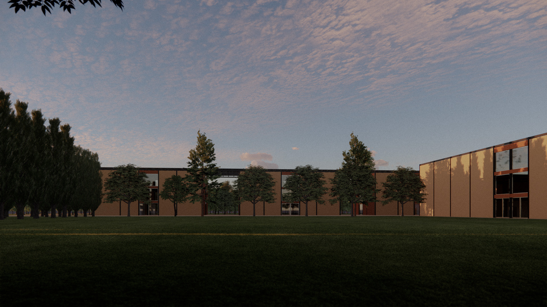
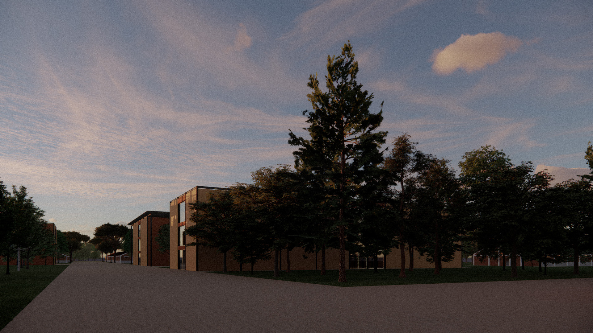
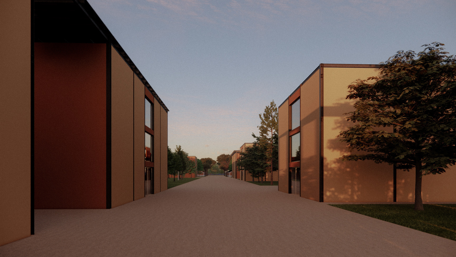
Renders of the project
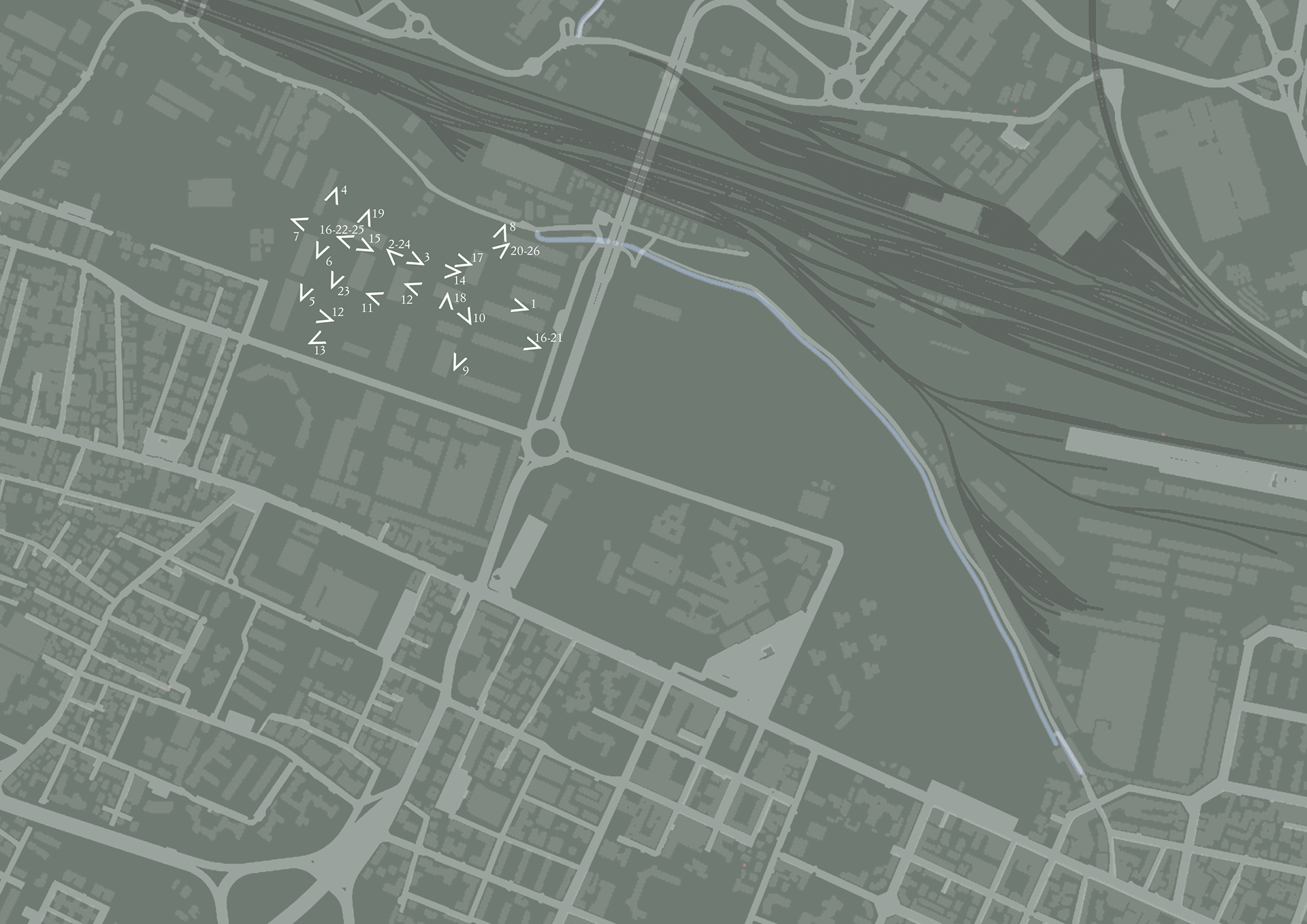
Project views navigator
1
2
3
4
5
6
7
8
9
10
11
12
13
14
15
16
17
18
19
20
21
22
23
24
25